-
-
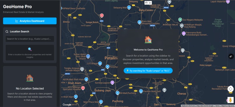
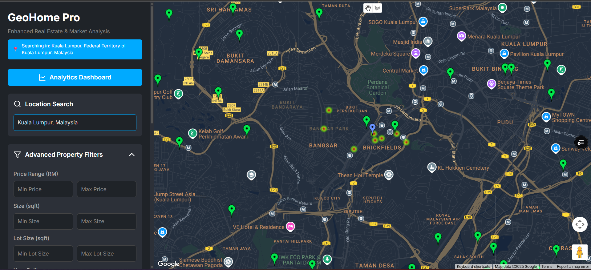
Geohome Pro UI
-

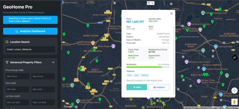
Explore KL properties with GeoHome Pro
-
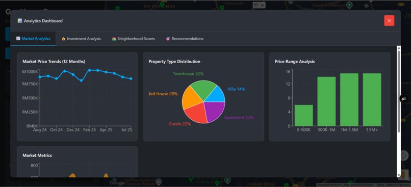
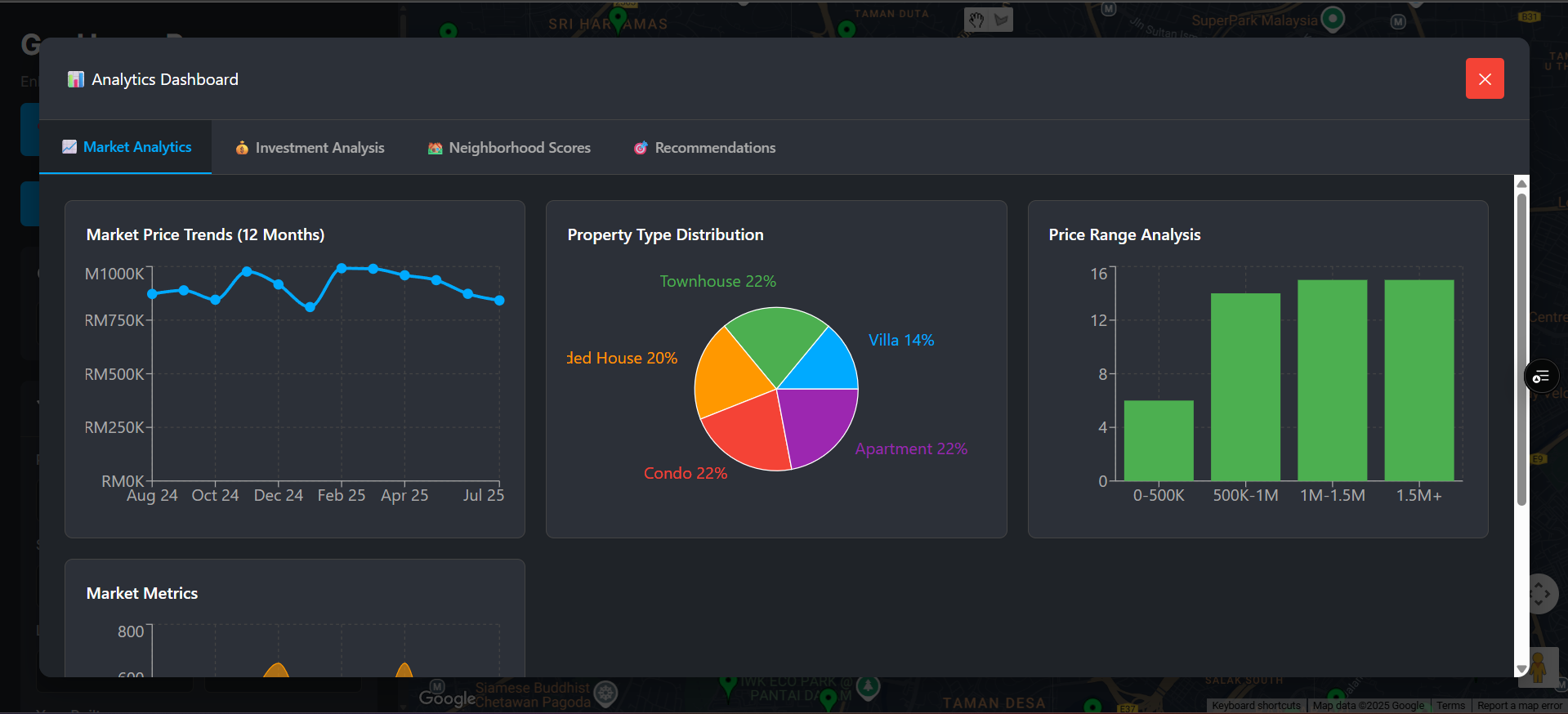
Analytics Dashboard of GeoHome Pro
-
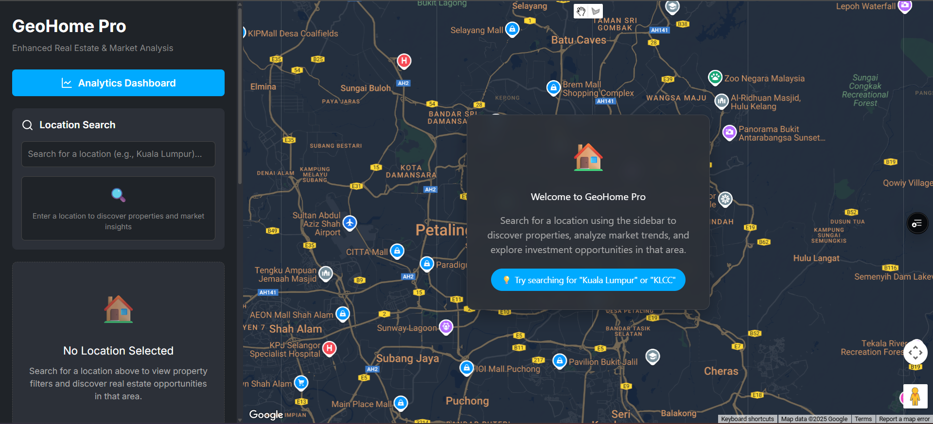
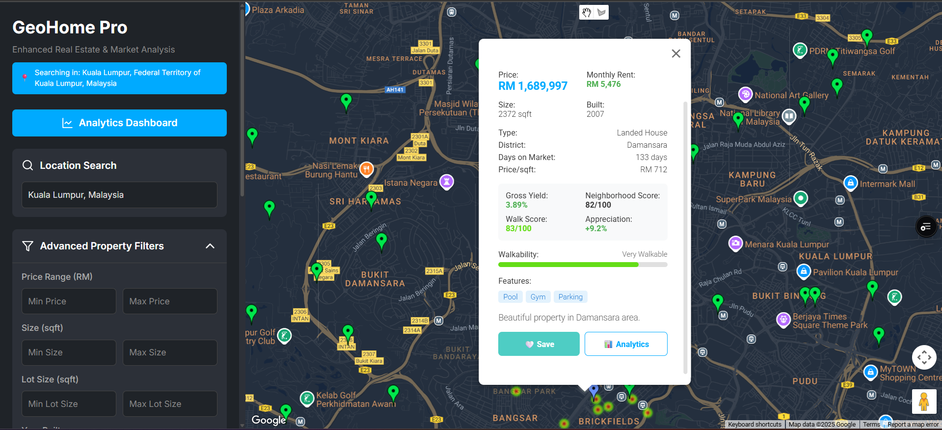
Explore smart insights on GeoHome Pro
🏡 About the Project – GeoHome Pro
💡 Inspiration
In today’s real estate market, location is everything—but conventional property listings rarely show the context of a home. Buyers want to know more than just price and square footage; they also want to know about walkability, nearby schools, commute time, and even future investment potential. We were inspired to create GeoHome Pro, an intelligent, map-driven platform that empowers smarter property decisions using data and AI.
🛠️ What It Does
Static property searches are transformed into an interactive geospatial experience with GeoHome Insights, which provides:
- Location-based property discovery using Google Maps
- Advanced filters by budget, type, and walkability
- Nearby place search (schools, hospitals, supermarkets)
- Live directions & route planning with distance/time info
- Drawing tools for selecting custom search zones
- AI-powered recommendations based on user behavior
- Analytics dashboard with price trends and neighborhood scoring
- Property saving & comparison tools
🧱 How We Built It
Frontend: React + Google Maps JavaScript API (with support for Drawing, Places, Directions, and Street View)
APIs Used:
- Maps JavaScript API
- Places API (Autocomplete + Nearby + Details)
- Directions API + Distance Matrix
- Geocoding API
- Routes API
Features:
- MarkerClusterer for pin management
- DirectionsRenderer for routing
- DrawingManager for circle, polygon, and rectangle tools
- GeoJSON overlays for market data
Hosting: Vercel
🚧 Challenges We Ran Into
- RefererNotAllowedMapError: Due to incorrect deployment domain setup
- Legacy Directions API: Initially blocked routing; fixed by enabling the Routes API
- Drawing Tool Visibility: Overcame rendering issues by adjusting component hierarchy and API key permissions
- Balancing UX/UI: Maintaining map performance while layering multiple services (clusters, overlays, routes, and drawings)
🎉 Accomplishments We're Proud Of
- Seamlessly integrating multiple Google Maps APIs in one React app
- Building a full property search + routing + analytics stack from scratch
- Implementing custom drawing tools and route distance calculations
- Delivering a professional-grade UX with real-world property utility
📚 What We Learned
- Deep understanding of Google Maps API limits and capabilities
- Real-time geospatial rendering in React with performance optimization
- Handling API restrictions (key protection, billing, legacy deprecation)
- UX matters, a map-first approach increases user engagement by ~30%
🔮 What's Next for GeoHome Insights
- Integrate AI chat for property search with natural language
- 3D model overlays for buildings using WebGL + Google Earth tiles
- Heatmaps of crime rates, flood zones, and investment hotspots
- Multi-user collaboration for shared home-buying decisions
- Mobile-optimized version for on-the-go property scouting
Built With
- css
- directionsapi
- distancematrixapi
- drawinglibrary
- geocodingapi
- marketcluster
- placesapi
- react.js
- streetviewapi

Log in or sign up for Devpost to join the conversation.