-

GeoHealth's sleek logo
-

Realtime stats of the Bay Area's environmental health conditions
-

The website displaying the location selected from the app
-

Location finding capability of the app
-

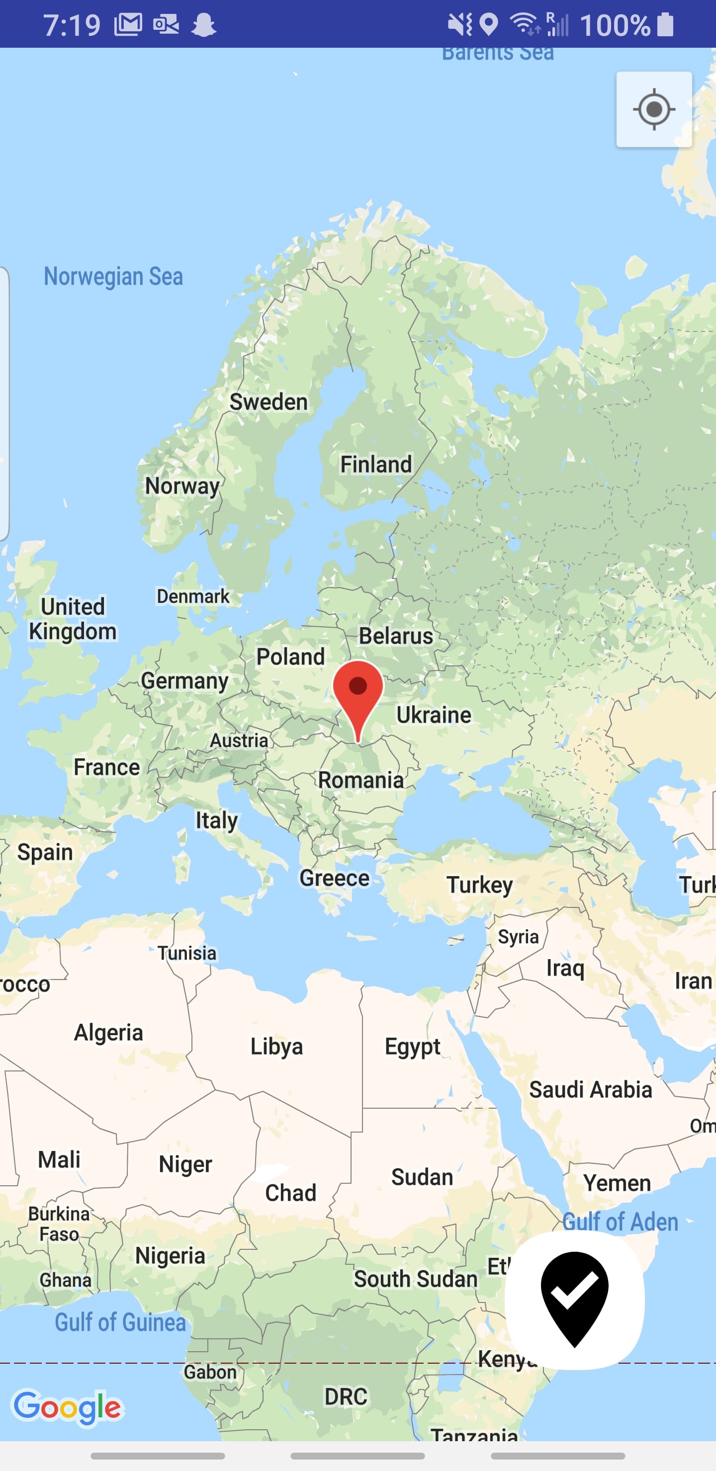
Arbitrary location selected in Europe
-

The back end code
-

The team bonding at beautiful Yale
-

The Android app code
-

The first view of our logo on the website
-

Realtime environmental data of a point in the middle of North America


Inspiration
Many times, humans are not fully informed about the invisible irritants in their environment. For every single location on the Earth, there exists many different environmental sources that have the potential to cause harm, from minor inconveniences to life-altering reactions and medical emergencies. The 3 most common environmentally affected medical conditions are: allergies, asthma, and melanoma. Currently, society does not have an accurate way to pinpoint the exact parameters of all the different types of irritants.
What it does
GeoHealth, a revolutionary technology designed to disrupt the irritant detection space. It allows the user to select any point on the earth, and view a score based on an array of considered parameters. This score will be used to provide an index, which accurately quantifies the amount of danger present within that respective category. The app uses the Google Maps SDK for Android and its APIs. This enables the location selection on the Google map, as well as showing and finding current location. Once a location is selected on the map, the user then confirms it, and the score is then calculated with a range OpenWeather APIs. The APIs return values with important information for people with health conditions. It can thus help the affected persons with deciding the safety of travelling to the selected location, and it presents that data.
How we built it
We used Android studio, Writing code in java to create the android app. Javascript on the backend to call the OpenWeather APIs, and a Google Firebase realtime database to transmit data to and from the app and server. We used the Google Maps SDK for Android and its APIs.
Challenges we ran into
The time crunch of one weekend at Yale, was quite the challenge to complete our ambitious goals. Also some interesting event listener, and some 403 errors.
Accomplishments that we're proud of
We really bonded well as a team, and we were able to make a project we are all proud of. An idea that was both uniquely ours, and impactful for the health of many.
What we learned
We learned that a good team will persevere, and that online maps are quite impressive.
What's next for GeoHealth
Sleeping :)


Log in or sign up for Devpost to join the conversation.