-
-

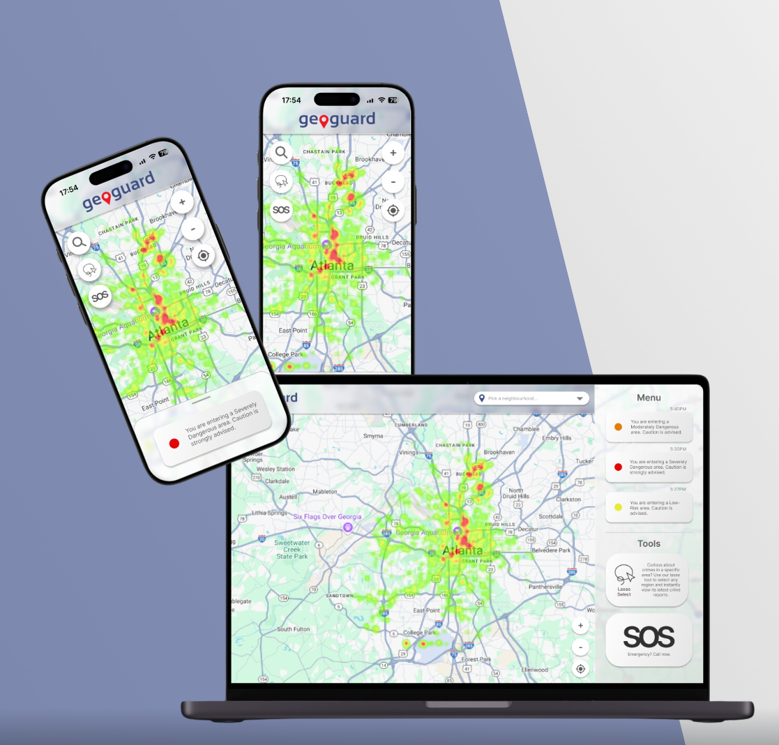
Demos of GeoGuard on assorted devices
Inspiration
GeoGuard was inspired by the growing need for personal safety in urban environments, especially during nighttime when people feel most vulnerable. The app seeks to address the concerns of individuals who wish to stay aware of their surroundings while navigating through potentially dangerous areas. Leveraging data from the Atlanta Police Department, we aimed to develop a tool that offers real-time information, alerting users about historically dangerous areas and providing proactive measures for their safety.
What it does
GeoGuard is a safety-focused web application that tracks your location and alerts you in real time if you are approaching high-crime areas. It visualizes crime data from the Atlanta Police Department through an interactive heatmap, helping users identify the most dangerous regions. GeoGuard also provides a Lasso feature that allows users to select specific areas on the map to get instant analysis of recent crimes. Additionally, it features a built-in SOS button that allows users to immediately call for help in case of emergencies without needing any prior setup.
How we built it
We built GeoGuard using a combination of frontend and backend technologies. The map-based interface was developed using the Google Maps API to display crime data through heatmaps. Crime data was sourced from the Atlanta Police Department and processed through the backend, which was built using Node.js and MongoDB Atlas to store and manage historical data. The Lasso feature was implemented with custom shape-drawing logic, allowing users to select specific regions and retrieve crime information. Real-time GPS location tracking was added to trigger notifications when users approach dangerous areas, and the SOS function was integrated for emergency response.
Challenges we ran into
One of the major challenges was integrating real-time GPS tracking with the map and ensuring that the notifications were timely and accurate. Managing large datasets of crime reports and optimizing the heatmap visualization for performance was another hurdle, as it involved balancing responsiveness with data accuracy. Another challenge was implementing the Lasso tool in a way that was both intuitive and functional while maintaining performance when processing complex shapes.
Accomplishments that we're proud of
We are particularly proud of the Lasso feature, as it gives users the ability to interact with the map in a unique and flexible way, allowing them to get localized crime reports based on their specific needs. Another accomplishment is the seamless integration of real-time notifications and the SOS feature, which makes the app not only informative but also a critical tool for personal safety. We also succeeded in processing and displaying large amounts of crime data in a user-friendly way.
What we learned
Through the development of GeoGuard, we learned the importance of data accuracy and its impact on user trust, especially when it involves personal safety. We also gained experience in working with real-time location tracking and handling geospatial data. Additionally, we learned how to design a user interface that balances functionality with ease of use, particularly in critical moments like emergencies where speed and simplicity are essential.
What's next for GeoGuard
In the future, we plan to expand GeoGuard by adding more data sources beyond Atlanta, including other major cities. We also aim to improve the notification system by incorporating more targeted alerts based on user preferences, such as time of day or crime type. Additionally, we plan to integrate more advanced analytics to predict crime patterns and offer users proactive advice. We also envision expanding the SOS feature to include alerts to emergency contacts and integrating wearable devices for even faster access to safety features.

Log in or sign up for Devpost to join the conversation.