-
-
Title Card
-
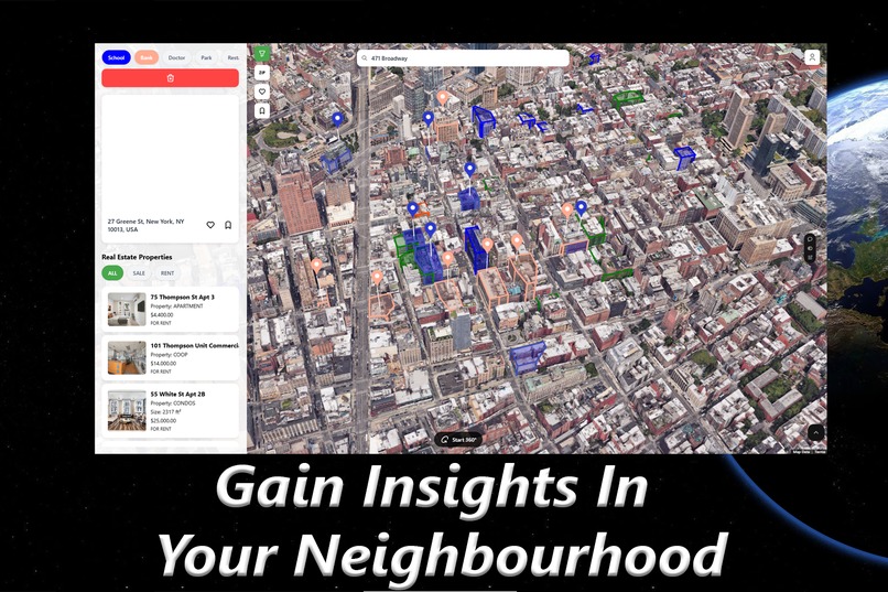
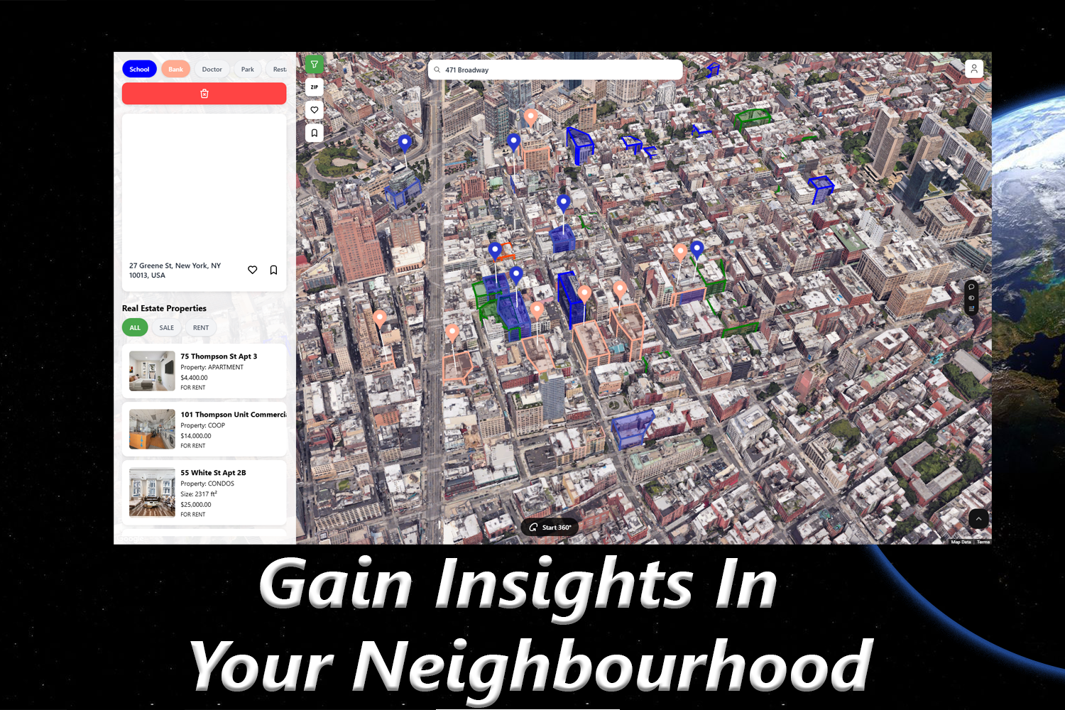
Gain Insights in Your Neighbourhood
-
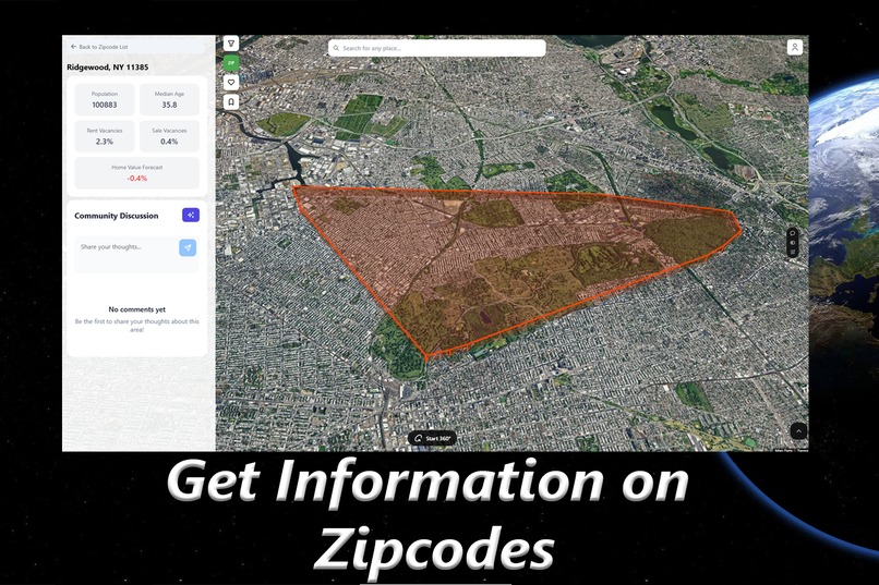
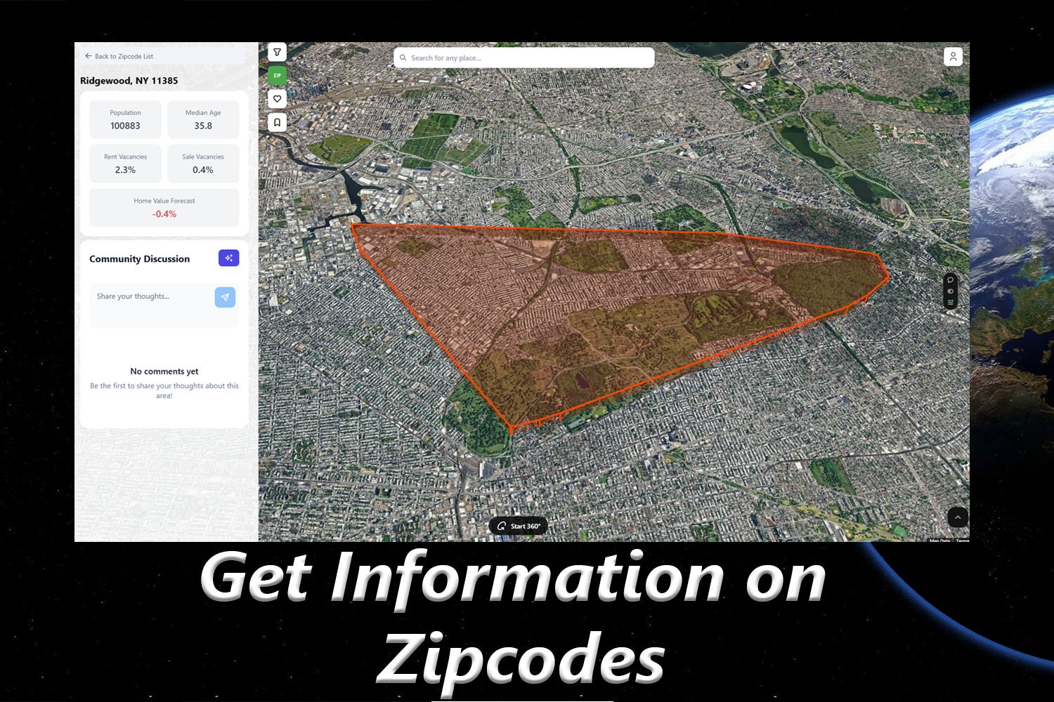
Get Information on Zipcodes!
-
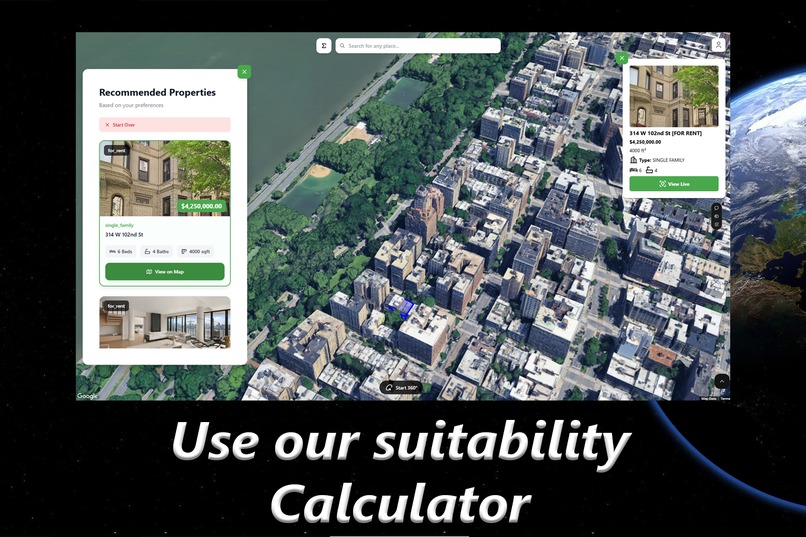
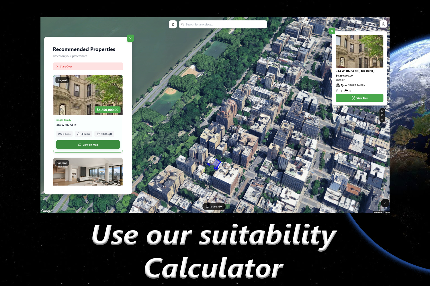
Use our Suitability Calculator
-
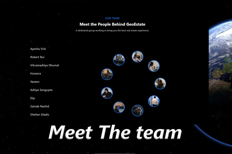
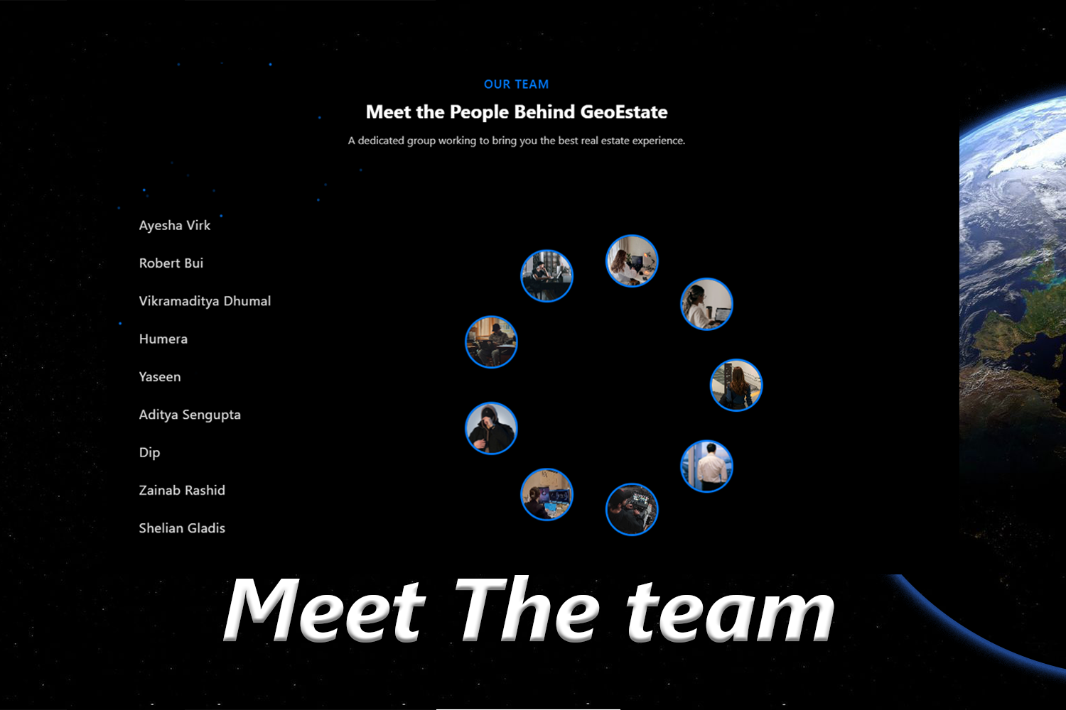
Meet our Team
Inspiration
Traditional maps serve their purpose but often fall short in delivering the engaging, interactive experiences that modern users demand. The process of exploring properties or neighborhoods without personalized insights can feel uninspiring, leaving users overwhelmed and under-informed.
Enter GeoEstate—a platform designed to revolutionize the way we navigate and understand the real estate landscape. More than just a map, GeoEstate combines photorealistic 3D mapping with cutting-edge technology to offer tailored property recommendations, comprehensive neighborhood insights, and real-time updates, all in one place.
GeoEstate transforms location exploration into an immersive, interactive experience, empowering users with meaningful data about schools, parks, amenities, and community dynamics. Born from a vision to bridge the gap between static maps and real-world connectivity, GeoEstate is the ultimate tool for making informed decisions and fostering a deeper connection to the spaces we inhabit.
With GeoEstate, discovering your next home isn’t just easier—it’s smarter, more dynamic, and more inspiring than ever.
What It Does
GeoEstate is revolutionizing the way users explore real estate and neighborhoods by offering an immersive, data-driven, and personalized experience. Here’s how:
Enhanced Neighborhood Visualization
GeoEstate enriches maps with dynamic layers that highlight essential neighborhood features, such as:- Schools, hospitals, parks, and amenities with color-coded overlays or icons
- Detailed insights into neighborhood characteristics for an informed exploration
Property Discovery
Receive personalized suggestions based on your search. GeoEstate provides:- Comprehensive details on nearby properties
- Easy comparison tools for finding the best fit for your needs
- Comprehensive details on nearby properties
360-Degree Building Views
Virtually tour properties and neighborhoods:- Explore buildings in 360-degree views, zooming in or “walking around” for a realistic and engaging experience.
Suitability Calculator with Custom Analytics
GeoEstate’s suitability calculator offers personalized property suggestions by:- Evaluating user preferences like room count, price range, and location
- Providing data-driven analytics to simplify decision-making
- Evaluating user preferences like room count, price range, and location
Neighborhood Vibes
Understand the character of a location through crowd-sourced and social media data:- Ratings for walkability, nightlife, and family-friendliness
- Filters to match your lifestyle needs
Zip Code View of Locations
Streamlined navigation using zip codes:- Pinpoint desired locations quickly
- Explore with precise overlays and markers for a clearer view of neighborhoods
AI-Powered Surroundings Insights
GeoEstate harnesses AI to analyze:- Key aspects like amenities, connectivity, and environmental factors
- Public comments from residents and visitors to enhance your decision-making
- Key aspects like amenities, connectivity, and environmental factors
Save Favorite Locations
Bookmark preferred properties or areas for:- Easy access during property searches.
- Seamless comparison of shortlisted options.
- Easy access during property searches.
Gamification Features
GeoEstate engages users with fun, interactive tools:- Bucket Lists:
- Create, share, and explore trending properties or locations
- Find others with similar bucket lists or search specific users by username
- Public Comments on Zip Codes:
- Contribute feedback on areas and help others
- Earn Geobits coins for likes on your comments, which can be used within the platform
- Bucket Lists:
GeoEstate combines cutting-edge technology, user engagement, and community-driven insights to redefine how we explore and choose real estate, making it more personalized, intuitive, and insightful.
How We Built It
GeoEstate was developed using a robust tech stack that combines frontend, backend, and database technologies. We utilized React Native and several supporting libraries, such as React Native Slider, Async Storage, and Gesture Handler, to create a seamless and intuitive user interface. React Google Maps (vis.gl) and Three.js powered our photorealistic 3D visualizations and interactive map features, while Firebase handled user authentication and hosting.
The backend was built with Node.js and Express, incorporating PostgreSQL as the database for secure and efficient data management. Key libraries like Dotenv, Wellknown, and CORS ensured smooth API integrations and secure environment configurations. For testing, we relied on Jest and Supertest to maintain reliability across all features.
We incorporated zip-code specific data from the Census and Zillow's open-source data offerings. For individual properties, we scraped data and images from real-estate websites to use for the preview and demonstration until we acquire our own data for when the app is deployed commercially.
Challenges we ran into
Deploying the project was a significant challenge, from setting up triggers and gateways to fixing CORS errors. At one point, resolving the CORS issue accidentally disabled authentication, which took an entire day to fix. Shaping a clear vision and integrating diverse contributions into a unified solution was another hurdle, requiring close coordination.
Mastering new technologies like Three.js and Express, along with implementing complex features such as user authentication, refresh tokens, and property polygons, tested our skills. Despite these obstacles, each challenge enhanced our understanding and strengthened our project.
Finding current and open source data to inform some potential features proved to be difficult. We adapted our approach quickly based on readily available data that we could merge usefully.
Accomplishments that we're proud of
We successfully brought our reimagined idea to life by integrating it into maps, delivering a smooth and personalized user experience. GeoEstate enhances property discovery and makes map exploration more engaging, providing users with an intuitive and immersive way to explore locations and find their ideal properties.
What we learned
Throughout the development of GeoEstate, we gained invaluable insights into the integration and utilization of APIs, including photorealistic 3D JavaScript APIs and property data APIs. These tools enabled us to create an engaging and detailed platform. We explored diverse locations, enhancing our understanding of real-world map-based applications and their intricacies.
Additionally, we learned to tackle complex challenges like implementing user authentication, managing CORS issues, and handling advanced features such as property polygons. The collaborative process helped us refine our technical skills in Three.js, Express, and other frameworks while ensuring seamless integration of multiple features into a unified solution.
What's next for GeoEstate
GeoEstate’s journey doesn’t end here. We want to position the platform as a leader in integrated real estate. Here's how we plan to expand the application: 1) Job Market Analytics: To attract a broader audience and offer a comprehensive analysis of options, we will:
- Integrate local job market data to personalize property recommendations further, aligning housing options with users’ career aspirations and commuting needs
- Offer insights about salary trends, job growth and top professions of available jobs to help users with their decision making process.
- Visualize job market trends with heatmaps and charts
- Add notifications for job market updates in chosen areas 2) Add more real estate features: We want GeoEstate to have all the conventional real estate features. So, we plan to add at least the following features that allow the users to:
- Save listings
- Contact agents
- Schedule viewings 3) More Gamification: To improve user retention, smoothly directing the user to what features would give them the most bang for their time, and become a data-driven application by collecting home-grown user data:
- Daily Quests: Tasks like “Save 5 dream homes” or “Explore 3 new neighborhoods” with rewards for completion
- Progress Tracker: A visual bar showing progress toward completing tasks
- Levels: Gain levels like "Neighborhood Scout" and "Market Expert" for saving properties, writing reviews, referring friends etc.
- Leaderboards: Showcase top users
Built With
- cors
- express.js
- firebase
- gemini
- google-cloud
- google-maps
- google-vertex-ai-studio
- javascript
- jest
- node.js
- postgresql
- python
- react-expo
- react-native
- supertest
- three.js
- vercel
- vis.gl
- wellknown


Log in or sign up for Devpost to join the conversation.