
GeoAlerta AI: Intelligent Early Warning for Climate Resilience
Inspiration
Extreme weather events are becoming more frequent and severe, while many vulnerable communities still rely on reactive emergency management. Floods and landslides often cause devastating human and economic losses because authorities lack timely, localized, and actionable information.
GeoAlerta AI was created to bridge this gap by combining Artificial Intelligence, geospatial analytics, satellite imagery, and weather forecasting into an intelligent decision-support platform that helps emergency agencies anticipate disasters instead of simply responding to them.
Our vision is simple:
Predict earlier. Respond faster. Save lives.
What it does
GeoAlerta AI is an AI-powered Early Warning System designed to support disaster risk management.
The platform continuously analyzes multiple data sources, including:
- Satellite imagery
- Digital Elevation Models (DEM)
- Rainfall forecasts
- Terrain slope
- Hydrology
- Population exposure
- Historical disaster events
Using machine learning and geospatial intelligence, GeoAlerta AI identifies areas with elevated disaster risk and provides:
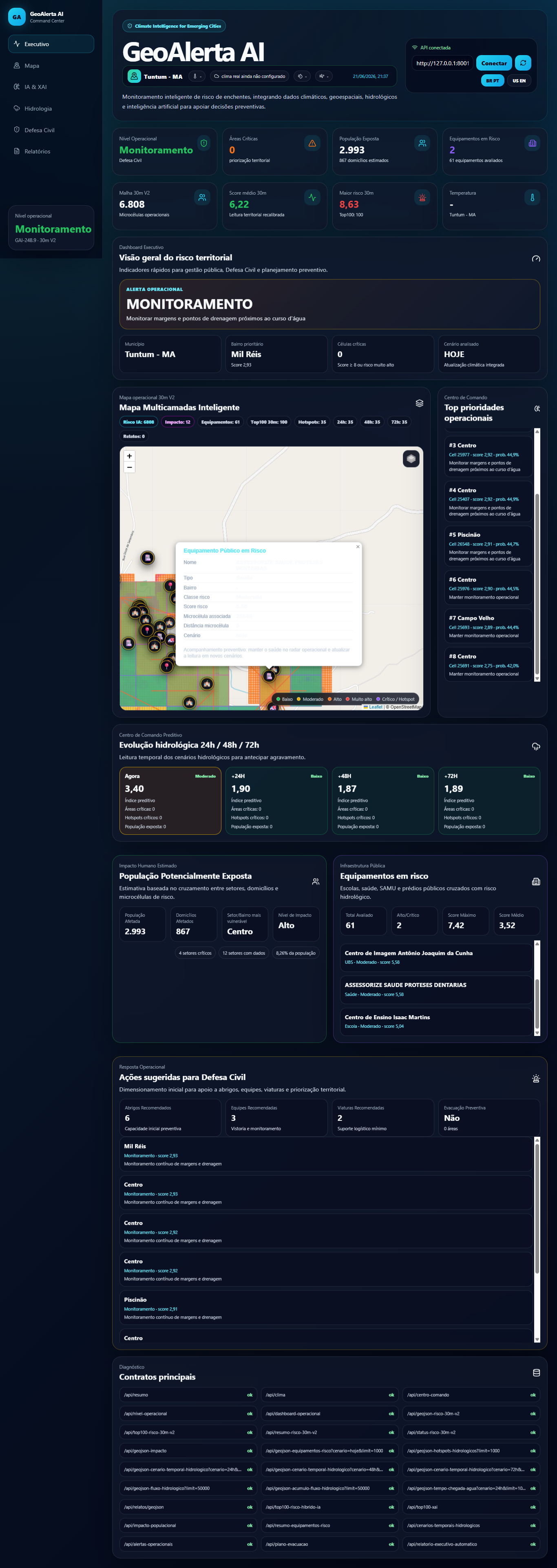
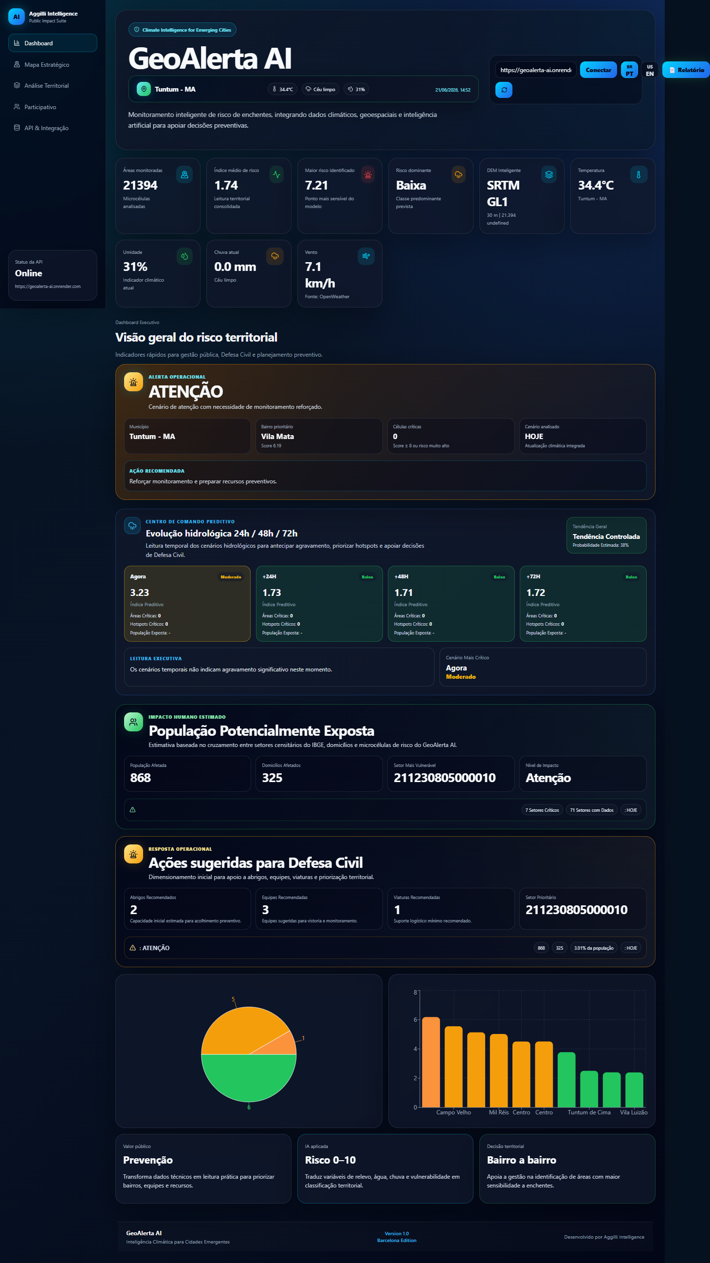
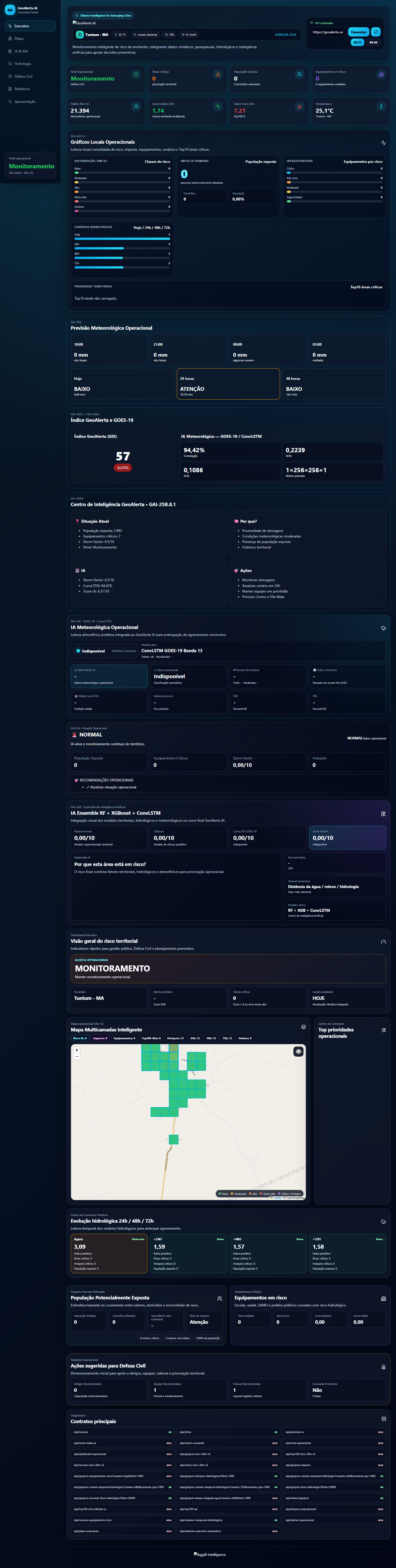
- Real-time risk maps
- AI-generated alerts
- Risk prioritization
- Decision support dashboards
- Operational recommendations for emergency managers
Instead of presenting raw environmental data, the platform transforms complex information into actionable intelligence.
How we built it
GeoAlerta AI combines modern AI technologies with geospatial computing.
Artificial Intelligence
- Random Forest
- XGBoost
- Deep Learning
- Large Language Models (LLMs)
Geospatial Intelligence
- GeoPandas
- PostGIS
- Digital Elevation Models
- Satellite imagery
- Remote sensing
Backend
- Python
- FastAPI
- PostgreSQL/PostGIS
- REST APIs
Frontend
- React
- JavaScript
Cloud Infrastructure
- Docker
- Google Cloud Run
The platform integrates multiple environmental datasets into a unified AI pipeline that continuously evaluates disaster risk.
Challenges we faced
Developing GeoAlerta AI involved several technical challenges.
The largest challenge was integrating heterogeneous geospatial datasets with different spatial resolutions and update frequencies.
Another challenge was designing machine learning models capable of producing interpretable risk scores suitable for decision-makers rather than only maximizing predictive accuracy.
Deploying scalable geospatial APIs and optimizing performance for large spatial datasets also required significant engineering effort.
What we learned
This project demonstrated that combining AI with geospatial intelligence can significantly improve disaster preparedness.
We also learned that operational systems require much more than accurate machine learning models.
Scalability, explainability, data quality, user experience, and integration with emergency workflows are equally important for real-world impact.
Impact
GeoAlerta AI enables emergency agencies to:
- Detect high-risk areas earlier
- Prioritize vulnerable populations
- Improve emergency planning
- Optimize resource allocation
- Reduce disaster response time
- Increase community resilience
The platform transforms environmental data into actionable decisions that can help protect lives and infrastructure.
Future Work
Our roadmap includes:
- Multi-hazard prediction
- Wildfire and drought monitoring
- AI agents for emergency operations
- Multi-city deployment
- Explainable AI (XAI)
- Integration with additional Earth observation satellites
- Mobile applications for field responders
- International deployment in climate-vulnerable regions
Why GeoAlerta AI?
Climate disasters are increasing worldwide.
Communities need intelligent systems capable of anticipating risks before they become emergencies.
GeoAlerta AI combines Artificial Intelligence, Earth Observation, and Geospatial Analytics to provide actionable early warnings that support faster decisions, stronger resilience, and ultimately help save lives.## Inspiration
What it does
How we built it
Challenges we ran into
Accomplishments that we're proud of
What we learned
What's next for GeoAlerta AI
Built With
- artificial-intelligence
- climatetech
- deep-learning
- disaster-risk-management
- docker
- early-warning-systems
- fastapi
- geoai
- geopandas
- gis
- google-cloud
- javascript
- llm
- machine-learning
- postgis
- postgresql
- python
- pytorch
- react
- remote-sensing
- rest-api
- satellite-imagery
- scikit-learn
- tensorflow
- xgboost


Log in or sign up for Devpost to join the conversation.