-
-

GeoAlerta AI Dashboard
-
GeoAlerta AI
-
GeoAlerta AI
-

GeoAlerta AI
-
GeoAlerta AI
-
GeoAlerta AI
-
GeoAlerta AI

Inspiration
GeoAlerta AI
Inspiration
Every year, floods and extreme weather events affect millions of people worldwide. While weather forecasts are increasingly accurate, local governments often lack intelligent tools that transform raw environmental data into actionable decisions.
GeoAlerta AI was created to bridge this gap by combining satellite imagery, weather forecasting, geospatial intelligence, and Large Language Models to help emergency teams anticipate disasters, prioritize response efforts, and protect vulnerable communities.
What it does
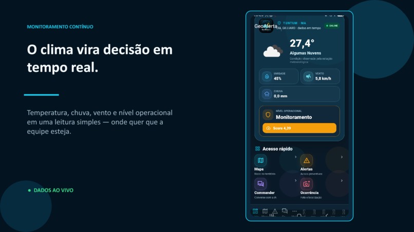
GeoAlerta AI is an AI-powered disaster prevention platform that predicts flood risk at high spatial resolution and assists emergency managers with real-time decision support.
The platform integrates:
- Satellite imagery
- Weather forecasts
- Terrain elevation and slope
- Hydrological features
- Population exposure
- Historical disaster events
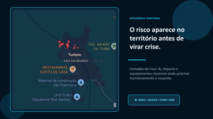
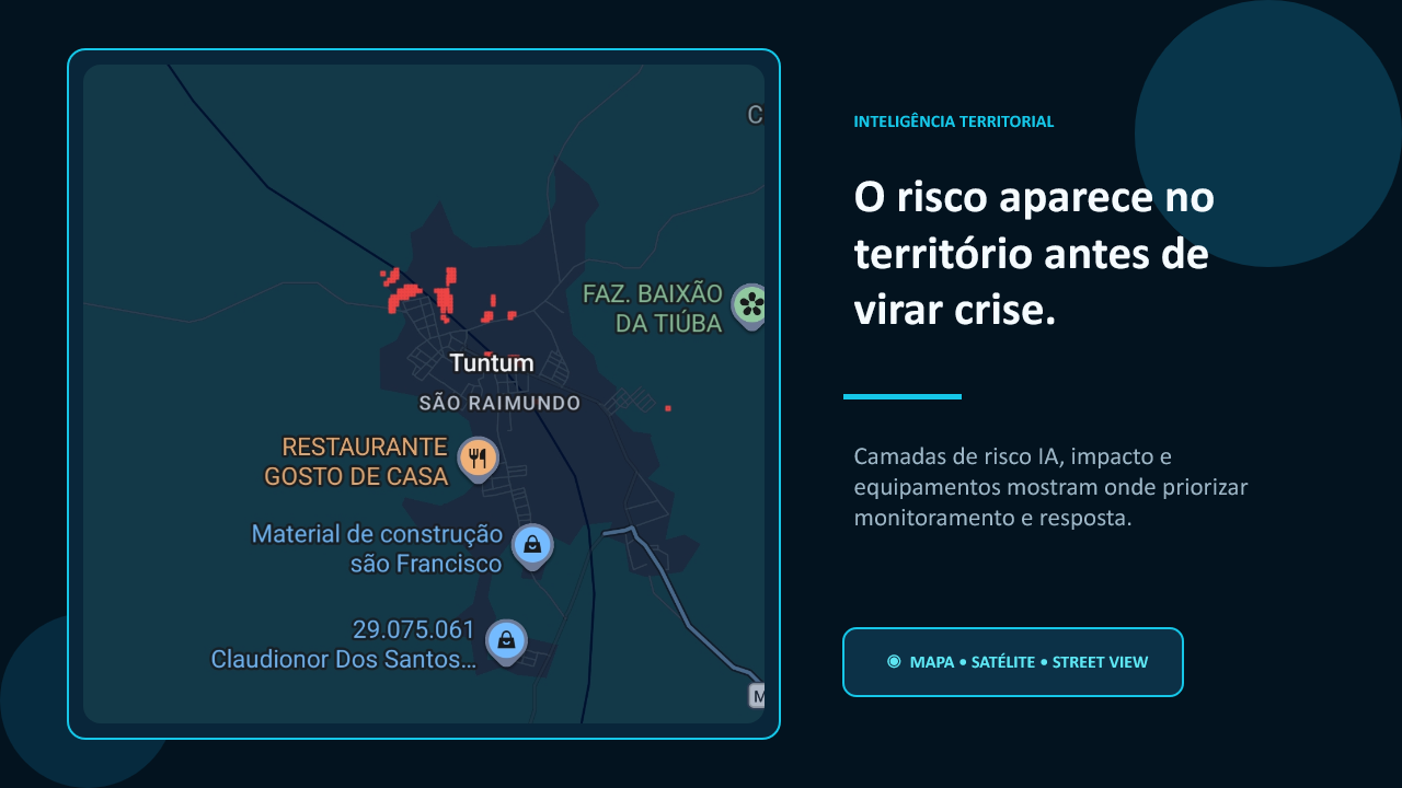
Using these data sources, GeoAlerta AI generates dynamic flood-risk maps, identifies vulnerable areas, and provides AI-assisted operational recommendations.
How we built it
GeoAlerta AI combines multiple AI techniques:
- Computer Vision
- Machine Learning
- Deep Learning
- Geospatial Analytics
- Retrieval-Augmented Generation (RAG)
- AI Agents
Our predictive engine uses:
- Random Forest
- XGBoost
- Convolutional Neural Networks (CNNs)
- ConvLSTM for spatiotemporal forecasting
- LLM-powered reasoning agents
The application is built using:
- Python
- FastAPI
- React
- PostgreSQL
- Docker
External data sources include:
- Satellite imagery
- Weather APIs
- Digital Elevation Models
- Hydrological layers
- Population datasets
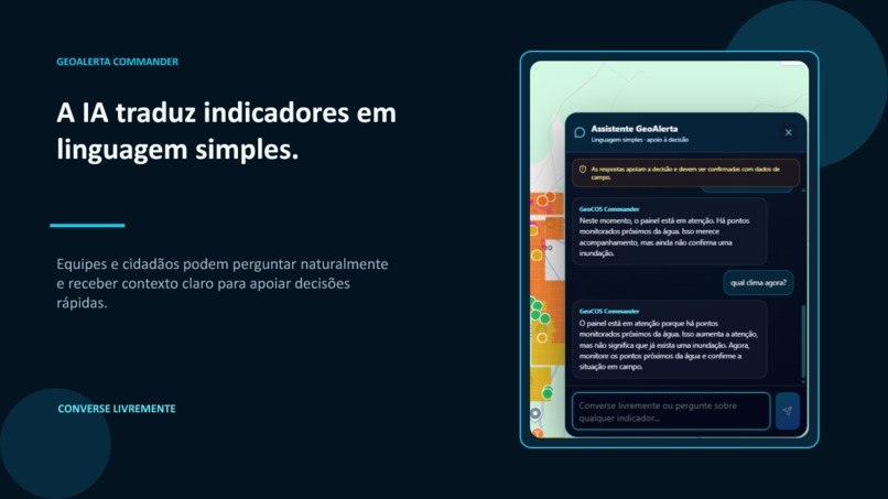
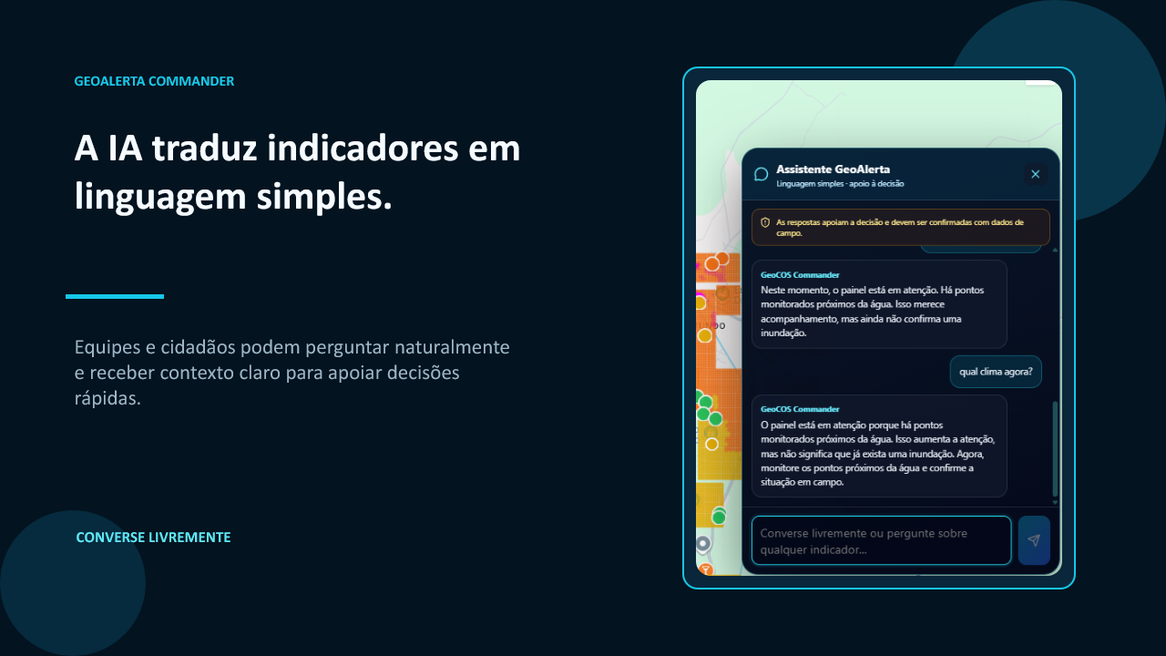
OpenAI models power the intelligent assistant, enabling emergency responders to query complex situations using natural language and receive contextual recommendations.
Challenges we ran into
Building a real-time disaster intelligence platform required solving several complex challenges:
- Integrating heterogeneous geospatial datasets
- Handling satellite imagery efficiently
- Predicting localized flood events
- Explaining AI predictions to decision makers
- Combining deterministic models with LLM reasoning
Ensuring reliable AI explanations for public-sector decision-making was one of the most important challenges.
Accomplishments that we're proud of
- High-resolution flood-risk prediction
- AI-powered emergency decision support
- Integration of multiple geospatial datasets
- Intelligent operational recommendations
- Scalable architecture ready for municipal deployment
GeoAlerta AI demonstrates how modern AI can improve disaster preparedness while supporting governments with faster and more informed decisions.
What we learned
We learned that combining predictive machine learning with reasoning-capable LLMs creates a much more useful system than using either approach independently.
Traditional models identify where risk exists, while AI agents help explain why it exists and recommend the best operational response.
What's next for GeoAlerta AI
Our roadmap includes:
- Multi-hazard prediction (floods, landslides, droughts and wildfires)
- Real-time satellite monitoring
- Autonomous AI emergency agents
- Voice-based emergency assistant
- Integration with Civil Defense agencies
- Deployment for municipalities worldwide
Our long-term vision is to build an AI Copilot for Disaster Management that helps governments save lives before disasters happen.
What it does
How we built it
Challenges we ran into
Accomplishments that we're proud of
What we learned
What's next for GeoAlerta AI
Built With
- agents
- ai
- api
- cnn
- codex
- computer
- convlstm
- database
- deep
- docker
- fastapi
- forest
- geopandas
- gpt-5
- learning
- machine
- openai
- postgresql
- python
- rag
- random
- react
- vision
- xgboost


Log in or sign up for Devpost to join the conversation.