-
-
Your intelligent spatial assistant for drawing, searching, and chatting to unlock spatial insights
Inspiration
It all began with a simple question during a brainstorming session: "Why can't finding the best place to open a store be as easy as asking Google a question?" We recognized that powerful geospatial analysis is often hidden behind complex technical tools, requiring specialized GIS expertise and datasets that are difficult for non-experts to interpret. From farmers planning optimal crops to retailers selecting new store locations or EV companies scouting charging stations, everyone needs spatial insights, but not everyone is a GIS analyst. This core challenge sparked the creation of GeoAI—an intuitive, AI-powered platform designed to bridge the gap between intricate spatial data and everyday decision-makers.
What it does
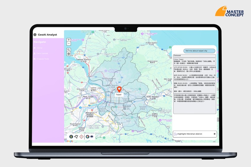
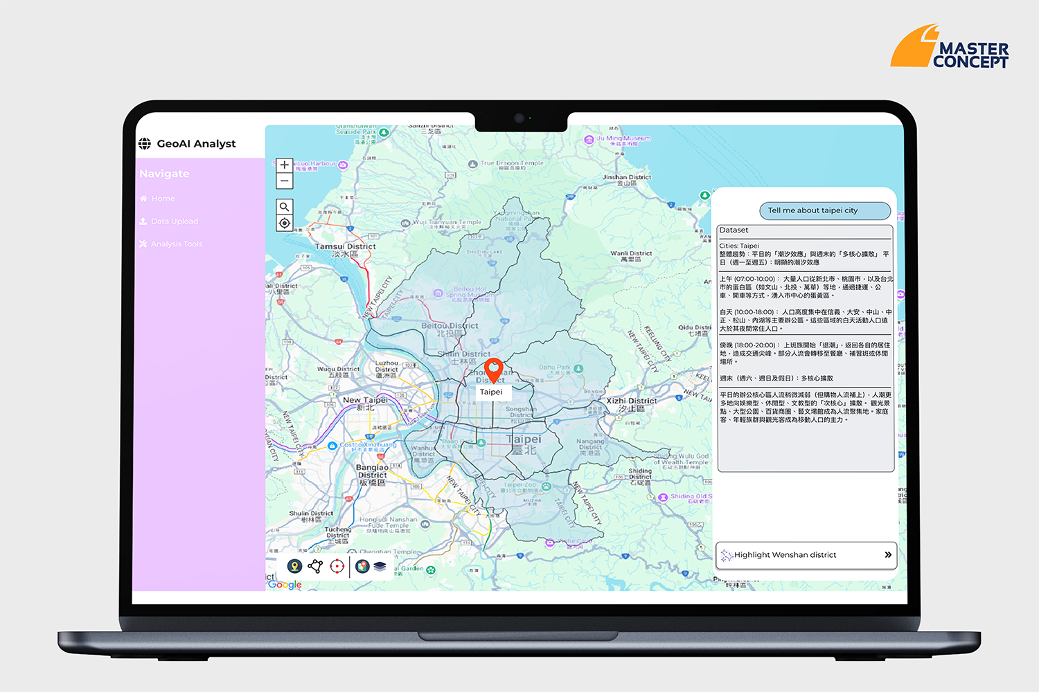
GeoAI empowers users to unlock valuable spatial insights through natural language. We envisioned a tool where anyone could:
- Simply type a question like "Where can I build a hospital in Taipei?"
- Draw a shape on the map and instantly receive relevant building or zoning insights.
Crucially, GeoAI provides these powerful capabilities without requiring users to understand technical jargon like Overpass, PostGIS, or complex zoning codes. It democratizes access to sophisticated geospatial analysis, making it accessible and actionable for a wide audience.
How we built it
We built GeoAI by meticulously integrating advanced AI with robust geospatial data and tools. A key aspect of our development focused on creating a seamless user experience. We engineered the platform to:
- Translate vague or complex natural language prompts into precise, usable spatial queries that the system can interpret.
- Dynamically handle large-scale OpenStreetMap (OSM) data in real-time without compromising browser performance.
- Guide users step-by-step when the AI requires more input for clarification, ensuring an intuitive and helpful interaction.
- Utilize AI as a collaborative partner in decision-making, rather than just a simple responder, enhancing the quality of insights.
We also developed powerful features such as highlighting buildings within user-drawn polygons and combining spatial filters with natural language commands, which were unlocked by successfully integrating AI with shape tools.
Challenges we ran into
Developing GeoAI presented several significant technical and design challenges:
- Managing large spatial datasets in real-time proved complex, requiring innovative solutions to ensure performance and responsiveness.
- Handling fuzzy and ambiguous natural language prompts from users demanded sophisticated AI interpretation models.
- Combining dynamic Large Language Model (LLM) outputs with precise geospatial boundaries required careful integration to maintain accuracy.
Integrating AI with interactive shape tools was a major puzzle, but solving it unlocked some of the platform's most powerful and intuitive features.
Accomplishments that we're proud of
GeoAI empowers users to ask, explore, and act on spatial data, one prompt or shape at a time. From identifying land for a solar farm to strategically planning a retail chain, GeoAI transforms complex analyses into straightforward actions. Our ability to simplify intricate geospatial processes and provide immediate, actionable insights to a broad audience is a testament to our innovative approach.
What's next for GeoAI
This is just the beginning for GeoAI. We are excited to continue expanding its capabilities, focusing on:
- Broader geographical coverage: Incorporating more cities and countries to extend its global reach.
- Real-time risk overlays: Integrating dynamic data for factors like flood, climate, and crime to provide more comprehensive insights.
- Dynamic dashboards: Developing customizable dashboards for more in-depth data visualization and analysis.
- Even more powerful LLM + GIS fusion: Continuously advancing the integration of AI and geospatial information systems to unlock new analytical possibilities.
We believe GeoAI will continue to revolutionize how individuals and businesses interact with and leverage spatial data for critical decisions.
Built With
- flask
- gemini-api
- geopandas
- google-maps-platform-sdks
- osm-extract
- shapely

Log in or sign up for Devpost to join the conversation.