Inspiration
The inspiration came from Patricia Lambert, a retired teacher in Sault Ste. Marie whose five-minute bus trip to church became 49 minutes after the city redesigned its transit network. Her experience made me question how municipal decisions are evaluated. A change might improve a transit network overall, but what about the individuals it leaves behind?
I built Gait to make those consequences visible, particularly for riders with mobility challenges, by showing how council decisions affect the journeys people actually take.
What it does
Gait shows what a Toronto council decision does to your own bus trip.
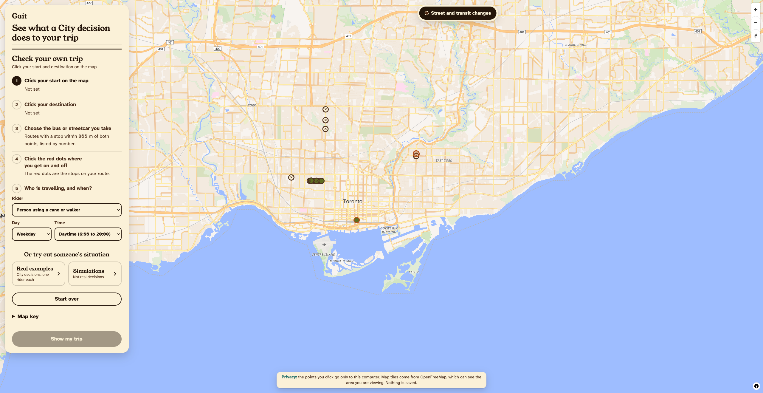
- Pick your trip on a 3D map: your start, destination, route and stops, plus who you are: a wheelchair user, a senior with a walker, or a shift worker.
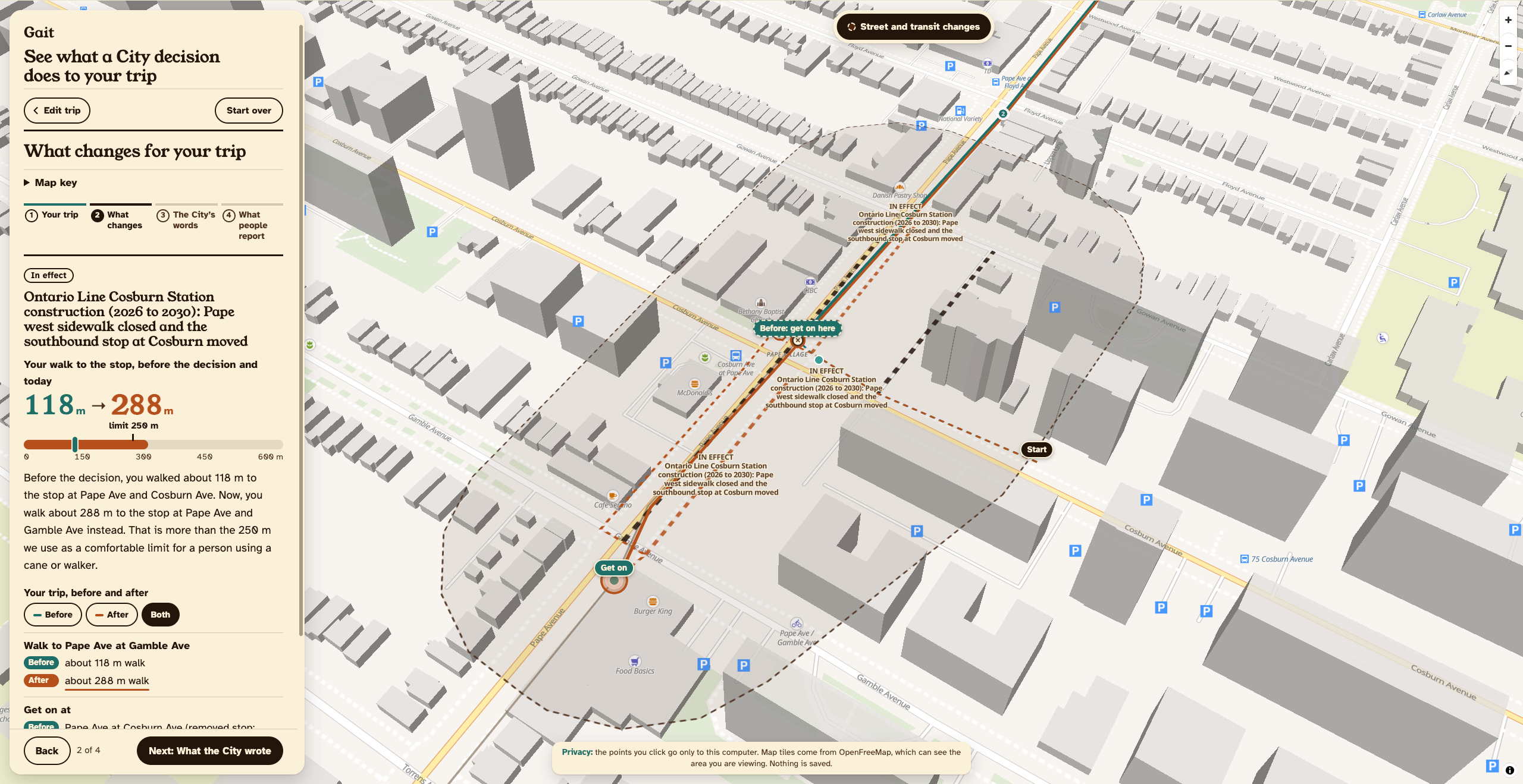
- See before and after: how a decision changed your walk and stops. For example, Ontario Line construction stretched one senior's walk to the 72 Pape from 118 m to 288 m, measured on the City's real sidewalks.
- Every fact is sourced: Gait quotes the City's own reports with page numbers, and re-checks each quote on its page live.
- See what people report: 311 complaints (snow, broken sidewalks) along your new route.
- Have your say: Gait drafts a report you can send to your councillor, 311 or the TTC. Fully private! No accounts, and nothing stored about you.
How I built it
Stack: Python, FastAPI with server-rendered Jinja pages, MapLibre for the 3D map with OpenFreeMap tiles, and SQLite. It's deployed with Docker on Railway.
- Saved real pages from Toronto council and parsed them into stages, decisions and comment buttons. Extracted these reports with pypdf, which went into a SQLite search index.
- AI is important. Claude sdk is used to write plain summaries. RAGs are used to retrieve report passages from the above.
Challenges I ran into
- Data is considerably hard to get. First of all, even extracting the information-- they're often long pdfs with hundreds of pages. Searching for something in that is not that efficient, which is why I used a RAG.
- only today's TTC schedule is published. As you can imagine, you'd have to "reverse" map each proposal to get older schedules. That is quite hard.
- Many more issues that I had claude help debug
Limitations
- No live conditions. Reports on a new route can't be verified. The TTC does not document well enough how acccessibility needs are met (curb ramps, slopes, elevators for accessibility, conditions of seats and shelters, etc...) 311 data is the best I have to estimate the accessibility situation at a station.
- Currently, decisions are entered by hand. It is quite difficult to keep track of every single change and takes quite a lot of storage (public transit changes aren't the only changes that get passed). Also this is a prototype, so keeping the # of municipal decisions small is good.
- Only supports one ride: a boarding stop and exit stop and walking to and from those. This could be expanded in the future.
Accomplishments that I'm proud of
- Found an actual problem and addressed it. Would've loved to work with someone else on it to alleviate the workload.
What I learned
- a creative ui design is quite hard
What's next for gait
- Obviously expand for more than several municipal decisions, (prototype to actual product)
- Integrate with a maps app. Riders actually use google maps everyday, so they could see municipal decisions often. I thought of making this some sort of extension of google maps, but that will take a long time.
https://vinyx-gait.up.railway.app/ <- instead of inputing your own route, instead opt for the example routes.

