-
-
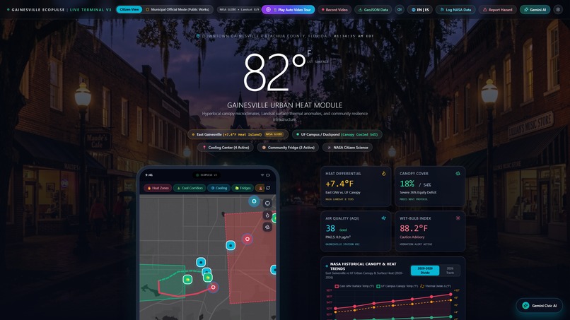
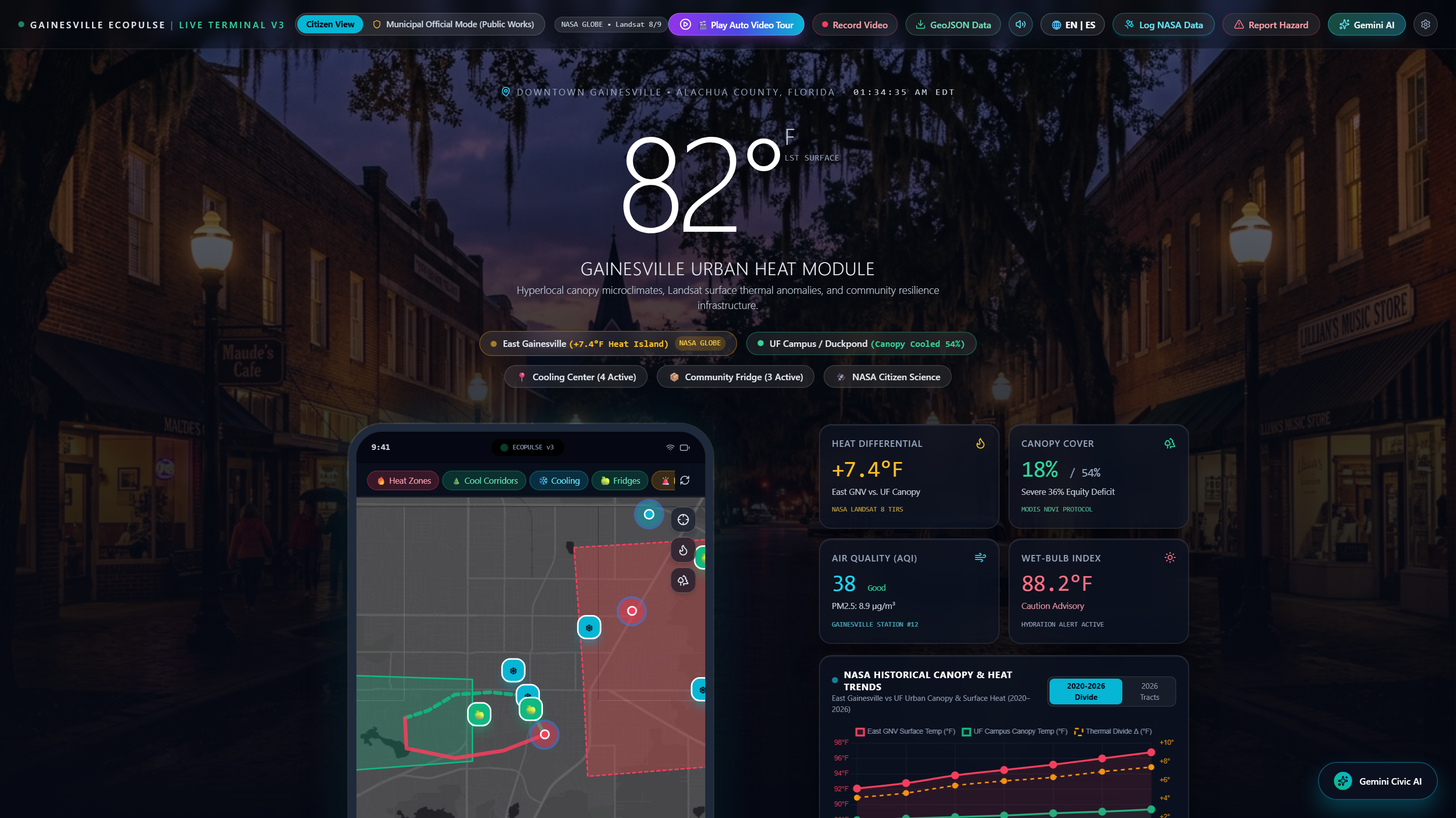
Citizen Dashboard: Hyperlocal Gainesville heat metrics, NASA GLOBE telemetry, and 82°F surface temp index.
-
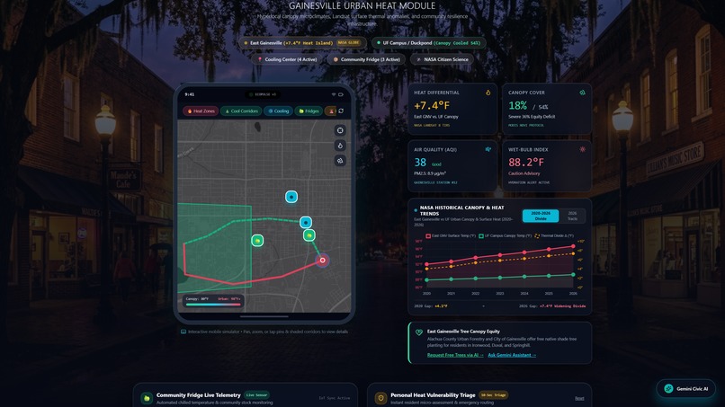
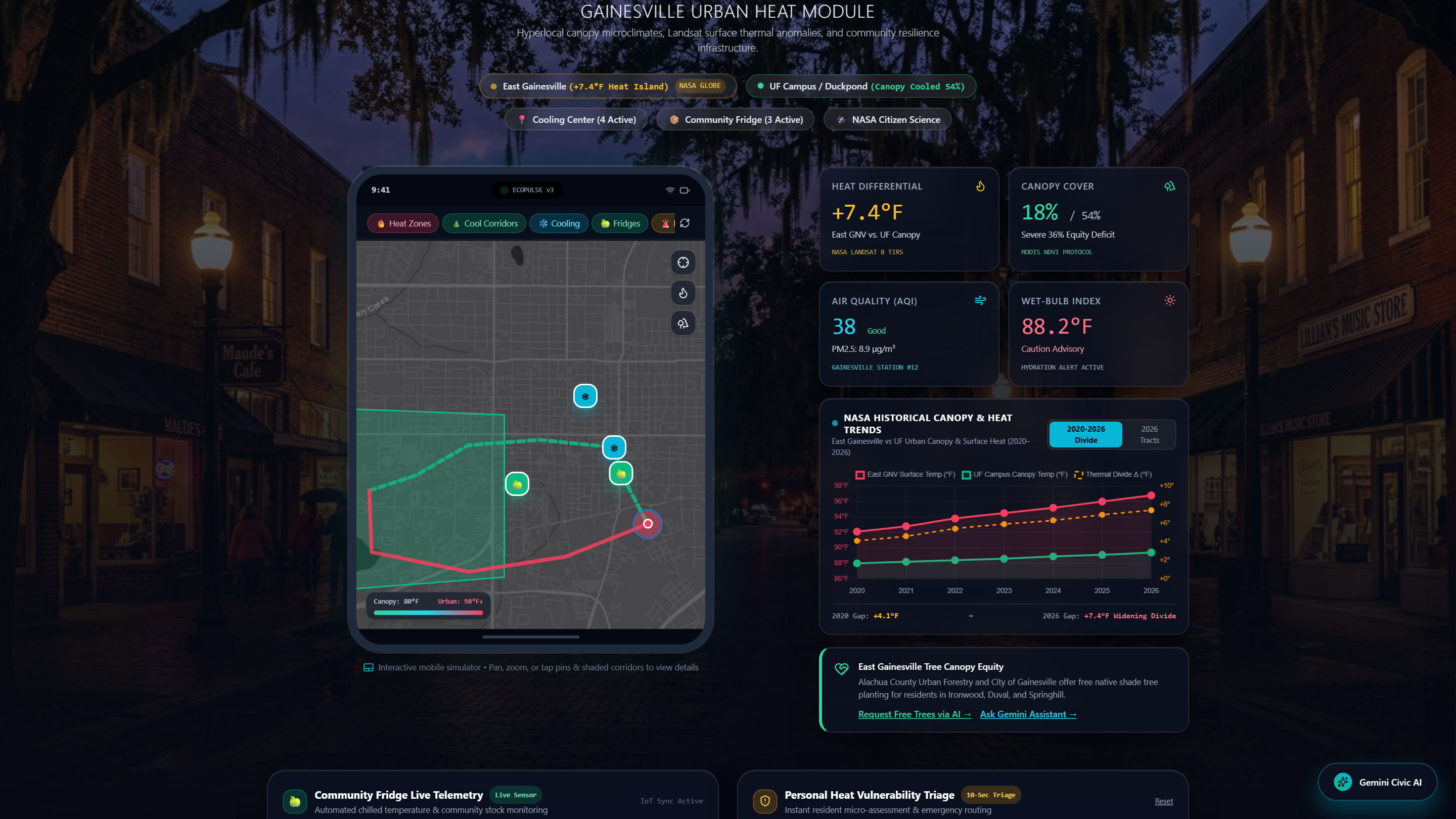
Interactive GIS: Canopy-shaded Cool Corridors (-4.5°F thermal buffer) and real-time mutual-aid fridge telemetry.
-
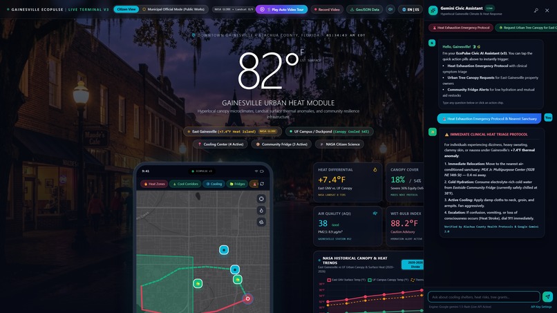
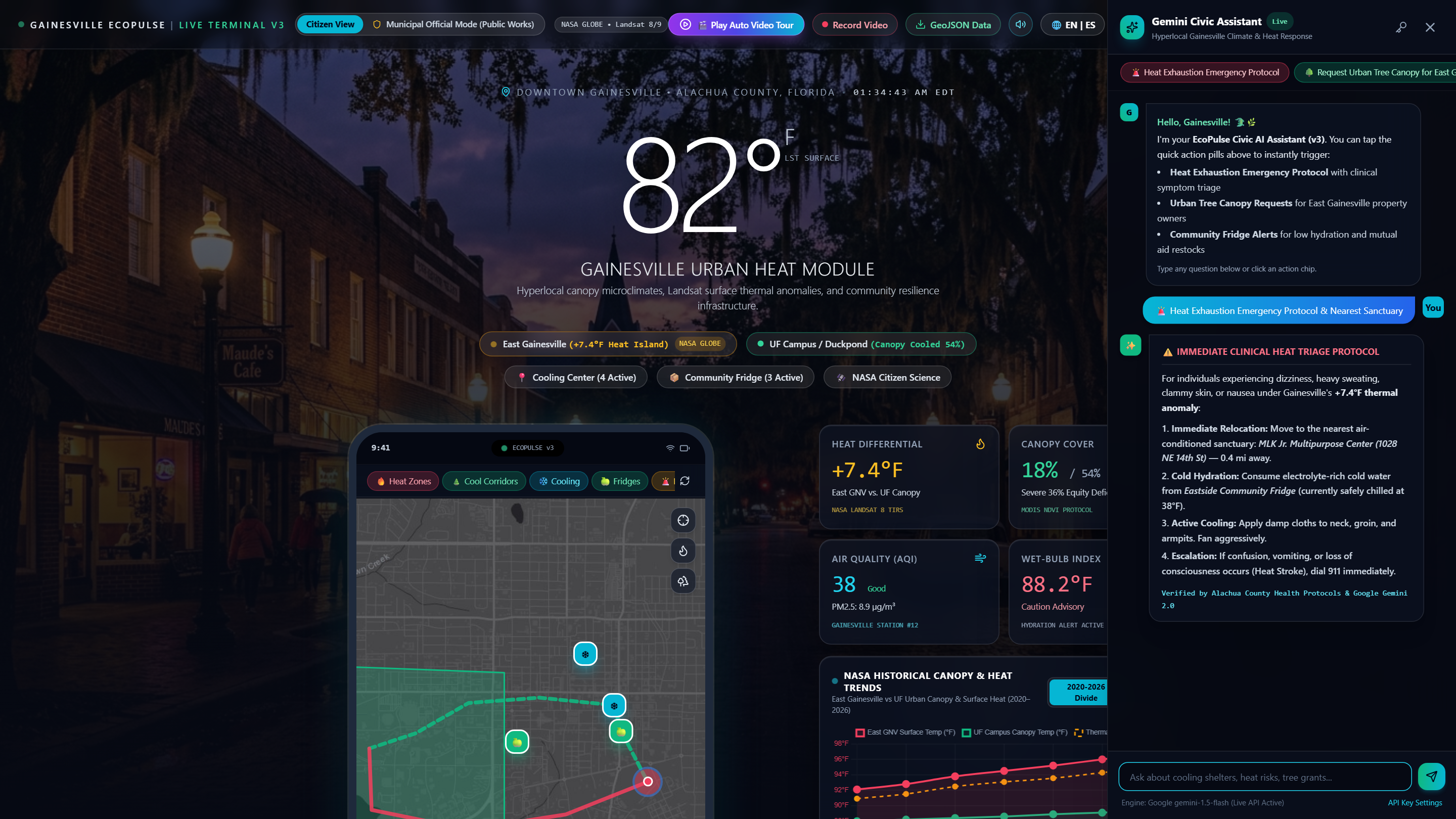
Google Gemini AI: Instant clinical heatstroke triage and automated civic cooling shelter navigation.
-
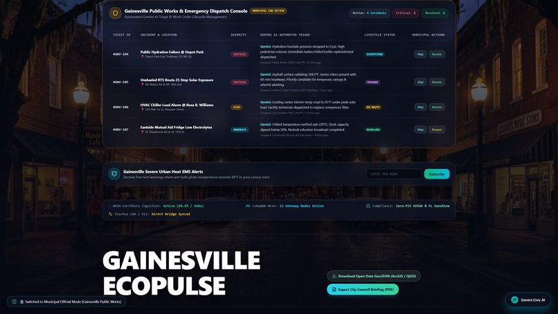
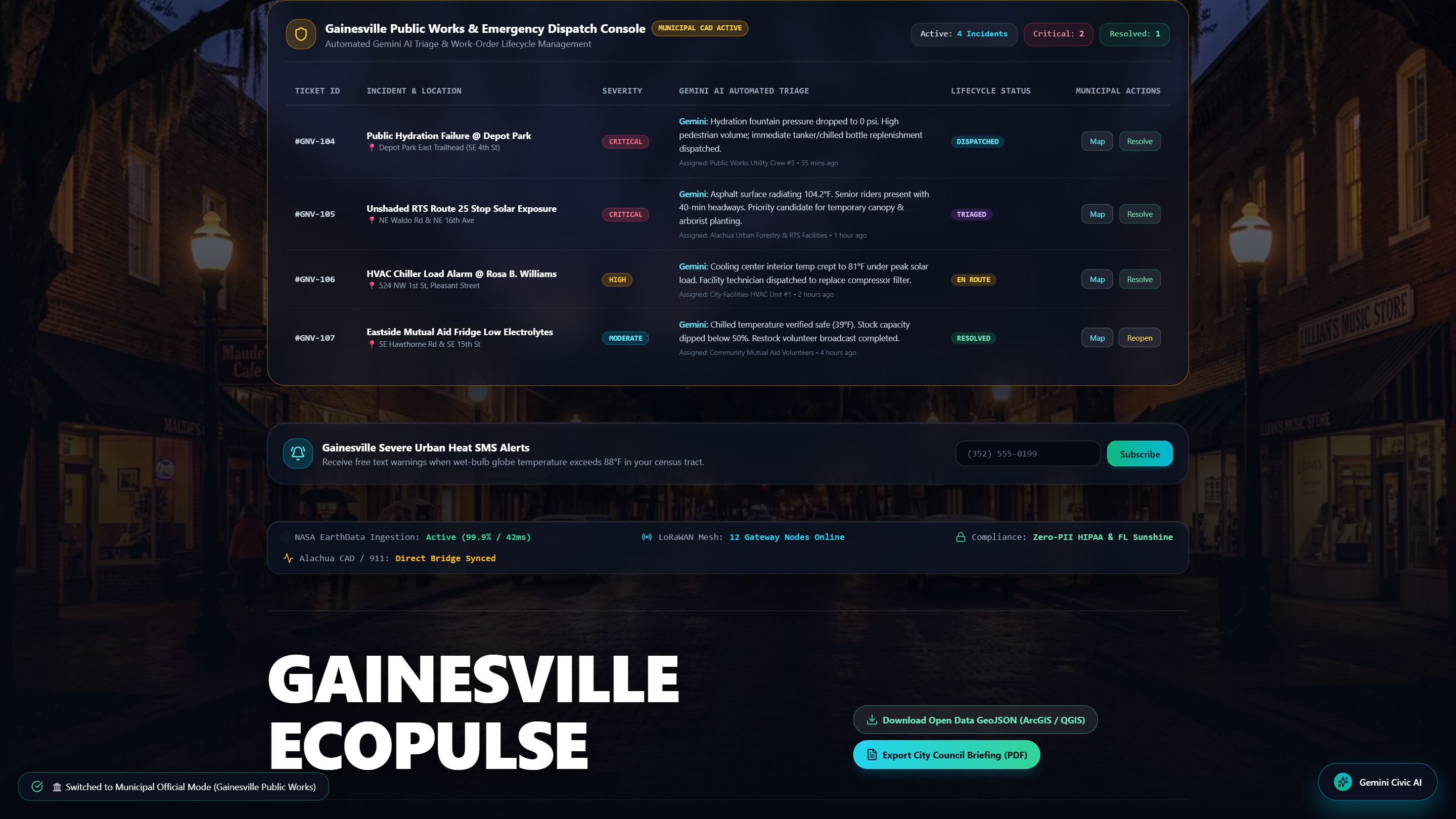
City Official Console: Public Works CAD dispatch, priority ticketing, and one-click ESRI ArcGIS GeoJSON export.
Inspiration
What it does
How we built it
Challenges we ran into
Accomplishments that we're pr## Inspiration
In Gainesville, Florida, summer heat is unequally distributed. Historic tree canopy loss and asphalt density produce a persistent +7.4°F to +9.2°F Urban Heat Island anomaly in East Gainesville compared to shaded zones like the UF Campus. Gainesville EcoPulse was built to bridge this thermal and environmental divide using open NASA earth data and Google Gemini AI.
What it does
- Hyperlocal GIS Heat Map: Visualizes microclimates, canopy coverage, and thermal anomalies calibrated against NASA Landsat-9 and GLOBE protocols.
- Cool Corridors: Directs pedestrians along shaded oak canopies to reduce direct heat exposure by 4.5°F.
- Mutual-Aid Telemetry: Monitors Community Fridge internal temperatures and hydration stock levels in real time.
- Google Gemini AI Triage: Delivers instant clinical heat exhaustion guidance and Cooling Shelter routing.
- Municipal Official CAD: Equips City Public Works with an incident dispatch console and one-click ESRI ArcGIS/GeoJSON export.
How we built it
- Frontend: HTML5, Tailwind CSS, Leaflet.js, and Chart.js.
- AI Engine: Google Gemini API for emergency triage and automated civic ticketing.
- Data Sources: NASA GLOBE surface telemetry and City of Gainesville open GIS layers.
- DevOps: Containerized with Docker and deployed on Vercel.
Challenges we ran into
Integrating real-time geospatial layers while ensuring Zero-PII compliance under Florida Sunshine Law (F.S. Ch. 119) requirements.
Accomplishments that we're proud of
Delivering an enterprise-ready civic dashboard with sub-second response times, dual-stakeholder (Citizen vs. City Official) modes, and offline deterministic fallback.
What's next for Gainesville EcoPulse
Deploying physical ESP32 LoRaWAN ambient temperature sensors across RTS bus stops and expanding integration with Alachua County emergency management systems.oud of
What we learned
What's next for Gainesville EcoPulse
Built With
- chart.js
- docker
- google-gemini-api
- html5
- javascript
- leaflet.js
- nasa-globe-data
- tailwindcss

Log in or sign up for Devpost to join the conversation.