
Inspiration
GAIA was inspired by a simple question:
What if environmental data could do more than describe a problem — what if it could help us decide what to do next?
Many regions face increasing environmental pressure from drought, extreme heat, vegetation loss, land degradation, water stress, and soil problems. However, environmental information is often scattered, technical, or difficult for non-specialists to translate into practical action.
I wanted to build a system that could take a location, evaluate its environmental condition, and transform that information into clear and understandable restoration recommendations.
That idea became GAIA — an environmental decision-support prototype for smarter ecological restoration.
What GAIA Does
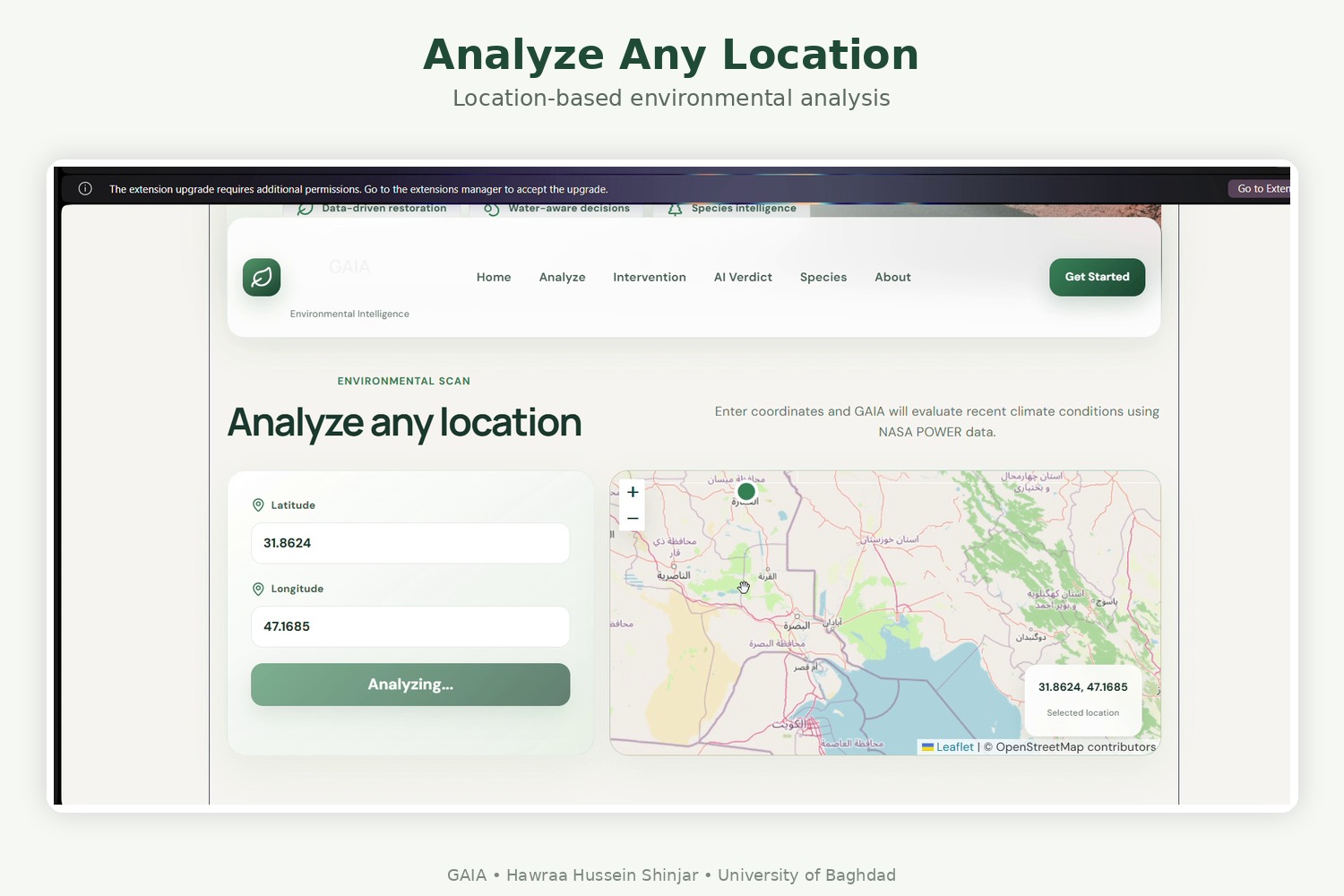
GAIA allows a user to analyze a specific geographic location using latitude and longitude.
The system then:
- Evaluates environmental risk for the selected location
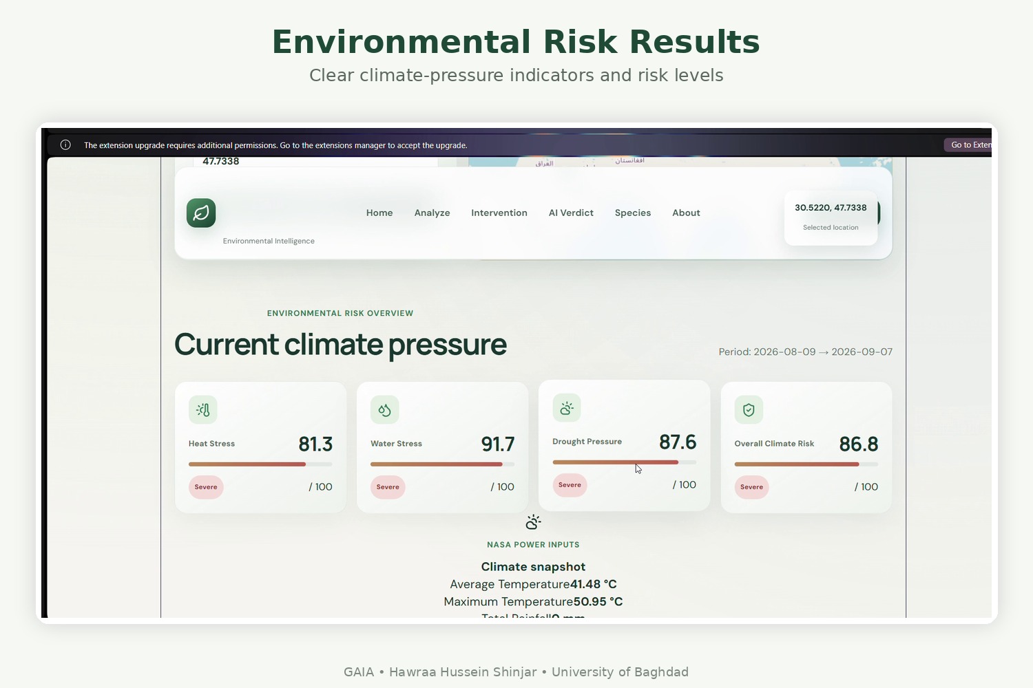
- Generates an overall risk score and severity level
- Identifies major environmental pressures
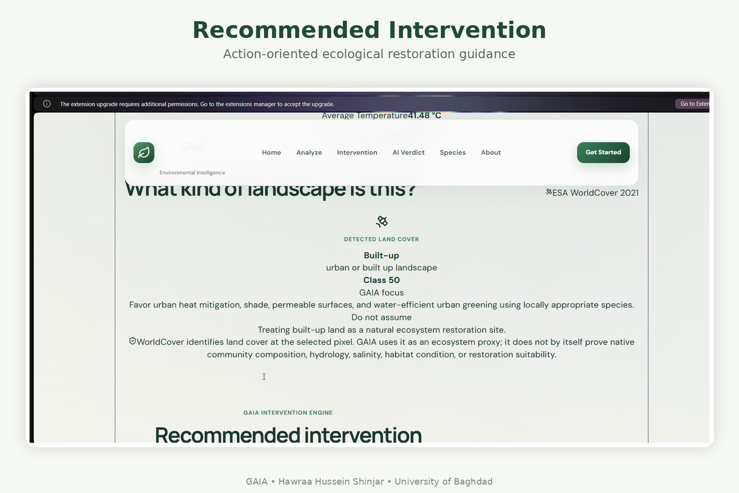
- Recommends an appropriate ecological intervention
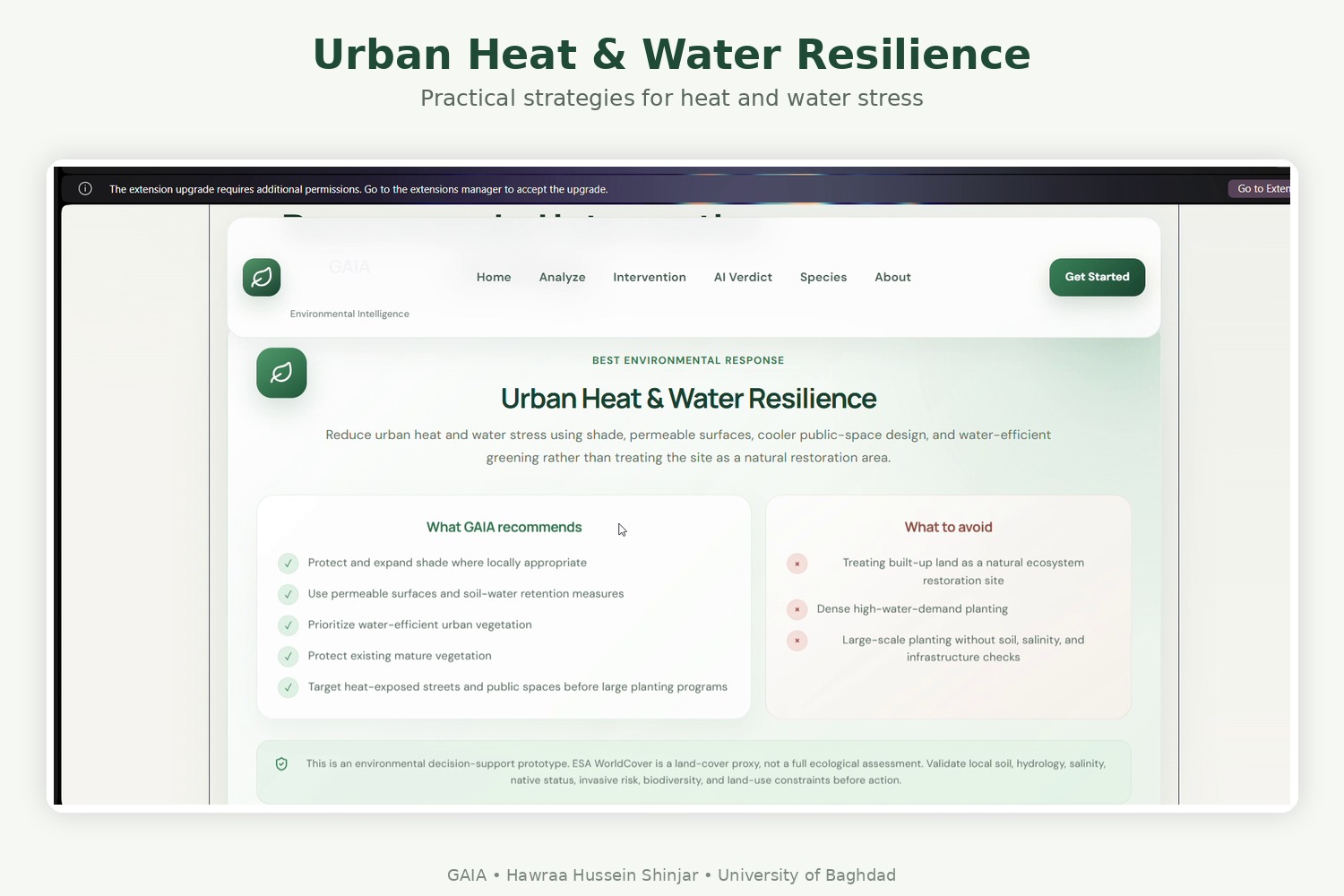
- Provides practical restoration actions
- Highlights actions that should be avoided
- Presents the results through a simple and understandable interface
For example, when a location shows severe drought and heat stress, GAIA may recommend drought-resilient ecological restoration, including:
- Prioritizing drought- and heat-tolerant native vegetation
- Improving soil moisture retention
- Reducing unnecessary irrigation demand
- Protecting existing vegetation
- Checking soil, salinity, and groundwater conditions before large-scale planting
The system can also address challenges such as urban heat and water resilience.
How I Built It
GAIA was developed as a web-based environmental decision-support prototype.
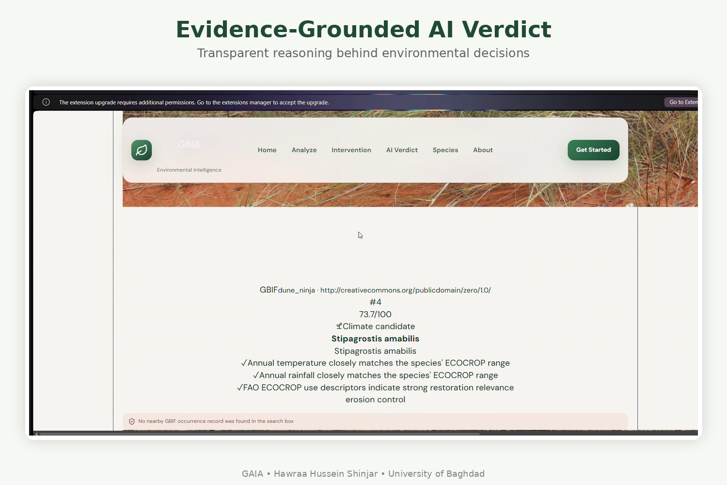
The workflow begins when the user provides geographic coordinates. The system processes the location through an environmental decision engine and returns structured results containing:
- Environmental risk score
- Risk classification
- Recommended intervention
- Priority level
- Restoration strategy
- Suggested actions
- Actions to avoid
The current version of GAIA uses a rule-based decision engine.
This is an important part of the project: the current prototype is not a trained machine-learning model. Instead, environmental conditions are evaluated using predefined decision rules that connect different risk conditions with appropriate restoration strategies.
This approach allowed me to build a transparent prototype where the reasoning behind a recommendation can be understood and improved.
The architecture was also designed so that future versions can integrate richer spatial datasets, satellite observations, environmental APIs, GIS layers, and eventually machine-learning models.
Challenges I Faced
One of the biggest challenges was deciding how to transform environmental indicators into recommendations that were actually useful.
Simply displaying a risk score was not enough. I wanted GAIA to answer a more important question:
“What should we do about this risk?”
Another challenge was designing the decision logic carefully enough to avoid unrealistic recommendations.
For example, recommending large-scale vegetation restoration without considering drought, water demand, soil conditions, or salinity could create new problems instead of solving existing ones.
I also had to think about how to present technical environmental information in a way that remains understandable to users without an environmental science background.
Finally, I had to balance the ambition of the idea with what could realistically be built as a working prototype during a hackathon.
What I Learned
Building GAIA taught me that creating an intelligent system is not only about using complex AI models.
A useful system also needs:
- Clear decision logic
- Reliable data
- Explainable recommendations
- Good user experience
- Awareness of real-world limitations
I also learned more about environmental decision-making, spatial data, backend logic, API-based systems, and how software can connect technical information with real-world sustainability problems.
Most importantly, I learned how to move from an environmental problem to a functioning prototype that demonstrates a possible solution.
What's Next
GAIA is currently a proof of concept, but the idea can grow significantly.
Future versions could integrate:
- Satellite and remote-sensing data
- NDVI and vegetation monitoring
- Temperature and drought indicators
- Soil and salinity datasets
- Rainfall and groundwater information
- GIS and other spatial datasets
- Historical environmental trends
- Machine-learning models
- More advanced location-specific recommendations
With richer spatial and environmental data, GAIA could evolve from a prototype into a more powerful decision-support platform for researchers, planners, environmental organizations, and communities.
The long-term goal is simple:
Turn environmental data into decisions — and help restoration happen smarter.
Built With
- api
- data
- ecocrop
- environmental
- esa
- fao
- fastapi
- gbif
- geospatial
- javascript
- leaflet.js
- nasa
- numpy
- openai
- pandas
- power
- react
- render
- requests
- rest
- scikit-learn
- uvicorn
- vite
- worldcover

Log in or sign up for Devpost to join the conversation.