GAIA Reach: Health Resource Optimization Platform
Data-Driven Healthcare Access for Malawi
Inspiration
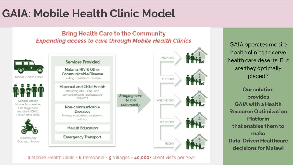
GAIA Global Health operates mobile health clinics across Malawi to bring care to communities living in healthcare deserts.
But a critical question remains — are these clinics placed where they can have the greatest impact?
Our goal with GAIA Reach is to help answer that question. We wanted to build a platform that empowers GAIA to make data-driven healthcare decisions, ensuring every new clinic or mobile stop reaches those who need it most.
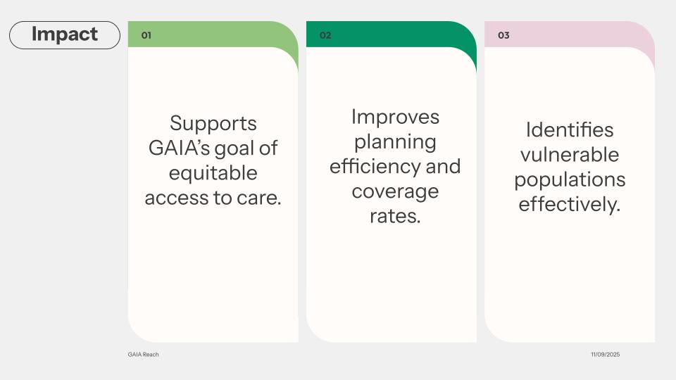
At its heart, this project is about equity: transforming data into actionable insights that help deliver care to the underserved.
What It Does
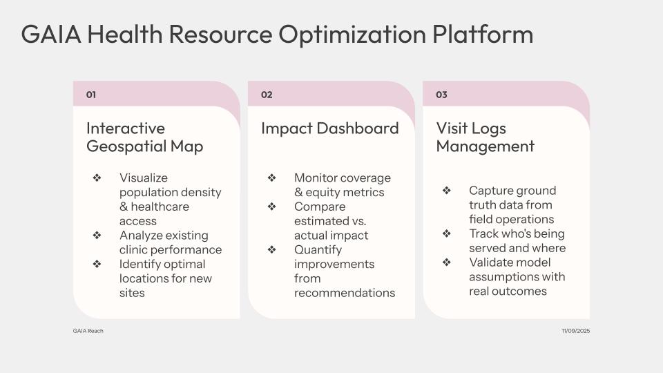
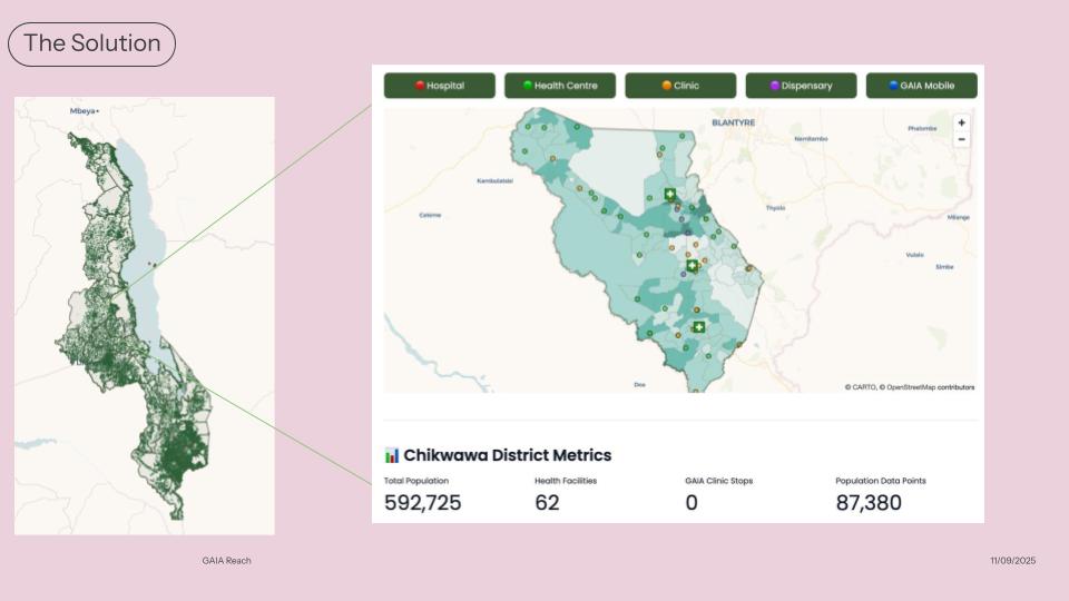
GAIA Reach is a geospatial decision-support platform that helps GAIA visualize, analyze, and optimize healthcare access.
The platform integrates multiple capabilities:
- 🗺️ Interactive Geospatial Map: Visualizes population density and healthcare access gaps.
- 📊 Impact Dashboard: Compares estimated vs. actual clinic performance and monitors equity metrics.
- 🧾 Visit Logs Management System: Captures field data from mobile health operations to validate model assumptions with real-world outcomes.
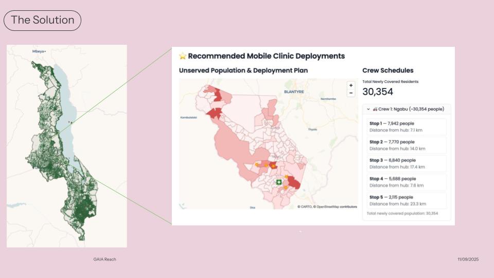
- 🌍 Optimization Algorithm: Recommends new clinic or mobile stop locations that maximize coverage, equity, and efficiency.
Together, these tools give GAIA the power to see where gaps exist, measure their impact, and plan smarter interventions.
How We Built It
The platform was developed as a Python-first solution, balancing accessibility with analytical power.
- Frontend: Built with Streamlit for an intuitive, browser-based interface with built-in caching for instant load times.
- Mapping & Visualization: PyDeck (deck.gl) for interactive web-based maps, Streamlit's native charting for metrics and bar charts.
- Geospatial Analysis: GeoPandas and Shapely for spatial operations, joins, and GeoJSON boundary management.
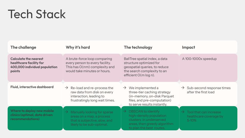
- Spatial Optimization: Custom algorithms using BallTree (scikit-learn) and cKDTree (scipy) spatial indices for efficient haversine distance calculations across millions of population points.
Data Pipeline: Three-tier caching system (memory, disk, pre-computation) with Parquet storage for fast startup and responsive analysis.
Data Sources:
- Meta Data for Good via HDX - High-resolution population density maps (~1.5GB)
- GAIA's internal clinic locations and visit logs
- Malawi Health Facility Registry (MHFR) - ~1,400 facilities
- geoBoundaries - Administrative boundaries
By layering these datasets and analytics with optimized spatial algorithms, GAIA Reach produces evidence-based recommendations in seconds, even when analyzing millions of data points.
Challenges We Ran Into
- 🧩 Data Fragmentation: Population, clinic, and performance data existed in silos — integration and cleaning required careful alignment.
- 🧮 Model Validation: Estimating “expected impact” required assumptions about clinic catchment areas and service utilization.
- 🗺️ Visualization Complexity: Showing all data on one map was overwhelming, so we implemented district-level filtering and progressive disclosure.
- 🧠 Equity Metrics: Defining fairness in healthcare access (not just distance or coverage) required balancing quantitative and qualitative measures.
Accomplishments That We're Proud Of
- Built a working prototype that unifies spatial data, analytics, and visualization in one cohesive platform.
- Enabled district-level exploration so decision-makers can focus on local realities, not just national aggregates.
- Developed a data-driven recommendation engine that highlights high-impact new clinic sites.
- Strengthened GAIA’s mission with a tool that directly supports equitable healthcare access.
What We Learned
- Data visualization is as much about storytelling as it is about statistics.
- Simplicity in interface design can make complex analytics accessible to non-technical users.
- Collaboration between technical and healthcare professionals is crucial — context matters as much as code.
- Geospatial analysis can uncover invisible patterns — the “hidden deserts” that traditional planning misses.
What's Next for GAIA Reach
We’re excited to expand GAIA Reach beyond the prototype stage into a scalable planning and monitoring tool.
Next steps:
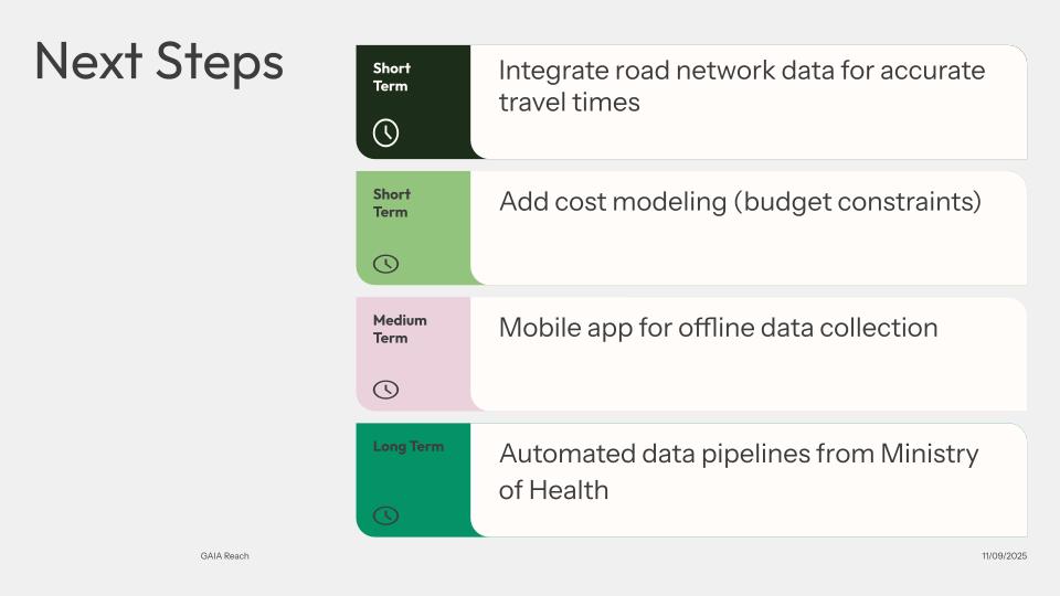
- 📱 Mobile app for offline data collection and field validation.
- 🔗 Automated data pipelines to integrate with Ministry of Health systems.
- 🛣️ Road network analysis for more accurate travel-time modeling.
- 💰 Cost modeling to incorporate budget constraints in recommendations.
- 🌍 Regional scale-up across multiple countries where GAIA operates.
Our vision:
A world where no community is left behind because of where they live — and where every healthcare investment is guided by data, compassion, and equity.
Built With
- streamlit

Log in or sign up for Devpost to join the conversation.