-
-

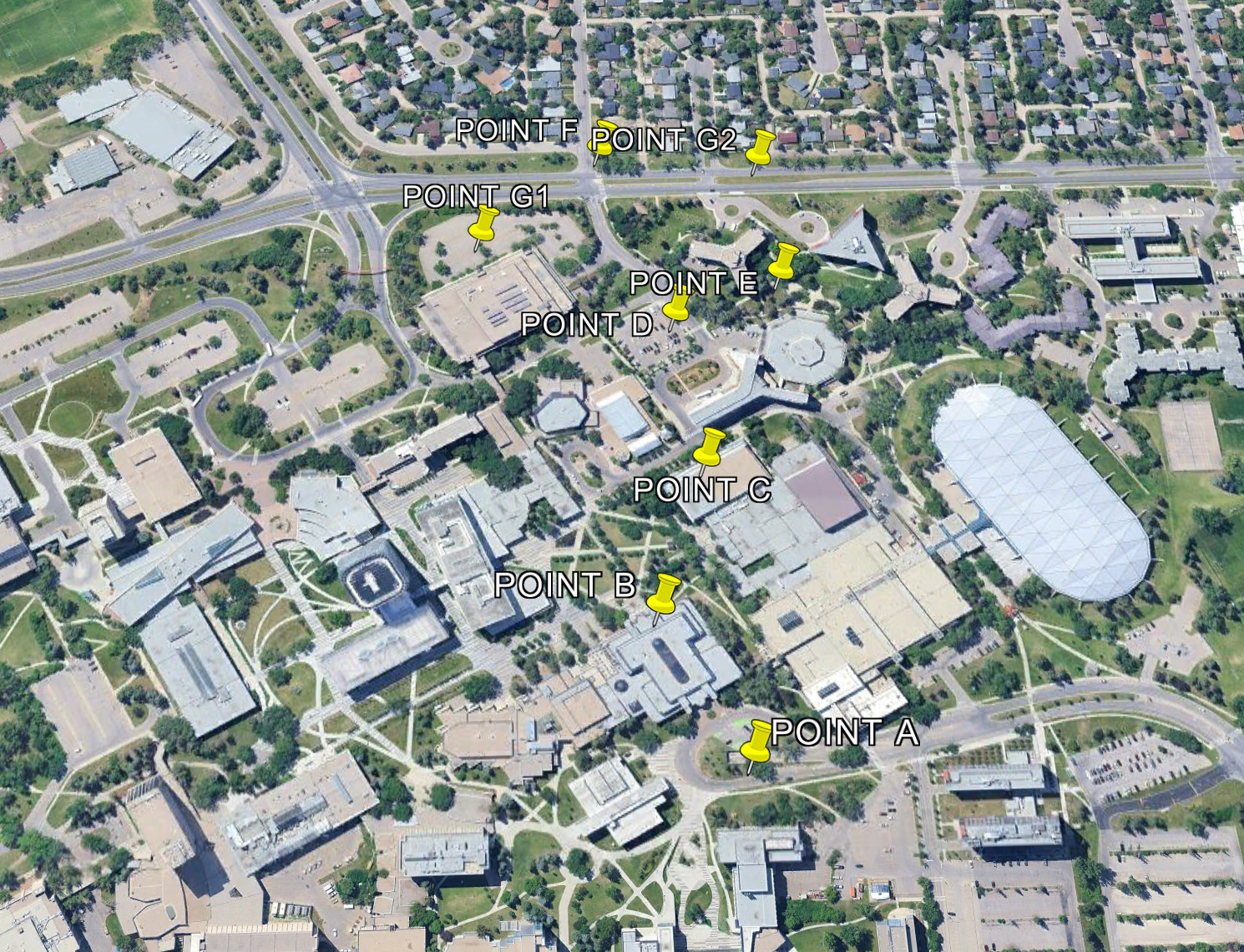
Visualization of our results
Inspiration
We wanted to learn how to solve problems with spatial data.
What it does
Shows a visual pattern with points on Google Earth.
How we built it
Collection of data in the field, then solving for the location of points using given information.
Challenges we ran into
The points E, F and G were challenging.
Accomplishments that we're proud of
We are proud of the accuracy and reliability of our results.
What we learned
How to convert and work with different coordinate systems.

Log in or sign up for Devpost to join the conversation.