-
-
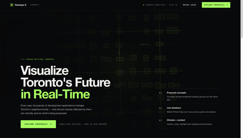
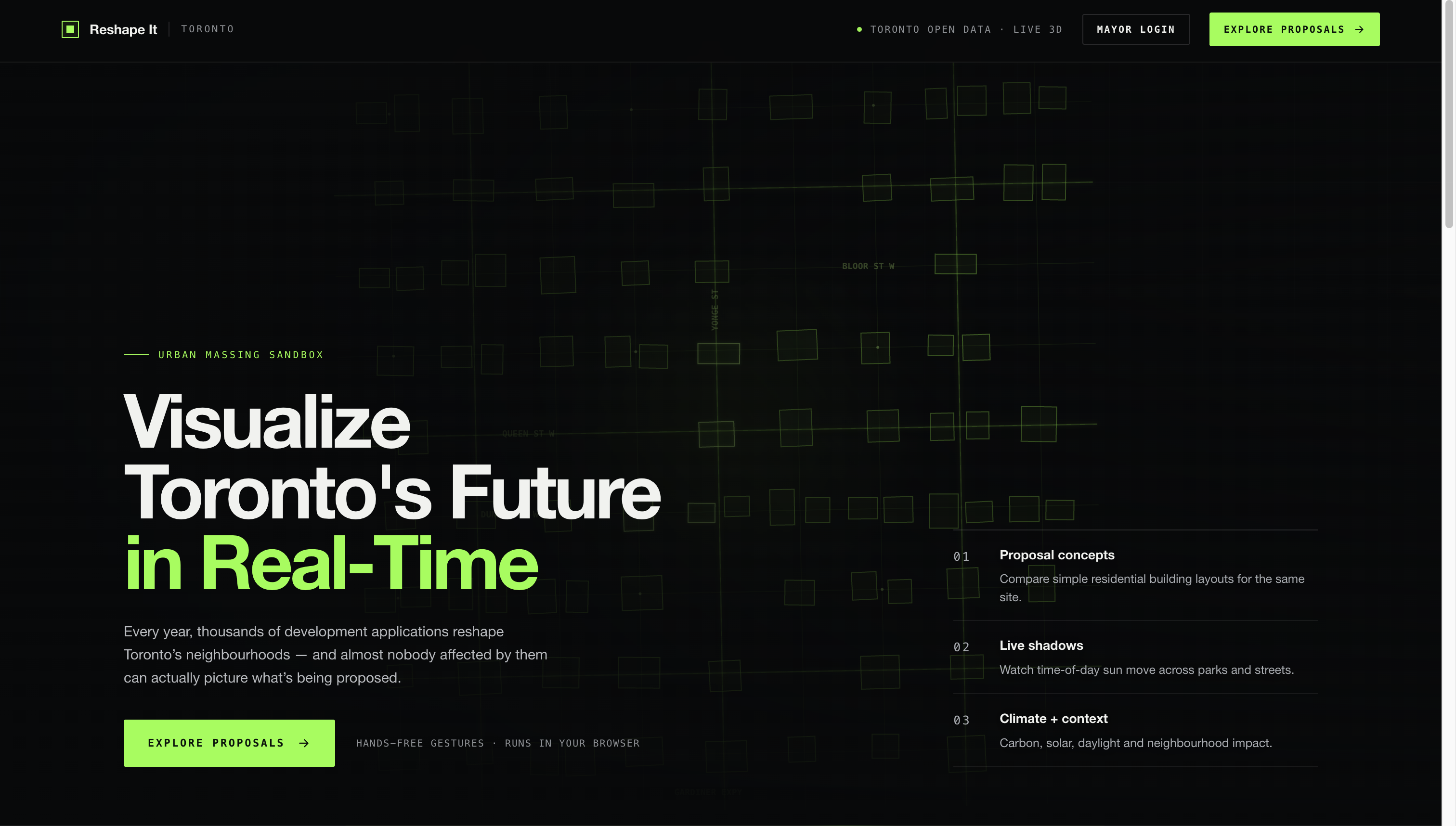
Landing Page
-
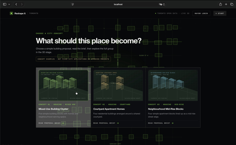
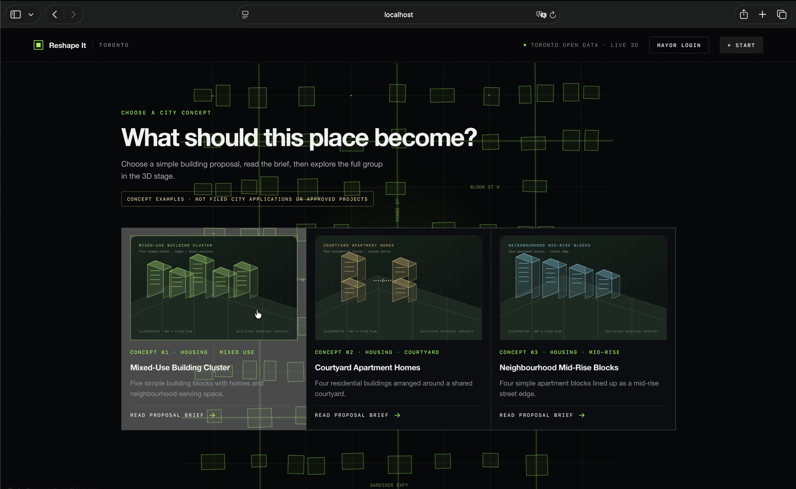
Proposal options
-
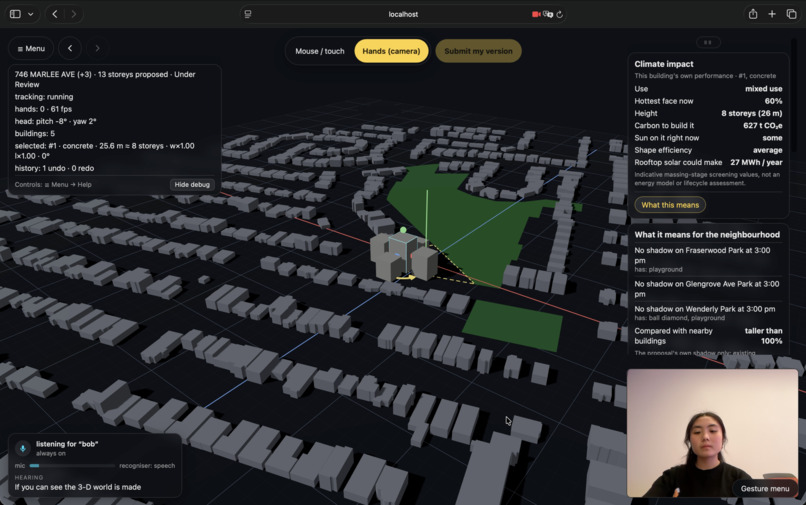
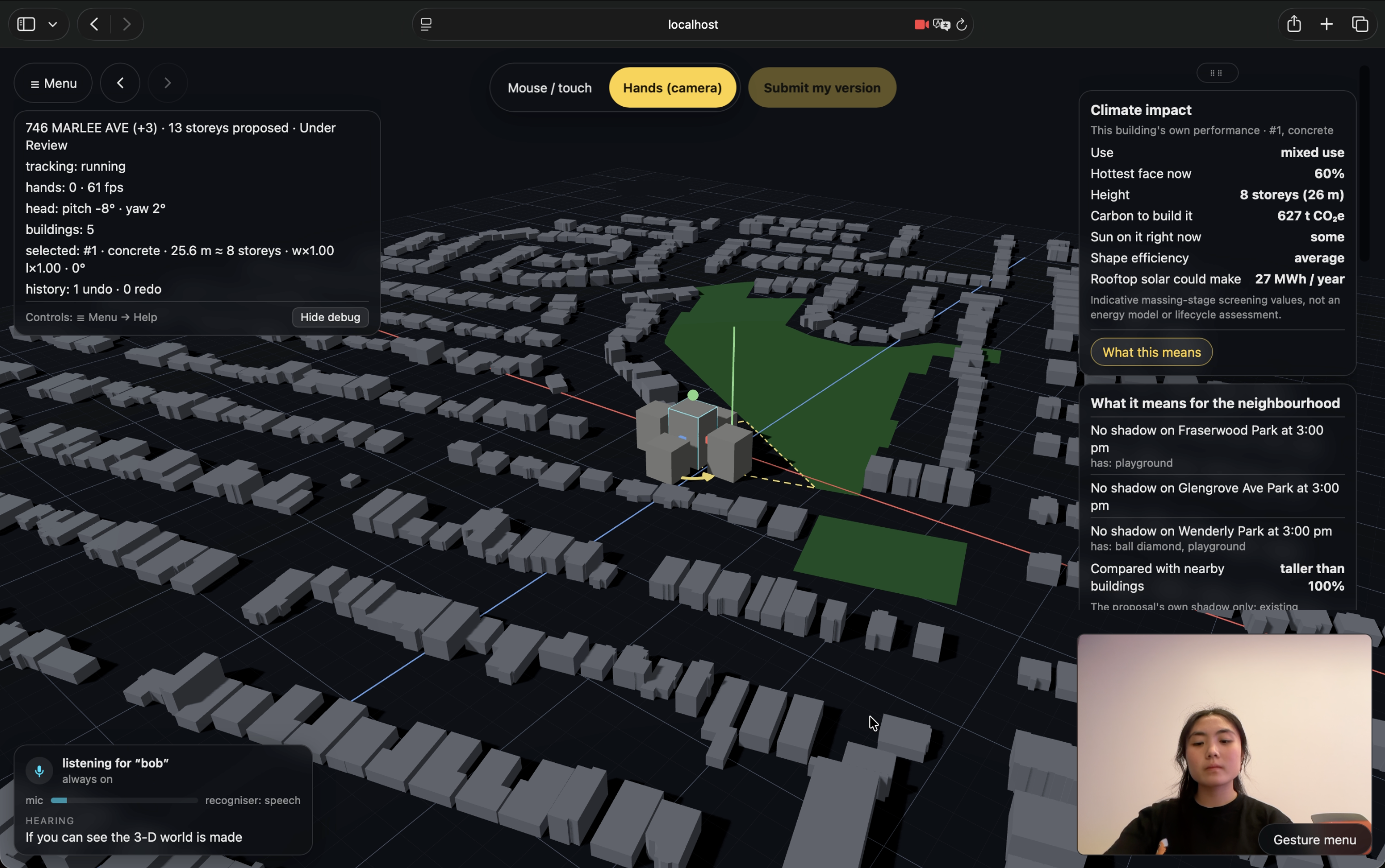
3D map of Toronto Location
-
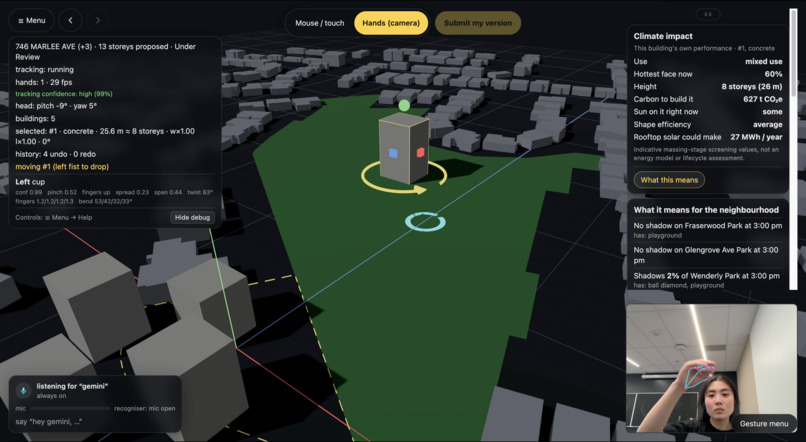
3D vectors for resize and rotation
-
Mayor View
What it does
Reshape It transforms urban planning into an interactive, AI-powered, community-driven design experience. Residents can explore proposed developments in a realistic 3D Toronto neighbourhood, redesign buildings themselves, and investigate the potential environmental, spatial, and economic consequences of their decisions.
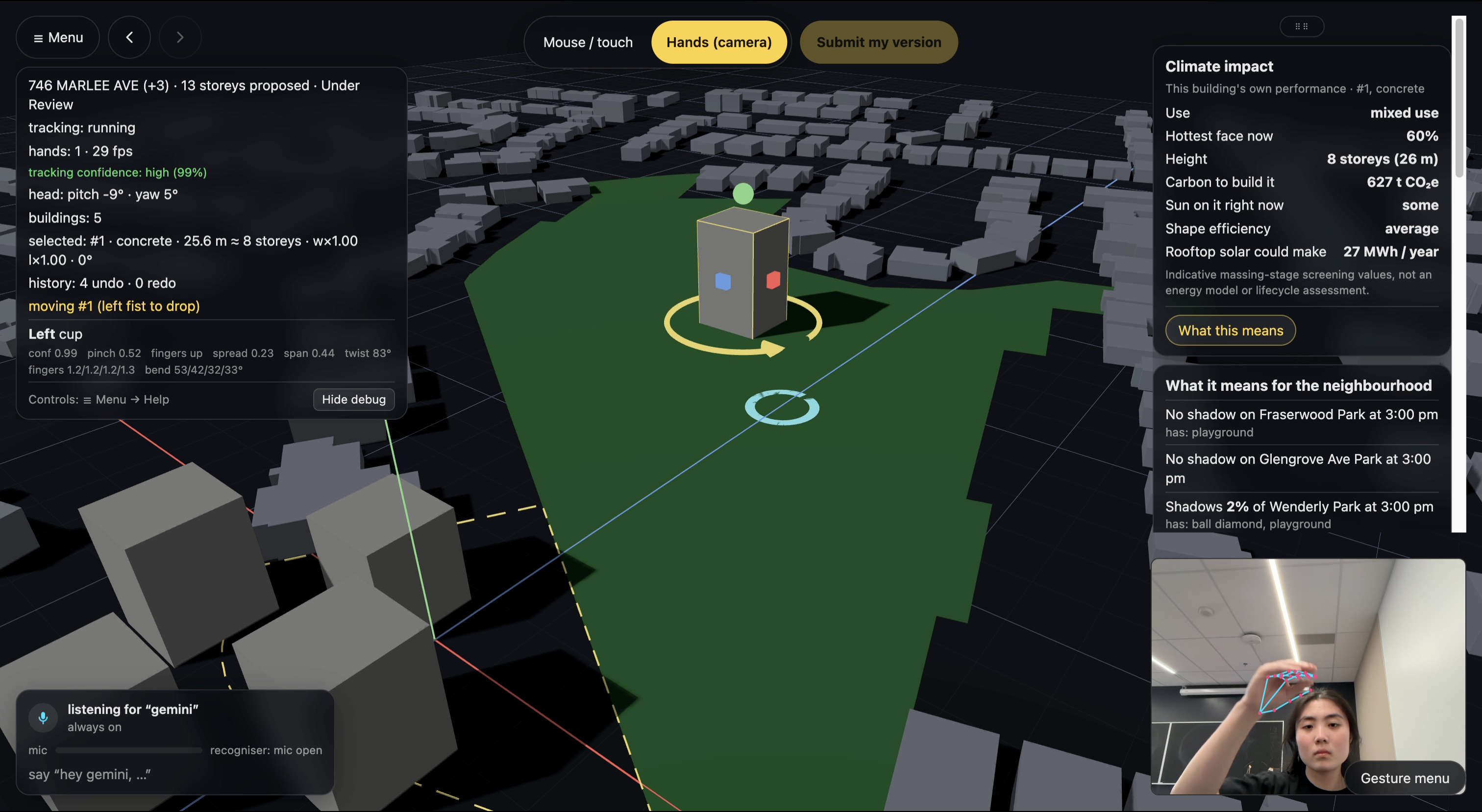
Design your city, your way. Draw building footprints, move, rotate, resize, and copy structures, customize materials and facades, add green roofs, and reshape public spaces with parks, ponds, promenades, and transit infrastructure. Interact through mouse and touch, or experiment with hands-free gesture and voice controls.
Meet Bob, your personal AI urban planner. Inspired by Tony Stark’s JARVIS, Bob lets users interact with their city through natural language; essentially "vibe-code" their way through city design. Request design changes, control the scene, ask questions about environmental impacts, and receive spoken explanations. Powered by Gemini, voice recognition, and ElevenLabs text-to-speech, Bob makes urban design feel less like operating complex software and more like collaborating with an intelligent assistant.
See the consequences of every design decision. Our live analysis engine estimates park shadows, embodied carbon, rooftop solar potential, daylight, urban heat, housing capacity, zoning constraints, and construction costs. Explore different times of day, seasonal sun angles, and historical Toronto weather to investigate how proposed changes could affect the surrounding neighbourhood.
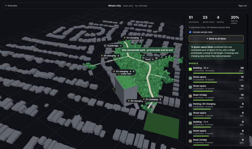
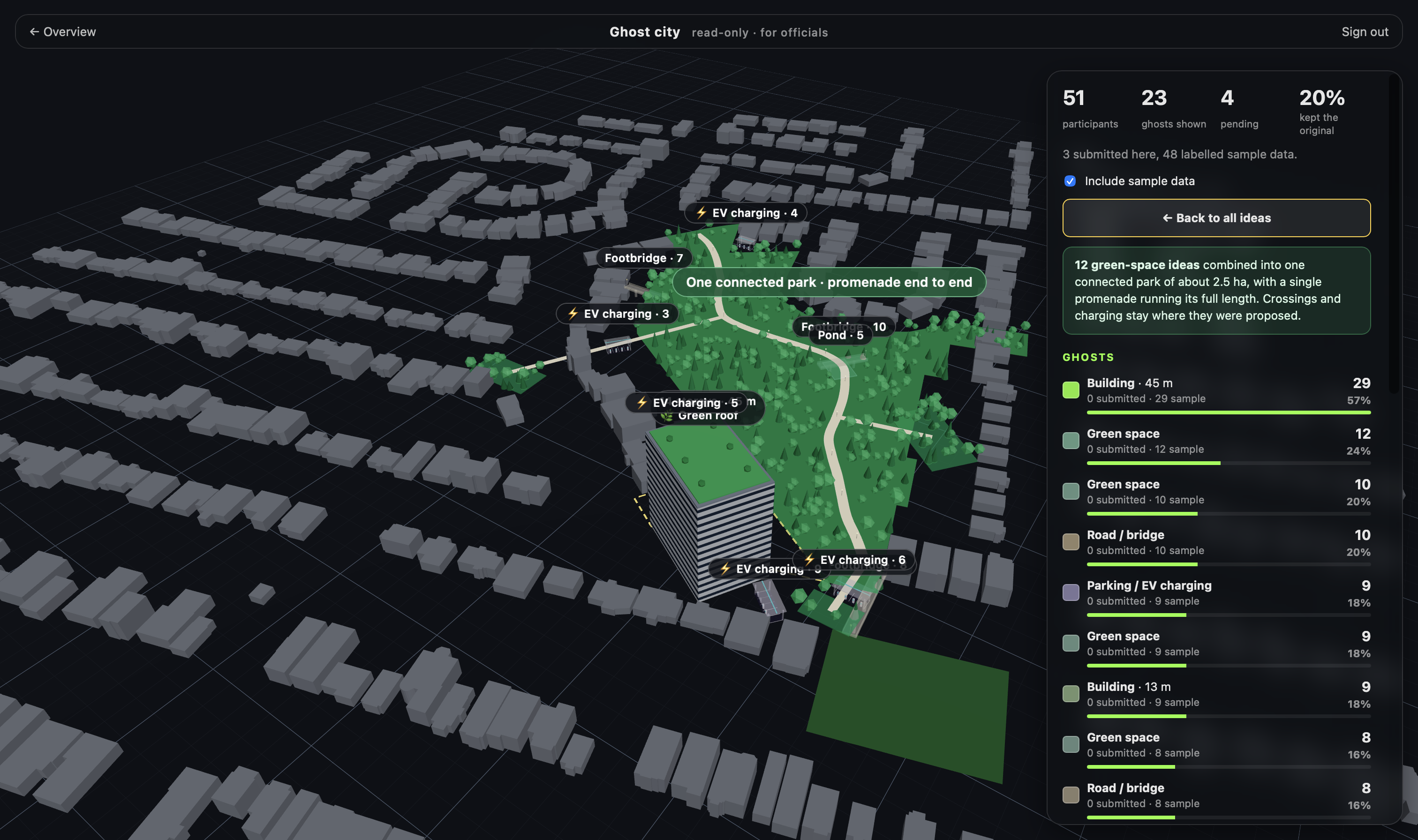
Turn community ideas into a shared vision. Our Mayor Screen brings together everything participants propose for a development site, displaying only ideas independently supported by at least three different people. Each idea appears as a ghost on the 3D map, from taller buildings with green roofs to footbridges, parks, ponds, and EV charging stations. The more support an idea receives, the more solid and saturated its ghost becomes, while a side panel displays its supporter count and share of participants. Nothing is ranked or recommended: the interface simply makes community suggestions and their levels of support visible.
Merge ideas into one cohesive city plan. With a single press of Merge Ideas, overlapping suggestions become a unified development concept. Separate green-space proposals can combine into one connected park with a continuous promenade, while the building takes on its agreed dimensions and becomes a solid model rather than a translucent ghost. EV charging stations are positioned clear of the building, while footbridges and the pond retain their proposed locations. Instead of choosing a winner, Reshape It helps transform independently proposed ideas into a spatially coherent plan.
Connect residents with decision-makers. Our read-only officials dashboard presents aggregated community proposals and planning metrics, providing a starting point for exploring public preferences and alternative development scenarios.
Reshape It goes beyond showing people what their city might look like. It lets them redesign it, understand the trade-offs, and see how their individual ideas can contribute to a shared future.
Accomplishments that we're proud of
We're proud to have combined interactive 3D city design, an AI assistant, live sustainability analysis, and community-driven plan generation into one cohesive experience.
Our most exciting achievement is connecting the entire journey: a resident can reshape a building, explore its estimated environmental impacts, ask Bob to explain the results, and submit their proposal for others to build upon.
We're particularly proud of three innovations:
An AI assistant you can interact with naturally. Bob combines contextual AI assistance, voice commands, spoken responses, and optional hand tracking to make complex urban-design tools more approachable.
Environmental analysis that responds to design. Our shared calculation engine connects building geometry, materials, sunlight, and weather conditions to environmental indicators, allowing residents to explore the potential consequences of their decisions rather than relying on static visualizations.
A community-driven path from ideas to a unified plan. Our Mayor Screen makes independently supported suggestions visible directly in the 3D environment, with ghost opacity and saturation reflecting relative levels of support. The Merge Ideas feature then takes this a step further, combining compatible suggestions into a cohesive spatial proposal—for example, connecting separate green-space ideas into one continuous park and promenade while preserving other proposed features.
What makes this especially meaningful is that the platform does not rank proposals or dictate what a neighbourhood should become. It gives people a way to see what others have suggested, understand how much independent support each idea has, and explore how different ideas can work together.
We're not just visualizing a future city; we're building a way for communities to imagine, negotiate, and design one together.
Built With
- gemini
- javascript
- mediapipe
- react
- three.js
- typescript
- vite
- webspeech
- zustand


Log in or sign up for Devpost to join the conversation.