-
-
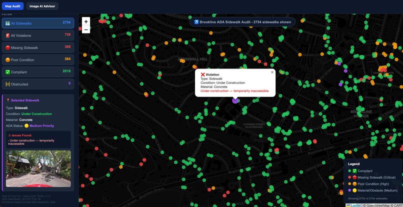
Map Audit
-

Close Look At SideWalks
-
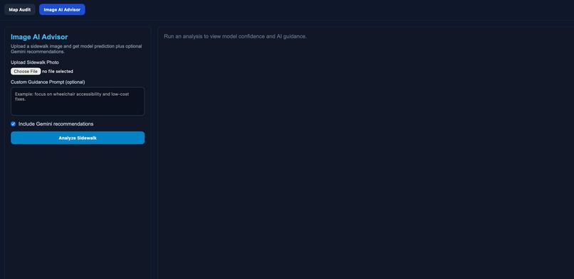
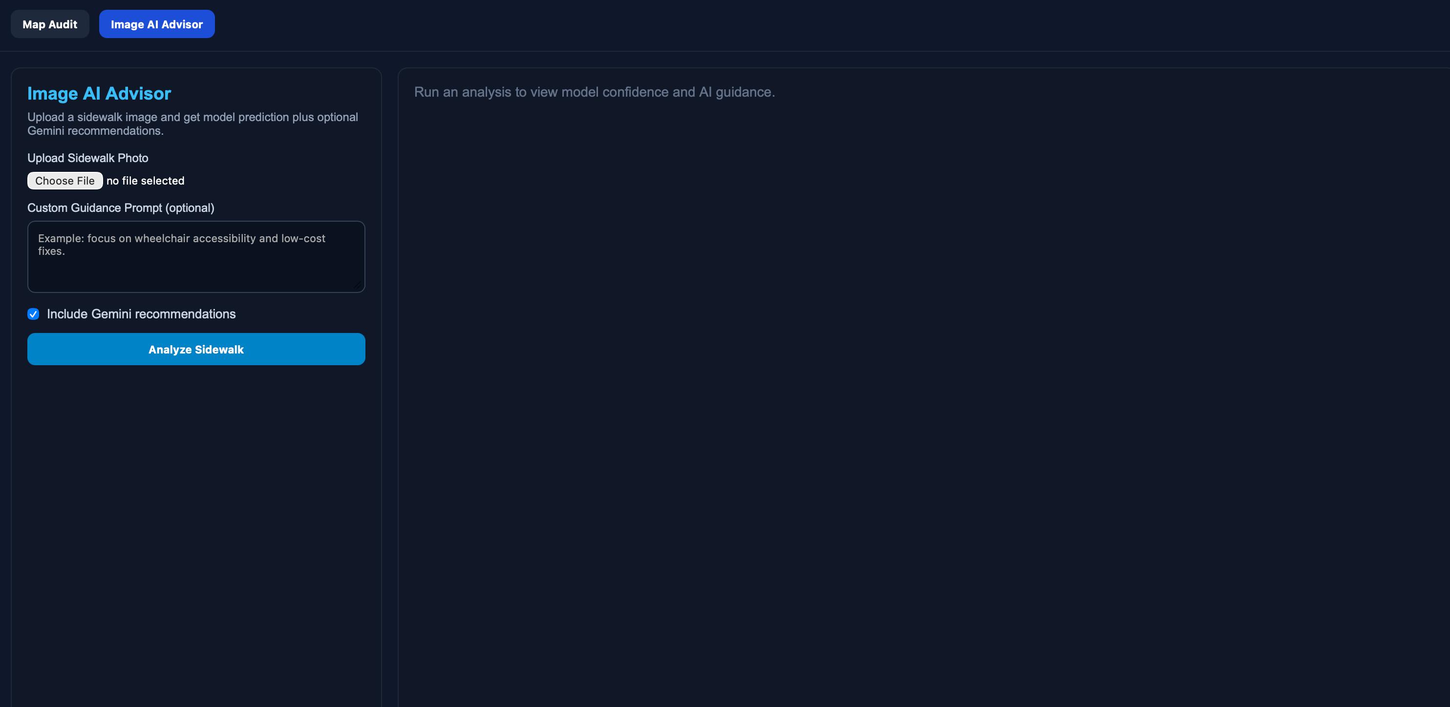
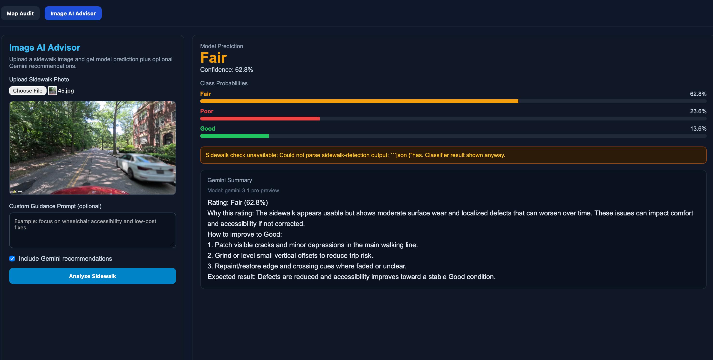
Image AI Advisor
-
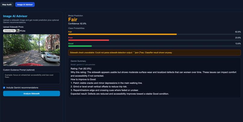
Summarizing some Fair Image
-
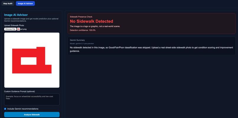
Summarizing which is not a Side Walk
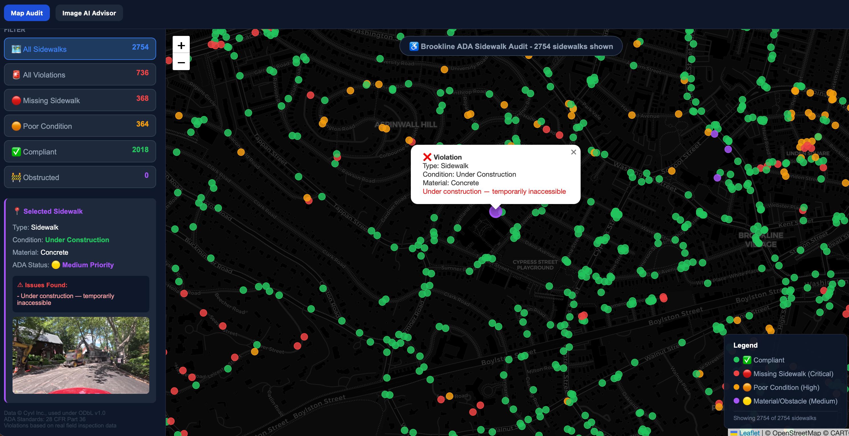
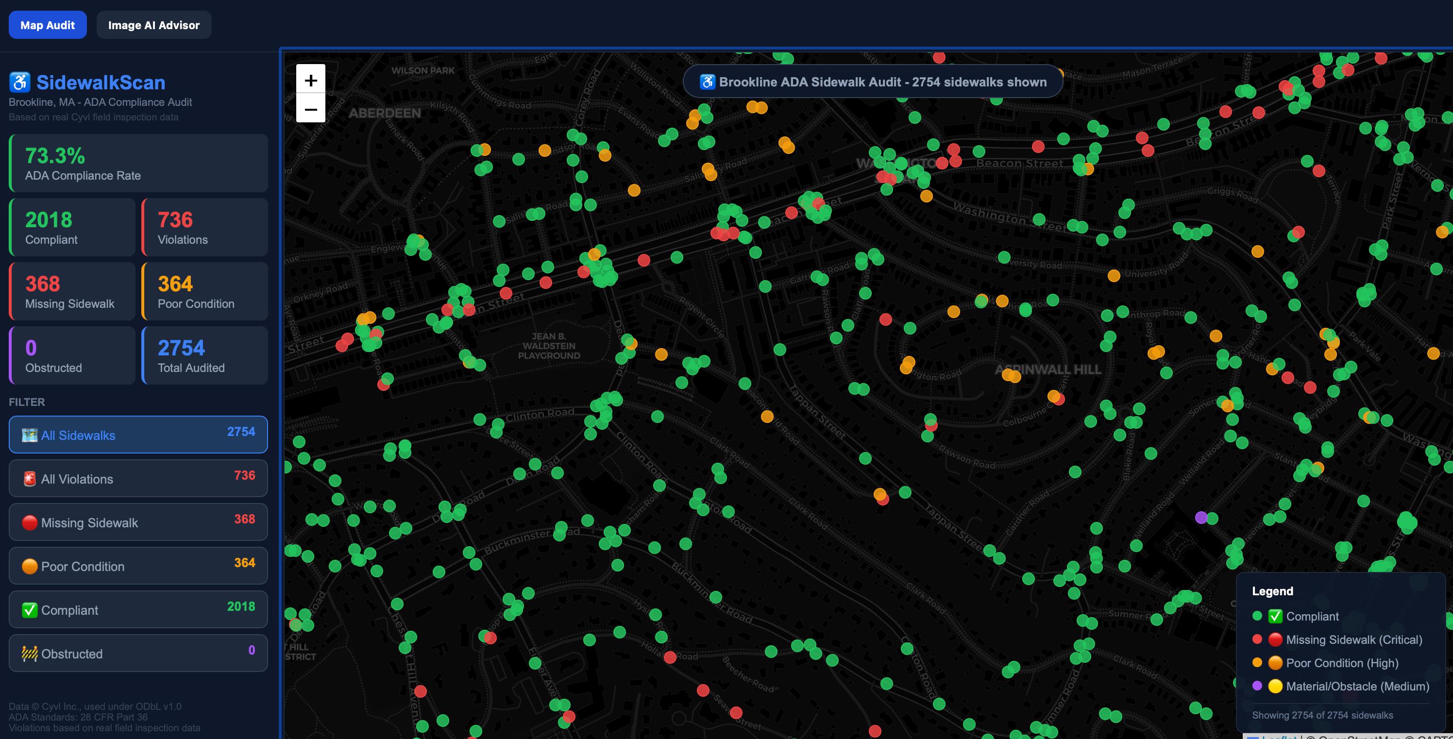

We were inspired by the dataset provided to us by Cyvl.ai and the opportunity it presented to make Boston's sidewalks more accessible. Seeing real, georeferenced street imagery with labeled condition data made us ask: if the data already exists, why are cities still relying on manual inspection? That question drove everything we built.
What we learned was that building a fair, reliable AI pipeline is as much about the decisions you make around the model as the model itself. Choosing balanced accuracy over raw accuracy, filtering irrelevant images before classification, and generating human-readable explanations rather than just labels all shaped our results in meaningful ways. We built our project using three core components: Mask2Former for segmenting sidewalk regions from street imagery, a condition classifier for analyzing and labeling sidewalk quality as Good, Fair, or Poor, and Gemini for summarizing results and generating actionable repair recommendations for city staff.
The challenges were real. Our biggest technical hurdle was finding a pre-trained segmentation model that could accurately isolate sidewalk regions — we had to experiment extensively and fine-tune the model before it performed reliably. We also ran into data scale issues; the dataset was too large to upload to GitHub, which complicated collaboration and version control throughout the project.
Looking ahead, with more time and resources, we plan to add a database layer to make the pipeline scalable, support larger datasets, and enable citywide deployment across Boston's full sidewalk network.

Log in or sign up for Devpost to join the conversation.