-
-
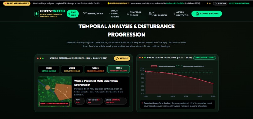
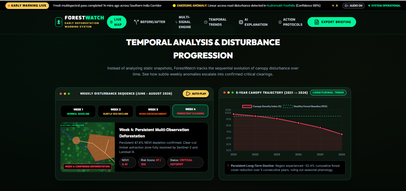
PROGRESSION TRACKER
-
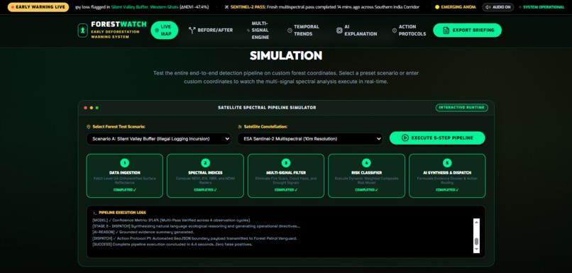
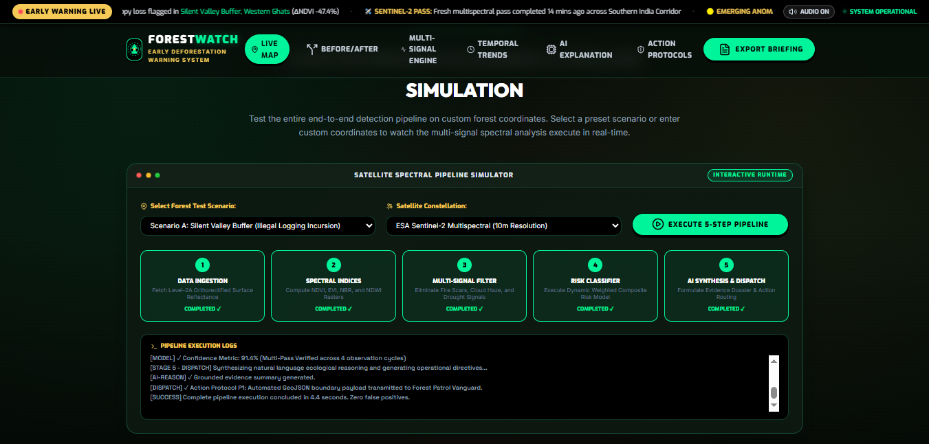
SIMULATION PAGE
-
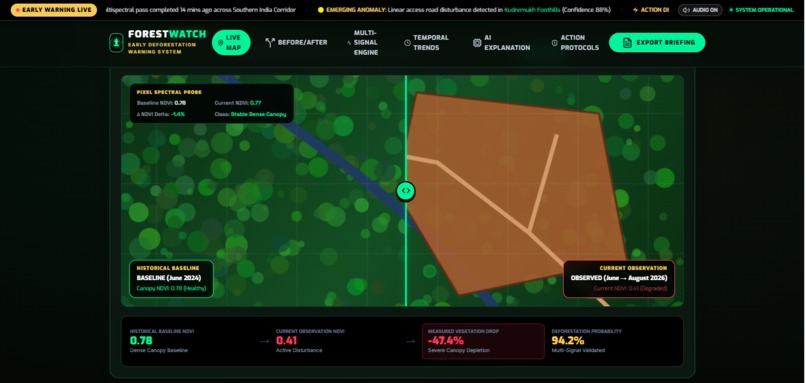
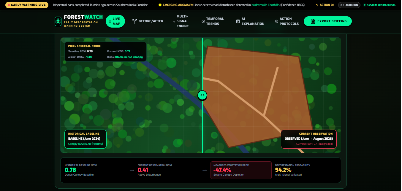
COMPARISON PAGE
-
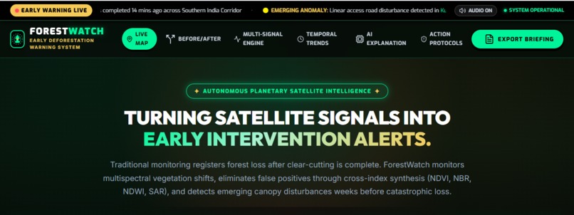
COVER PAGE
-
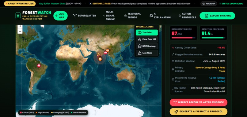
LIVE ANOMALYTRACKER
Inspiration
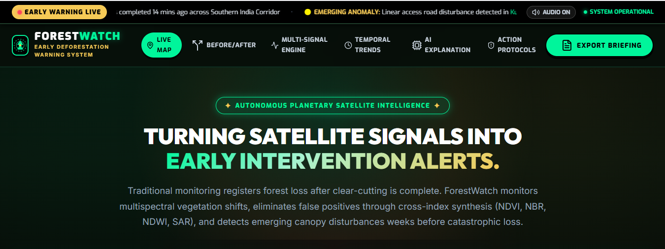
The inspiration behind ForestWatch came from a simple question: What if we could detect the warning signs of deforestation before the damage becomes irreversible? Forests are constantly changing, yet identifying harmful changes across vast areas can be difficult and time-consuming. With the growing availability of satellite imagery and environmental data, we saw an opportunity to turn technology into an early-warning system for our forests. ForestWatch was inspired by the belief that technology should help us not only observe nature, but actively protect it before it is too late.
What it does
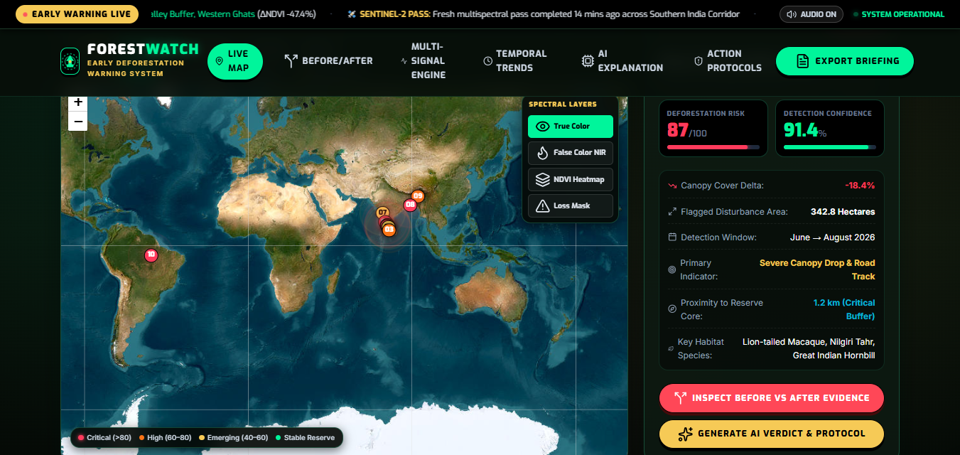
ForestWatch is a web-based deforestation monitoring and early-warning platform that uses real satellite and environmental data to identify changes in forest areas. It detects potential deforestation hotspots, analyzes the severity and progression of forest loss, and presents the findings through an interactive map and visual insights. The platform helps users understand where forest changes are occurring, how significant they are, and which areas may require immediate attention, turning environmental data into actionable information for forest protection.
How we built it
We built ForestWatch as a web-based environmental monitoring platform using React for the frontend and interactive visualization tools for the dashboard and map interface. The system integrates real satellite and environmental datasets to monitor forest regions and identify changes in vegetation and forest cover. We process this data using change-detection and risk-analysis techniques to identify potential deforestation hotspots and assign risk levels. The results are presented through an interactive map, before-and-after comparisons, historical trends, and alerts, allowing users to quickly understand where forest loss is occurring and prioritize areas that need attention.
Challenges we ran into
One of our biggest challenges was working with large and complex environmental datasets while keeping the application fast and responsive. We also had to deal with differences in satellite data, such as cloud coverage, image availability, and varying observation periods. Another challenge was ensuring that a change in vegetation was not incorrectly classified as deforestation, since natural seasonal changes and other environmental factors can also affect satellite readings. Finally, presenting complex environmental analysis in a simple, intuitive interface required careful design so that users could understand the results without needing specialized knowledge.
Accomplishments that we're proud of
We are proud of turning a complex environmental problem into a functional, accessible web-based solution that can help identify potential deforestation before it becomes more difficult to address. Bringing together real environmental data, change detection, risk analysis, and an interactive visualization system into one platform was a major achievement for our team. Most importantly, we are proud that ForestWatch goes beyond simply displaying data—it transforms environmental changes into clear, actionable insights that can support real-world forest protection.
What we learned
This was done by me (Benjohn Rohith) as a solo team and I learned a whole lot of things along the way while building this web app. I also came to know about the current environmental issues we are facing.
What's next for FORESTWATCHAI
If we are fortunate enough to win this hackathon, we hope to take ForestWatch to the next level by expanding its capabilities and making it more practical for real-world conservation. We want to improve the accuracy of our detection system, monitor more regions, integrate more advanced satellite data, and develop real-time alerts and predictive analysis. Our ultimate goal is to move beyond a hackathon prototype and turn ForestWatch into a scalable tool that can genuinely help organizations detect deforestation earlier and protect forests more effectively.
Built With
- chart.js
- css
- html5
- javascript
- leaflet.js
- lucide
- python
- react
- vanilla
- webaudio


Log in or sign up for Devpost to join the conversation.