-
-

Our Landing Page
-

How our Model Works
-

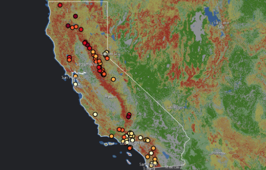
Forest Fires in California


Inspiration
Over the last year, we have all personally seen how wildfires in California wreaked havoc on the surrounding landscape and communities with us only being able to watch. We felt helpless as students, but realized we could put our coding abilities to good use. If we could come up with a forest fire prediction model that could alert firefighters and rescuers in at-risk areas to put a swift stop to an endangering forest fire, we figured we could help make a difference.
What it does
Our bot is a 3-piece model that works in the following way: First, our model uses LANDSAT imagery to collect daytime geographic images over various regions. Next, we use the GOLI algorithm which allows us to avoid smoke and clouds that could potentially distort images of fires. The core architecture of the model revolves around the usage of 2D CNNs alongside max pooling within its hidden layers. Finally, the output is a numerical percentage output that states the probability of a fire within a given region captured by LANDSAT.
How we built it
We used LANDSAT images from different regions in the world, for example, Indonesia, Australia, and California. We also ensured that pictures were specifically taken at a distance away from urban cities since our focus is more on natural lands. After that, we implemented the premade GOLI algorithm to avoid smoke and clouds. Following this, we fed the model images that were visually assessed as active fires and lands that aren’t burning to model the probability of an active fire.
Challenges we ran into
On our team, we have a member who is doing their first hackathon with Ecohacks, and as a result, they lack some experience. However, we found that while it was a challenge to breakdown our model into its absolute core and basics, we found that doing so gave us a clearer idea of how we want to build the model, but also helped us rationalize some of the issues we were facing. Clear and realistic goal making also proved to be a challenge. We had a big idea that we wanted to work on, and as a result we may have bitten off more than we could chew given the 2-day time period. Moving forward, we aim to continue working on this project with smarter timelines and more achievable short-term goals.
The lack of resources was also a big factor in our inability to achieve all the goals we had set out to do. Since we didn’t have a GPU to run our algorithm and process the large amounts of satellite data, we found ourselves stuck with a 250h runtime, which we managed to cut down to 25h by using a ssh server.
Accomplishments that we're proud of
Despite the fact that our goals were slightly unrealistic, we showed great adaptability and communication skills. We were able to shift our focus and communicate the new goals at a moment’s notice despite the many issues we came across.
Furthermore, conducting research on this project and working on it throughout the course of this hackathon was extremely eye-opening and gave us a much clearer goal to work towards. It made us aware of how beneficial a well-implemented fire detection model could be, and we’re all proud of contributing to fighting climate change in some way.
What we learned
We learned loads more about forest fires than we could have imagined, and the disproportionate effects it may have on less economically developed communities. The effects of a well implemented project such as this are far reaching and through this, we have learned how important something like this could be.
For projects as ambitious as these, this hackathon has been a good learning opportunity for realistic goal making and has been a great slingshot into us understanding the scope of this project we have taken upon ourselves. We now know what the bigger picture is, and in the weeks to come after this hackathon, we are going to continue working on this project and realize our initial long-term goals.

Log in or sign up for Devpost to join the conversation.