

Summary
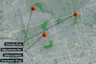
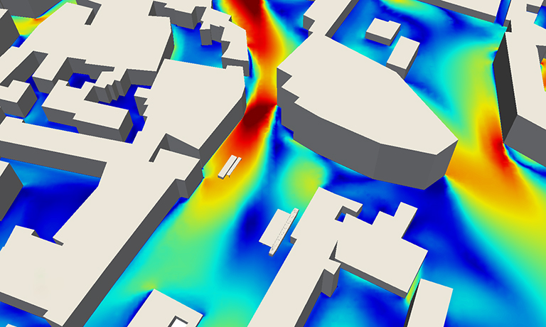
FluidKit renders real-time maps of where people are gathering and moving through your city. Street-level pedestrian forecasts are made using a fluid mechanics engine that realistically combines sensor information from buildings, businesses, people and environmental barriers.
Made for YOU
Use these maps to know when it’s safe to visit your local grocery store or to avoid large gathering of groups in parks or restaurants.
How I built it
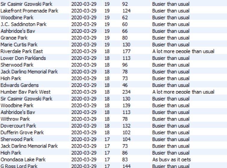
We combined a WebGL visualization tool with a computationally intensive GPU model of fluid dynamics – all within the browser! Real-time activity data is sourced through a number of 3rd party tools (see data table below for a sample)
Challanges I Ran Into
I'm on day 6 of coronavirus infection -- so my energy is low!
Future Plans
- Fluid can interact with map buildings and barriers (not activated in this beta version)
- Gamify elements (we can render 3d avatars)
- Export your local map to daily consumable pdf report
Built With
- gpu
- harp.gl
- python
- typescript
- webgl


Log in or sign up for Devpost to join the conversation.