Inspiration
Access to clean water is a daily challenge for many rural communities, where sources are scattered, often unsafe, and difficult to track over time. Villagers may spend hours searching for water only to discover it is polluted or unusable, leading to wasted effort and health risks. We were inspired by the idea of combining simple water quality testing with GPS mapping and navigation, so that once a safe source is found, it can be saved, shared, and reliably returned to. This ensures not only safer drinking water but also empowers communities with knowledge and tools to manage their own resources more effectively.
What it does
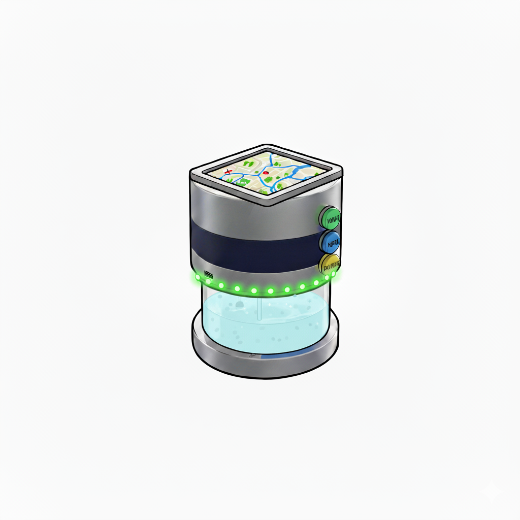
FlowFinder is a portable device that helps villagers reliably monitor and return to safe water sources by combining turbidity sensing, GPS mapping, and navigation. When placed in a stream or pond, its green light indicates safe turbidity levels while the exact location is automatically logged and stored locally on the device. A green dot then appears on the device’s built-in map, and this saved point remains available days later, becoming part of a growing record of community water sources. Navigation arrows guide villagers and workers back to the same spot, ensuring consistent access to safe water without wasted time or uncertainty.
How we built it
We prototyped FlowFinder using an ESP32 microcontroller connected to a turbidity sensor and GPS module. The ESP32 runs Arduino C++ firmware to capture sensor data and log locations, which are stored directly on local memory for offline use. A simple on-device interface with a screen displays turbidity readings, marks green dots on the map, and shows navigation arrows to guide villagers back to safe sources. For the physical design, we used Fusion 360 to model a durable waterproof casing.
Challenges we ran into
We faced difficulties with sensor calibration, since raw turbidity values varied based on lighting, placement, and water bubbles. Power management for the ESP32 was also a challenge, as the device needed to be portable and last for days in rural settings. On the software side, integrating GPS logging with an offline mapping system on limited hardware memory required careful optimization. Finally, designing a minimal, intuitive display for non-technical users was critical to ensure villagers could use it without training.
Accomplishments that we're proud of
We successfully built a working prototype that integrates turbidity sensing, GPS, and offline navigation in one device. Our biggest achievement is demonstrating how low-cost electronics and offline storage can provide a practical solution to a real-world challenge without relying on internet or cloud infrastructure. We’re also proud that the design can be adapted for other rural applications, such as soil monitoring or forest mapping.
What we learned
We learned the importance of sensor calibration and validation when moving from theory to real-world conditions. We also gained experience in optimizing offline data storage and navigation, which is crucial for areas with little or no internet access. Most importantly, we learned how crucial simplicity and reliability are when designing for communities with limited exposure to technology.
What's next for FlowFinder
We plan to improve sensor accuracy by testing with standardized turbidity samples and developing adaptive calibration methods. We also want to expand local storage capacity, add SMS alerts via GSM modules for when a new safe source is found, and refine the navigation system for more precise guidance. On the hardware side, we aim to design a solar-powered, ruggedized casing for long-term field use. Ultimately, we envision FlowFinder being deployed across rural villages, helping communities build a living offline map of safe water sources that grows stronger with each use.
Built With
- arduino-c++
- autodesk-fusion-360
- esp32
- gps-module
- microcontroller

Log in or sign up for Devpost to join the conversation.