Inspiration
Floods can devastate communities, damage infrastructure, and disrupt transportation, especially in mountainous regions like Nepal's Trishuli River corridor. We built FloodSight to explore how satellite imagery, geospatial analysis, and AI can help identify potential flood hazards and support faster, data-driven disaster response.
What it does
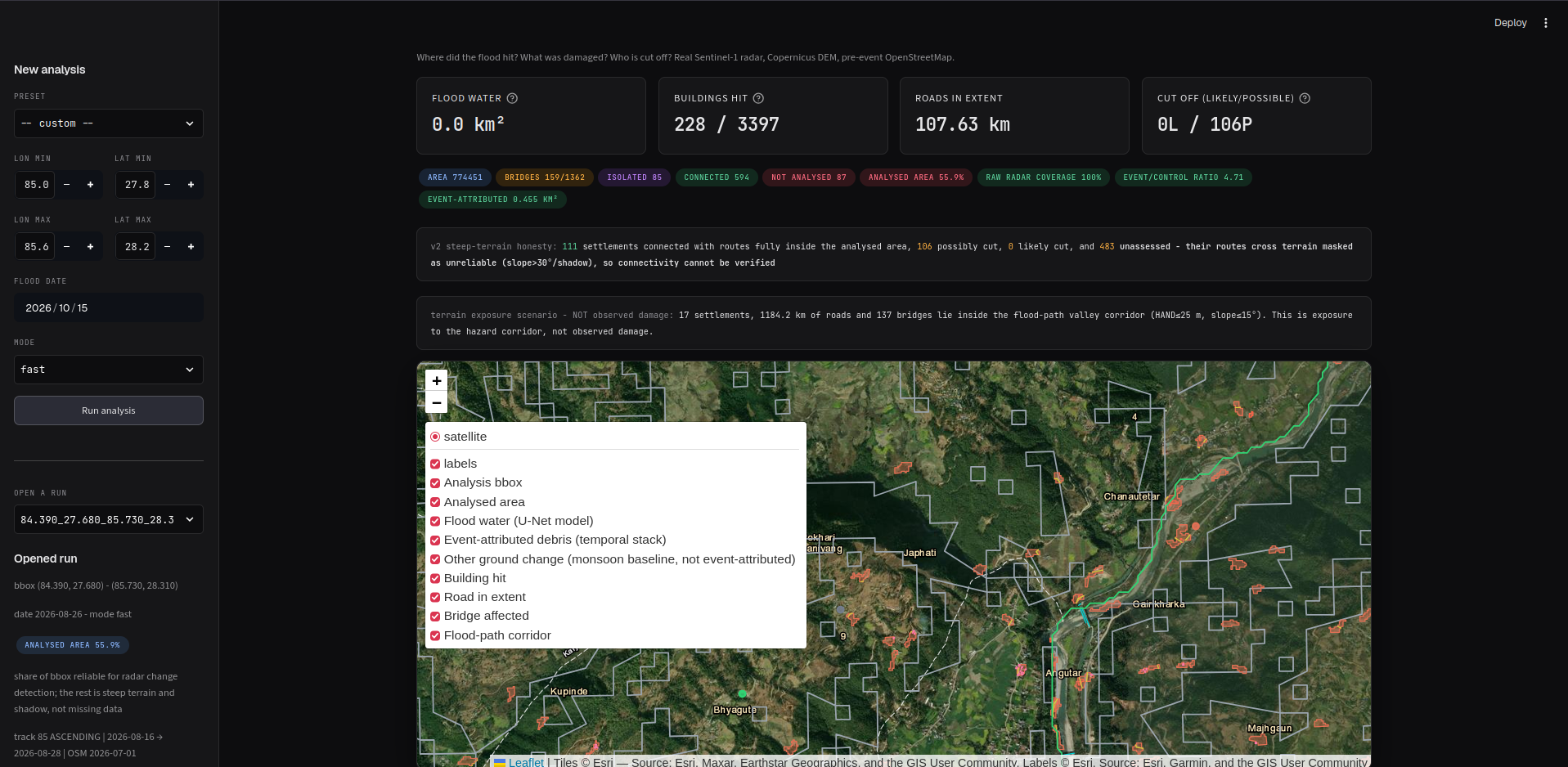
FloodSight is a geospatial flood-hazard analysis platform that processes satellite and geographic data to:
- Detect potential floodwater: Analyze satellite imagery to identify possible water-related hazards.
- Map debris: Identify potential debris-affected areas.
- Assess infrastructure impacts: Analyze nearby buildings, bridges, roads, and settlements.
- Evaluate accessibility: Estimate potential road disruptions and settlement connectivity.
- Visualize results: Present geospatial outputs through an interactive dashboard and generate structured analysis reports.
How we built it
We built FloodSight using Python and a modular geospatial processing pipeline. The system combines satellite imagery, terrain information, and OpenStreetMap data to analyze a defined geographic region. Raster processing and vector-based analysis produce outputs such as GeoTIFF rasters, GeoJSON features, and GeoPackage datasets. We also developed an interactive dashboard to explore analysis results, along with evaluation scripts to examine coverage, detection performance, and potential errors.
Challenges we ran into
- Incomplete satellite coverage: Available imagery did not always cover the entire requested region.
- Complex mountainous terrain: Elevation changes and narrow river valleys make hazard analysis challenging.
- Distinguishing debris from other land features: Construction areas, vegetation, and exposed soil can create potential false positives.
- Data integration: Combining satellite imagery, terrain data, and geographic infrastructure datasets required consistent spatial alignment.
- Reliable evaluation: Producing outputs was not enough; we also needed to examine coverage limitations and validate the results carefully.
Accomplishments that we're proud of
- Built an end-to-end geospatial analysis pipeline for a real-world Himalayan study region.
- Integrated satellite, terrain, and infrastructure data into a unified workflow.
- Generated spatial outputs for floodwater, debris, potential damage, and accessibility analysis.
- Developed a dashboard for exploring geospatial results.
- Created evaluation tools to investigate detection quality, geographic coverage, and potential sources of error.
What we learned
We learned that effective disaster intelligence requires more than detecting patterns in satellite imagery. Geographic coverage, data quality, terrain effects, validation, and uncertainty all influence the reliability of the results. We also learned the importance of distinguishing between an area where no hazard was detected and an area where insufficient data was available for reliable assessment.
What's next for FloodSight
- Improve satellite coverage and identify unanalysed areas explicitly.
- Strengthen floodwater and debris detection through additional validation and improved models.
- Evaluate results against independent reference datasets and real-world observations.
- Improve the dashboard with clearer legends, coverage indicators, and uncertainty visualizations.
- Expand analysis to additional flood-prone regions and historical events.
- Develop more reliable infrastructure-impact assessments to support emergency planning and disaster-response teams. -Applying for all languages and different tearin.
Built With
- javascript
- osm
- python
- shell
- snap
- streemlit


Log in or sign up for Devpost to join the conversation.