-
-
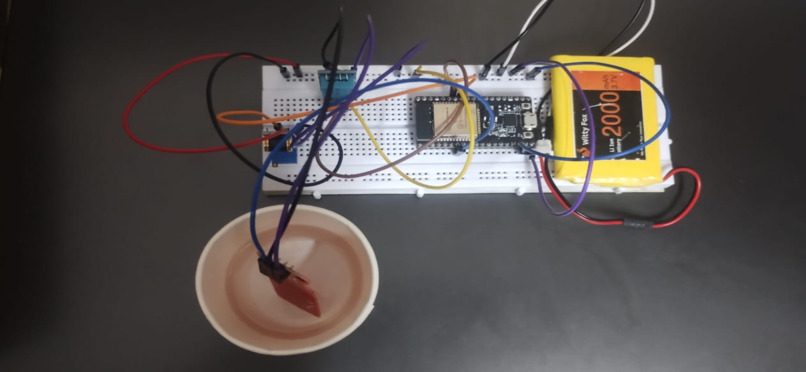
IoT sensor node: ESP8266 with water level and temperature/humidity sensors for real-time flood monitoring.
Inspiration
Floods, wildfires and cyclones are becoming more frequent as the climate changes, and cities are growing into risk zones. Most warning systems still fail in the same four ways:
- Alerts arrive late, after the disaster has already escalated.
- Forecasts depend on one data source (usually weather alone), so they are unreliable.
- Warnings are generic and don't say which areas are affected.
- Emergency response is slow because resources are deployed late.
What it does
Our platform combines IoT and AI/ML into one real-time prediction system:
- Sensors placed in disaster-prone areas track water level, temperature, humidity and rainfall, and push the readings to the cloud continuously.
- Multi-source data fusion combines the live sensor feeds with satellite imagery and historical disaster records.
- ML models detect anomalies and predict the probability, severity and timing of a disaster for specific areas.
- A web dashboard shows the results, and SMS go straight to emergency teams for quick evacuation and resource allocation.
How we built it
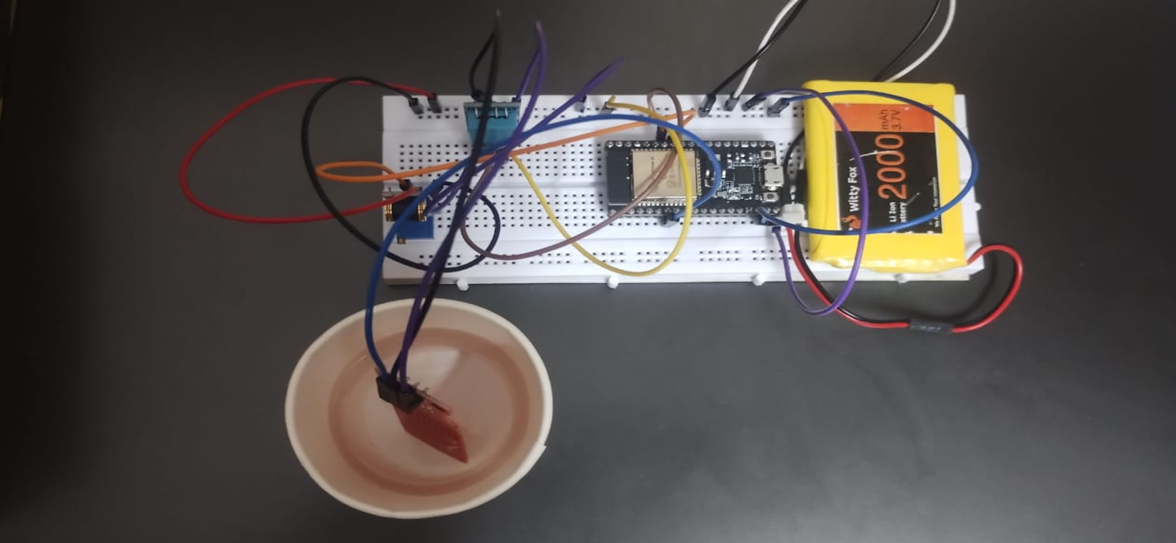
- Hardware: an ESP8266 microcontroller connects an HW-038 water level sensor and a DHT11 temperature/humidity sensor. A weather API supplies rainfall data.
- ML: a Random Forest model, trained in Python, predicts disaster risk. We chose it because it is an ensemble of decision trees, which makes it accurate and robust on noisy data.
- Backend: Flask APIs.
- Frontend:a React dashboard.
- Data: MongoDB for real-time sensor streams and PostgreSQL for structured disaster records.
- Cloud: Designed for AWS hosting and scaling.
Challenges we ran into
- Unreliable connectivity in remote areas: sensors can fail to transmit. We planned edge computing with offline buffering, so data is stored locally and synced when the network returns.
- Noisy or inconsistent data: sensor errors and mismatched satellite data hurt predictions. We apply cleaning, normalization and outlier removal before the data reaches the model.
- Heavy compute: running ML on large disaster datasets is resource-intensive. We designed for scalable cloud deployment with on-demand computation.
- Getting alerts to people: We send multi-channel alerts (SMS, apps) and plan awareness programs.
Accomplishments that we're proud of
- Built a working end-to-end prototype: an IoT hardware unit (ESP8266 with water level and temperature/humidity sensors) that feeds a live web dashboard.
- Combined multiple data sources:Live sensor readings, satellite imagery and historical disaster records feed one prediction pipeline, instead of relying on weather data alone.
- Went from prediction to action: The system estimates the probability, severity and timing of a disaster for specific areas, then sends alerts by SMS, email and notifications to emergency teams.
- Kept it affordable:Low-cost sensors and cloud services make it practical for vulnerable, remote regions.
- Designed for real-world failures: Offline buffering, noise filtering and scalable cloud deployment let it cope with poor connectivity and messy data.
- Grounded the work in research and global goals:The design draws on current flood forecasting and IoT research, and aligns with the Sendai Framework, the Paris Agreement, SDG 9 and WHO Health-EDRM.
- Took on a real-world problem as a team:We built a solution aimed at saving lives, working through hardware, ML, backend and dashboard together.
What we learned
- Fusing several data sources gives more reliable forecasts than any single feed.
- A good prediction is only useful if the alert reaches the right people quickly, so the dashboard and alert delivery matter as much as the model.
- Our design draws on research on ML flood forecasting, IoT flood monitoring, hybrid physics + deep learning models, and uncertainty-aware forecasting.
What's next for FloodSense: IoT + AI Early Warning
- Pilot in flood-prone regions: Deploy sensor nodes along rivers and lakes and test alert accuracy and lead time against real events.
- Expand beyond floods: The same pipeline can cover wildfires and cyclones by adding sensors (smoke, wind, pressure) and retraining the models.
- Improve the models:Explore hybrid physics + deep learning approaches and probabilistic forecasting, so each alert comes with a confidence level.
- Work offline:Strengthen edge computing so sensors keep working and buffering data in areas with weak network coverage.
- Reach more people:Add multi-language SMS alerts, a citizen-facing mobile app and community awareness programs.
- Partner with authorities: Work with local governments, NGOs and disaster response teams to turn alerts into evacuation plans and resource allocation.
- Scale up: Move from villages to districts and states, with a dashboard that gives policymakers data-driven insight for planning.
Built With
- amazon-web-services
- dht11
- esp8266
- flask
- iot
- machine-learning
- mongodb
- postgresql
- python
- random-forest
- react
- rest-api
- scikit-learn
- sms-alerts
- weather-api


Log in or sign up for Devpost to join the conversation.