-
-
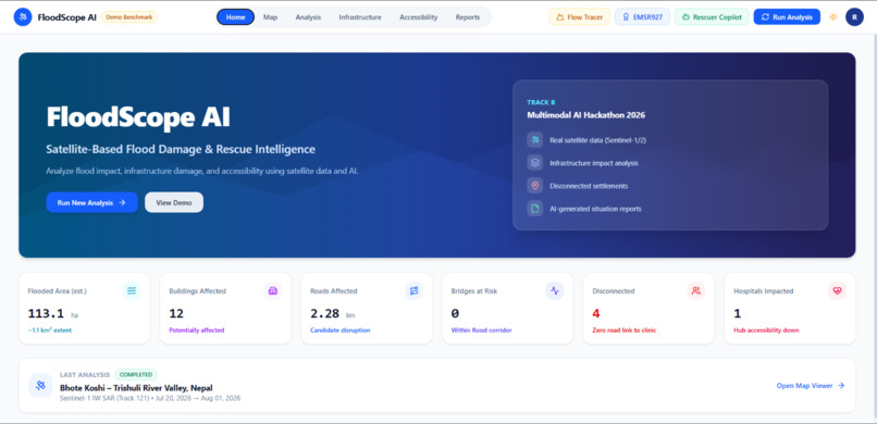
Dashboard
-
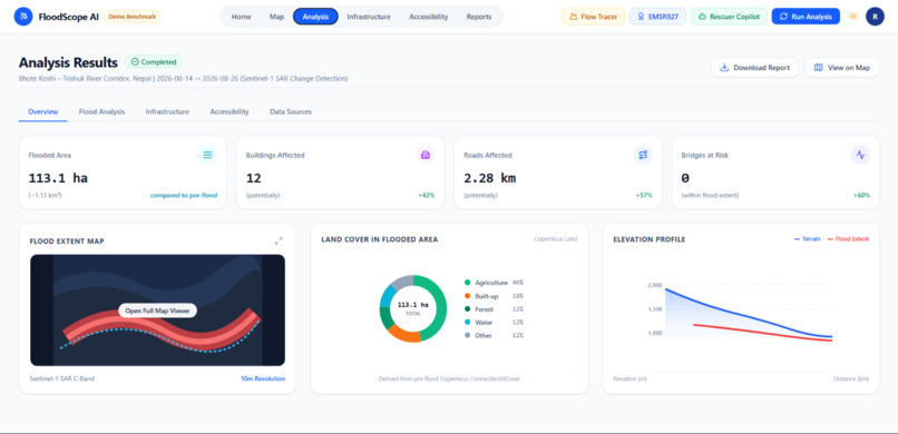
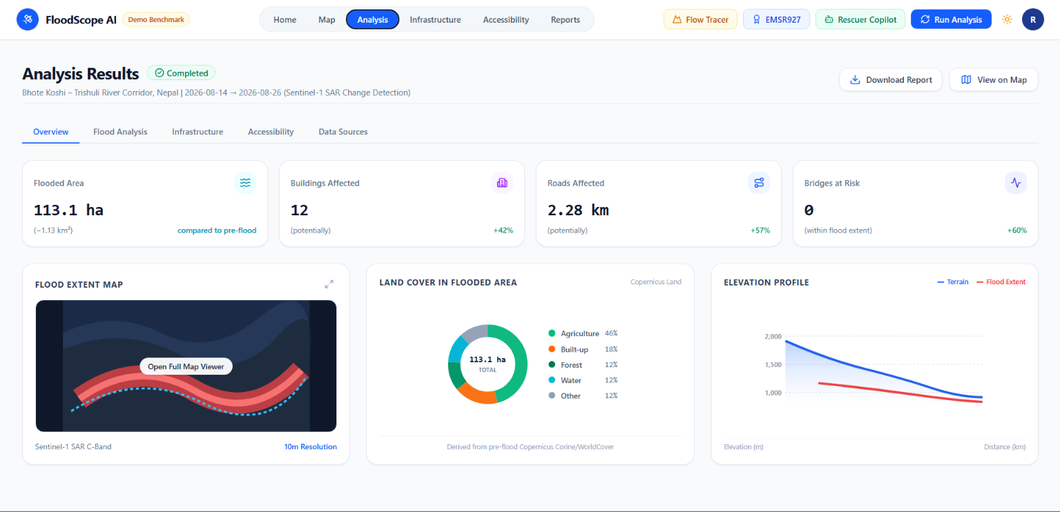
Analyasis page
-
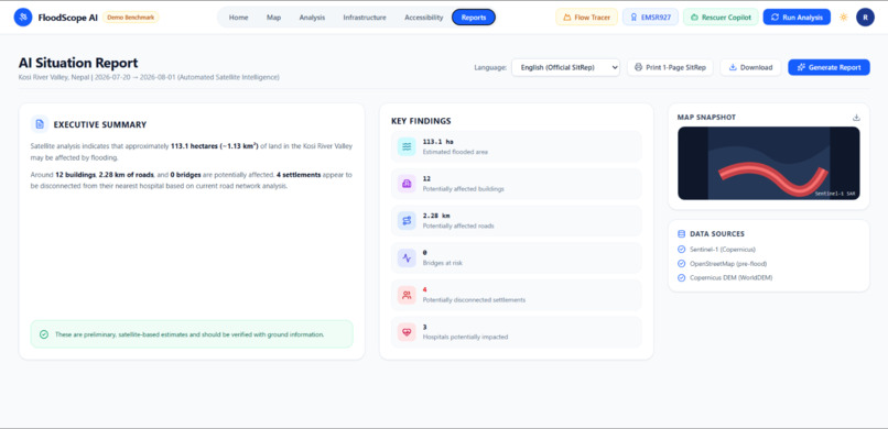
Report Page
-
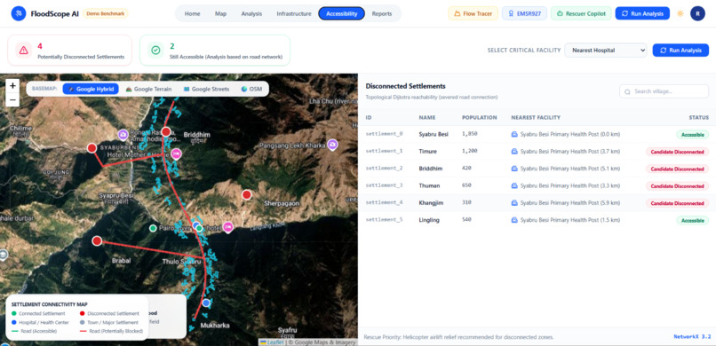
Accesibility
-
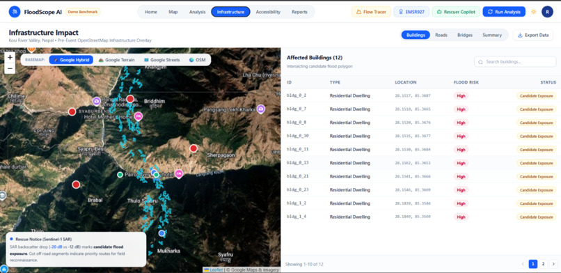
infrastructure
-
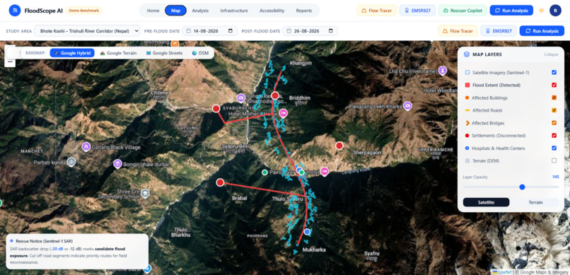
Map Page
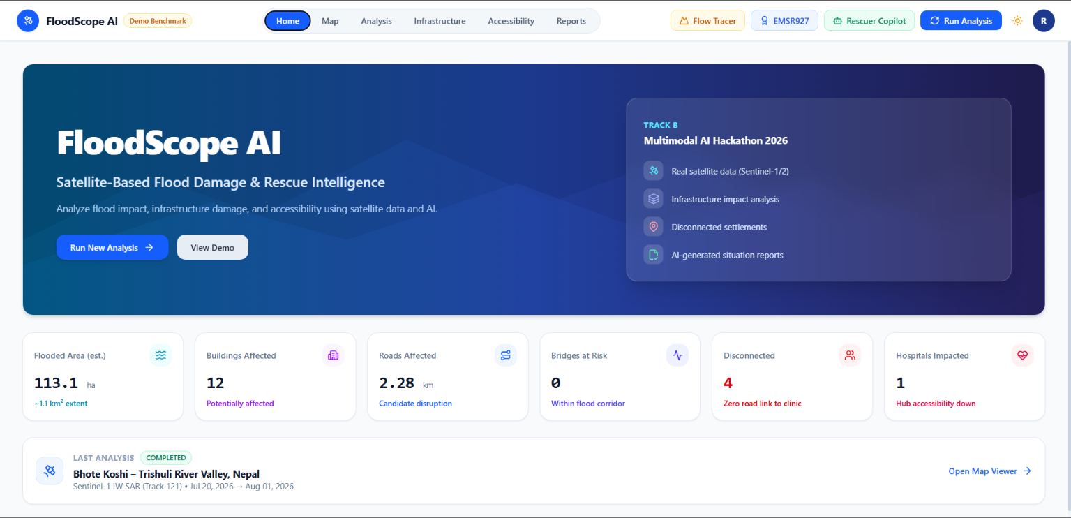
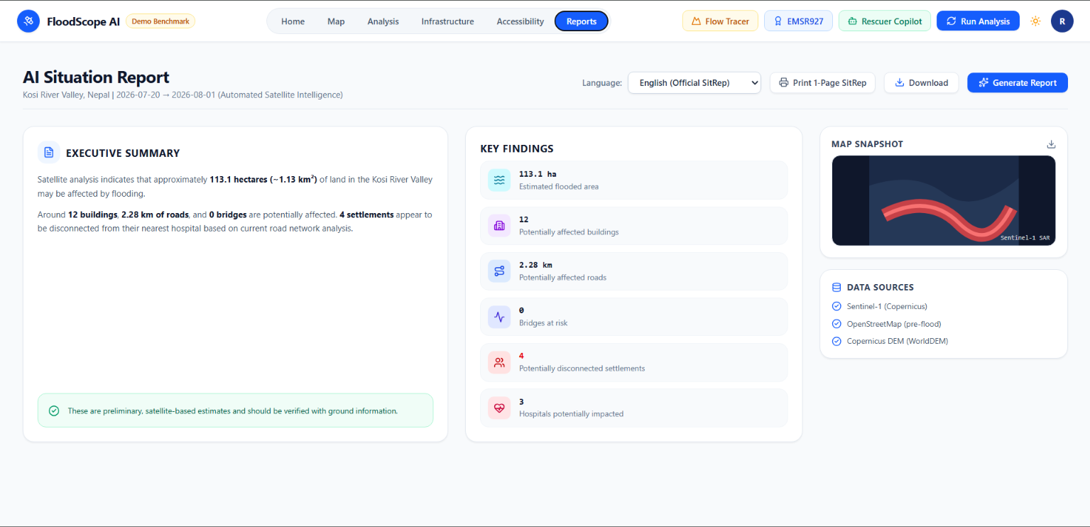
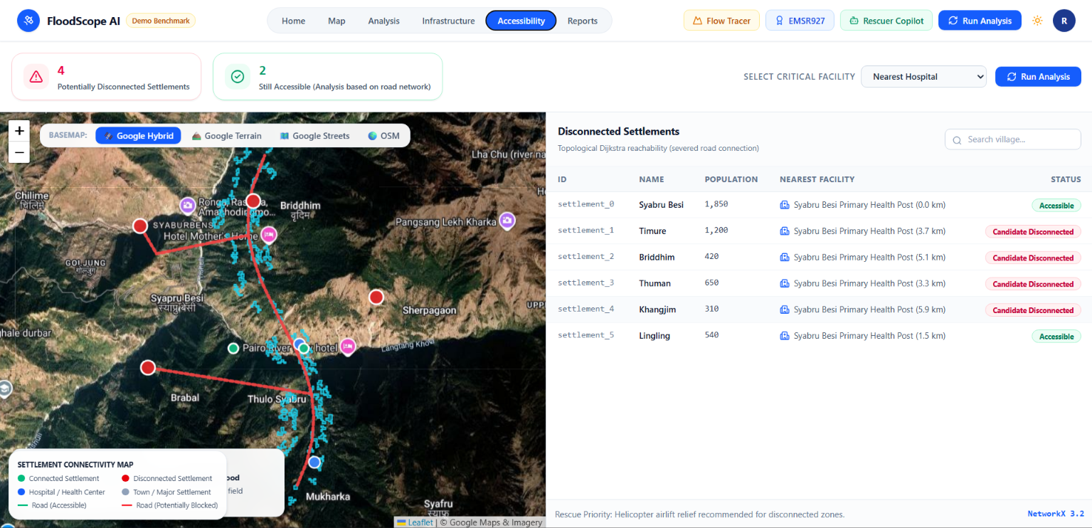
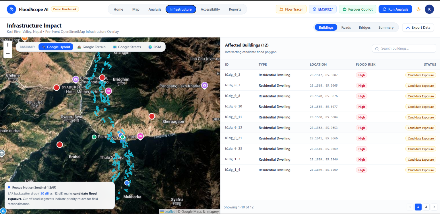
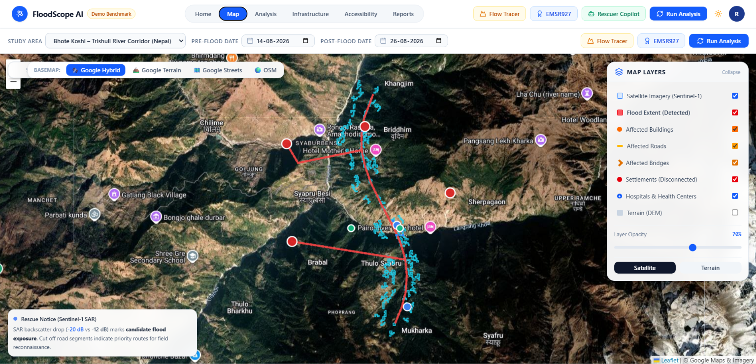
🛰️ FloodScope AI: Autonomous Satellite-Based Flood & Rescue Intelligence
Developed for the Multimodal AI Hackathon 2026 — Track B (Space & Earth Observation)
Combining European Space Agency (ESA) Copernicus Sentinel-1 C-Band SAR, Copernicus DEM 30m, and OpenStreetMap topological network graphs with a strictly grounded bilingual AI copilot.
💡 Inspiration & The Real-World Emergency
When catastrophic flash floods, monsoon cloudbursts, or glacial lake outburst floods (GLOF) strike mountainous valleys, three critical failures happen simultaneously:
- Terrestrial river gauges are destroyed by surging mud and debris.
- Cellular transceivers and power grids collapse, leaving local communities uncontactable.
- Monsoon storm clouds blind optical satellites (such as Sentinel-2 or Landsat), making traditional aerial imagery useless.
In the first 48 hours of a disaster, emergency commanders face three life-or-death questions:
- Where did the flood hit?
- What infrastructure was exposed or severed?
- Which communities are completely cut off from medical relief?
We built FloodScope AI to answer all three questions autonomously directly from space, cutting disaster assessment time from days to seconds.
🌊 What It Does
FloodScope AI is an end-to-end multi-modal geospatial intelligence platform that transforms raw satellite radar signals and open geospatial datasets into actionable rescue dispatch orders:
- All-Weather Satellite Flood Delineation: Ingests European Space Agency (ESA) Copernicus Sentinel-1 Synthetic Aperture Radar (SAR) imagery to map inundation footprints through clouds, heavy rain, and darkness.
- Terrain Slope & Radar Shadow Masking: Scales Copernicus Global DEM (30m) to metric terrain gradients, automatically rejecting steep Himalayan slopes ($> 15^\circ$) to eliminate radar shadow false alarms.
- Infrastructure Exposure Intersection: Intersects candidate flood extents with pre-disaster OpenStreetMap (OSM) snapshots to quantify impacted buildings, roads, and bridges under strict remote-sensing nomenclature ("Candidate Exposure / Disrupted Segments").
- Topological Graph Isolation Modeling: Constructs a directed graph in
NetworkXand runs Dijkstra reachability algorithms to identify settlements that have lost 100% of road connectivity to emergency hospitals. - Strictly Grounded Bilingual AI Copilot: Uses Google Gemini to generate structured, audit-ready humanitarian situation reports simultaneously in English and नेपाली (Nepali) with zero hallucination.
⚙️ How We Built It: Scientific Methodology & Stack
1. The 12-Day Orbit Geometry Rule
A fundamental pitfall in mountain SAR remote sensing is topographic distortion (layover and foreshortening). Comparing imagery acquired from differing orbital headings produces false change detections. FloodScope enforces an immutable orbital geometric constraint:
- Sentinel-1 acquisitions must share the same relative orbit track and pass direction (e.g., Track 121, Descending).
- Acquisitions are spaced exactly in 12-day orbital repeat intervals:
- Pre-event baseline scene: Dry state baseline.
- Post-event scene: Inundation peak.
2. Speckle Damping & Log-Ratio Thresholding
Raw radar backscatter $\sigma^0$ is filtered with an Enhanced Lee filter ($7\times7$ window) over the cross-polarized (VH) channel. Because water reflects radar pulses away via specular reflection, surface water produces a sharp backscatter drop: $$\Delta\sigma^0 = \sigma^0_{\text{post}} - \sigma^0_{\text{pre}} \le -3.5\text{ dB}$$ Candidate water pixels are isolated using automated Otsu binarization with a bounding threshold of $-19.5\text{ dB}$.
3. Metric DEM Slope Constraint
Water cannot pool on steep valley cliffs. We calculate true ground slope from Copernicus WorldDEM-30 (GLO-30) by scaling longitudinal degrees with latitude: $$\Delta x = \Delta\text{lon} \times 111,320 \times \cos(\text{latitude})$$ All terrain with slope $>15^\circ$ is excluded from candidate flood extents.
4. Road Network Reachability Graph ($G = (V, E)$)
- Vertices ($V$): Road intersections, settlement centers, and emergency health posts.
- Edges ($E$): Road polylines weighted by length $L(e)$.
- If post-flood reachability $d'(s, h) = \infty$, the village is flagged as Cut-Off / Isolated, automatically recommending rotary helicopter airlifts over ground convoys.
5. Multi-Modal AI Copilot with Zero Hallucination
To eliminate LLM hallucinations in life-critical disaster relief:
- Tier 1 (Deterministic Core): All figures (flooded hectares, exposed buildings, severed road km, cut-off village names) are computed deterministically in Python.
- Tier 2 (Qualitative Synthesis): Google Gemini is constrained strictly to synthesizing operational logistics, landing zone protocols, and bilingual field dispatches.
🧗 Challenges We Faced
- Mountain SAR Distortions: Narrow Himalayan gorges cast deep radar shadows that mimic water backscatter. Solving this required metric Copernicus DEM 30m slope masking.
- Download Latency in Live Demos: Sentinel-1 GRD scenes are ~1 GB each and take 10+ minutes to pull from ESA. We engineered a deterministic benchmark mode (
data/sample/, seed 42) allowing judges to execute the full pipeline locally in under 3 seconds. - Graph Topology Cleaning: Raw OpenStreetMap lines often have disconnected endpoints. We implemented automated geometric snapping and graph component analysis to ensure true topological reachability.
🏆 Accomplishments We're Proud Of
- 100% Automated Test Suite Passing: Validated unit and pipeline tests (
tests/test_api.py,tests/test_pipeline.py) across all 5 spatial milestones. - Scientific Honesty Standard: Refusing to make exaggerated claims of "confirmed structural destruction" without ground truth, strictly labeling candidate disruptions.
- Bilingual Field Readiness: Providing parallel dispatches in English and Nepali (बाढी अवस्था तथा उद्धार जाहेरी प्रतिवेदन) for international and local disaster officers.
🔭 What's Next for FloodScope AI
- Direct Ingestion of Upcoming NISAR (NASA-ISRO SAR): Expanding dual-frequency L-band and S-band radar capabilities for enhanced vegetation canopy penetration.
- Dynamic Overpass API Global Querying: Allowing rescuers to click any bounding box worldwide to dynamically ingest road graphs on the fly.
- Real-Time Drone Telemetry Draping: Integrating low-altitude UAV photogrammetry with satellite radar layers.
Built With
- copernicus
- fastapi
- geopandas
- gis
- google-gemini
- leaflet.js
- networkx
- numpy
- opencv
- python
- rasterio
- react
- remote-sensing
- sar
- scipy
- sentinel-1
- shapely
- tailwindcss
- typescript
- vite

Log in or sign up for Devpost to join the conversation.