The problem
After a flood, the arguments start. Did anyone see it coming? Which agency knew, and when? Was that rainfall reading real, or adjusted later? Insurers dispute claims, funders hold back relief money, and communities that raised the alarm are told no record exists. The evidence is scattered across weather services, satellite passes, terrain maps and phone reports, and none of it carries proof of when it was captured or whether anyone edited it since.
Flood risk tools keep getting better. Proof of what was known before the water arrived has stayed out of reach. Without it, nobody can be held accountable and nobody gets paid quickly.
My solution
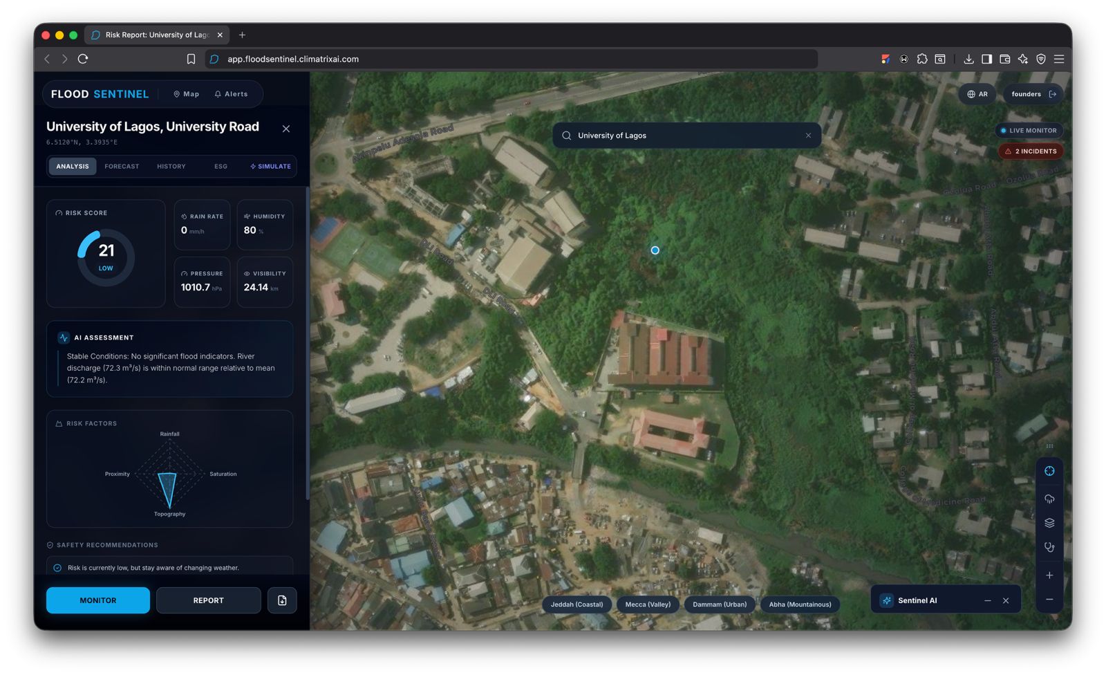
FloodSentinel is an evidence layer for floods. It gathers rainfall, terrain, distance to water and community incident reports for an area, then seals each risk snapshot into a record holding its timestamp, source, location reference and a cryptographic hash. Records are grouped into batches, and one fingerprint per batch, a Merkle root, is anchored on a low-cost public blockchain. Later, anyone can take a single observation and prove with a short mathematical receipt that it existed at that moment and has not changed by one character.
A flood warning gains a property it never had: it cannot be backdated.
Every record carries a label for what it is: a sensor measurement, a satellite estimate, a model output or an unverified community report. Reports gain weight when neighbours independently corroborate them. An AI layer reads the sealed evidence and writes a plain-language account of why an area is flagged, which factors drove the score and where the uncertainty sits. It can only cite records that exist in the registry, so it has nothing to invent from.
Only fingerprints go on-chain. Personal details and raw datasets stay off-chain, which protects privacy and keeps costs low.
Why Web3 belongs here
The body that issues a warning is often the body blamed when it fails, so a database it controls proves little. A public ledger gives insurers, funders, journalists, residents and city officials one shared timestamp that no single institution owns. That shared proof makes something practical possible: parametric flood cover and emergency funding that release the moment verified conditions are met, with no weeks of claims assessment.
How I am building it
The proof of concept runs in four steps: capture an observation, seal it into a record, check its integrity, and show the flood-risk picture in a simple interface. A reviewer can tamper with a record and watch verification fail. The analysis engine and the verification layer are separate modules, so the risk model can be upgraded without breaking the chain of proof. I am starting with one flood-prone urban area and designing the registry to carry over to others.
What I learned and the hard parts
People trust climate intelligence when they can trace it. A polished map falls short if a user cannot tell a measurement from an estimate or see where a number came from. That shaped the design. The chain’s job is narrow: it vouches for what was recorded and when. The environmental models do the analysis, and the AI stays tied to cited records. The balancing act is transparency against privacy against cost, and anchoring batches instead of single records is how I keep all three in line.
Who benefits and what comes next
Local authorities and emergency teams get warnings they can defend. Infrastructure operators get an audit trail. Insurers and relief funders get a trigger they can trust enough to pay on. The model can sustain itself through institutional subscriptions, per-verification fees and partnerships on trigger-based cover.
Next, I will like to test whether users can trace an observation and catch a modified record, publish the data sources and their limits, and then pilot a verified-trigger payout with a partner.
FloodSentinel turns flood evidence into something you can prove.
Built With
- artificial-intelligence
- blockchain
- climate-change
- climate-data
- disaster-risk-reduction
- environmental-monitoring
- flood-risk
- geospatial
- sustainability
