-
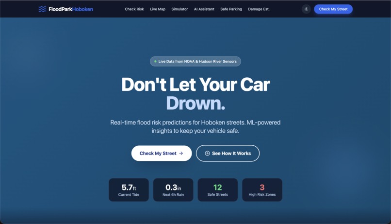
Home Screen for our FloodPark Hoboken website
-
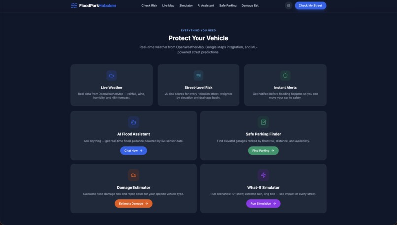
More of our home screen of our FloodPark Hoboken website
-
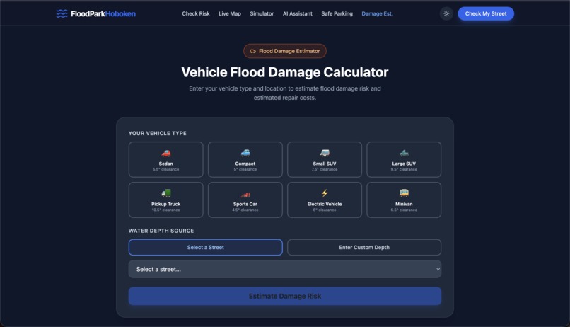
Gives potential risks depending on your car model and street you are parked on.
-
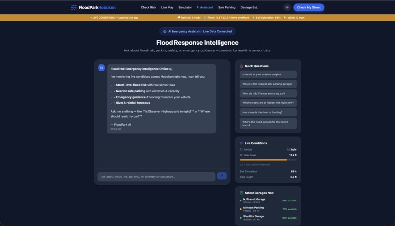
AI bot where you can ask it questions about your specifc situation and it'll give you the answer.
-
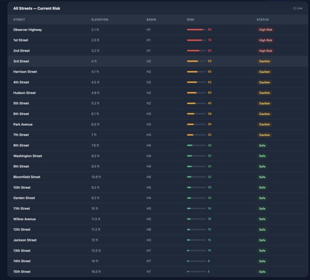
Give the current risks of all the streets in Hoboken which is updated and gives you the status of the streets.
-
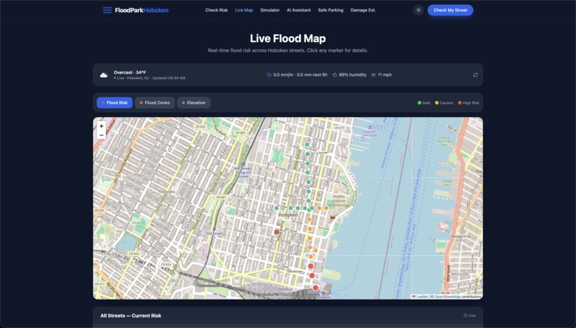
The map of Hoboken in which you can see the specific risks of all the streets more a visual then just the table.
-
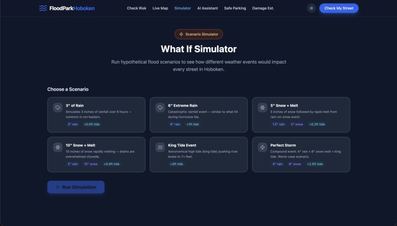
Give a simulator of what it'll look like for a forecast weather on the streets if you wanted to plan for the future.
-
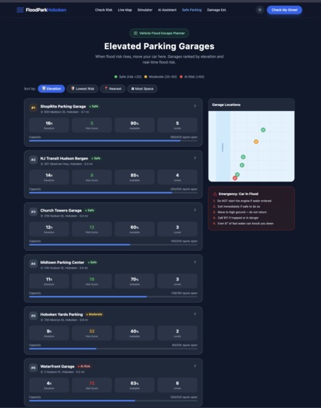
Elevated Parking Garages Recommendation that gives you options organized by elevation, lowest risk, nearest, and most space.


Inspiration
As students at Stevens Institute of Technology, flooding in Hoboken is a recurring issue to residents across the town, it’s something we see right outside our campus. After a heavy rainstorm, certain streets begin to fill up almost immediately. Group chats light up with people asking if they should move their cars. Some of us have run out in the rain, hoping we picked the right garage. Businesses close early, sidewalks disappear under water, and what started as a normal day suddenly becomes a logistical problem. We’ve seen firsthand how quickly everyday life in Hoboken can be disrupted by flooding. What stood out to us was how little guidance actually exists in those moments. Weather apps tell us how much it’s going to rain, but that’s not the real question people are asking. The real questions are: Will my street flood? Is my car safe where it’s parked? How bad could this get? Do I need to act right now? As engineering students, we naturally started thinking about this as a systems problem. Hoboken is one of the most flood-prone cities in New Jersey, yet there isn’t a simple, centralized platform that translates weather conditions into clear, street-level impact. We didn’t want to build another weather dashboard. We wanted to build something that helps people make decisions.
FloodPark Hoboken came from that mindset. Our focus wasn’t just on predicting rain, it was on modeling impact. Instead of giving general warnings, we aimed to provide localized, practical insight. Our goal is to give Hoboken residents, including our own Stevens community, the clarity to act before flooding turns into costly damage.
What it does
FloodPark Hoboken is designed to answer the question people in Hoboken ask every time it starts pouring: “Is my street going to flood?” The platform pulls in live tide and weather data and combines it with street-level elevation modeling to estimate flood risk in real time. Behind the scenes, it uses mathematical operations and weighted formulas to calculate risk based on rainfall, tide levels, wind speed, and elevation. To make the predictions realistic and dynamic, the system also uses probability-based random curves (normal distributions) to simulate how rainfall and environmental conditions typically vary. These modeled curves help generate more natural, scenario-based predictions rather than static outputs. Users can enter their street and quickly see whether they’re likely in the clear or if it’s time to move their car. If the risk is high, FloodPark suggests safer nearby garages, estimates how much damage rising water could cause, and even lets users simulate extreme weather scenarios to see how different conditions would impact their area. There’s also an AI assistant built in, so users can ask questions about current conditions or what steps to take and get clear, straightforward guidance. At the end of the day, FloodPark isn’t just about showing flood data. It’s about helping people make quick, informed decisions before a bad storm turns into an expensive mistake.
How we built it
We built the frontend using JavaScript, HTML, and CSS. We then used the React.js database to connect the backend to the frontend. As for the API calls, we pulled live data from real sources such as NOAA Tides and Hudson River Sensors. We also used Base44 for assistance in creating a prototype website and then coded it individually in VScode. As for the main code in the backend, we used Python. We started by generating a random set of 2000 data points on known flood factors such as elevation, rainfall, tide level etc. We then trained a Random Forest Regressor on these data points to predict one outcome which was then normalized on a scale of 0-100 to better understand the flood risk score. When the code is run, the user selects a street and then live data from Open-Meteo API is pulled and then mapped to the current parameters of street. It also includes a simulation engine which can model extreme events such as king tides. This makes the ML model more predictive and decision focused. For the chatbot we implemented an AI assistent by connecting a frontend chat interface to a backend API that routes user queries to a large language model and returns contextual responses in real time.
Challenges we ran into
One of the challenges we faced was using a uniform distribution instead of a normal distribution. A uniform distribution picks a selection of equally likely points along the entire range while a normal distribution is more biased towards the middle due to its bell shape which gives it a more realistic simulation overall. Once we changed this, we also had to change the parameters because while in a uniform distribution the endpoints are the only parameters while in a normal distribution the mean and variance are there. We also ran into overfitting early on because before having the random simulation of 2000 values, we put in about 10 arbitrary points which was too small to train/test on. To solve this we implemented the 2000 values to perform a proper 80/20 train test split.
Accomplishments that we're proud of
Building a fully functional, custom-engineered product from scratch during a hackathon is a significant achievement for our team. We transformed a personal problem into a working platform featuring a machine learning model with 93% accuracy, capable of retrieving real-time tide, rainfall, and elevation data. The scenario simulator, particularly the snowmelt feature, demonstrates a level of technical depth that exceeded our initial expectations for this timeframe. Most importantly, we developed a solution that addresses a tangible problem within our own community. Another thing that we were proud of was using the stuff we learned at Stevens with probabilities and statistics to come up with the risk percent based on the rain data that we got from the past.
What we learned
We discovered that the most effective way to validate an idea is to build a functional prototype before attempting to perfect it. We also recognized the importance of hyper-local data; flood risk is not a city-wide issue but rather varies block by block, and our model only became meaningful when we accounted for this granularity. Technically, integrating multiple live data sources into a unified, reliable risk score provided valuable insights into data normalization and model calibration in real-world scenarios.
What's next for FloodPark Hoboken
Our immediate priority is to expand the safe garage finder by integrating live parking availability through direct partnerships with local garages and municipal lots. Subsequently, we aim to implement push notifications to enable residents to receive proactive flood alerts before conditions deteriorate. In the long term, the infrastructure we have developed is city-agnostic, offering a clear opportunity to extend FloodPark to other flood-prone cities in the Northeast that face similar challenges with tidal flooding, heavy rainfall, and limited resident awareness.
Built With
- base44
- css
- fast-api
- html
- javascript
- noaa-tides
- open-meteo-forecast
- python
- react
- usgs-elevation

Log in or sign up for Devpost to join the conversation.