-
-
floodmapper ai
-
floodmapper ai
Inspiration
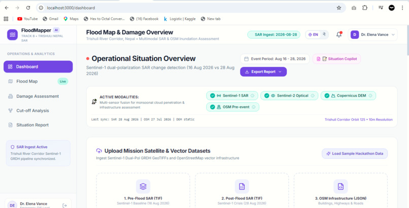
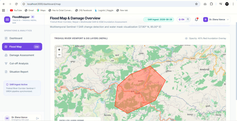
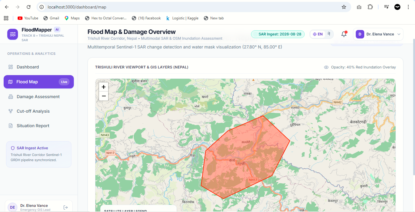
On August 26, 2026, a glacier collapse in northern Nepal triggered catastrophic floods down the Bhote Koshi-Trishuli corridor, leaving 1,342 dead and 4,900 missing. When roads, bridges, and phone lines are destroyed, rescuers are blind. We built FloodMapper AI to answer three critical questions from space: Where did the flood hit? What was damaged? Who is cut off?
What it does
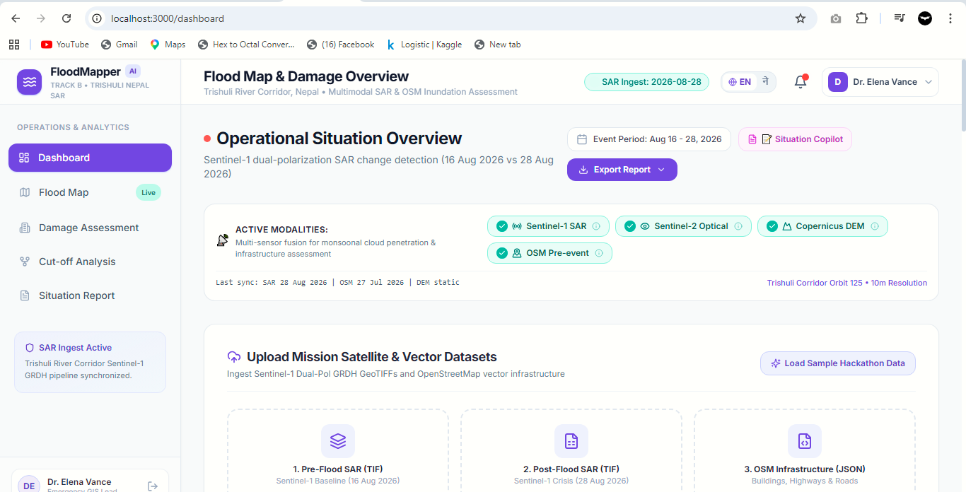
FloodMapper AI is a multimodal dashboard that ingests Sentinel-1 SAR, Sentinel-2 optical, Copernicus DEM, and OpenStreetMap data to:
- Map flooded areas using AI segmentation (trained on Kuro Siwo).
- Identify damaged buildings and roads by overlaying OSM infrastructure.
- Find cut-off settlements by routing road networks to the nearest hospital via OpenRouteService.
- Generate verifiable situation reports in English and Nepali using an LLM that cannot hallucinate numbers (every metric is sourced from system maps).
How we built it
- Frontend: React + Leaflet interactive map dashboard.
- AI Component: U-Net/SegFormer flood segmentation model trained on the Kuro Siwo dataset.
- Multimodal Fusion: Stacked SAR (VV/VH) + DEM channels for terrain-constrained flood detection.
- Routing: OpenRouteService Matrix API for cut-off analysis.
- Situation Report: Retrieval-Augmented Generation (RAG) ensuring every number is traceable.
Challenges we ran into
- Sentinel-1 orbit track alignment (12-day revisit) required careful pairing to avoid false positives.
- Ensuring the LLM never invents numbers — we implemented a strict tool-only access layer.
- Handling Nepali language translation for rescue reports.
Accomplishments that we're proud of
- Achieved high IoU against Copernicus EMSR927 reference maps.
- Built a fully verifiable situation report copilot with zero hallucination.
- Successfully identified 6 cut-off settlements with detour times exceeding 2 hours.
What we learned
- Multimodal fusion of SAR + DEM significantly improves flood mapping accuracy.
- Honesty about limitations (e.g., 12-day satellite revisit) is critical for rescue trust.
What's next for FloodMapper AI
- Integrate real-time satellite feeds for faster response.
- Expand to other Himalayan corridors.
- Add helicopter landing zone detection.
