-
-
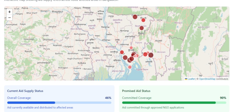
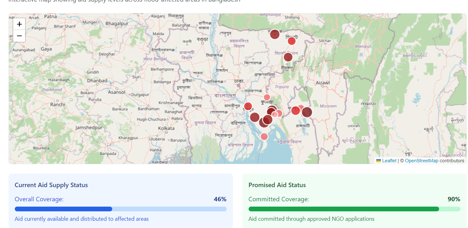
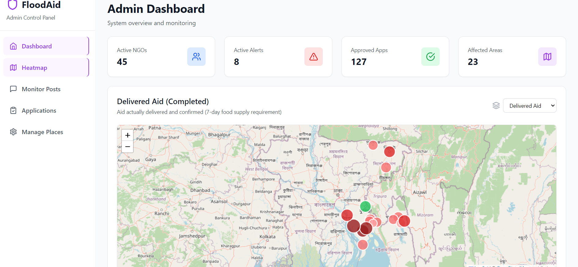
Homepage map for citizen to track aid distribution
-
-
-
-
-
-
-
-
-


FloodAid_Bd
Inspiration
Every year, floods devastate communities across Bangladesh. While aid often pours in from generous NGOs and donors, the distribution is frequently unequal. Villages near highways or easy-access points receive more attention, while remote or submerged areas are left with little or no aid. We were inspired to build FloodAid_Bd to fix this misdistribution problem — ensuring every affected family, no matter how remote, gets the help they need.
What it does
FloodAid_Bd is a prototype web platform designed to coordinate flood relief efforts by NGOs and different organizations across Bangladesh. Key features include:
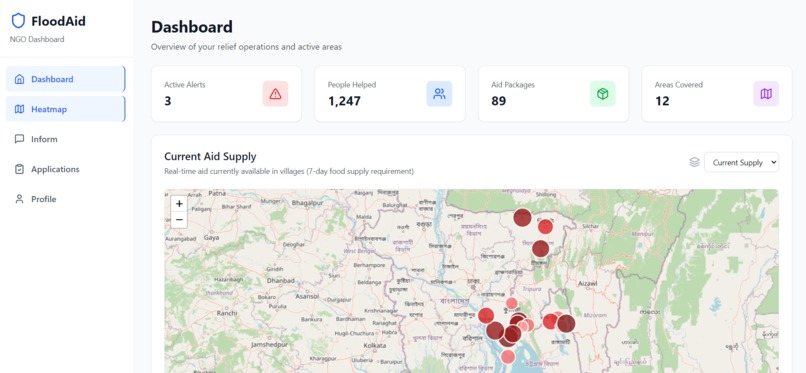
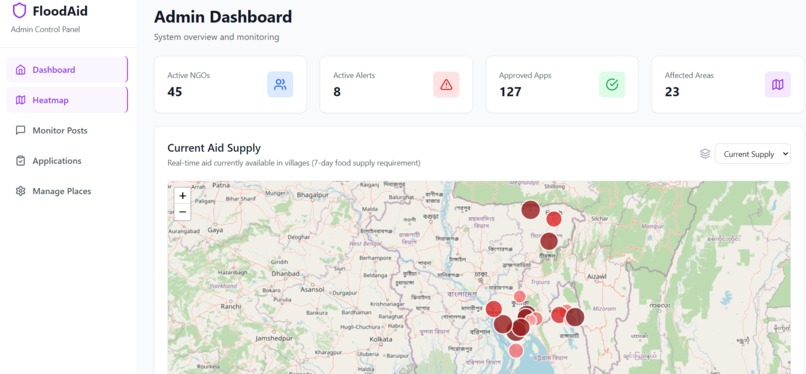
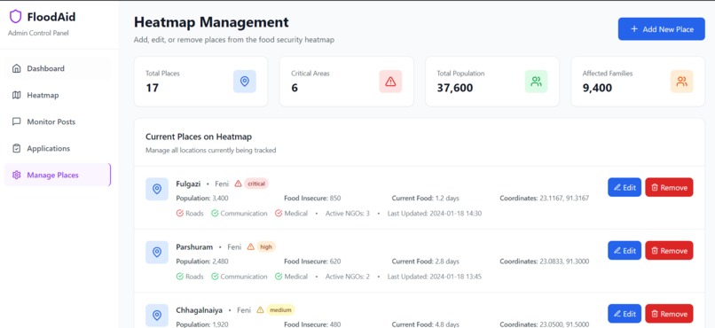
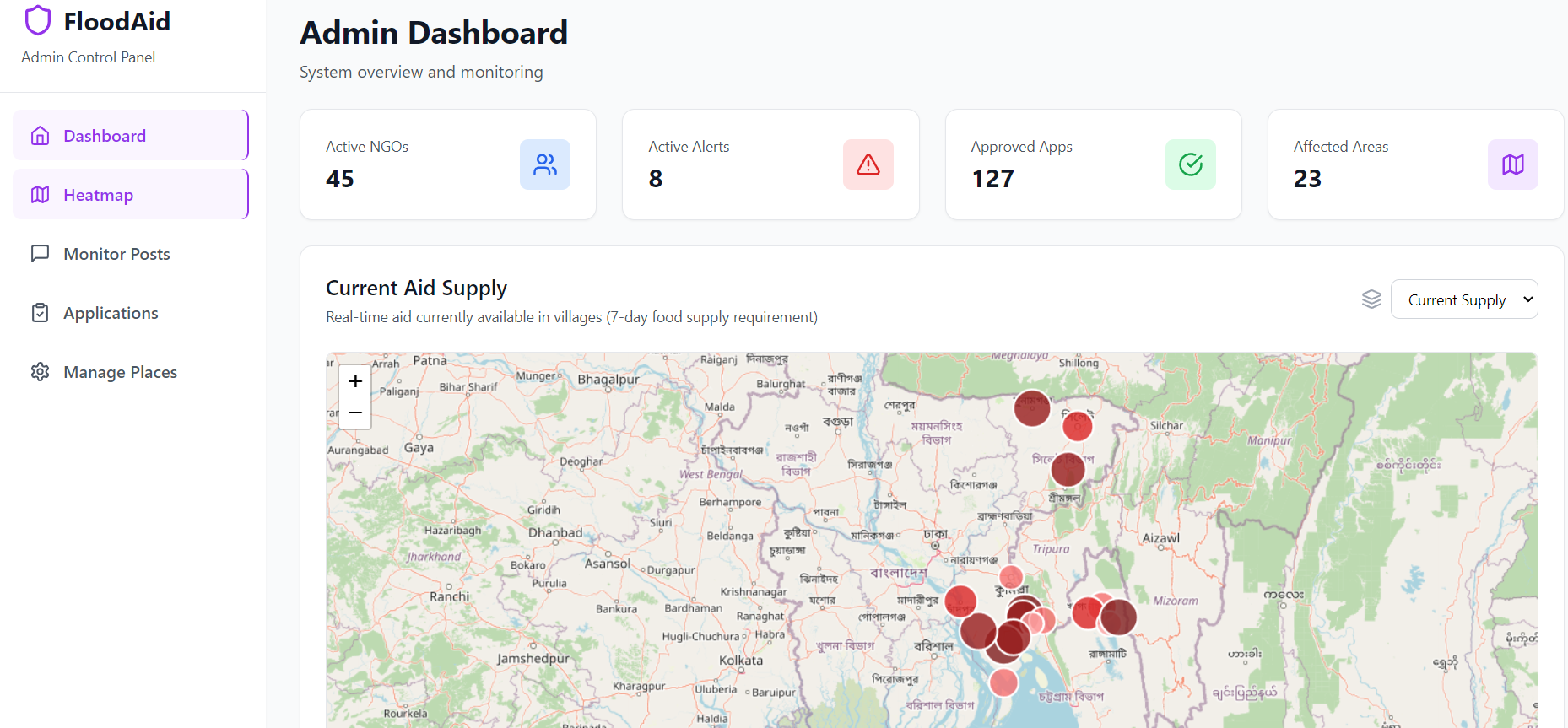
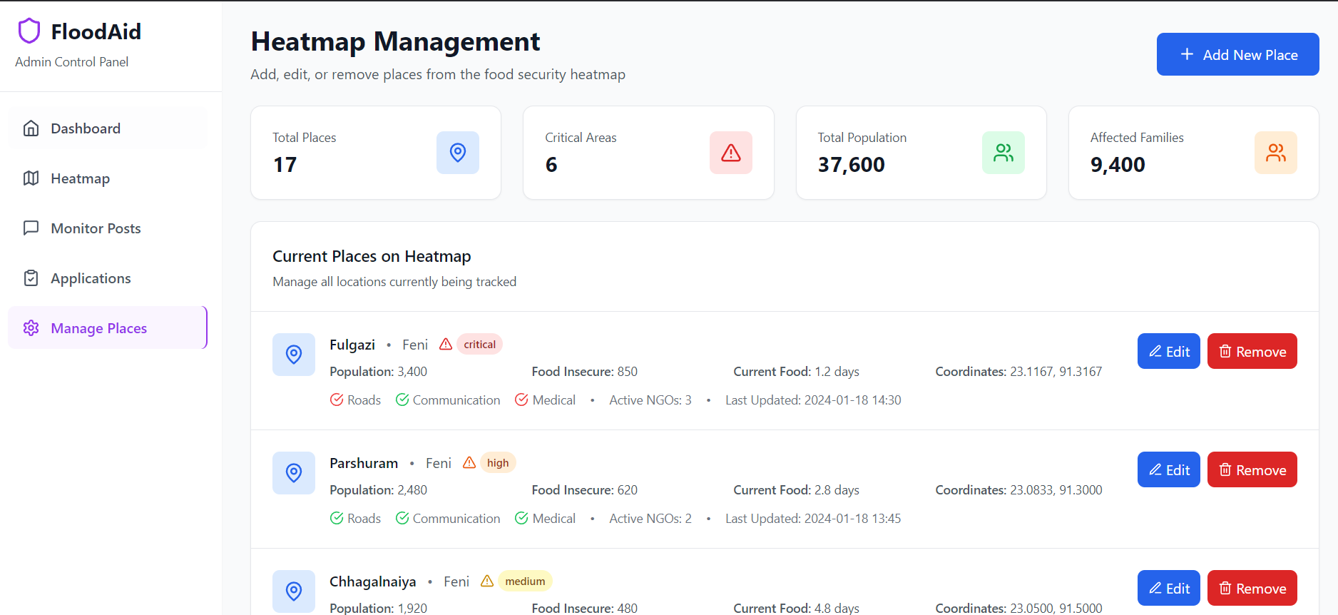
- A real-time heat map showing villages that have received aid, promised aid, or still need urgent help
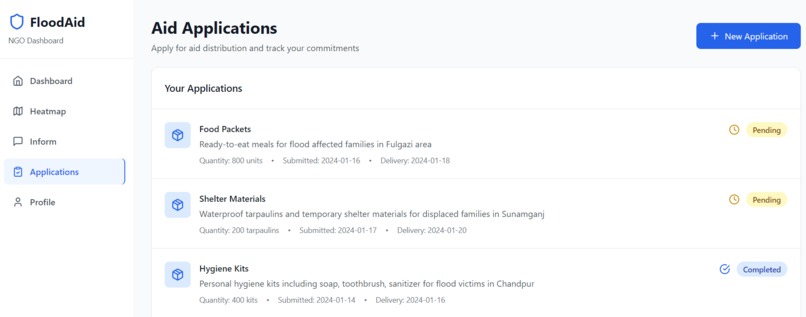
- A system for NGOs to log aid delivery plans, mark them as completed, or flag emergencies
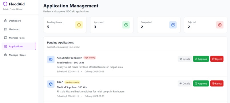
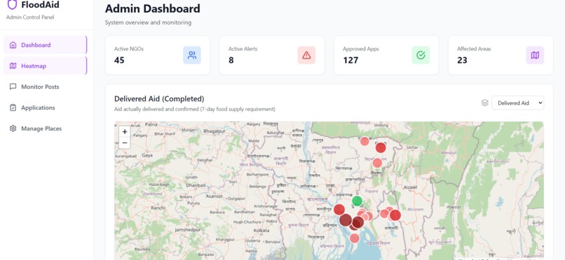
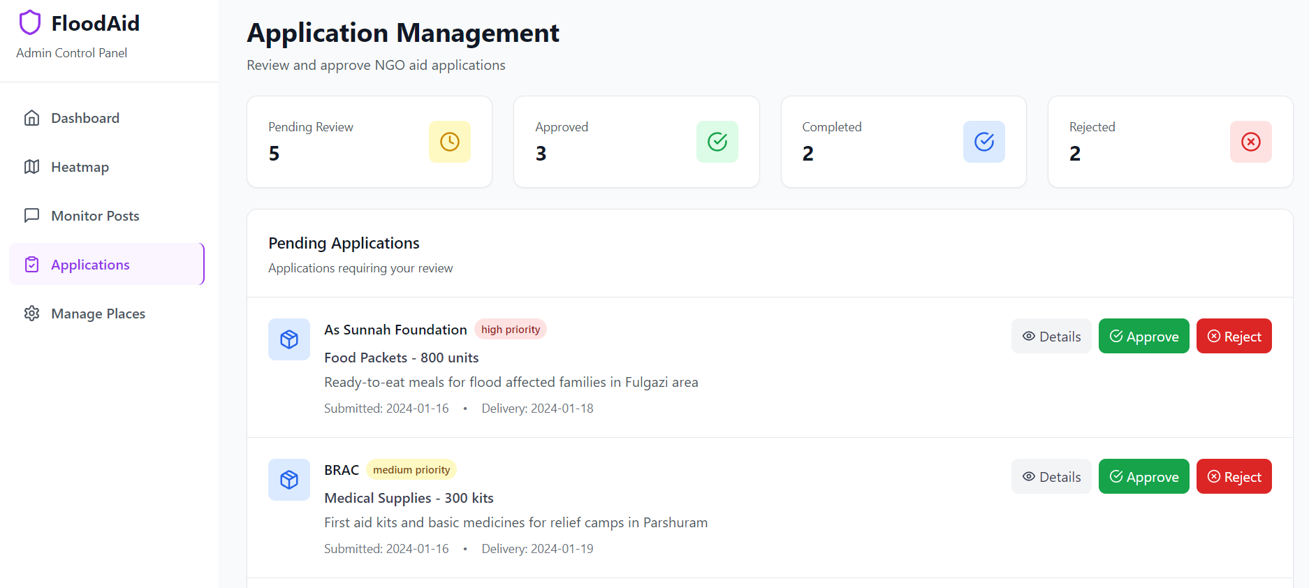
- An admin dashboard to verify aid requests, moderate misinformation, and monitor delivery status
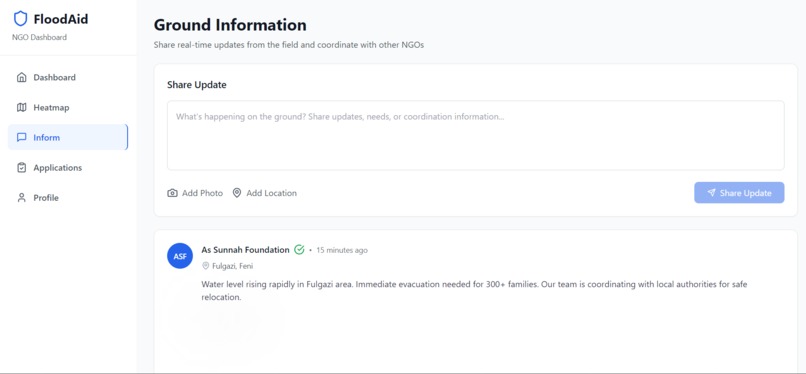
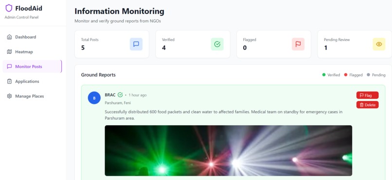
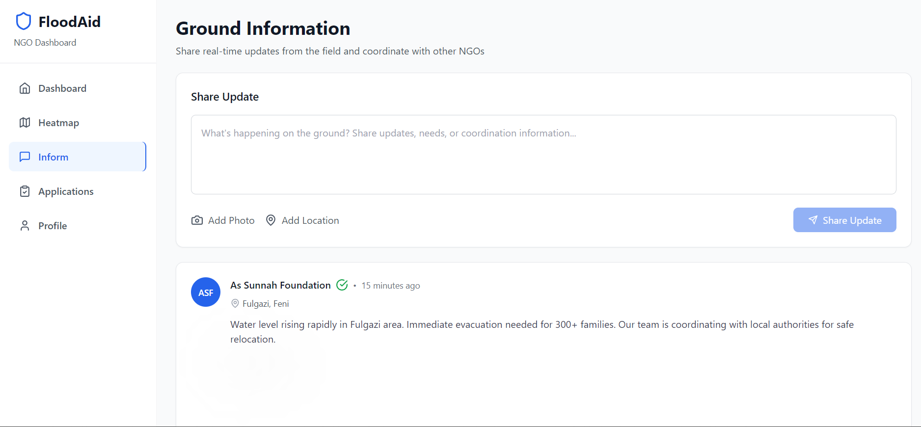
- A centralized “Informe” section where NGOs can report urgent rescue needs (e.g., stranded families)
How we built it
We built the prototype using:
- Technology: Next.js + Tailwind CSS for fast, responsive UI
- Map Layer: Leaflet.js for heat map visualization and location plotting
- Admin Interface: Custom panel with CRUD functions for aid approval, flagging, and verification We focused on building core features first, especially the map logic and aid request flow.
Challenges we ran into
- Mapping accuracy: Plotting aid data and ensuring precise coordinates is difficult
- Designing fair aid distribution logic: Deciding how to visually represent underserved vs overserved areas
- Mocking NGO behavior: Simulating real-world workflows (e.g., promises, delivery, emergencies) in code
- Time and scope: As this is a prototype, we had to prioritize features under tight time constraints
Accomplishments that we're proud of
- Tackled a critical social issue with real potential impact in our local context
- Built an aid tracking heat map with status overlays
- Created a simple but flexible NGO reporting and admin approval system
- Defined a clear workflow that models real-world NGO coordination dynamics
What we learned
- How to translate real humanitarian problems into tech workflows
- Practical use of maps and geodata visualization in web development
- Importance of admin moderation in public data platforms
- Gained deeper understanding of logistics challenges during disaster response
What's next for FloodAid_Bd
- Build the backend properly to make the project come live and be used in real life
- Connect with real NGOs to validate our model and improve workflows
- Add secure authentication and role-based access (NGOs, admins, volunteers)
- Integrate live flood data from government or satellite APIs
- Build a mobile-first PWA version for field workers and affected communities
- Use AI or smart algorithms to suggest underserved areas needing more attention
Built With
- leaflet.js
- map
- nextjs

Log in or sign up for Devpost to join the conversation.