-

Flood Fill report of Kingston ON
Inspiration
Flooding is Canada's most common and most expensive natural disaster. On the other hand, Canadian real estate price is always increasing. Canadians need a way to predict whether a property is going to be underwater in the next 30 years before purchasing it.
What it does
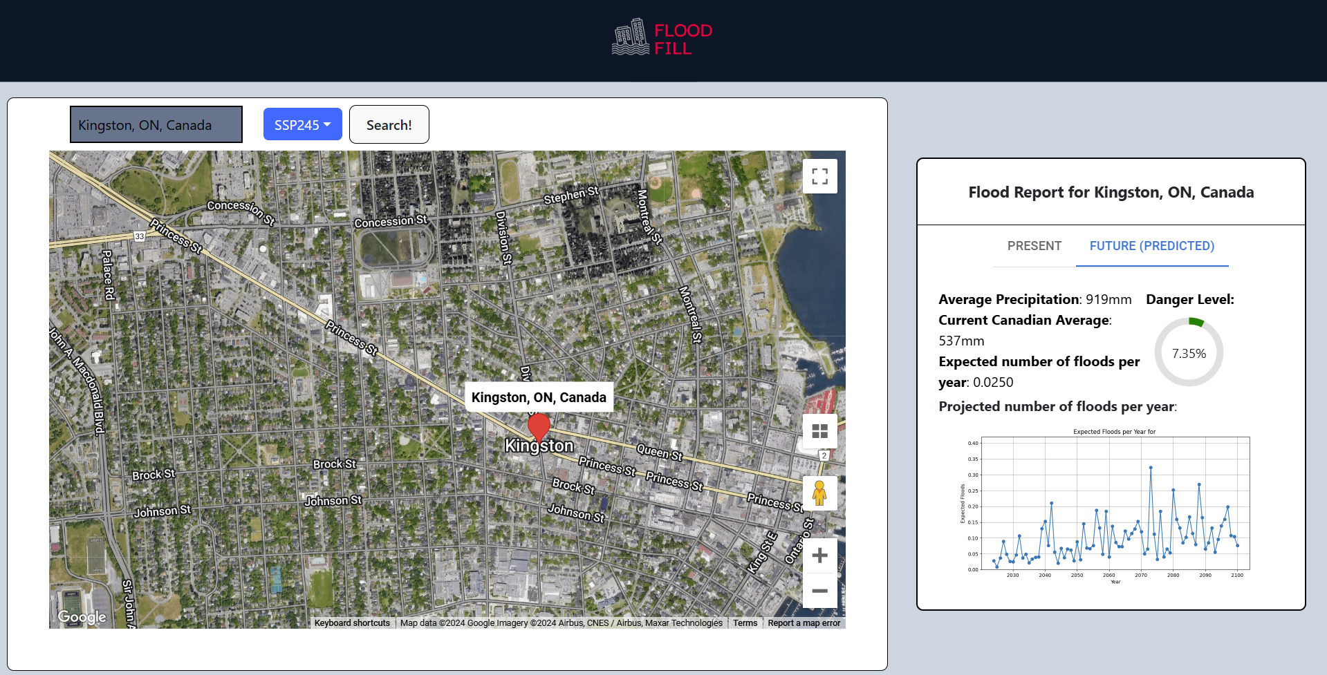
Flood Fill is a web app that allows users to input an address using an integrated Google Map and generate a report of its current flood risk, as well as its projected flood risks by 2100.
How we built it
In the backend, we created a Neural Net using Python and TensorFlow and trained it using precipitation and flooding data. We used Flask as our backend framework. We developed the frontend using React and Tailwind, which features a interactive Google Map and a autocompleting search bar.
Challenges we ran into
We had lots of trouble finding a suitable dataset for flooding, as flooded areas were never exact. We ended up having to do lots of computation ourselves to determine the area of floods.
Accomplishments that we're proud of
Managing to wrangle over 100 million data points to work with our model to predict as best we can!
What we learned
Data is one of the hardest parts of a project like this (slogging through api docs, formatting data...)
What's next for Flood Fill
Things to improve for Flood Fill :
- Develop Flood Fill into a web extension!
- Extend Flood Fill to work in other countries
- Improve the tuning of the model (add more factors)


Log in or sign up for Devpost to join the conversation.