-
-
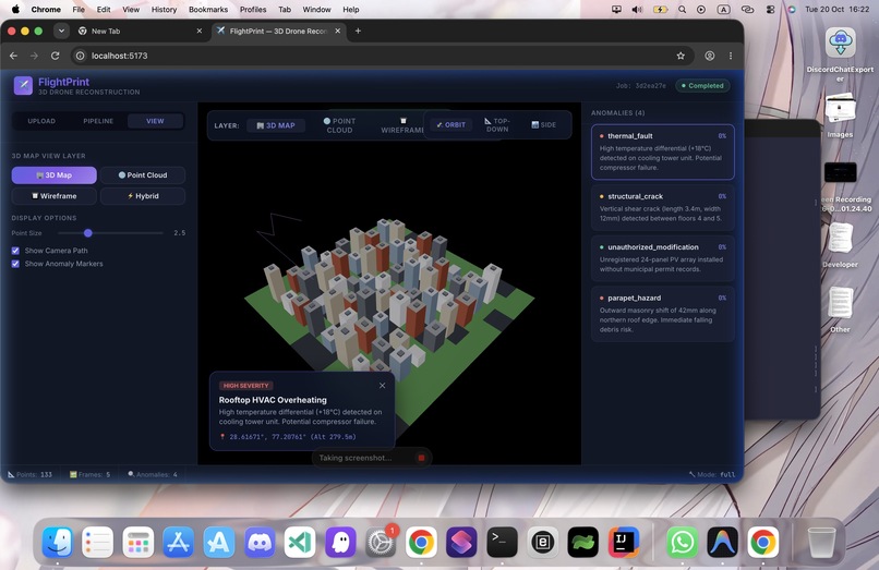
3D reconstruction
-
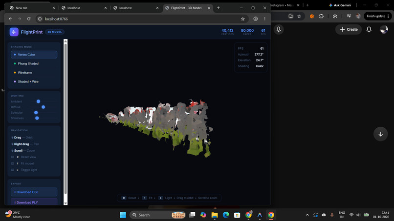
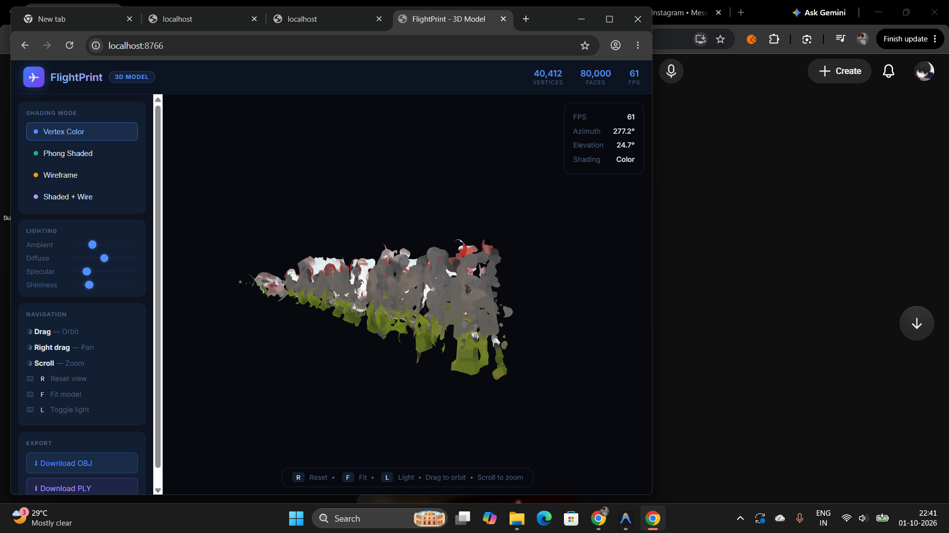
3D Model Viewer
-
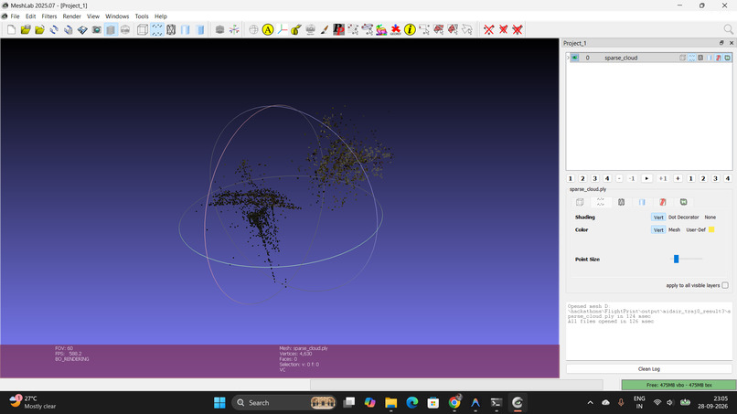
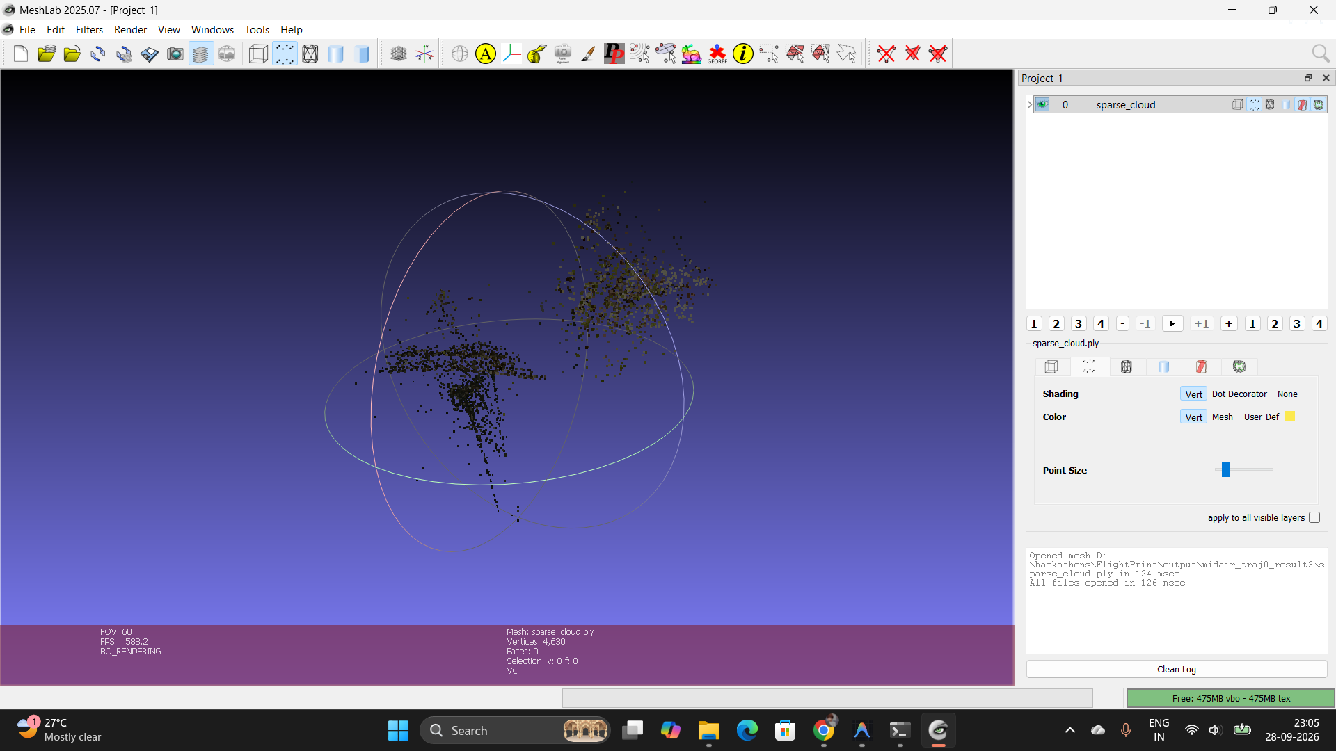
parse point clouds
-
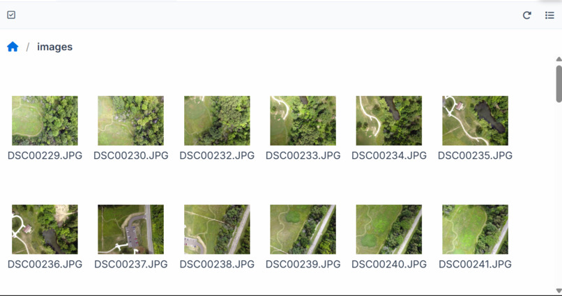
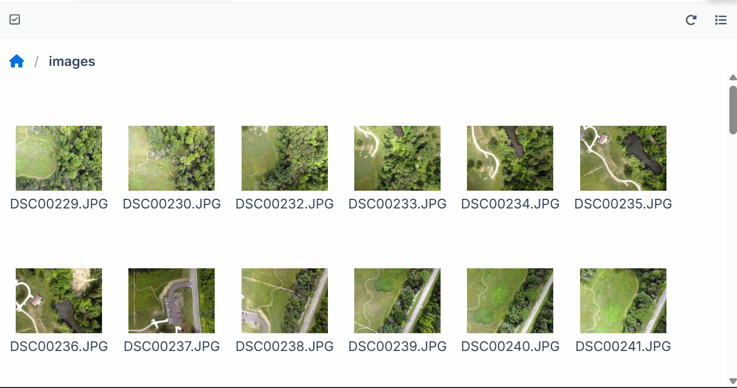
datasets
Inspiration
In disaster response, infrastructure inspection, and emergency mapping, there may not always be an opportunity to capture multiple drone passes of the same area. Traditional 3D reconstruction workflows often benefit from extensive image overlap and carefully planned flights, which can be difficult to achieve in time-sensitive situations.
We wanted to explore a different approach: what if a single drone pass could provide both a 3D representation of an environment and useful insights about areas that may need attention?
That idea led to FlightPrint, a system designed to combine computer vision, 3D reconstruction, and AI-powered scene analysis to turn drone footage into actionable inspection insights.
What it does
FlightPrint processes drone video to generate a 3D representation of the captured environment and identify potential anomalies that may require further inspection.
The system uses OpenCV 5 for visual processing and reconstruction tasks, including frame extraction, feature detection, feature matching, camera pose estimation, and 3D scene generation.
An AI-powered analysis stage, integrated with AWS Bedrock, examines selected visual evidence to help classify potential findings, such as visible damage, obstructions, or unusual objects. Each finding can be linked to supporting video frames and evidence crops, along with confidence scores and evidence-strength indicators.
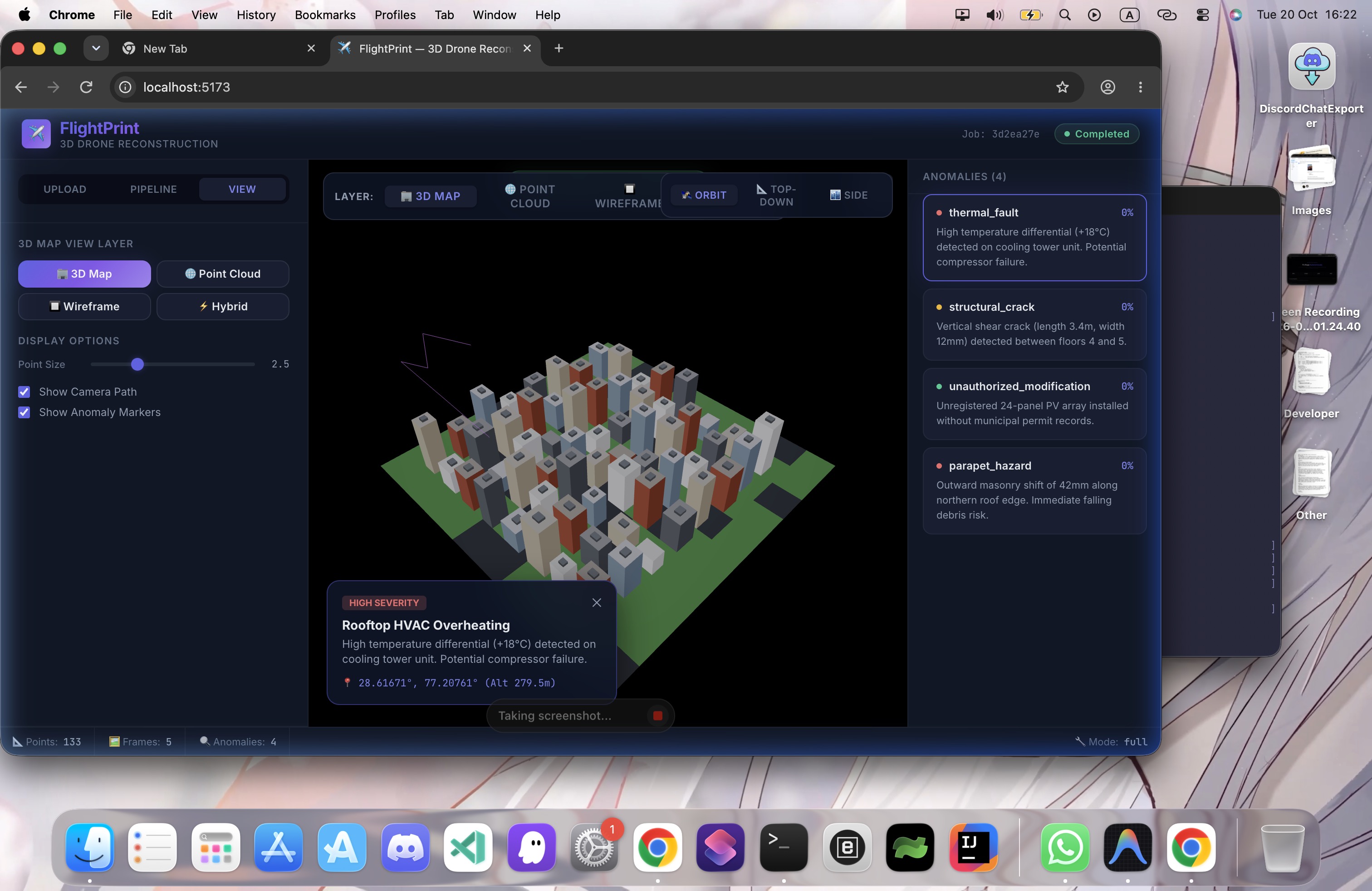
The results are presented through an interactive 3D viewer and inspection dashboard, allowing users to explore the reconstructed scene, examine potential anomalies, and identify areas recommended for human review.
How we built it
FlightPrint combines a computer vision pipeline, an AI analysis component, a backend API, and an interactive frontend.
- OpenCV 5: Forms the core of the visual processing pipeline, supporting video and frame processing, feature extraction, matching, camera motion estimation, and geometric reconstruction.
- 3D reconstruction pipeline: Processes visual features and camera information to generate point clouds, meshes, and other scene assets.
- AI and evidence analysis: Uses AWS Bedrock for visual assessment of selected evidence crops. Findings are linked to supporting frames and accompanied by confidence scores and evidence-level indicators.
- Backend: A FastAPI application manages video uploads, pipeline execution, job status, generated results, and access to reconstruction assets and evidence files.
- Frontend: A React-based interface presents the reconstructed scene, anomaly information, and supporting visual evidence.
- AWS integration: AWS services support cloud-based AI analysis and the planned storage, processing, and deployment workflow.
The system is organized into stages so that reconstruction, anomaly analysis, evidence generation, and visualization can be tested and improved independently.
Challenges we ran into
One of our biggest challenges was making the reconstruction pipeline work reliably with footage captured during a single drone pass. Limited viewpoints, occlusions, motion blur, and insufficient visual overlap can make camera estimation and 3D reconstruction difficult.
Another challenge was connecting AI-generated observations to meaningful visual and geometric evidence. We wanted more than an AI-generated description: users should be able to inspect the actual frames and crops that support a finding.
Integrating the different pipeline stages also introduced challenges around output formats, API contracts, processing status, and passing results between the backend and 3D viewer.
We also had to account for the competition's OpenCV 5 and AWS requirements, including compatibility testing and replacing non-AWS model integration with AWS Bedrock. Evaluating reconstruction quality, confidence scores, processing time, and the limitations of anomaly detection remains an important part of the work.
Accomplishments that we're proud of
We are proud of designing FlightPrint as an integrated inspection workflow rather than just a 3D reconstruction demo.
- Built a staged architecture connecting drone video processing, reconstruction, AI analysis, and visualization.
- Developed an evidence-aware anomaly reporting approach that links findings to supporting video frames and image crops.
- Designed confidence scoring that considers visual detector signals, available viewpoints, viewing-angle diversity, and reconstructed points.
- Integrated AWS Bedrock visual analysis into the anomaly assessment workflow.
- Developed a FastAPI backend contract for uploads, pipeline execution, status tracking, results, and 3D viewer assets.
- Established a workflow for presenting potential inspection findings alongside their supporting evidence.
These capabilities provide a foundation for making drone-derived 3D scenes more useful for inspection and decision support.
What we learned
We learned that building a useful computer vision system involves much more than running a model on an image. Reconstruction quality, camera geometry, evidence selection, confidence estimation, and integration all influence how useful the final result can be.
We also learned the importance of separating what a system observes from what it infers. An AI model may identify a suspicious visual pattern, but that does not automatically establish structural damage. Linking findings to their original evidence and communicating uncertainty makes the results more transparent and easier for a human to evaluate.
Finally, we gained a deeper appreciation for modular pipeline design, cloud integration, API contracts, testing with real datasets, and measuring performance rather than relying on assumptions.
What's next for FlightPrint
Our next steps are to validate the complete pipeline on real drone trajectories, improve reconstruction quality, and test anomaly detection against available ground-truth evidence.
We plan to:
- Complete and validate the OpenCV 5 reconstruction pipeline.
- Improve the association between detected anomalies and their corresponding 3D locations.
- Strengthen evidence linking, confidence calibration, and handling of occluded or weakly supported findings.
- Complete AWS deployment and cloud-based storage and processing integration.
- Improve the interactive 3D viewer with clearer evidence navigation, confidence visualization, and inspection prioritization.
- Measure reconstruction quality, detection performance, processing latency, and resource usage.
- Explore AWS Graviton optimization and compare performance and cost where feasible.
Our long-term goal is to make FlightPrint a practical tool that helps emergency responders and infrastructure inspection teams turn limited aerial footage into an interpretable 3D scene, evidence-backed observations, and better-informed decisions about what to inspect next.
Built With
- 3d-reconstruction
- amazon-bedrock
- amazon-web-services
- artificial-intelligence
- computer-vision
- fastapi
- machine-learning
- numpy
- opencv-5
- point-cloud
- python
- react


Log in or sign up for Devpost to join the conversation.