-
-
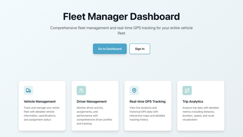
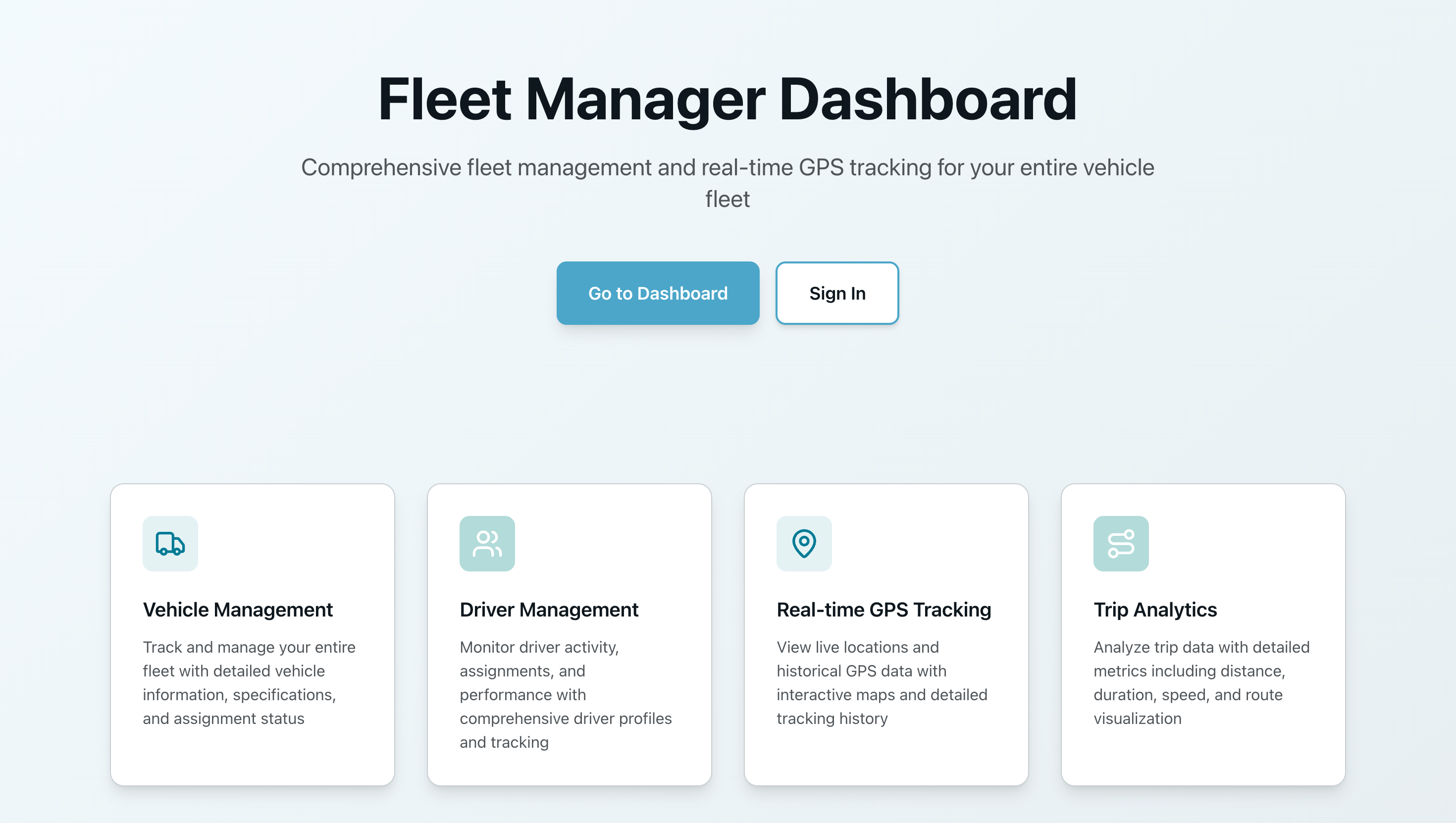
Landing Page
-
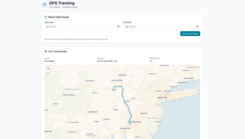
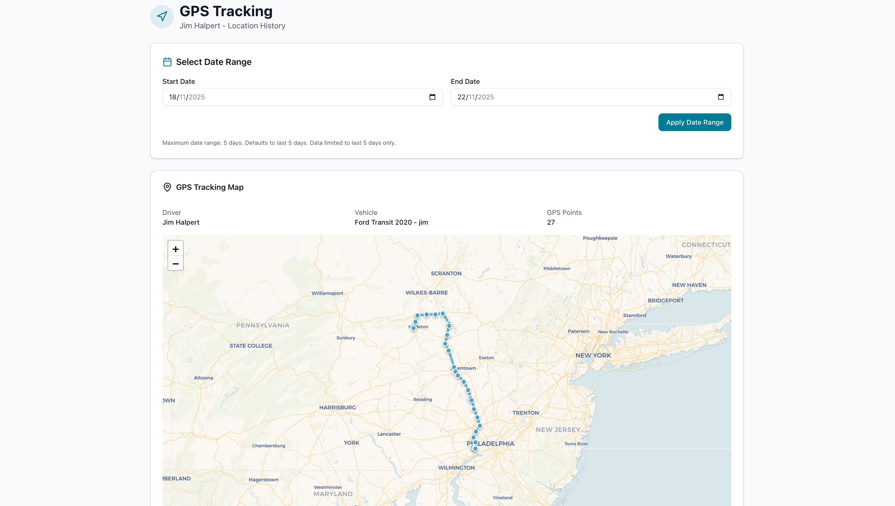
Live GPS Tracking
-
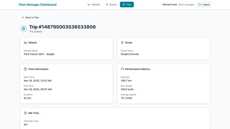
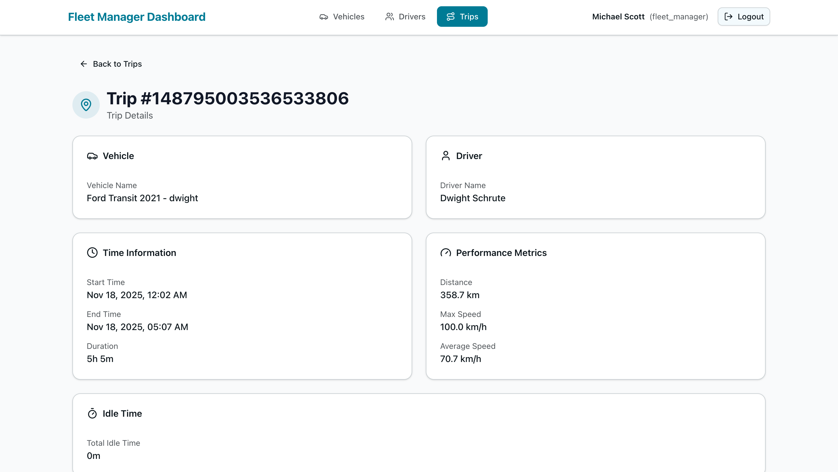
Trip Details 1
-
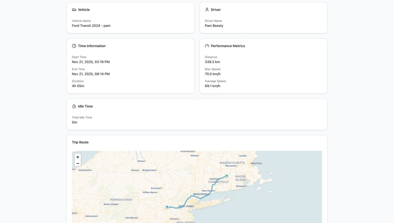
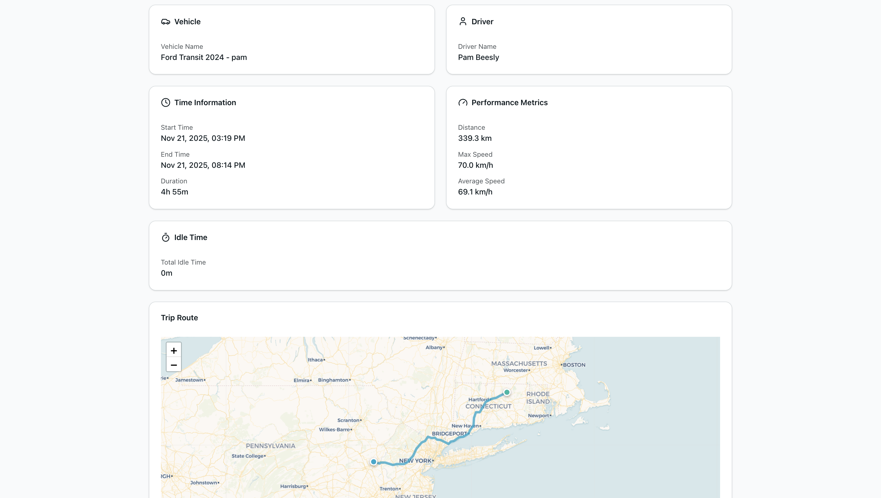
Trip Details 2
-
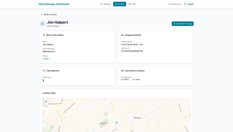
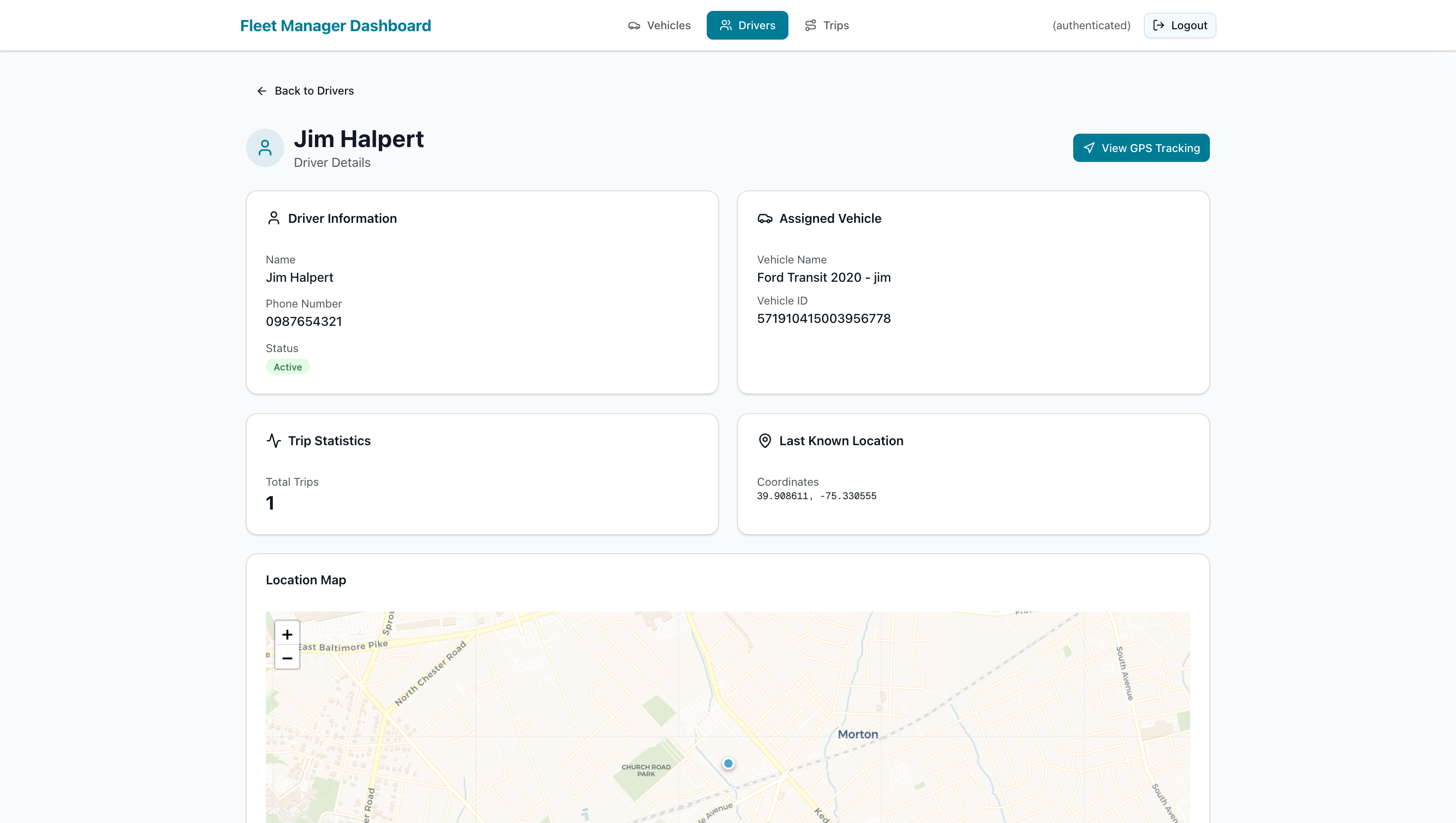
Driver Details
-
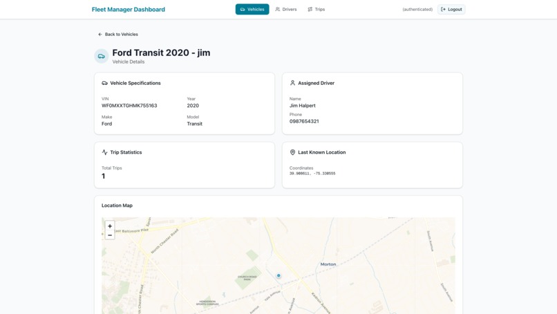
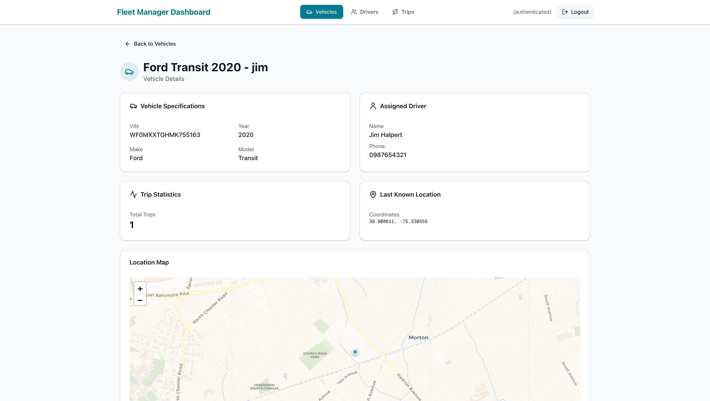
Vehicle Details
-
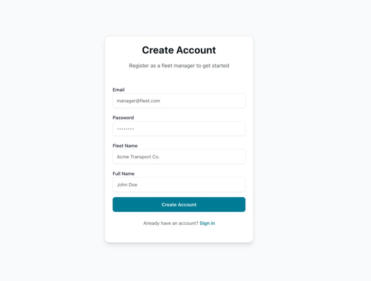
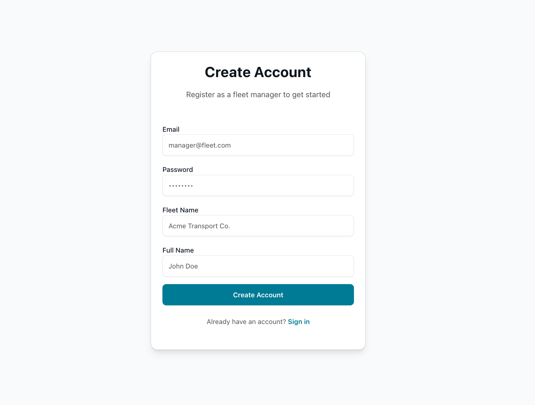
Create Account
-

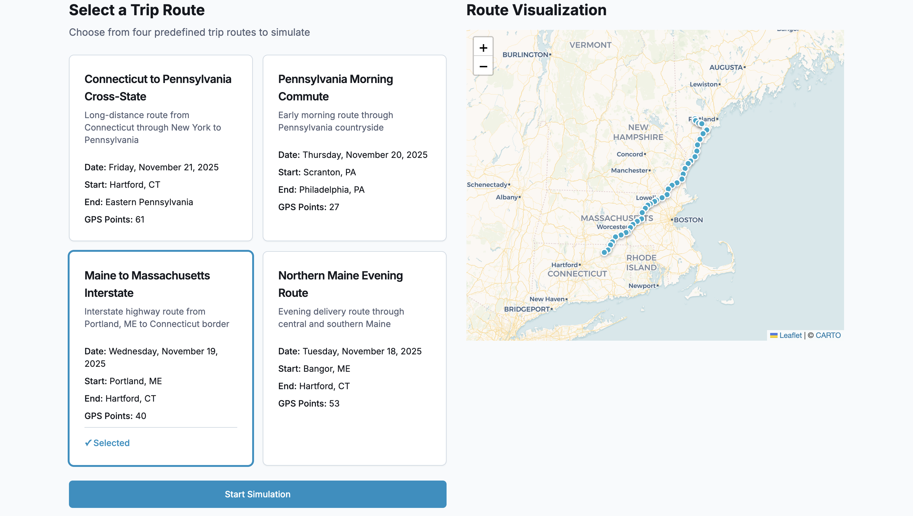
Driver Simulator
Fleet Management & Telematics Platform
Inspiration
During my last job, I was exposed to telematics providers like Samsara, Motive, and Geotab. These platforms fascinated me with their ability to track fleets in real-time and generate actionable insights from GPS data. I wanted to build something similar to understand the technical challenges behind fleet management systems.
I was also curious about geospatial data and how to work with location-based information at scale. This hackathon felt like the perfect opportunity to dive deep into PostGIS, distance calculations, and route visualization.
Beyond the technical domain, I wanted to explore if I could code in harmony with AI. Could AI-assisted development help me build faster while still learning and growing as a developer? Turns out, it worked out quite well.
What it does
The platform provides end-to-end fleet management capabilities with real-time GPS tracking and trip analytics:
- Fleet Manager Dashboard: Monitor vehicles, drivers, and trips in real-time with interactive maps and detailed analytics
- Driver Trip Simulator: Simulate realistic driver trips to test the system end-to-end
- Real-time GPS Tracking: Track vehicle locations with live map updates
- Automatic Trip Detection: Process GPS pings to identify trips, calculate distances, and generate insights
- Microservices Architecture: Four independent Go services handling auth, telematics, dashboard data, and trip processing
How I built it
Backend Services (Go + Gorilla Mux):
- Fleet Auth Service - JWT authentication and user management
- Vehicle Telematics API - High-throughput GPS ping ingestion
- Fleet Dashboard API - Fleet data retrieval and management
- Trip Insights Service - Trip detection and analytics processing
Frontend Applications (Next.js + React):
- Fleet Manager Dashboard - Built with shadcn/ui, Tailwind CSS, and Leaflet maps
- Driver Trip Simulator - Interactive trip simulation with real-time GPS transmission
Infrastructure:
- Database: Supabase (PostgreSQL with PostGIS for geospatial queries)
- Backend: Deployed on Render with cron job keep-alive
- Frontend: Deployed on Vercel
The architecture prioritizes separation of concerns - each service has a single responsibility and communicates through well-defined APIs.
Challenges
Trip Detection Logic: Determining when a trip starts and ends from raw GPS pings was tricky. Had to account for vehicles idling at traffic lights, GPS signal loss in tunnels, and distinguishing between short stops and trip completion. Solved this with time-based thresholds and ping pattern analysis.
Geospatial Calculations: Calculating accurate distances required understanding the Haversine formula and working with PostGIS geography types. Learned to optimize spatial queries with proper indexing to handle thousands of GPS pings efficiently.
Cold Starts on Free Tier: Services on Render's free tier sleep after inactivity. Implemented cron job pings to keep services warm while designing the system to handle occasional cold start delays gracefully.
Real-time Updates: Implementing real-time tracking without WebSockets required smart polling strategies and efficient API design to minimize latency while avoiding excessive database queries.
Accomplishments
- Built a fully functional microservices architecture with 4 backend services and 2 frontend applications
- Implemented automatic trip detection from raw GPS data with distance and duration calculations
- Created an intuitive UI with real-time map visualizations using Leaflet.js
- Successfully deployed the entire platform on free-tier services (Render + Vercel + Supabase)
- Achieved a productive balance between AI-assisted development and personal technical growth
- Designed a scalable architecture that could handle production workloads with minimal changes
Learnings
Geospatial Data: Working with PostGIS, calculating distances using the Haversine formula, and optimizing spatial queries for performance.
Microservices Architecture: Designing independent services that communicate efficiently while maintaining clear boundaries and single responsibilities.
Real-time Data Processing: Handling high-throughput GPS ping ingestion and processing trip data on the fly with proper indexing and query optimization.
AI-Assisted Development: Finding the balance between leveraging AI for productivity and ensuring my own technical growth. I made architectural decisions, designed the data flow, and wrote critical logic myself, while using AI to accelerate boilerplate code and catch edge cases.
The most valuable lesson was learning to use AI as a collaborative tool rather than a replacement. It's about maintaining intentionality - understanding what you're building and using AI as a force multiplier.
What's next for Fleet Management & Telematics Platform
- WebSocket Support: Implement true real-time updates instead of polling
- Advanced Analytics: Add fuel efficiency tracking, driver behavior scoring, and predictive maintenance alerts
- Route Optimization: Suggest optimal routes based on historical data and traffic patterns
- Mobile Apps: Native iOS and Android apps for drivers with offline support
- Multi-Fleet Support: Enterprise features for managing multiple fleets with role-based access control
- Integration APIs: Improve on the Insight generation. Bring in other data points like fuel, driver performance etc.
Built With
- go
- leaflet.js
- next.js
- postgis
- postgresql
- shadcn
- supabase

Log in or sign up for Devpost to join the conversation.