-
-
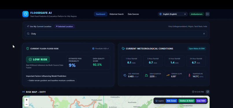
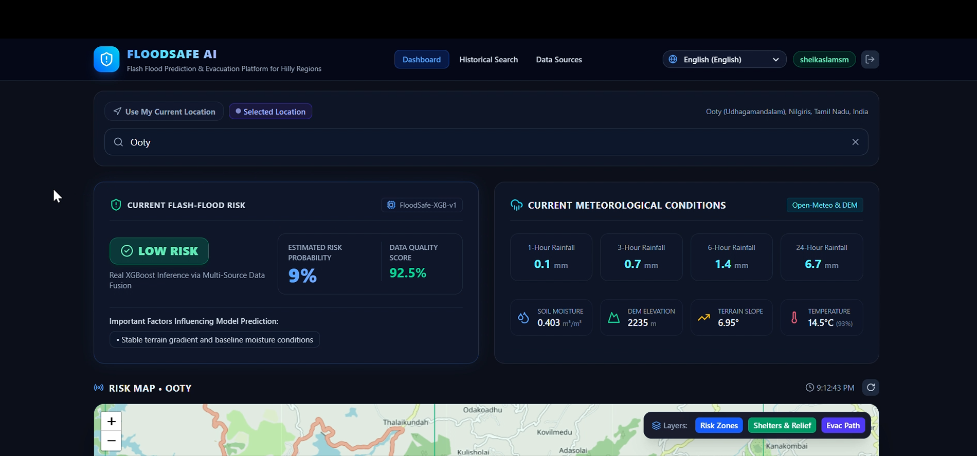
DASHBOARD
-
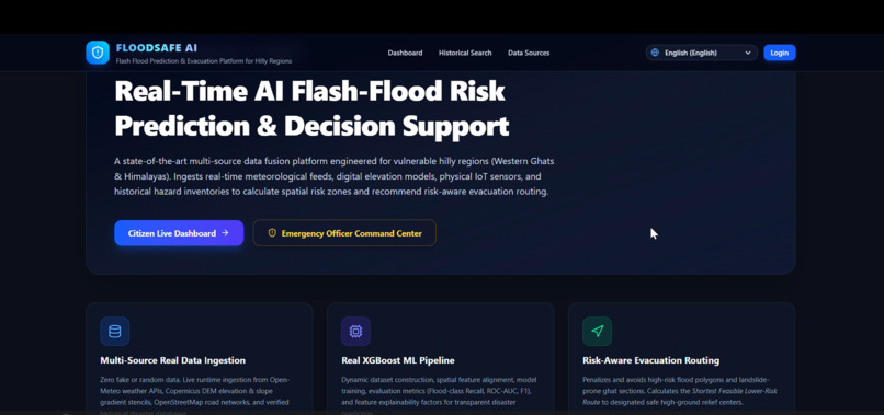
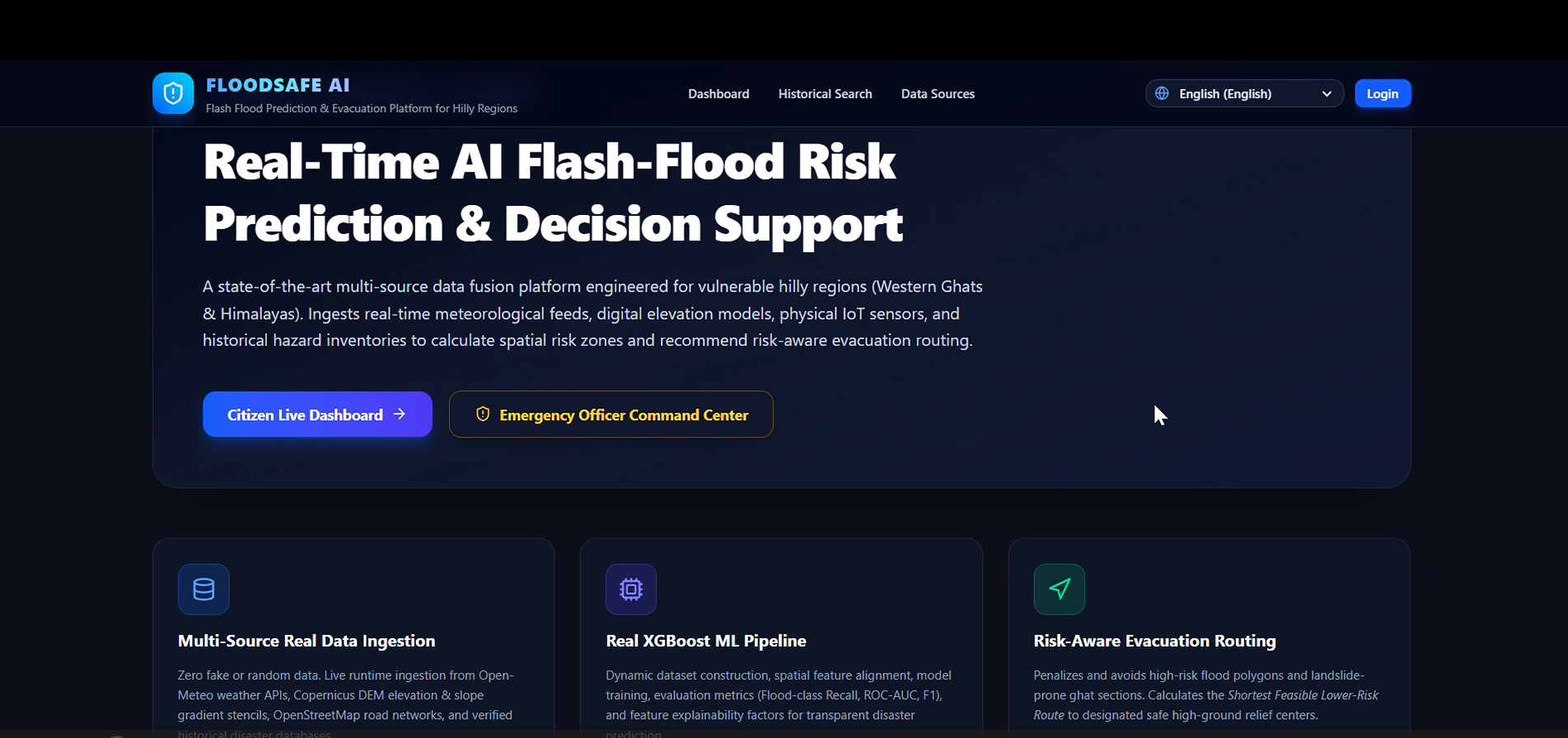
HOME PAGE
-
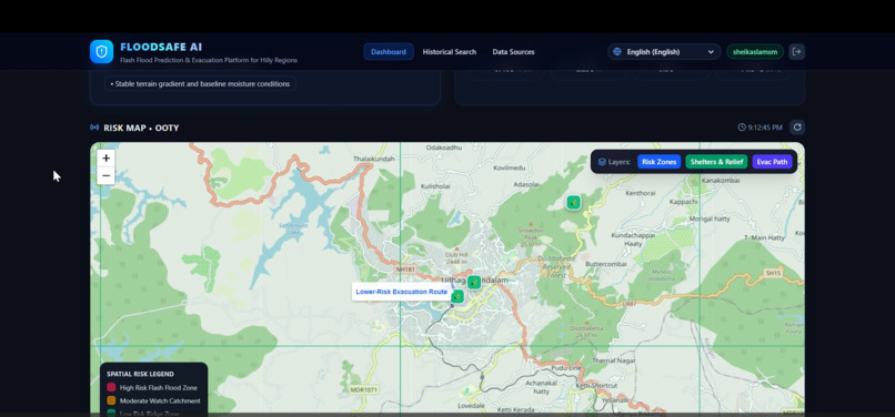
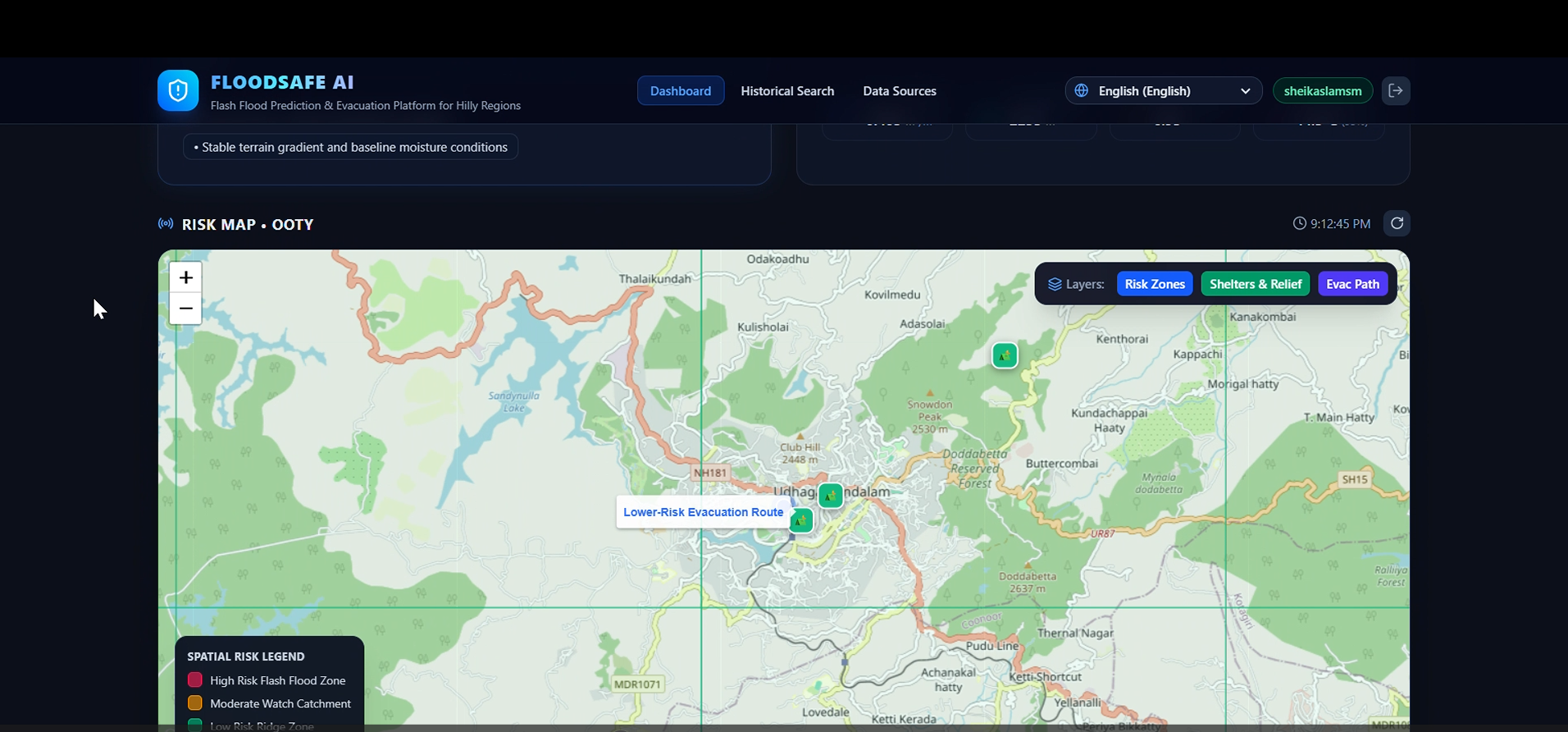
RISK ZONE MAP
-
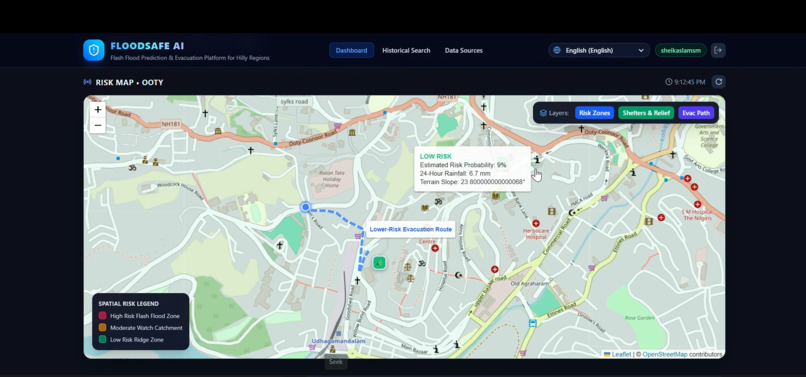
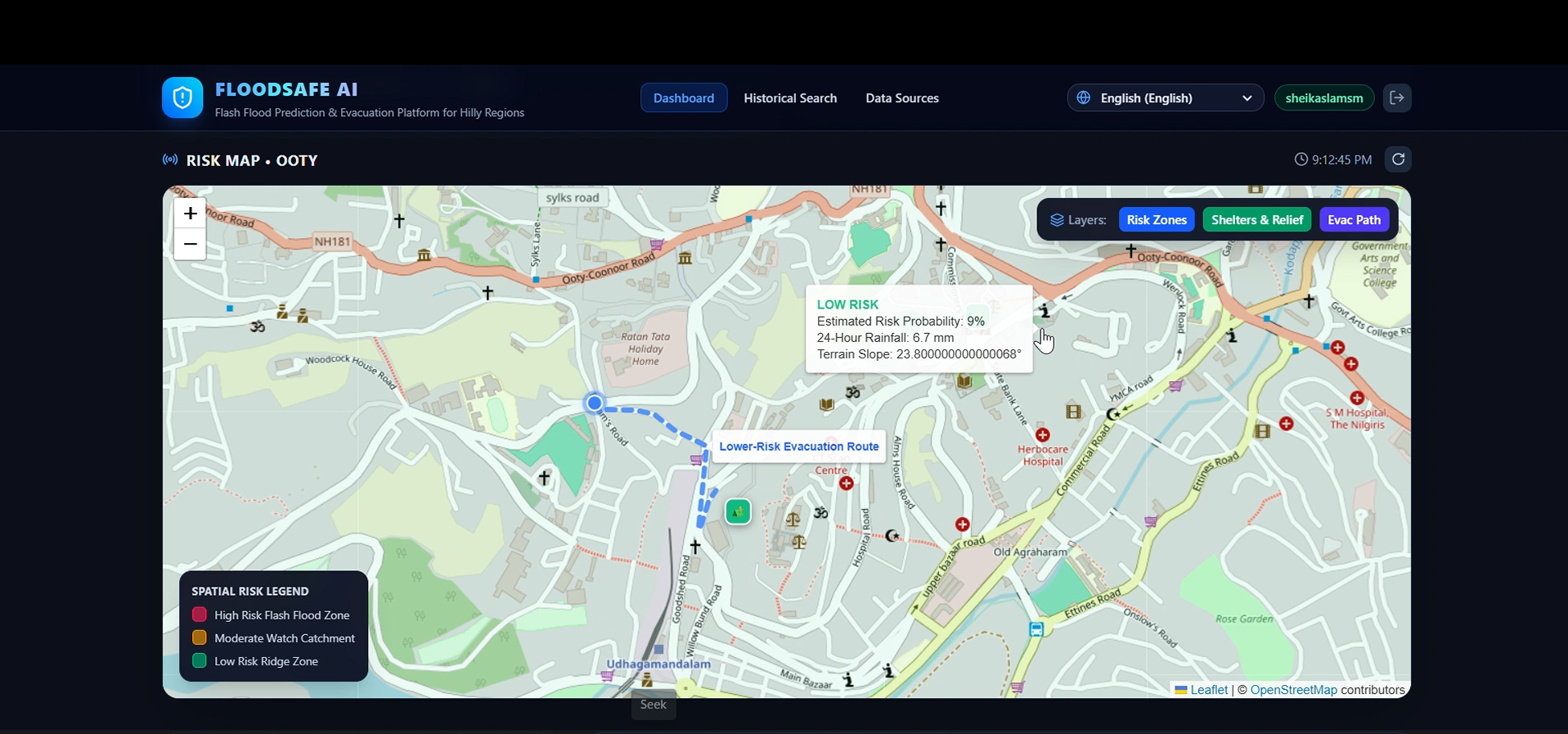
SAFEST ROUTE MAP
-
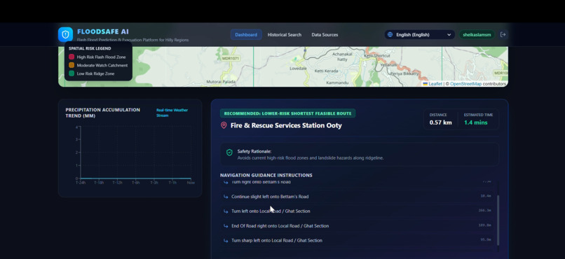
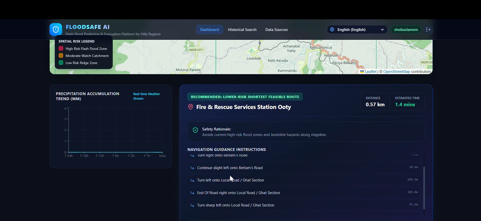
SAFEST ROUTE EVACUATION RECOMMENDATION
-
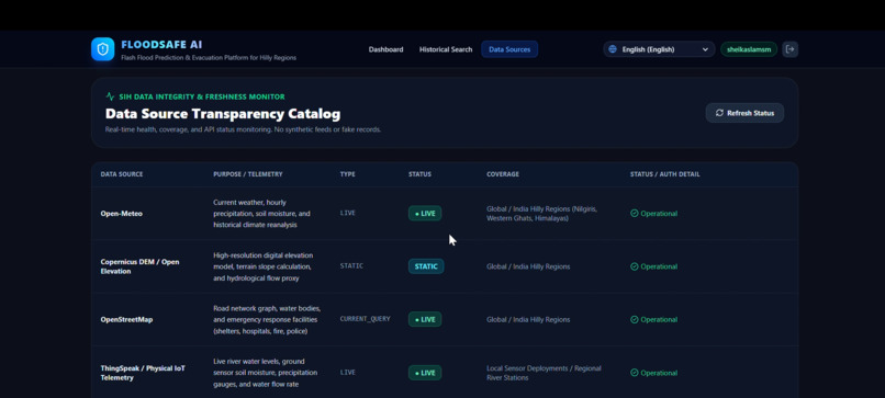
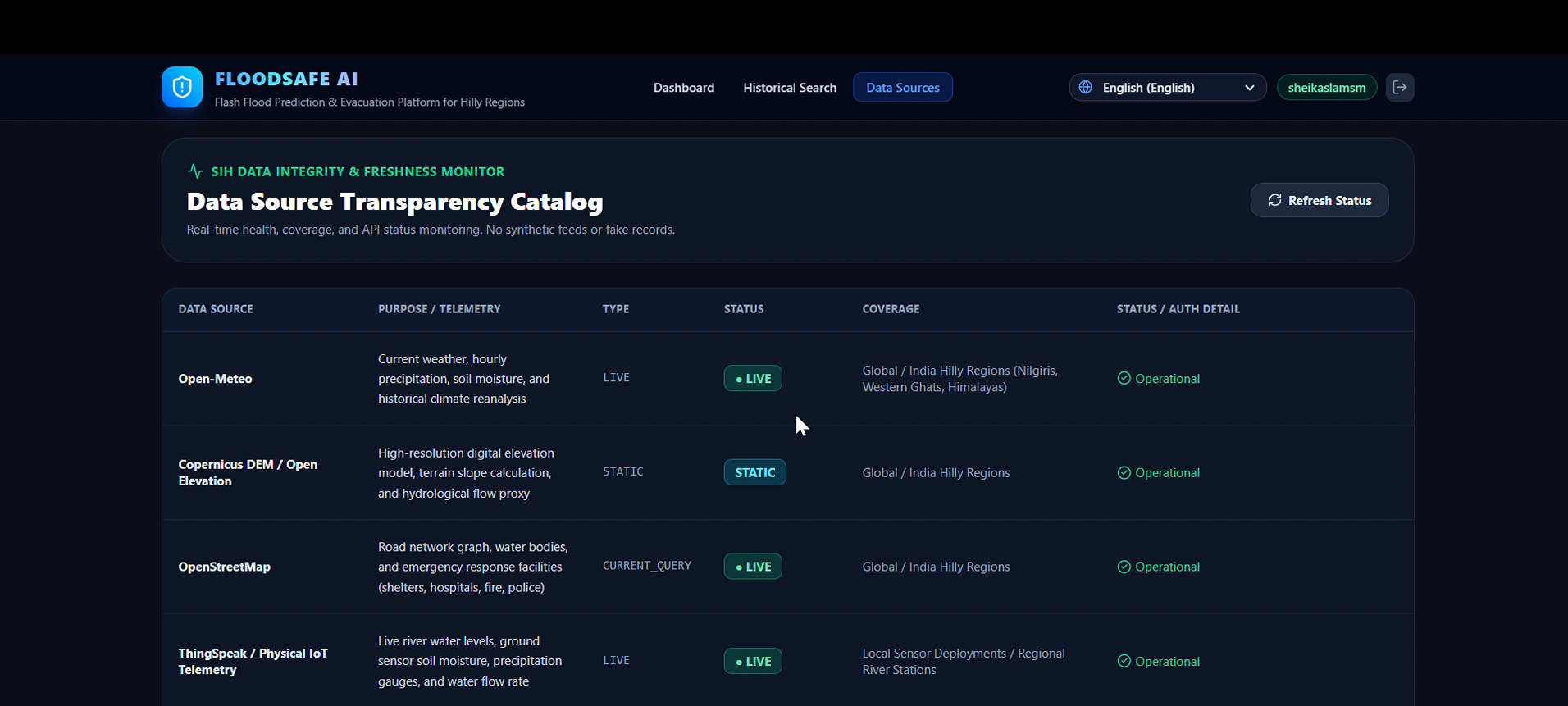
DATA SOURCES
-
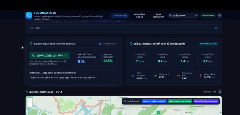
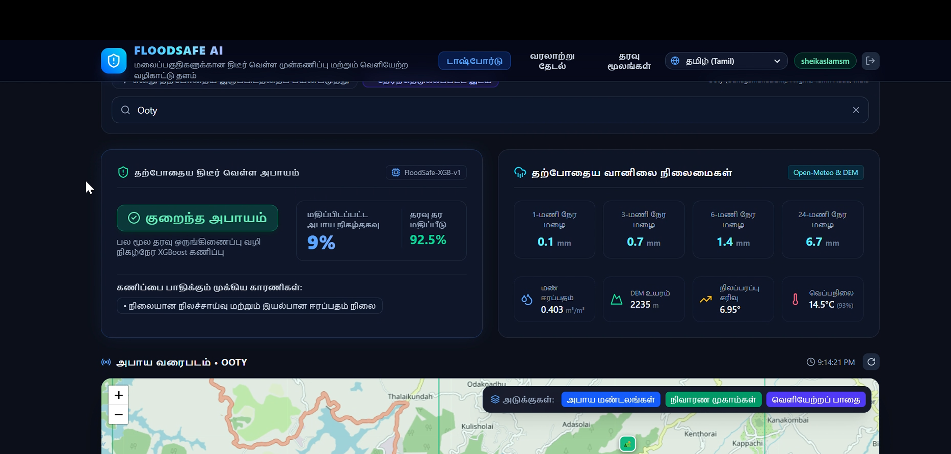
MULTILINGUAL DASHBOARD AVAILABLITY
Inspiration
Flash floods in hilly regions can occur suddenly due to heavy rainfall, steep slopes, and rapid changes in water levels. These disasters can threaten lives, damage infrastructure, and leave communities with very little time to respond. This inspired us to develop FlashFlood AI, an intelligent early warning system that combines Artificial Intelligence (AI), IoT sensors, and environmental data to help predict potential flood risks and improve disaster preparedness.
What it does
FlashFlood AI is designed to predict flash flood risks in hilly regions and support early warnings for vulnerable communities.
Collects environmental data such as rainfall intensity, soil moisture, and water levels using IoT sensors. Analyzes weather conditions, terrain characteristics, and historical flood data. Uses machine learning to estimate flood risk levels. Displays potential high-risk areas through interactive maps. Supports timely warnings and evacuation planning.
How we built it
We designed FlashFlood AI as a hardware and software-based solution. IoT sensors collect environmental measurements and transmit them to a cloud-based system. Python is used for data processing and machine learning, with the XGBoost algorithm for flood-risk prediction. FastAPI connects the prediction model to the application, while React.js provides an interactive dashboard. PostgreSQL with PostGIS can manage geographical data, and map visualizations help users identify potential risk zones.
Challenges we ran into
One major challenge was combining data from different sources, including sensor readings, weather information, terrain data, and historical flood records. Flash flood prediction is complex because environmental conditions can change rapidly. We also considered how to reduce false alarms, improve prediction reliability, and communicate warnings clearly to people living in vulnerable areas.
Accomplishments that we're proud of
We are proud to develop a project concept that combines AI, IoT, machine learning, and geospatial technologies to address a real-world environmental challenge. Our solution focuses on identifying potential flood-risk zones and presenting information in an understandable format. We aim to make flood-risk monitoring more accessible and support better disaster preparedness.
What we learned
We learned how AI, IoT, machine learning, and web technologies can work together to address environmental problems. We explored sensor data processing, flood-risk classification, API integration, and geographical visualization. We also learned that reliable data, accurate predictions, and timely communication are essential for effective early warning systems.
What's next for FlashFlood AI: Early Warning System
Our future plans include integrating physical IoT sensors, connecting real-time weather APIs, and improving predictions using regional rainfall and historical flood datasets. We also aim to introduce multilingual SMS and mobile notifications, interactive risk maps, and offline warning mechanisms for areas with limited connectivity. Our long-term goal is to help flood-prone communities prepare earlier, respond faster, and reduce the potential impact of flash floods.
Built With
- artificialintelligence
- css
- datavisualization
- fastapi
- geospatialanalysis
- html
- iot
- javascript
- machine-learning
- postgis
- postgressql
- python
- react
- xgboost

Log in or sign up for Devpost to join the conversation.