-
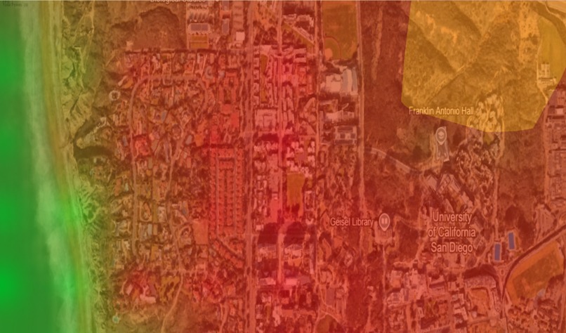
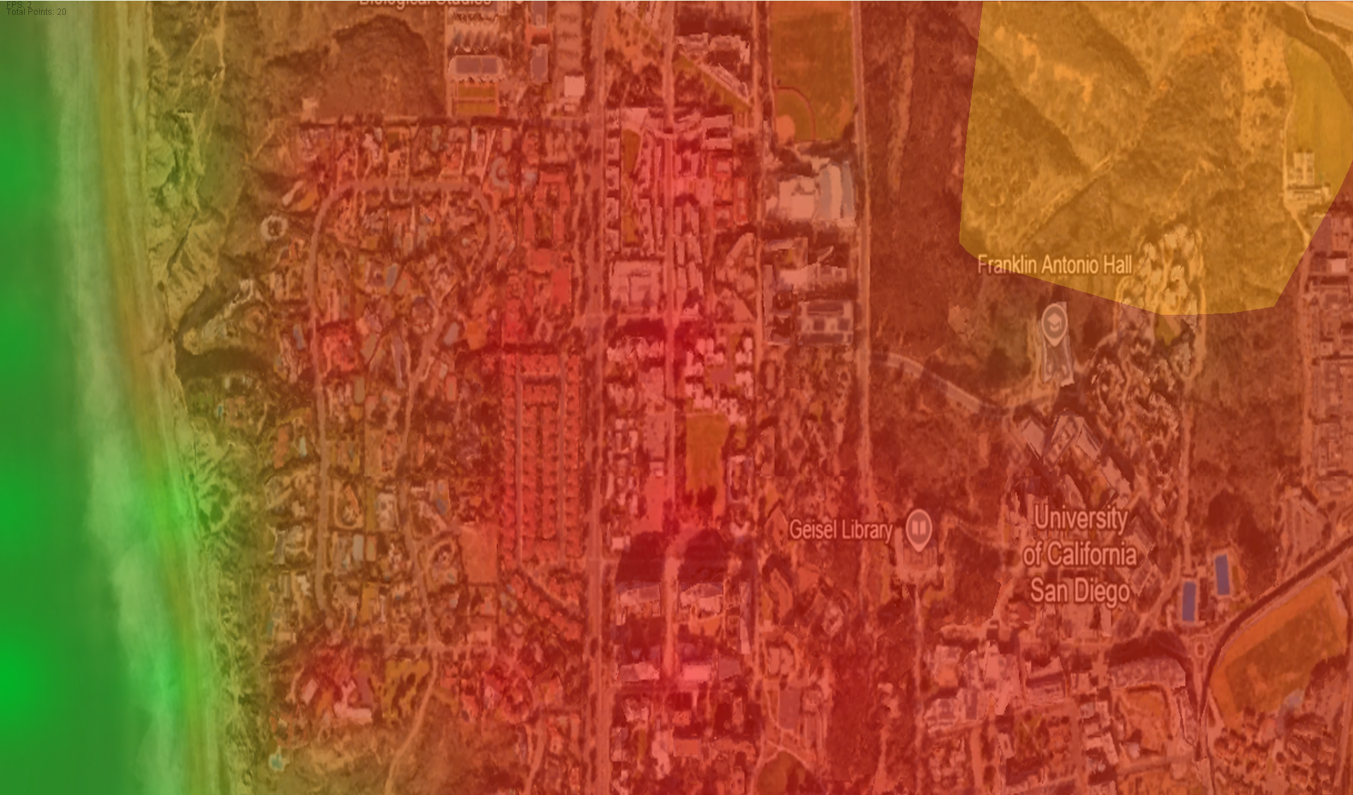
Simulation showing elevation heat map & simulated fire
Inspiration
When the LA fires hit, my sister and her friends who lived there were displaced. Fortunately they, their homes, and their school were untouched by the fires, however thousands were not so lucky. It was harrowing to know we were narrowly missed by a disaster, and since then I've been wanting to use technology to help prevent such a thing from happening in the future.
What it does
Simulates a wildfire's growth on a real world map.
How we built it
We built the project in Java using the IntelliJ IDE. We used Google Earth API's to pull topological data and project it as points in a map, and coded an algorithm that predicts the wildfire's growth using its surrounding elevation points.
Challenges we ran into
Java was a language that wasn't originally meant for API use, but we used it for its graphical convenience with JFrame. Thus, we had to learn how to connect these two vital pieces of our program. Additionally, with the city wide scale of the simulation, we initially struggled with optimising the generation of the shape of the fire as more vertices were added to the polygon representing the fire.
Accomplishments that we're proud of
We take pride in successfully creating a finished project in the limited time we had given the roadblocks mentioned. We were able to hook API's up to Java, and we were also able to optimise our prediction algorithm.
What we learned
We learned how to use API's in a language other than Python, learned project pitching skills.
What's next for flAIre
Using a learning model instead of an algorithm that takes into account variables such as temperature, humidity, and wind speed and direction Add in database of previous wildfire suppression to also suggest suppression strategy

Log in or sign up for Devpost to join the conversation.