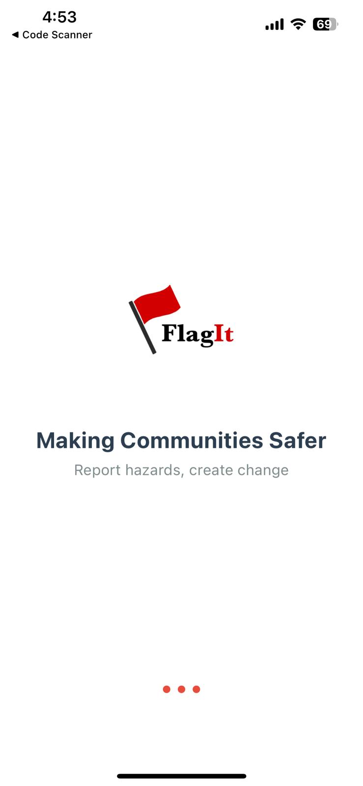
Inspiration
Every day, citizens encounter unreported hazards like potholes, broken sidewalks, overflowing trash, or exposed wires. These dangers often go unnoticed or neglected, putting public safety at risk. We were inspired to build FlagIt as a simple, intuitive way for people to make their voices heard and transform overlooked issues into actionable solutions.
What it does
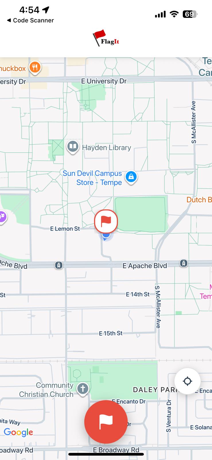
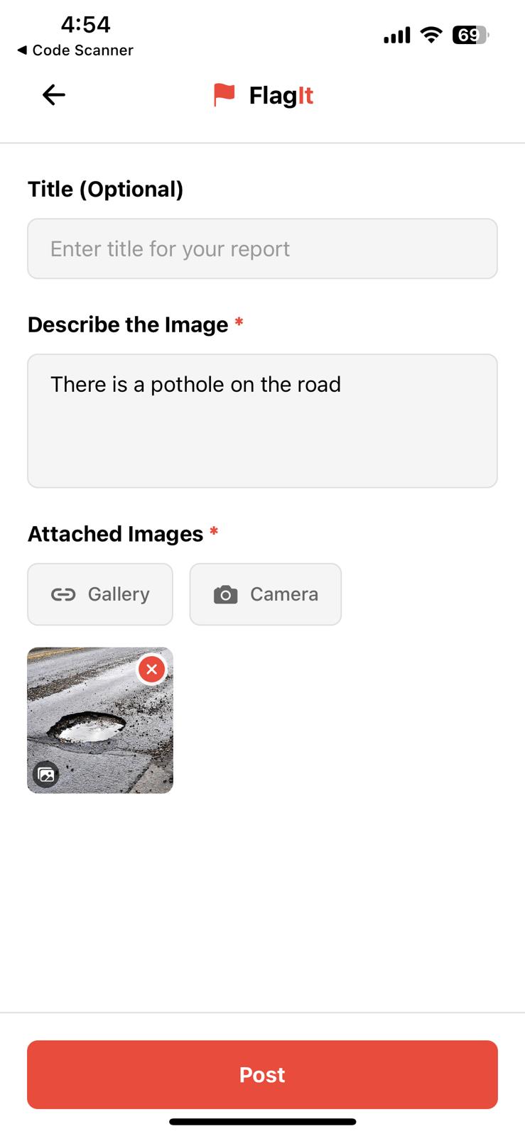
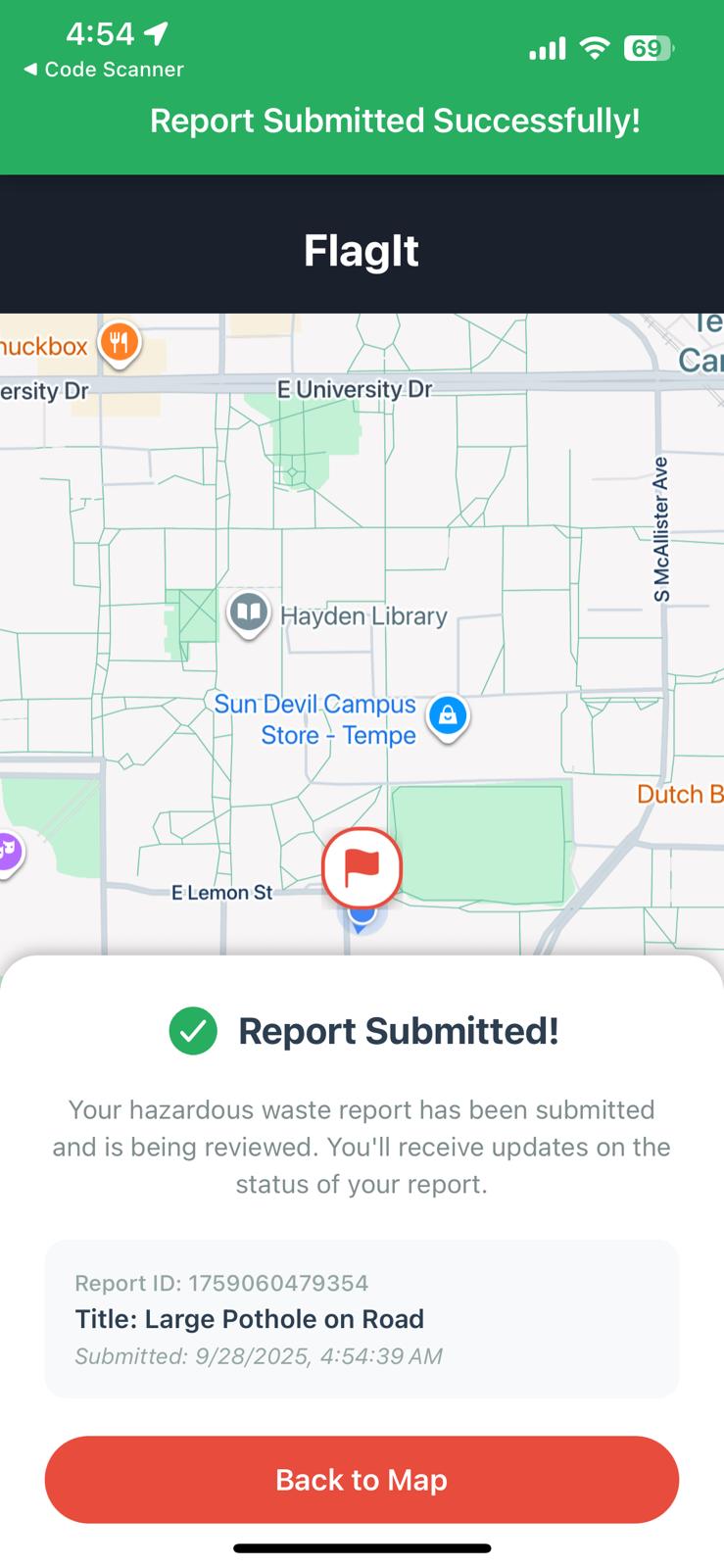
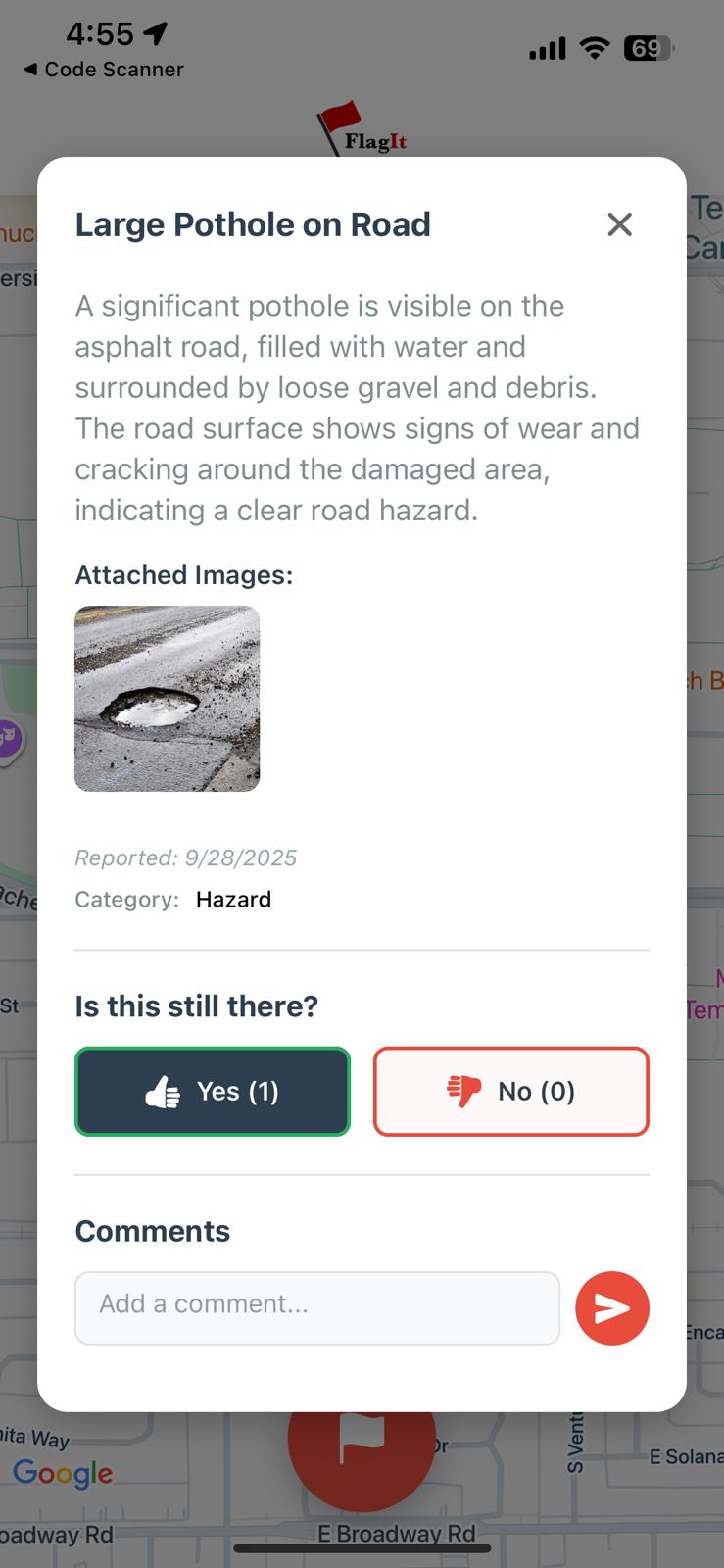
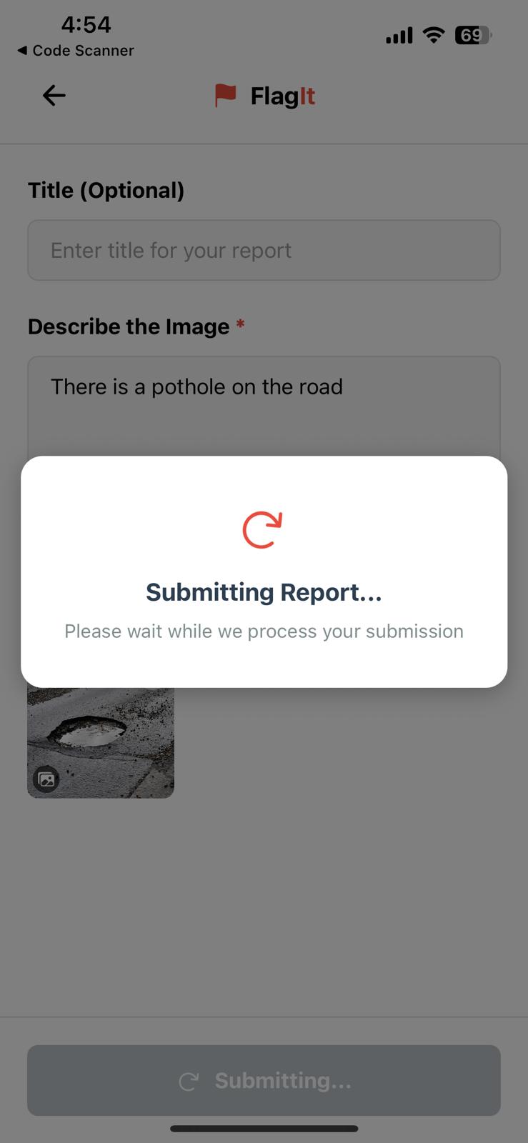
FlagIt is a mobile app that allows anyone to quickly capture and report hazards in public spaces. With a single tap, users can drop a location-based flag, upload a photo (via camera or gallery), and add a short description. Google Maps integration ensures precise location tracking, while AI services categorize reports automatically for faster municipal action. The app also alerts nearby users of hazards, fostering awareness and safer navigation.
How we built it
We built FlagIt using React Native with Expo to create a seamless cross-platform mobile experience. • Integrated Google Maps API for real-time location tracking and map visualization. • Used Expo’s Camera and Image Picker APIs to allow users to upload photos. • Implemented Gemini-based AI categorization logic to classify hazards from user-submitted reports.
Challenges we ran into
• Consistent bugs with maps integration, especially when implementing smooth live location tracking. • Delays in connecting to and summarizing user descriptions through the Gemini API. • Making the user flow intuitive enough for quick, on-the-go reporting. • Managing asynchronous image uploads and ensuring reliable cloud storage integration was tricky.
Accomplishments that we're proud of
• Delivering a polished, mobile-first interface with real-time location reporting. • Creating a scalable structure ready for cloud and AI integration. • Enabled users to upload and categorize hazards with photos and descriptions. • Building an application with meaningful social impact potential.
What we learned
• How to leverage React Native and Expo for rapid cross-platform development. • The importance of user-centered design in civic technology. • How to troubleshoot SDK and dependency issues efficiently under time constraints.
What's next for FlagIt
• Provide dashboards and analytics for municipalities to track, prioritize, and resolve hazards. • Integrate satellite or drone data to identify hazards at scale.
Built With
- figma
- firebase
- gemini-api
- google-cloud
- google-maps
- react-native
- typescript


Log in or sign up for Devpost to join the conversation.