
FixMyBlock See it. Pin it. Get it fixed.
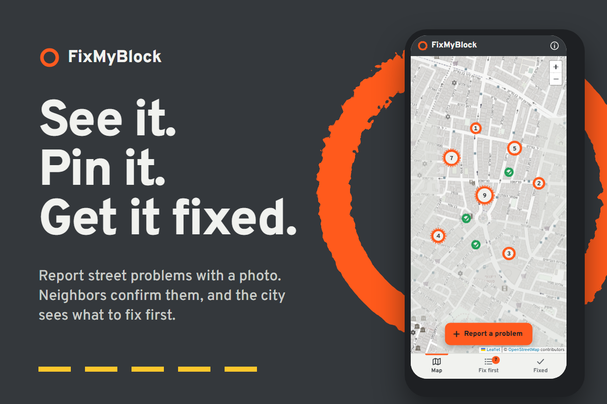
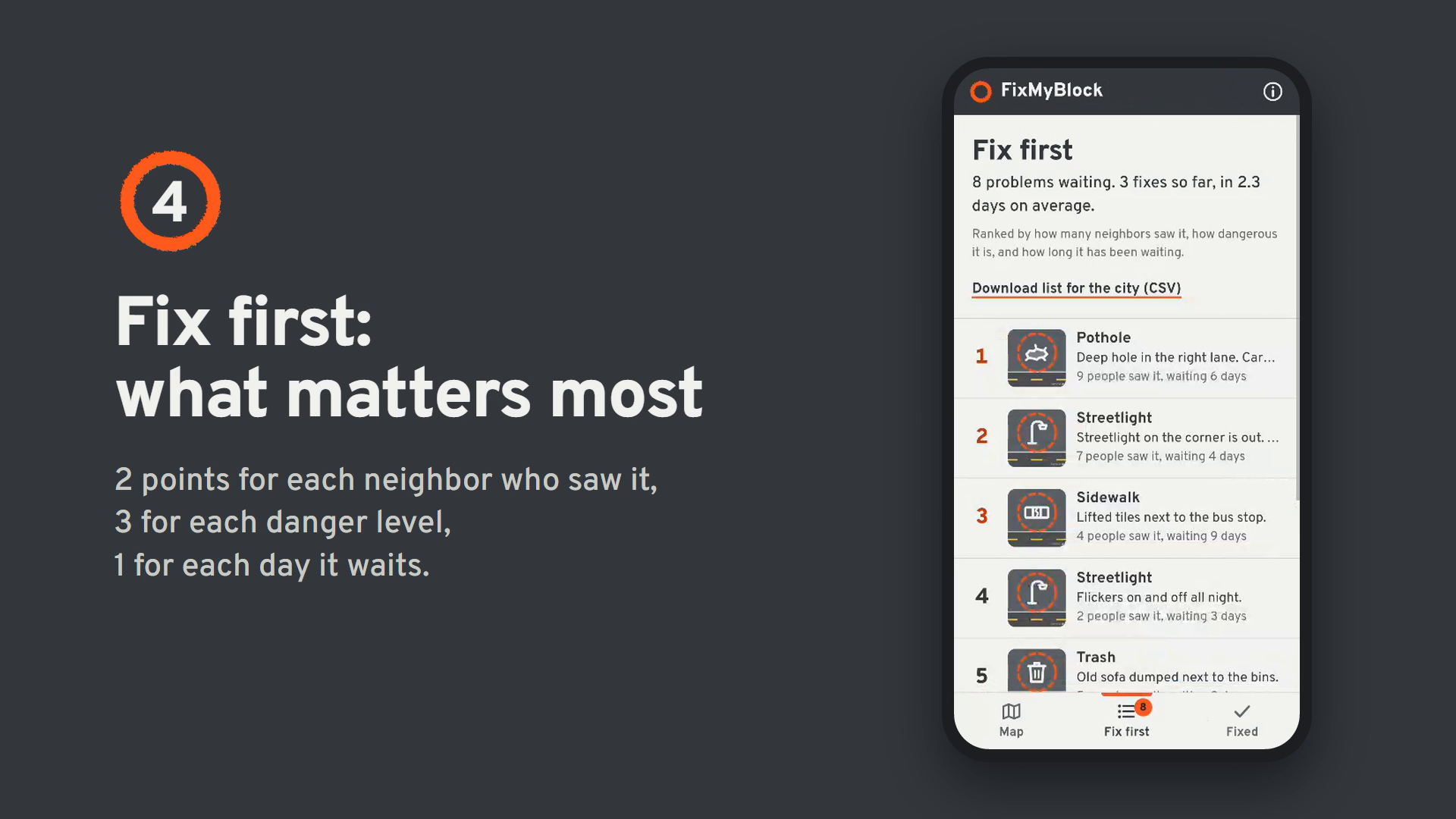
FixMyBlock is a web app for reporting problems in your neighborhood, like a broken streetlight, a pothole or a leaking pipe. You add a photo, pick what's wrong and put a pin on the map. Neighbors who saw the same problem tap I saw it too, so the most urgent problems rise to the top of a Fix first list that a city crew can work from.
FixMyBlock
Built for the Next Founders Hackathon (2026).
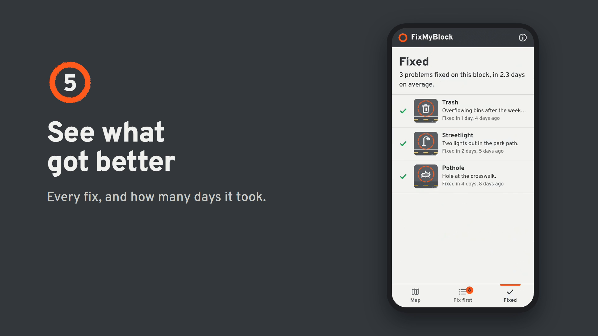
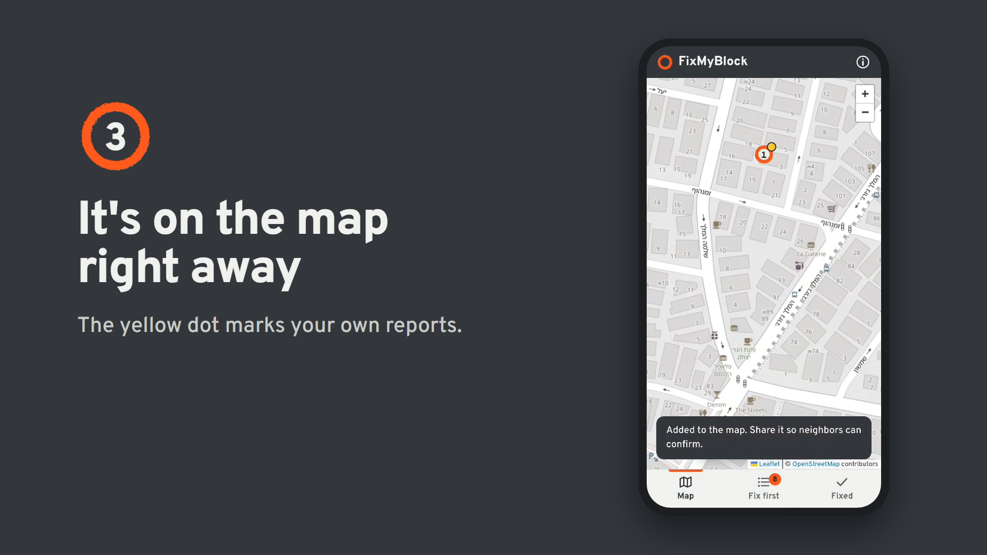
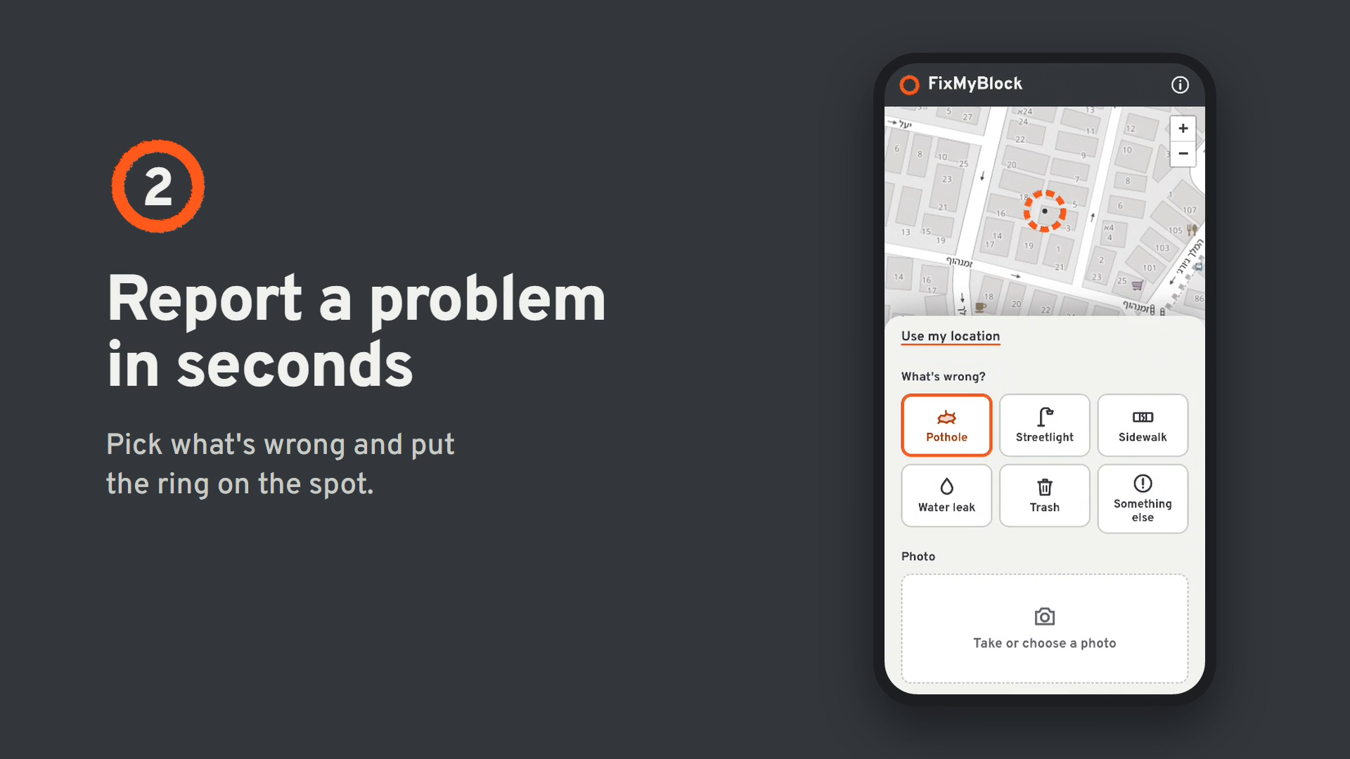
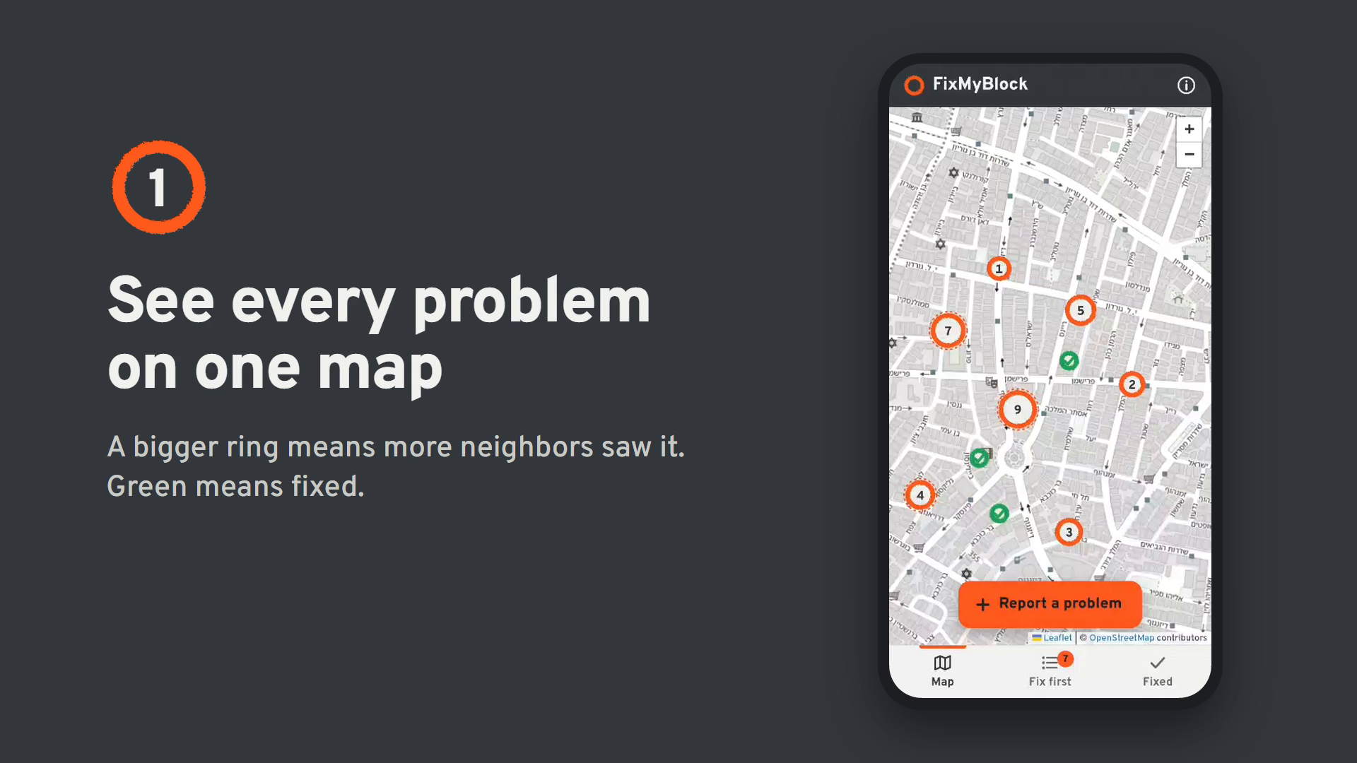
What it does Report a problem with a category, a photo and a location. Move the map so the orange ring sits on the problem, or tap Use my location. See everything on one map. Every report is a spray-paint ring, like the marks city crews paint around a pothole. The more neighbors saw it, the bigger the ring. I saw it too. One tap confirms a problem (one vote per device, and you can take it back). Fix first ranks the open problems by urgency: urgency = 2 × neighbors who saw it + 3 × danger (1–3) + days waiting (up to 30) Share with city opens the phone's share menu (email, WhatsApp…) with the details, a map link and the photo. On computers it copies the text instead. Download list for the city (CSV) exports the ranked list for Excel or Google Sheets. Mark fixed turns the ring green. The Fixed tab shows what got better and how many days each fix took. Mistakes can be undone or reopened. The app starts with 10 sample reports in a public area of central Tel Aviv, so there is something to see right away. They use drawn pictures, not real photos. You can bring them back any time with About (i) → Reset demo data.
How to run it It is plain HTML, CSS and JavaScript. There is nothing to install and no API key.
Easiest: double-click index.html. It opens in your browser. You need an internet connection for the map pictures and the font.
With a local server (recommended, so "Use my location" works in every browser):
python -m http.server 8000 Then open http://localhost:8000.
On your phone: put the folder on GitHub Pages (Settings → Pages → Deploy from branch → main / root) and open https://.github.io/fixmyblock/.
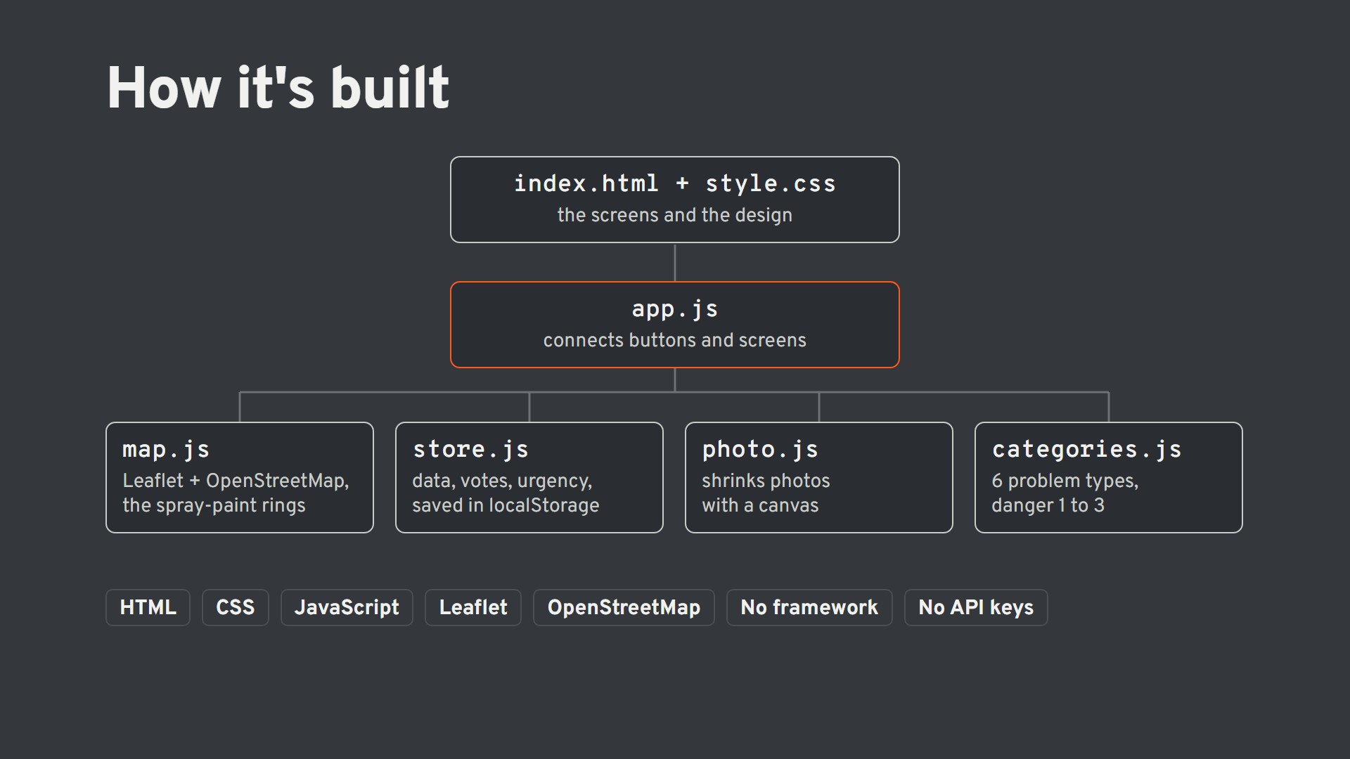
How it's built File What it does index.html The page: top bar, map, lists, bottom tabs and the three sheets (report, details, about) css/style.css All the design. Colors are named after the street: sidewalk, asphalt, paint, road line js/categories.js The six kinds of problems, their danger level and icons js/store.js The data layer: save, load, vote, mark fixed, the urgency score and the CSV export js/photo.js Shrinks phone photos to at most 900 px (about 100 KB) before saving js/map.js The Leaflet map with OpenStreetMap tiles and the spray-paint rings js/app.js Connects everything to the buttons and screens DESIGN.md The design idea, colors and type Map: Leaflet 1.9.4 with OpenStreetMap tiles. Free, no key. Storage: localStorage in the browser. This is a demo: reports stay on the device where they were made. Typeface: Overpass, based on Highway Gothic, the typeface on US road signs. No framework and no build step, so every line is easy to read and change. Scaling up All reading and writing goes through js/store.js. To share reports between everyone in a city, only that file changes: the same functions (add, toggleVote, markFixed) would call a hosted database (for example Supabase or Firebase) instead of localStorage, and photos would go to file storage instead of being saved inside the report. With many reports, the map would load only the reports inside the visible area and group nearby rings together.
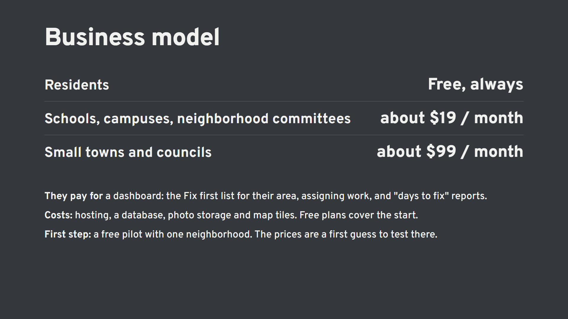
Limits of the demo Reports are saved only in this browser. Other people can't see them yet. Anyone can tap Mark fixed. A real version would ask a city account or two neighbors to confirm. Browser storage holds about 5 MB, which is roughly 30–50 reports with photos.
Built With
- claude

Log in or sign up for Devpost to join the conversation.