-

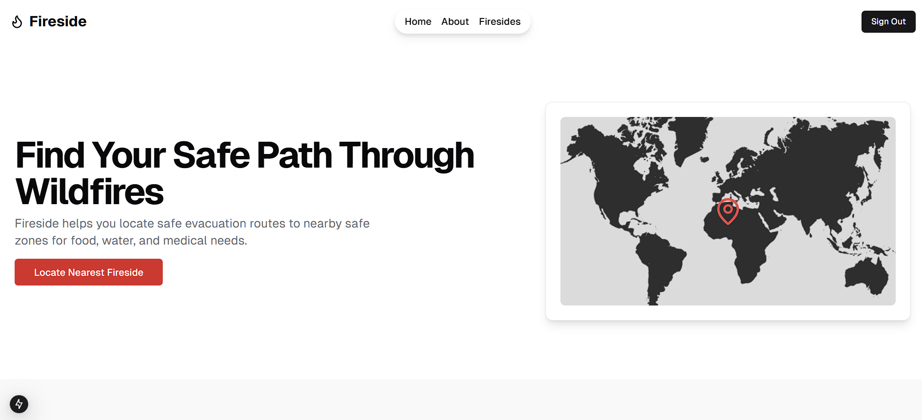
Landing page
-
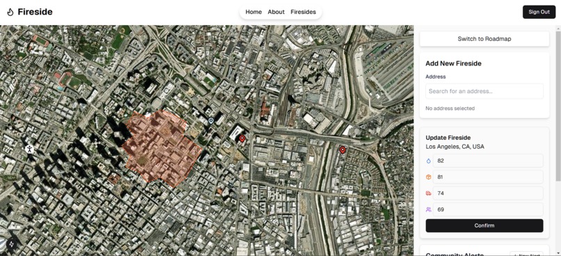
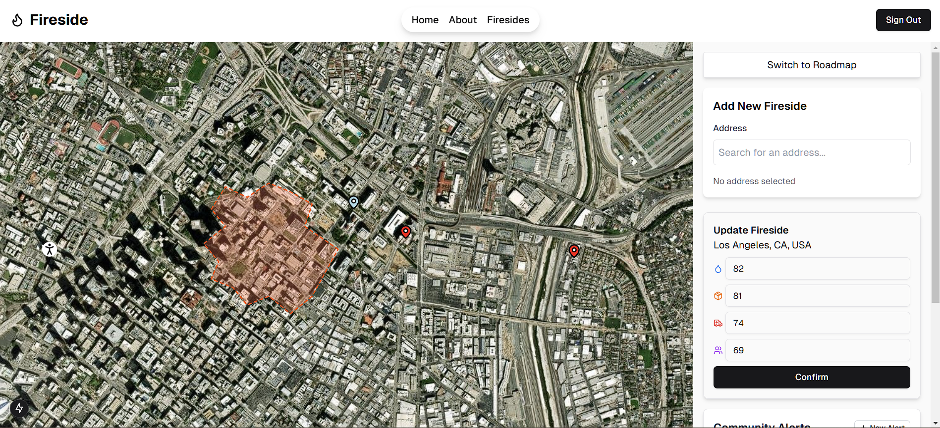
Organization view
-
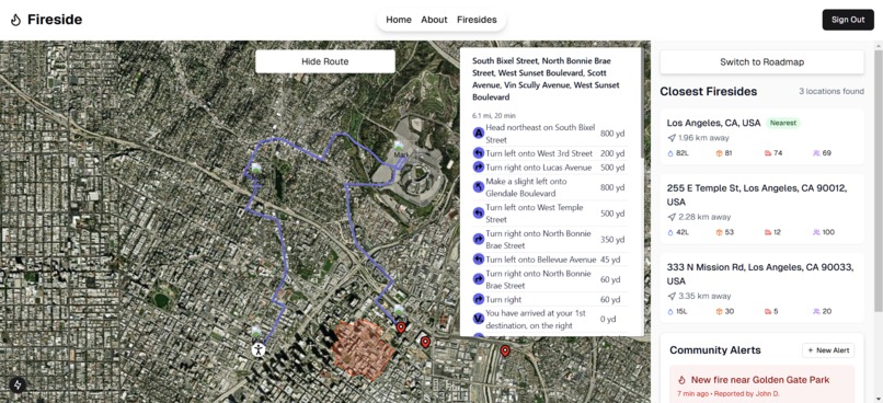
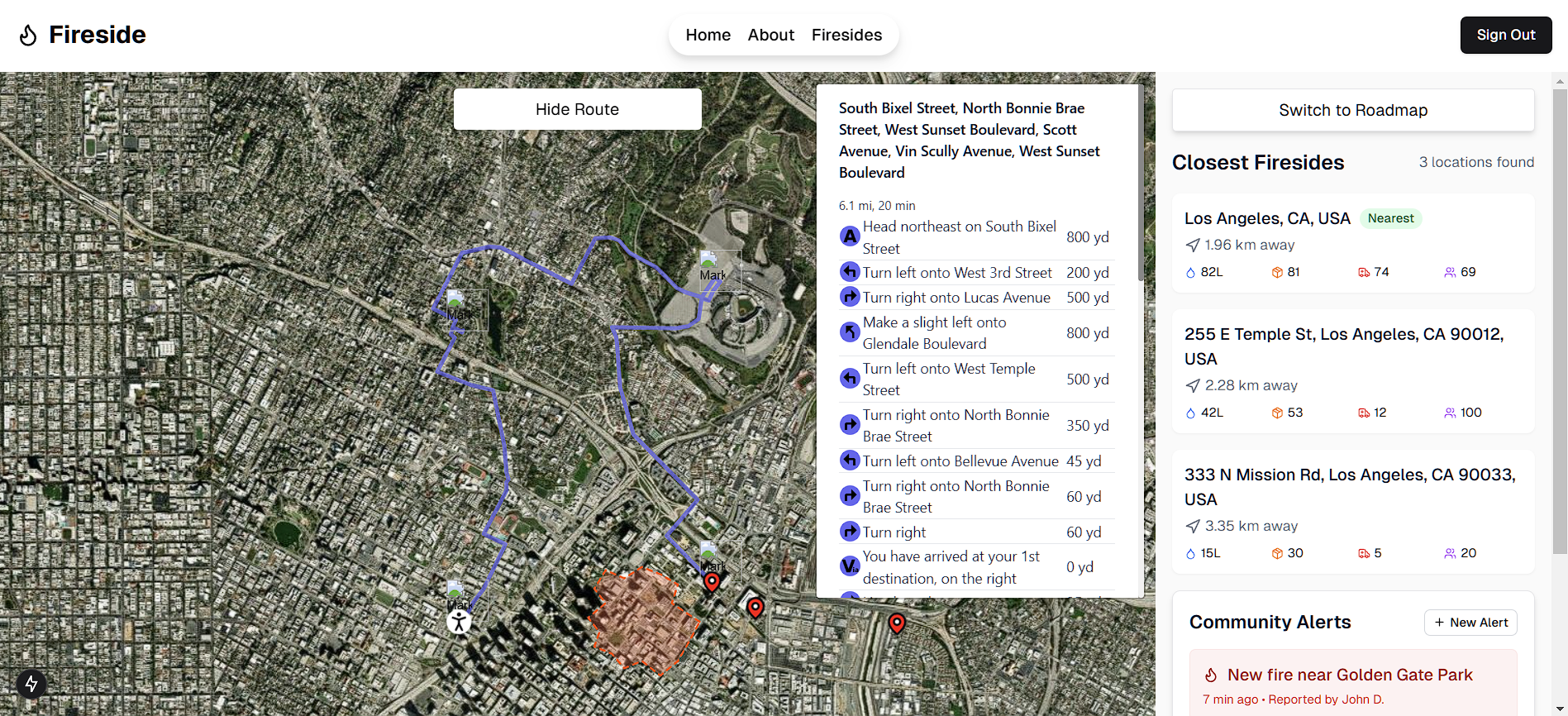
User view
Inspiration
Wildfires are becoming increasingly frequent and severe, putting lives at risk. While existing systems track fires, there’s a lack of community-driven evacuation support. Our goal was to create a platform that helps users find the safest escape routes to nearby safe zones (“Firesides”) during an emergency.
What it does
Fireside is a web application that allows users to:
✅ Select a nearby Fireside (for normal users) or create a Fireside (for organizations) - a designated safe zone created by organizations such as food banks and hospitals
✅ View available resources at a Fireside
✅ View a route to each Fireside that avoids the ongoing fire
How we built it
Frontend:
T3 web stack to set up server interactions with the frontend
Leaflet.js for interactive map rendering and routing between points
Backend:
Supabase for storing data
Prisma object relational manager to query data
Challenges we ran into
- Obtaining real, current fire data - our initial approach was using an ML model to generate a fire prediction heatmap, but the scale of doing so required time and compute power beyond the scope of a hackathon (i.e., large environmental dataset that gets fed into a deep learning model). Then, we tried using the Fire Weather Index (FWI) as a layer in our Leaflet map, through OpenWeatherAPI, but this requires a paid subscription (or it just wasn't working for some reason).
Accomplishments that we're proud of
Clean UI
Database set up with authentication
Distinguishing between roles of user and organization
Implementing a routing system that avoids (or at least tries to avoid) fires
What we learned
How to use the T3 web stack and set up OAuth with various providers
How to use Leaflet, display custom icons on the map, and route between points
What's next for Fireside
Training a deep learning model, such as a ConvLSTM, to predict fire probability across an area of land and deploying it via a Flask server that our website can interact with - display heat map over land and determine which areas are unsafe to navigate through
Implement real-time updates to Firesides on the map and Alerts, through Supabase realtime functionality
Implement Alert functionality on the backend
Built With
- next.js
- prisma
- react-leaflet
- supabase
- tailwindcss
- trpc
- typescript

Log in or sign up for Devpost to join the conversation.