-
-
-
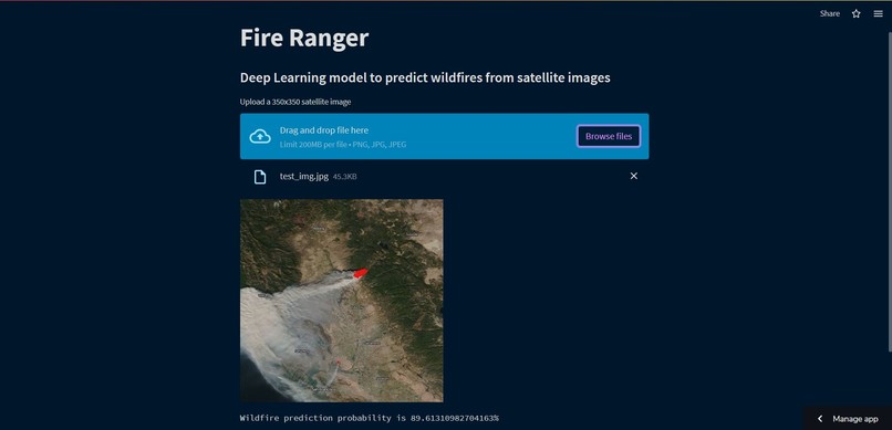
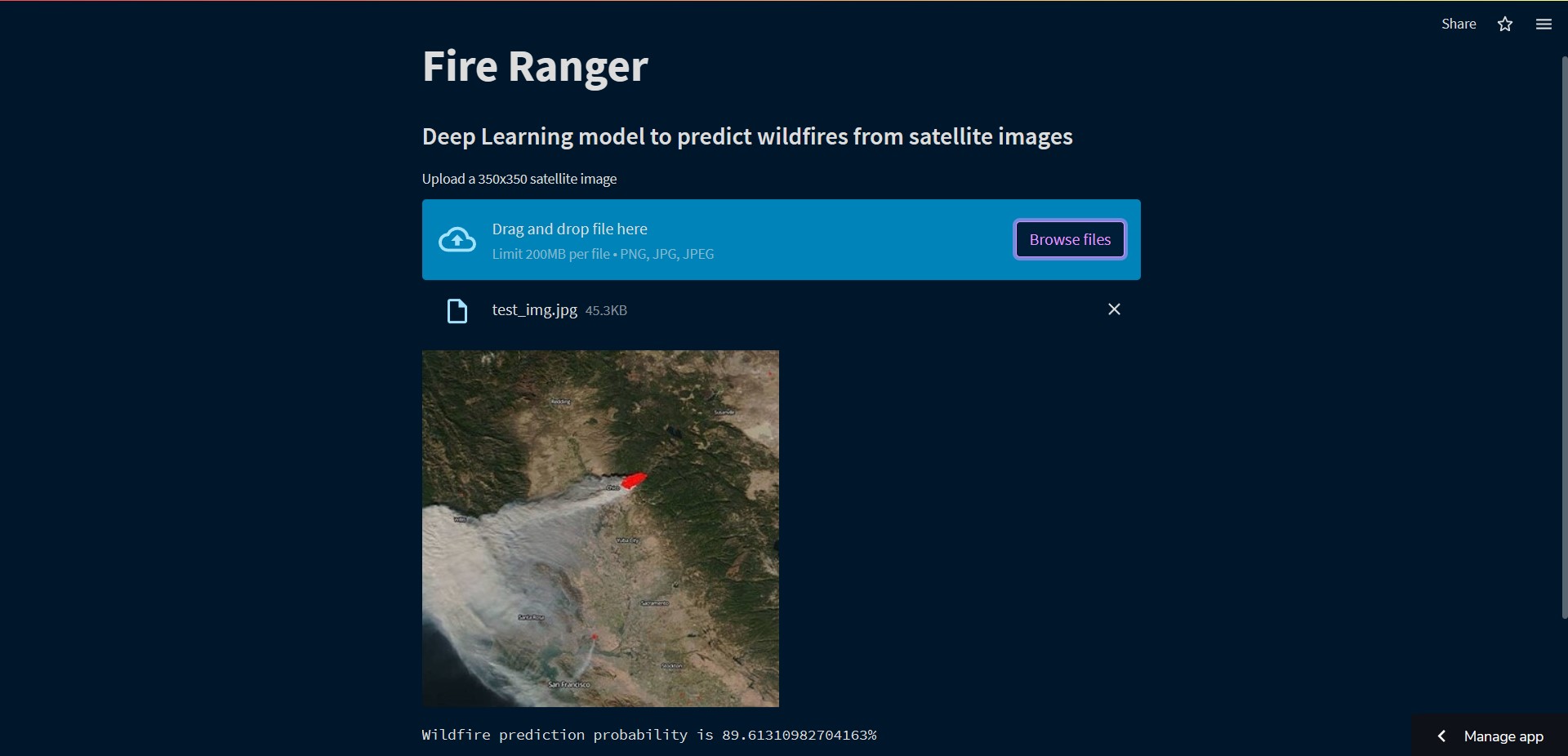
wildfire prediction on a image from California's wildfire

Inspiration
Wildfires significantly impact the environment and society, leading to the loss of property, habitats, and human lives. Accurately predicting and detecting the onset of wildfires is crucial in minimizing their damage. Satellite images can provide a wealth of information for wildfire detection and prediction, such as vegetation health, temperature, and weather patterns. Hence, we developed a deep-learning model to predict wildfires from satellite images.
What it does
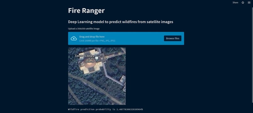
The developed deep learning model predicts the likelihood of wildfire occurrence from satellite images. The model utilizes a ResNet50 base and fully connected top layer to achieve high accuracy. The model takes in a satellite image as input and outputs a prediction of the probability of wildfire occurrence in the corresponding area. The model's predictions can aid in the early detection and prevention of wildfires, leading to reduced damage to the environment and human lives.
How we built it
We built a deep learning model using a combination of CNNs and Transfer Learning. We used a pre-trained ResNet50 model as a starting point and fine-tuned it for wildfire prediction. We then used fully connected top layer to output the probability of wildfire in the input image area.
Challenges we ran into
The major challenge while building the project was to find a dataset suitable for our needs, but luckily we found one on Kaggle. It contained consistent-sized images so it also reduced our preprocessing task. Another challenge was developing a web app for the project. I had no experience in building a web app before so I had to learn streamlit to make one. But it was worth it.
Accomplishments that we're proud of
I am proud of our model accuracy since early detection of wildfires is not only important for us humans but also the nature and the wildlife that flourishes in the forests.
Another thing I am definitely proud of is the experience and learning I had while building this project. It was totally worth it.
What we learned
I learned a lot about wildfires and how they affect us, and I learned a lot of new technologies.
What's next for fire ranger
Even though the model accuracy is satisfactory but training the model on a better dataset can definitely improve it. We would also like to add an interactive satellite map to the web app allowing users to directly select an area instead of uploading an image.

Log in or sign up for Devpost to join the conversation.