-
-
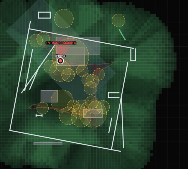
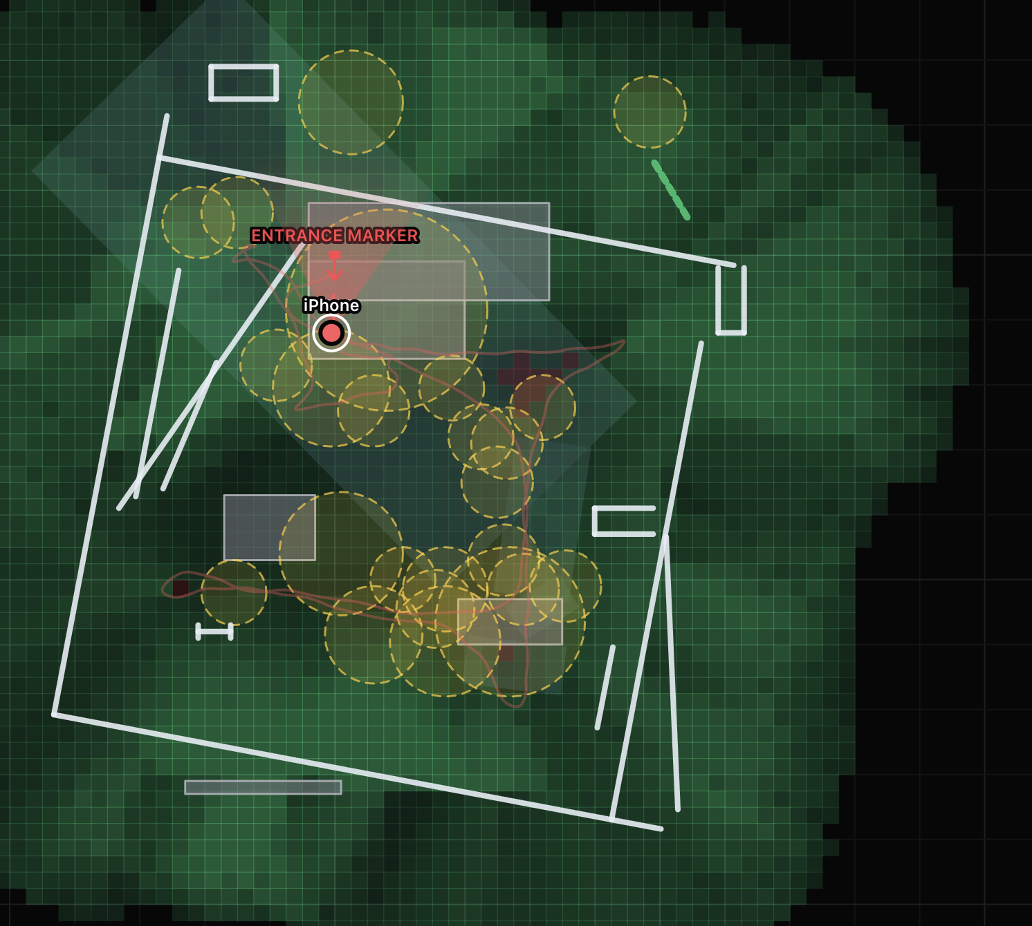
2D Map view from central commander screen
-
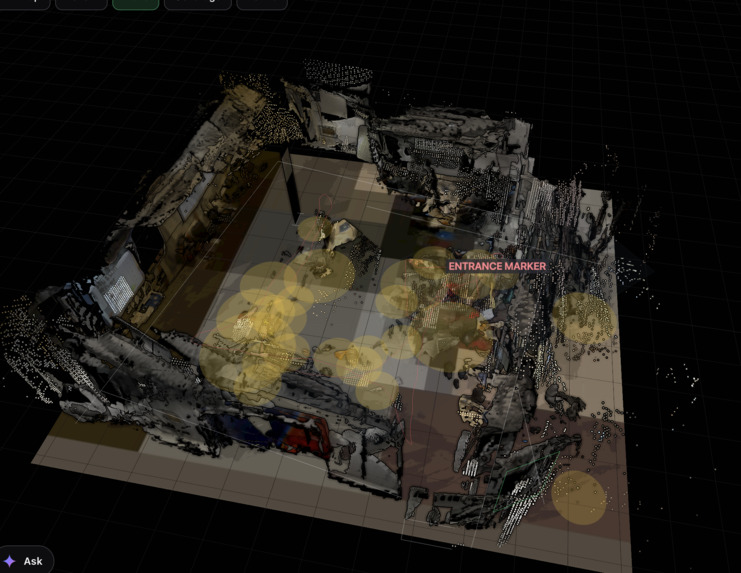
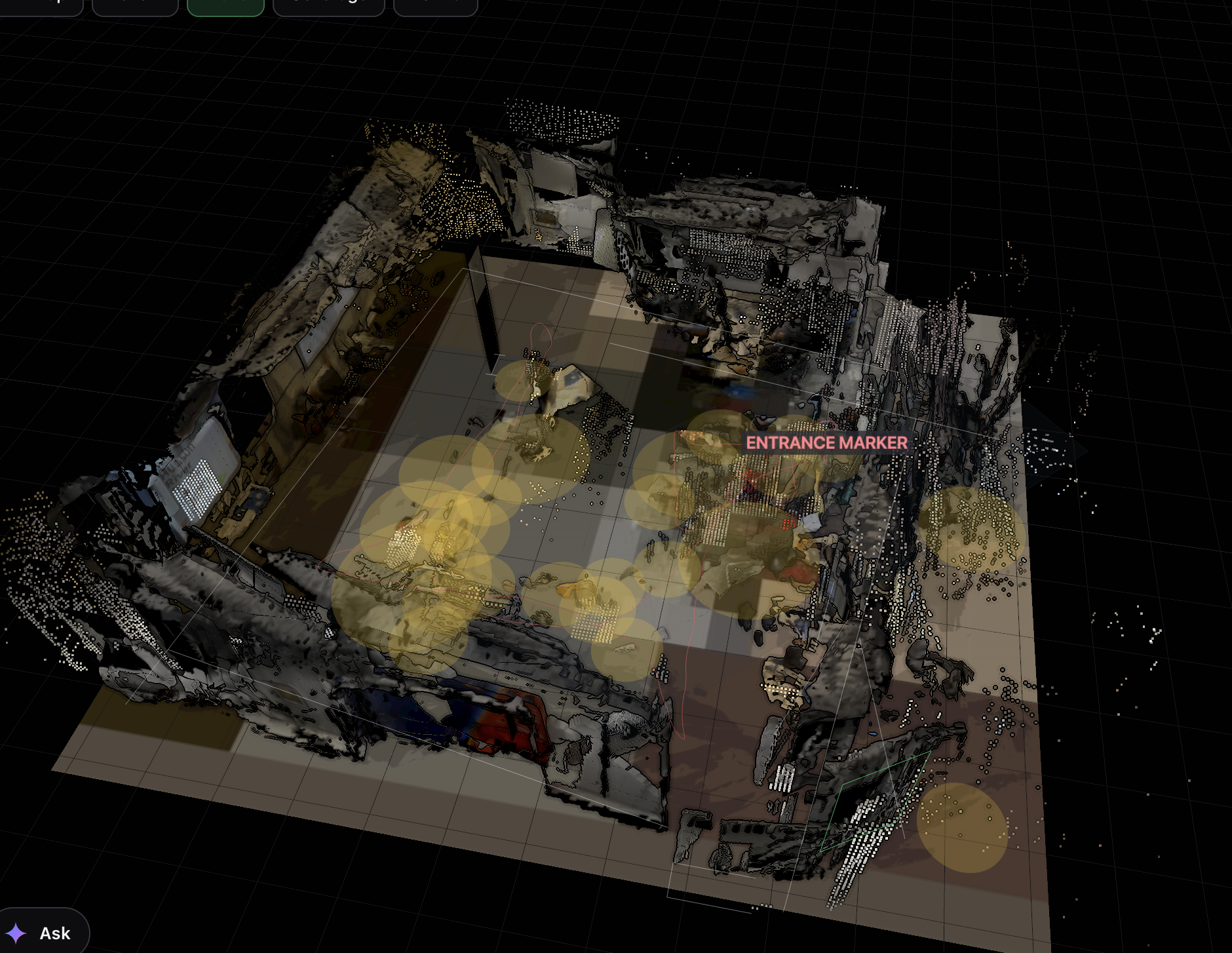
3D Map view from central commander screen
Inspiration
When firefighters enter a smoke-filled building, incident commanders lose visual contact immediately. GPS fails indoors, radios often garble, and traditional PASS alarms only work locally if someone is close enough to hear them. FindMyTeam enables ordinary smartphones to map indoor environments collectively in real time, giving commanders a live overview of responder locations, search coverage, and safe routes. It operates on existing hardware, starting with the non-LiDAR iPhone 13.
What It Does
FindMyTeam synchronizes ordinary smartphones into a single, shared 3D operational map:
- Unified Coordinate System: Scans a printed entrance marker so all devices share a common metric frame.
- Live Commander Dashboard: Displays a 2D and 3D browser interface featuring responder paths, walls, doors, a colored point cloud, and fused surface meshes.
- Through-Wall Visibility: Renders colleagues on the opposite side of walls as colored ghosts with live camera feeds and obstruction indicators.
- Search Coverage Heatmaps: Tracks room-by-room progress (searched vs. unsearched) and assigns unsearched spaces to available responders.
- Man-Down Alerts: Detects falls and prolonged lack of movement, triggering local acoustic chirps and commander warnings.
- Dynamic Safe Routing: Computes real-time paths back to command and exits, avoiding hazards, drops, and stairs.
- Voice Guidance: Employs ElevenLabs for spatial audio cues (e.g., "Trip hazard ahead in 2 metres").
- Gemini Integration: Allows commanders to query tactical status using natural language.
- Secure Architecture: Features single-use QR pairing, TLS 1.3 pinning, and session-only connections with zero on-device persistence.
How We Built It
Stack: Python FastAPI server (commander laptop), Vanilla JS + Three.js frontend, SwiftUI + ARKit + RealityKit + Core ML (iOS), and Kotlin + ARCore (Android).
1. Unified Coordinate System
Each phone tracks its local ARKit/ARCore world. By detecting a printed entrance marker, the system establishes a shared origin (Y up, Z pointing inward).
- Pose matrix S is inverted (
T = S^(-1)) to transform local coordinates into shared coordinates (x_shared = T * x_local). - To eliminate drift, the system requires 30 stable, face-on sightings to calculate a median lock ("Locked ±N mm"), applying smooth corrections when the marker re-enters the field of view.
2. Depth Without LiDAR
For devices like the iPhone 13 lacking native LiDAR, the app runs Depth Anything V2 via Core ML for relative depth (d_hat).
- Frame-by-frame calibration aligns relative depth to known ARKit feature points and plane ray-hits using RANSAC and least squares.
- The system fits linear (
z = a * d_hat + b) and inverse (1/z = a * d_hat + b) models, selecting the one with the lowest relative error, with adaptive throttling to manage thermal load.
3. Multi-Phone Map Fusion
- Voxel Filtering: Points are mapped to 5 cm voxels, registering only after being observed at least twice to eliminate speckle.
- TSDF Mesh Generation: Low-resolution depth images (128x96) fuse into a Truncated Signed Distance Function (TSDF) volume (4 cm cells) to construct solid surface meshes.
- Wall Alignment: Individual wall segments are merged into centerlines, with device poses fine-aligned to the primary map.
- Object Detection: YOLOv8n identifies doors and furniture on-device, while SegFormer-B2 on the server classifies structural openings (doors, windows, pillars).
4. Pathfinding and Task Allocation
- Grid Layout: Floor plans are discretized into 20 cm cells with probabilistic occupancy and uncertainty weights.
- A* Routing: Computes paths using a cost function balancing distance, zone uncertainty, and hazard proximity:
cost = d * (1 + 1.5 * u) * k_zonewherek_zoneis 1 for clear areas, 6 for fall-risks, and 250 near hazard pins. - Coordination: Employs Kalman filters for position prediction, Dijkstra for nearest-exit routing, and the Hungarian algorithm to assign unsearched rooms.
5. Safety Detection
- Fall Detection: Triggers if a phone drops over 0.7 meters within 2.5 seconds and remains stationary.
- Immobility Detection: Flags movement under 25 cm over 30 seconds.
- Coverage Tracking: Traces camera frustums (56° wide, 5 meters deep) against obstacles to ensure obscured areas are not falsely marked as searched.
6. Voice Guidance
- Computes turns based on heading deltas relative to route waypoints.
- ElevenLabs Integration: Uses Flash v2.5 for spatial audio cues, caching audio locally while routing sensitive identifiers (names, custom labels) through native text-to-speech to preserve privacy.
Challenges We Ran Into
- Coordinate Drift: Initial marker sightings yielded high error over distance; resolved via median locking, face-on filtering, and wall-based fine alignment.
- Monocular Depth Scale: Calibrating relative depth on featureless white walls required integrating ray-hits from detected planes alongside feature points.
- Map Consistency: Merging multiple overlapping corridors required deduplicating wall faces and locking settled structures.
- Thermal & Memory Management: Running continuous inference, AR tracking, and streaming required thermal throttling and proactive memory monitoring.
- Network Reliability: Ad-hoc venue Wi-Fi proved unstable; deployed personal iPhone hotspots paired with laptop clients.
- Audio Fatigue: Refined pathfinding lookahead logic to prevent repetitive instruction loops.
Accomplishments We're Proud Of
- Achieving a real-time, shared 3D mapping system using non-LiDAR consumer smartphones.
- Enabling real-time "through-wall" visualization of teammates via live video feeds.
What We Learned
- Geometry First: Most mapping challenges were fundamentally geometric rather than machine learning problems.
- Robust Statistics: Simple statistical filtering (medians, RANSAC, observation thresholds) outperformed complex models.
- Uncertainty Modeling: Treating unmapped areas as uncertain rather than open yielded safer, more dependable routes.
- Decision Support: Designing the system to advise commanders—rather than automate decisions—maintained operational transparency.
What's Next
- Expand voice guidance to Android platforms.
- Implement multi-floor tracking connected via stairwells.
Built With
- depthanything
- elevenlabs
- gemini
- javascript
- python
- yolo


Log in or sign up for Devpost to join the conversation.