-
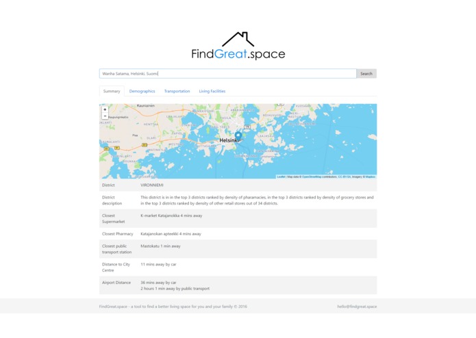
Wanha Satama address analysis

Inspiration
We wanted to help people make educated decisions for their real estate.
What it does
Our service starts with the user's address, and provides a full data analysis on the environment. The analysis includes walking, driving, and public transit times to nearby living facilities such as grocery stores, pharmacies, and public transit. We also showcase demographic and pollution data.
How we built it
We downloaded and cleaned data from Finland's open datasets, and leveraged Google's Places and Distance Matrix API to gain accurate insights into the data.
Challenges we ran into
- Forming a clear vision that we all shared
- Different team members use different technology stacks
- Combining our data streams into one product
Accomplishments that we're proud of
It's actually working To be able to debug after sleeping 2 hours and working for 50 hours
What we learned
- Learned some javascript coding
- Learned some Google API
- Understood how Helsinki is a shiny example how we can create civil society by making data public
What's next for FindGreat.space
Finalize the data agreggation and expand the service to other cities


Log in or sign up for Devpost to join the conversation.