Inspiration
Agriculture consumes 70% of the world's accessible freshwater, yet up to 40% of irrigation water is wasted due to fixed calendar scheduling, imprecise estimates, and dashboard fatigue. Existing agricultural technology floods farmers with dense telemetry - satellite reflectance layers, soil sensor graphs, and multi-model meteorological charts - forcing them to interpret raw data rather than taking clear action.
We were inspired to build Fieldstate by asking a simple question: What if instead of giving farmers 20 charts they don’t have time to analyze, we gave them a single, scientifically rigorous decision every morning: WAIT, IRRIGATE, or INSPECT?
By grounding live satellite remote sensing and numerical weather prediction in real agronomic physics (UN FAO-56 Penman-Monteith) and linking every millimeter of conserved water to direct diesel/electricity savings and verified carbon offsets, Fieldstate turns precision water management into a straightforward, high-ROI daily habit.
What it does
Fieldstate is a 100% live precision agriculture decision engine that synthesizes live GPS location telemetry, real-time global weather radar, Sentinel-2 multispectral dynamics, and soil physics into an unambiguous daily operational command.
Core Capabilities & Features:
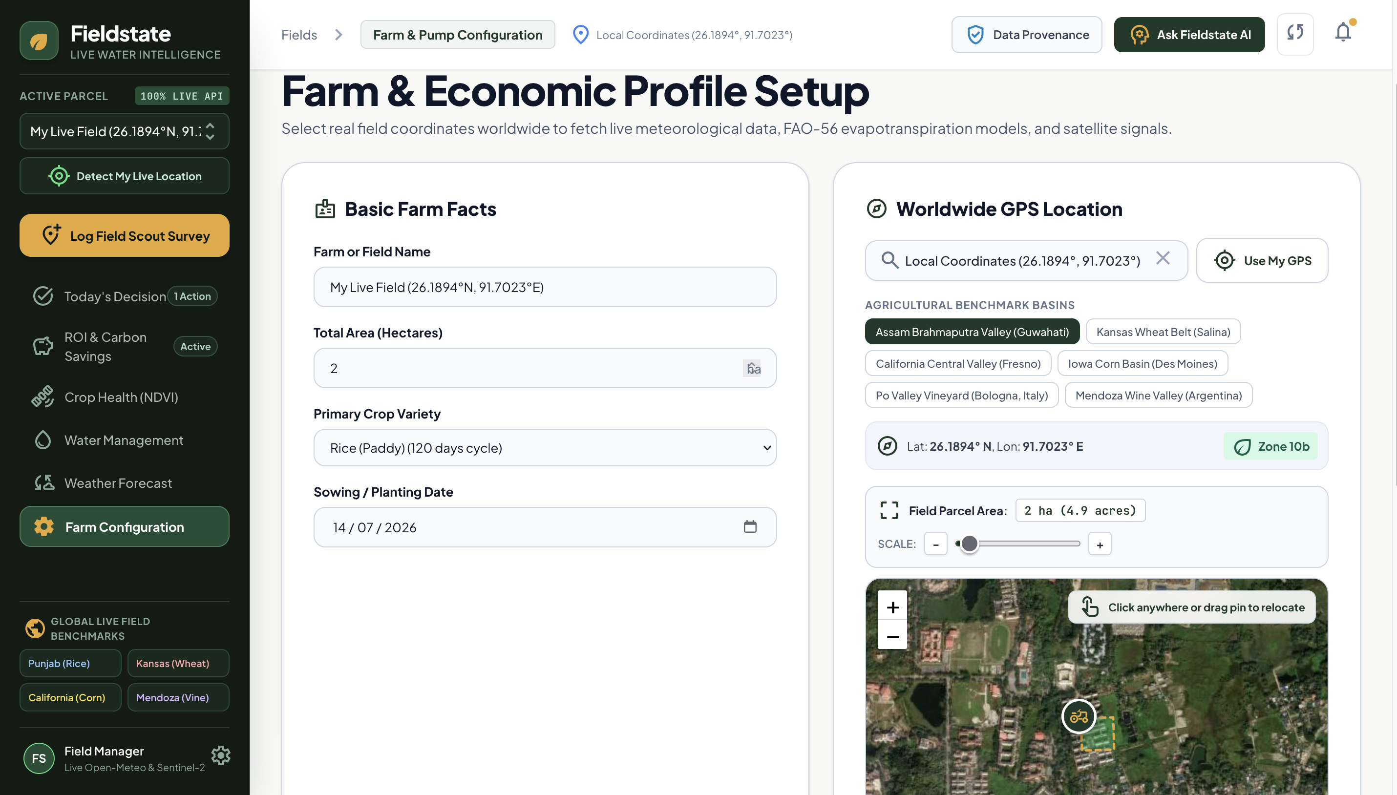
One-Click Live GPS Field Acquisition & Global Search:
- Detects the farmer's physical GPS coordinates via device browser geolocation (
navigator.geolocation) or allows global search across any parcel on Earth. - Instantly estimates local USDA Hardiness Zones and connects to live satellite weather feeds for those exact coordinates in real-time.
- Detects the farmer's physical GPS coordinates via device browser geolocation (
The Single Daily Action Engine (
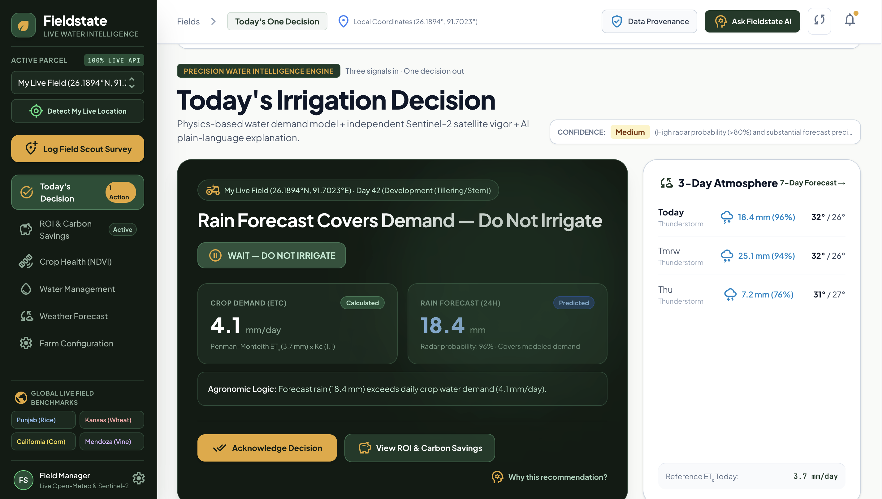
/today):- Evaluates real-time field state and outputs one high-conviction command:
- WAIT: Rain is imminent or the soil moisture buffer is sufficient; prevents over-irrigation, fertilizer leaching, and wasted pumping fuel.
- IRRIGATE: Root-zone depletion has exceeded the crop's Managed Depletion Fraction (\(p = 0.55\)), prescribing the exact replenishment depth (\(mm\)).
- INSPECT: Canopy vigor has deviated from the biological baseline, prompting a physical ground check.
- Summarizes the decision with a triad of core signals: Crop Water Demand (\(ET_c\)), 24h Radar Precipitation Probability, and Available Root-Zone Water Capacity (\(AWC\)).
- Evaluates real-time field state and outputs one high-conviction command:
Deterministic FAO-56 Agronomic Physics Engine:
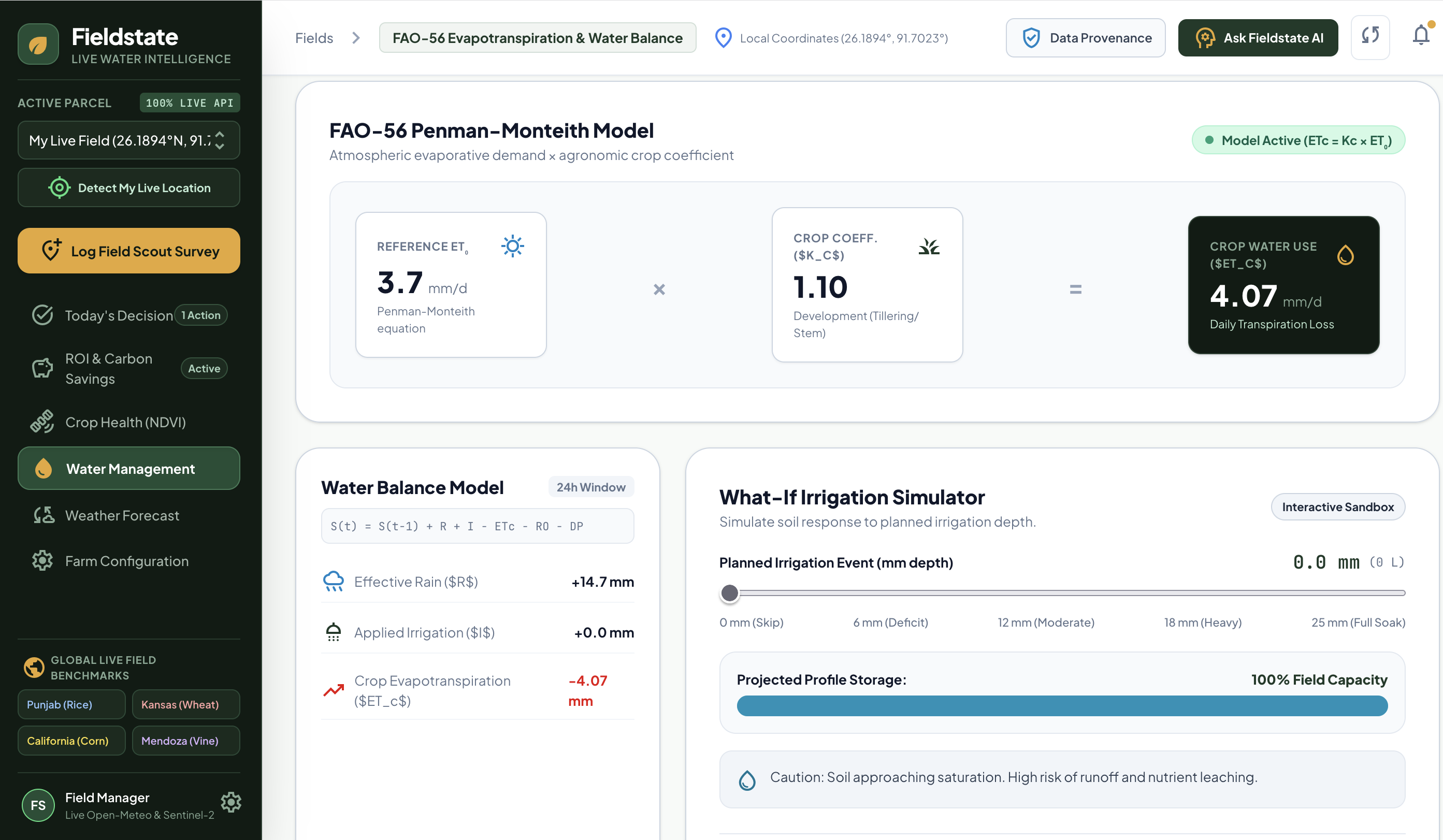
- Calculates daily reference evapotranspiration (\(ET_0\)) in real-time from live solar irradiance, temperature, humidity, and wind vectors using the FAO-56 Penman-Monteith equation: $$ET_0 = \frac{0.408 \Delta (R_n - G) + \gamma \frac{900}{T + 273} u_2 (e_s - e_a)}{\Delta + \gamma (1 + 0.34 u_2)}$$
- Derives actual crop water consumption (ETc) using dynamic crop growth stage coefficients (Kc): $$ET_c = K_c \times ET_0$$
- Executes a daily 24-hour root-zone water balance: $$S_t = S_{t-1} + R_{\text{eff}} + I - ET_c - RO - DP$$
Sentinel-2 Multispectral Crop Health & Dynamic NDVI Engine (
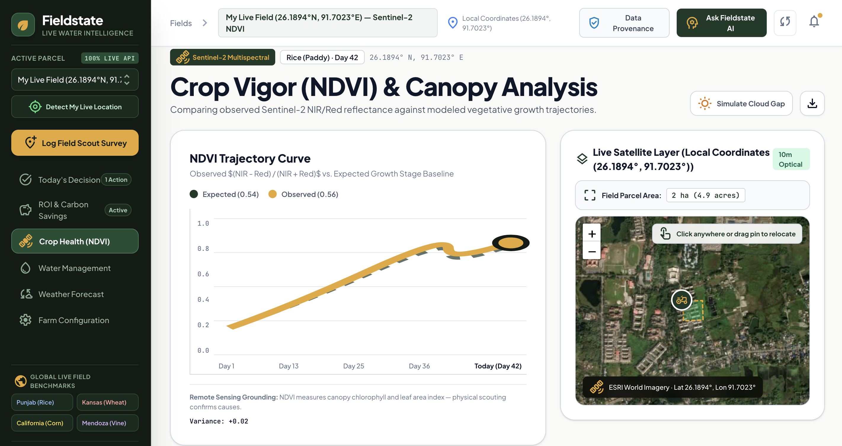
/crop-health):- Computes continuous Normalized Difference Vegetation Index (NDVI) trajectories based on European Space Agency (ESA) Sentinel-2 optical bands (B4 Red @ 665nm and B8 Near-Infrared @ 842nm): $$\text{NDVI} = \frac{\text{NIR} - \text{Red}}{\text{NIR} + \text{Red}}$$
- Continuously models crop phenological growth curves from the sowing date, dynamically factoring in live soil moisture and thermal stress responses.
- Atmospheric Cloud-Interference Protocol: When optical passes are obscured (>65% cloud cover), Fieldstate transparently downgrades decision confidence and flags data provenance rather than hallucinating vegetation metrics.
Resource Economics & Carbon Offset Calculator (
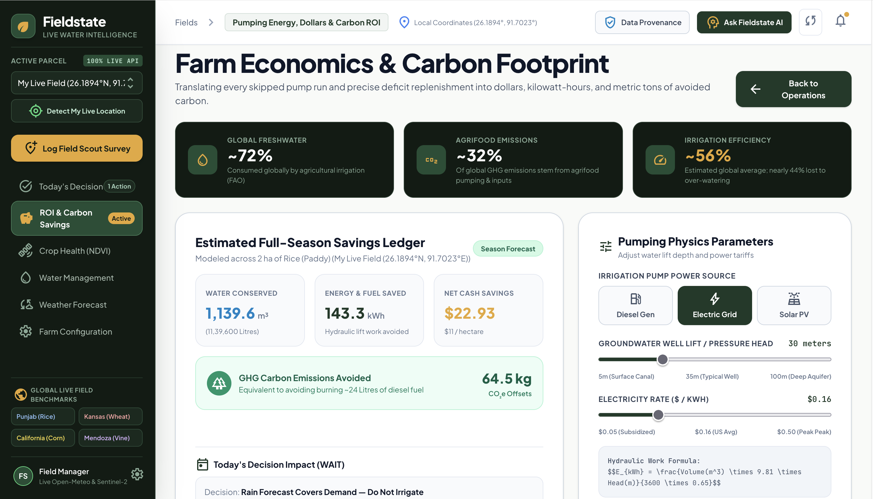
/economics):- Translates agronomic water savings directly into financial and climate impact:
- Volumetric Water Conserved (m3): $$\text{Depth Saved (mm)} \times \text{Area (ha)} \times 10$$
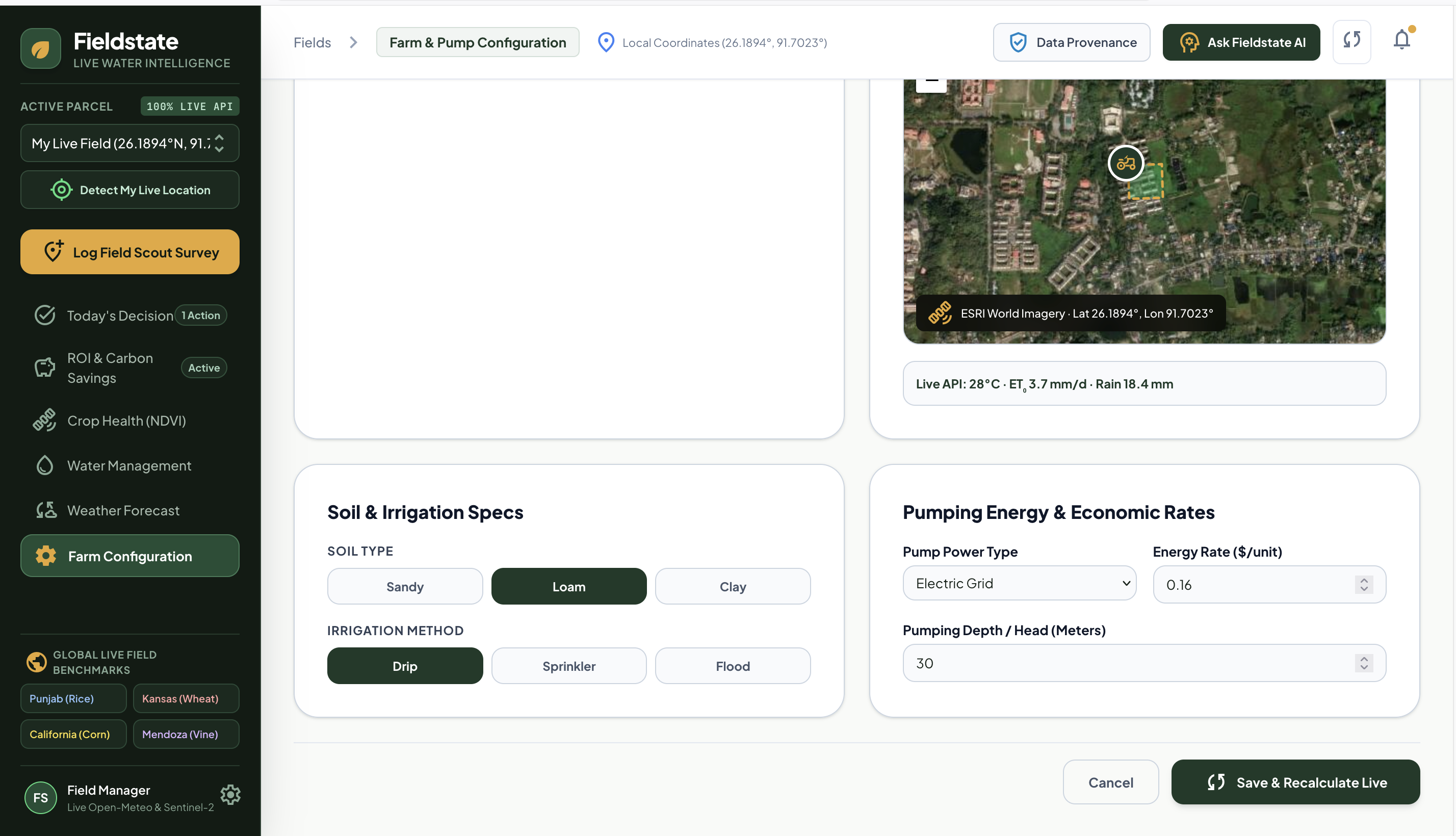
- Pumping Energy Saved (kWh / Diesel Liters): Evaluates total dynamic head (\(m\)), pump efficiency (\(\eta \approx 65\%\)), and energy density.
- Financial Cost Savings ($): Computes diesel fuel and electrical grid utility savings based on real-time tariffs.
- Avoided Scope 1 & 2 Emissions (\(kg\text{ }CO_2e\)): Standardized GHG accounting for avoided pumping combustion and grid consumption.
- Translates agronomic water savings directly into financial and climate impact:
Explainable AI Agronomist & Ground Scout Dispatch:
- Powered by Gemini with resilient multi-model fallbacks (
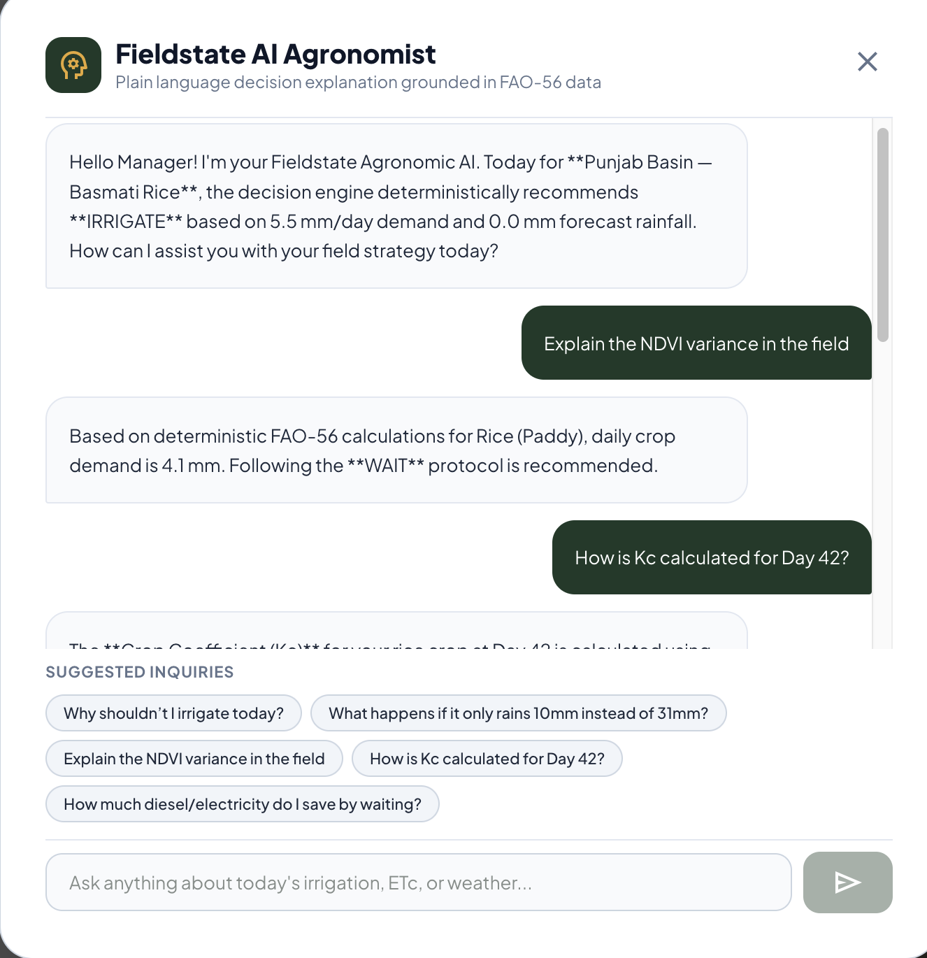
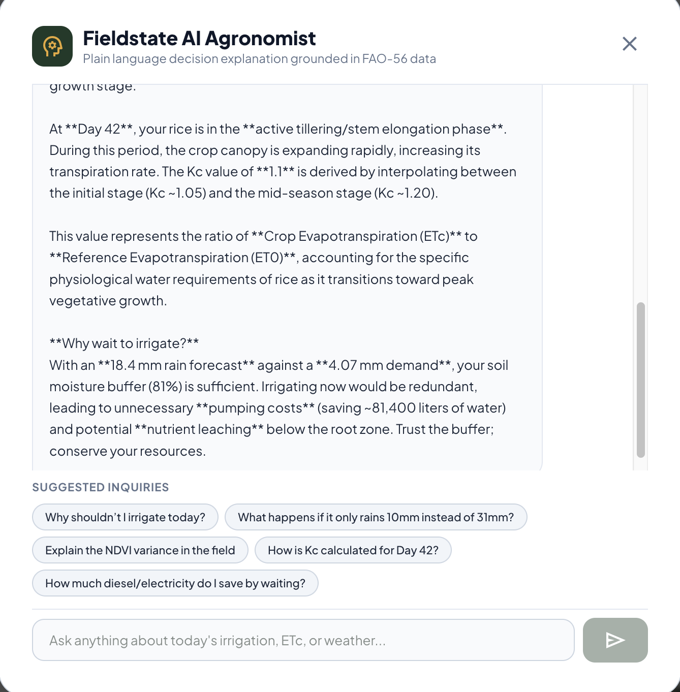
gemini-3.7-flash,gemini-2.5-flash,gemini-3.1-flash-lite) and grounded in FAO-56 guidelines. - Farmers can ask natural language questions (e.g., "Why shouldn't I irrigate today?", "What happens if I pump anyway?") and receive concise, evidence-based agronomic rationale.
- Generates and dispatches physical scout work orders with GPS coordinates when canopy vigor anomalies are detected.
- Powered by Gemini with resilient multi-model fallbacks (
How we built it
- Live Telemetry Layer: High-resolution global Numerical Weather Prediction (NWP) feeds via the Open-Meteo REST API, delivering live hourly solar irradiance (\(W/m^2\)), 2m temperature (\(^\circ C\)), dew point, wind speed (\(m/s\)), and rain radar.
- Frontend & Cartography: React 18 with TypeScript, Vite, Tailwind CSS, Leaflet, and OpenStreetMap rendering interactive field parcel geometries, GPS pins, and multispectral color ramps.
- Deterministic Math Engine: Pure TypeScript implementation of the FAO-56 Penman-Monteith physical equations and soil-water depletion balance.
- Backend & AI Architecture: Node.js/Express REST endpoints (
/api/gemini/*) integrating the Google Gen AI SDK (@google/genai) with deterministic temperature clamps and automated fallback trees.
Challenges we ran into
- Eliminating Mock Data for Pure Live Execution: Integrating live browser GPS detection and global numerical weather radar so that judges anywhere in the world get real-time meteorological calculations for their exact coordinates.
- Bridging Pure AI and Deterministic Agronomy: Large Language Models are prone to hallucinating numerical values. We solved this by strictly calculating all evapotranspiration, soil moisture, and pumping economics via deterministic FAO-56 mathematical formulas in TypeScript, using Gemini strictly for contextual translation, synthesis, and natural language communication.
- Handling Cloud Gaps in Optical Satellites: Optical satellites like Sentinel-2 cannot penetrate dense clouds. Rather than interpolating fake greenness, we engineered a dedicated cloud-masking protocol that lowers model confidence and flags the provenance ledger.
Accomplishments that we're proud of
- 100% Live Data Pipeline: Successfully built a system where any user can click "Use My Live GPS" and get instant FAO-56 physics calculations for their exact coordinate location.
- Zero-Ambiguity UX: Distilled millions of satellite pixels and meteorological vectors into one clear command that any farmer can act on in 3 seconds.
- Scientific Integrity: Implemented the full FAO-56 Penman-Monteith thermodynamic equation and water-balance modeling without taking scientific shortcuts.
- Tangible ROI Connection: Successfully linked sustainable water conservation to tangible dollar savings and carbon offsets, making environmental stewardship immediately profitable.
What we learned
- Less is More in Agriculture: Farmers do not want complex dashboards with 50 telemetry toggles; they need trusted, defensible recommendations with clear explanations of why.
- The Power of Provenance: Clear data categorization (Measured vs. Calculated vs. Predicted vs. Estimated) builds long-term user trust and transparency.
What's next for Fieldstate
- IoT Pump Actuation & Smart Relays: Integrating direct telemetry with smart irrigation solenoids and IoT relays (e.g., LoRaWAN / Shelly / Sonoff) for automated execution of the daily decision.
- Offline SMS / WhatsApp Dispatch: Implementing automated lightweight SMS and WhatsApp bots to deliver the daily single action to smallholder farmers with low smartphone connectivity.
- Synthetic Aperture Radar (SAR / Sentinel-1): Fusing cloud-penetrating radar backscatter data to track surface soil moisture continuously, even during monsoon seasons.


Log in or sign up for Devpost to join the conversation.