-
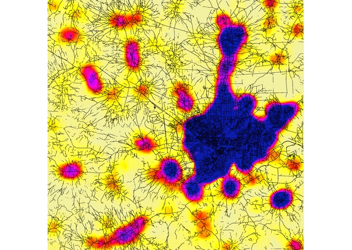
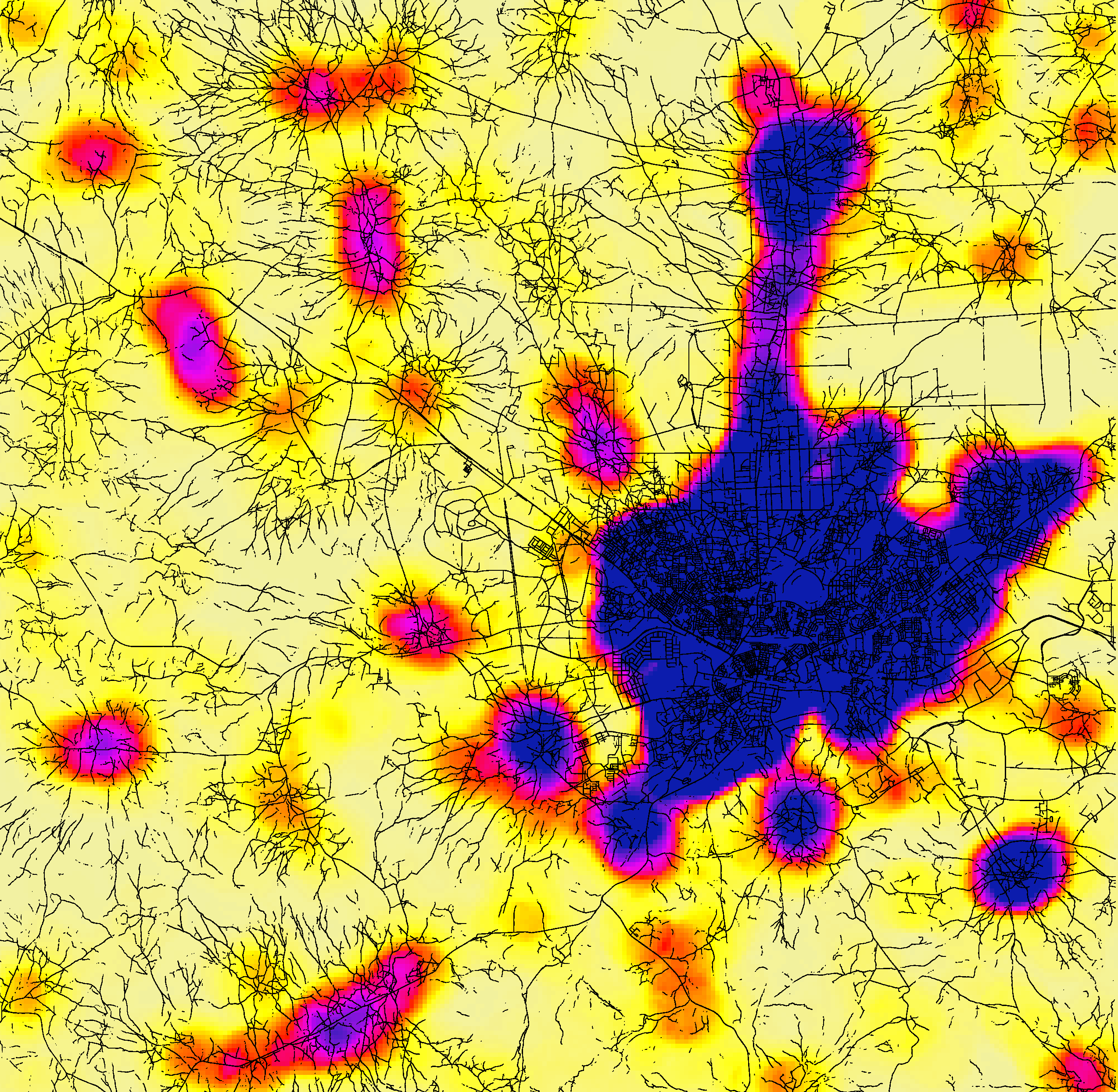
Population Density with roads overlayed
-
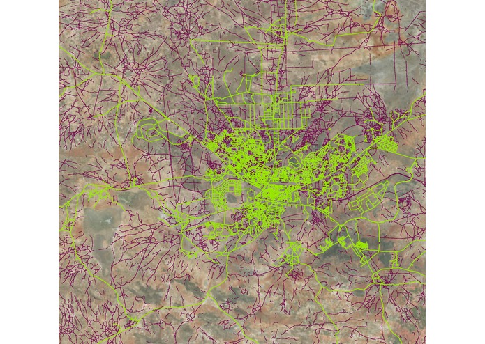
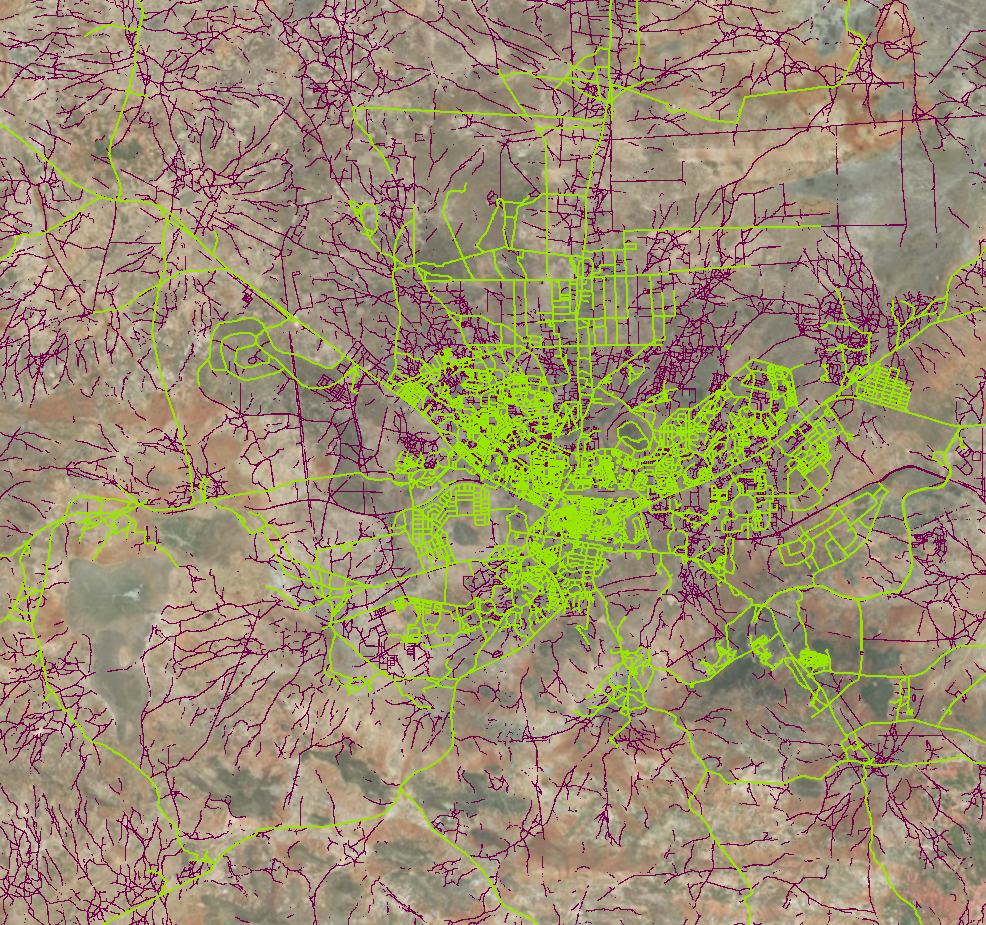
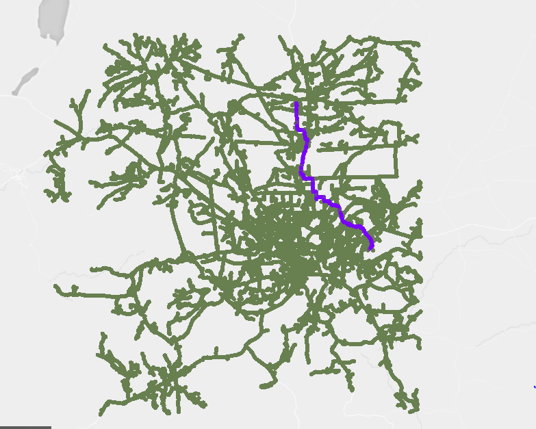
Comparison between OSM roads (green) and ML roads (purple)
-
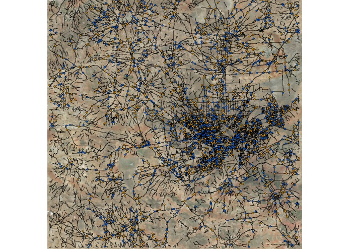
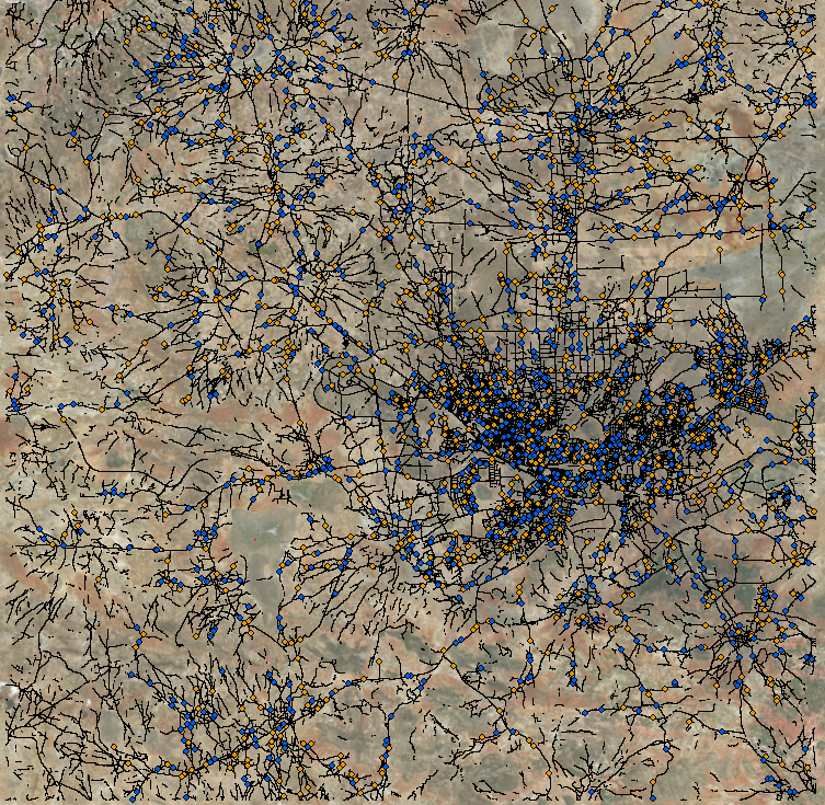
Routes with Starting Points (blue) and Ending Points (orange)
-
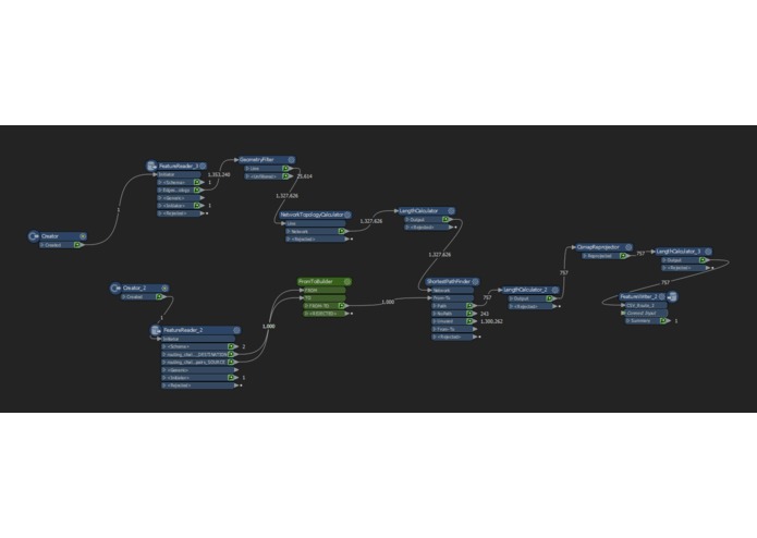
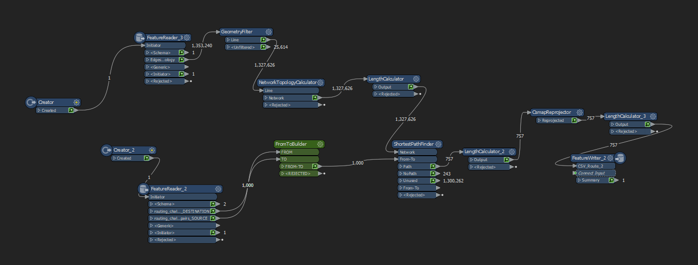
FME Workbench of Routing
-
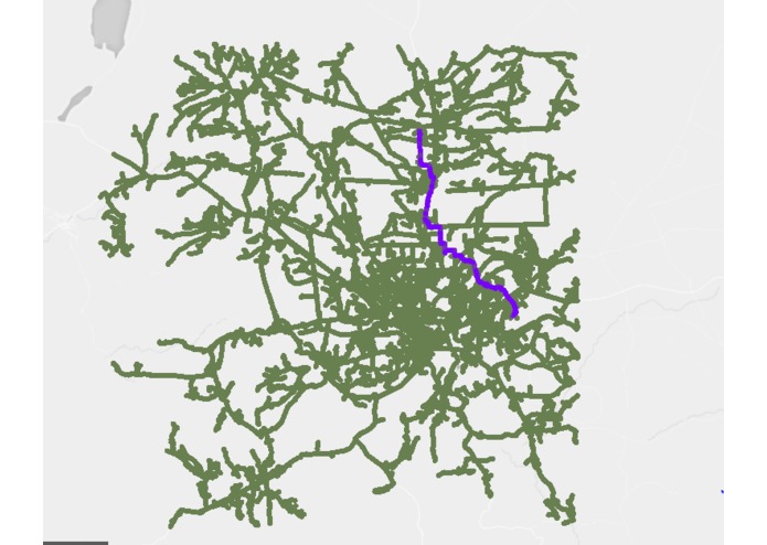
Routes
Two CSV outputs
https://drive.google.com/drive/folders/1KswL-NuhMOp0uOkkpFlvieaIwZO7ymQK?usp=sharing
Inspiration
This challenge was spatially derived and has a humanitarian aspect that appealed to both members.
What it does
The FME workbench automates routing between two From-To points based on a created Topo-network from the provided Raster PNG images (Georefferenced automated). The routes then collect distances, and output as a CSV.
How we built it
Using FME and ArcGIS Pro, we wanted quantified the population densities relative to the road networks in Tanzania. From there, using FME we created routing networks and ran a workbench to create the actual routes between the specified test points).
Accomplishments that we're proud of
Getting routing to work 30 minutes before the turn in time.
What we learned
We learned some complex algorithms that go behind network analysis and got to experience more that automation has to offer.
What's next for Facebook Challenge LT
We hope to be able to make a web-application out of this process that can display the results via polylines and a hosted ArcOnline service.
Built With
- arcgis-pro
- arcpy
- fme

Log in or sign up for Devpost to join the conversation.