-
-
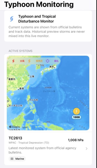
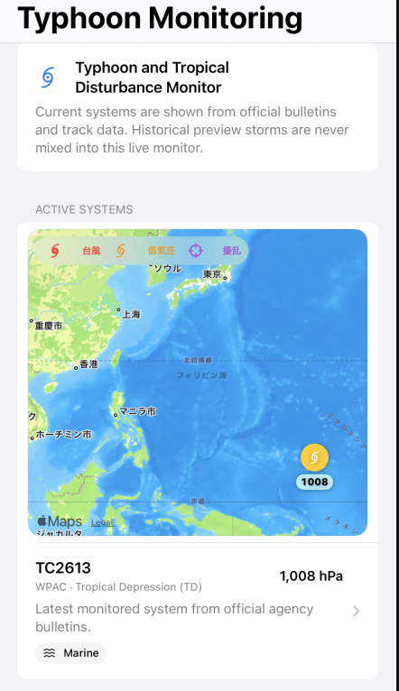
Tropical Storm Position
-
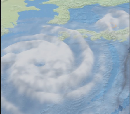
3D Satellite Image
-
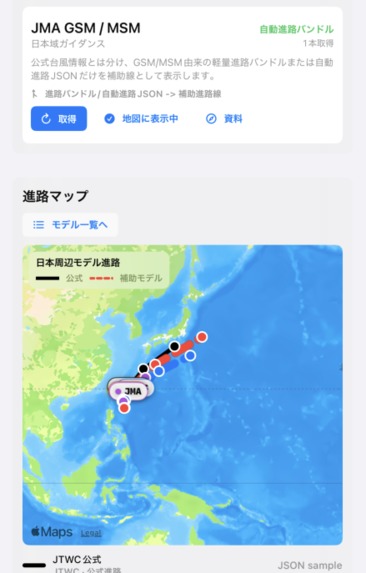
Typhoon Tracks
Inspiration
Extreme weather is usually presented through icons, flat maps, and separate charts. These are valuable, but they can make it difficult for non-specialists to understand how clouds, precipitation, wind, and terrain interact.
I wanted to build a weather observation experience where people could move from a regional overview into the atmosphere itself, while keeping official sources, model guidance, synthetic demonstrations, and AI-assisted interpretation clearly separated.
What it does
ExtremeWeather is a native iOS prototype for observing typhoons and severe weather across Japan and the western Pacific.
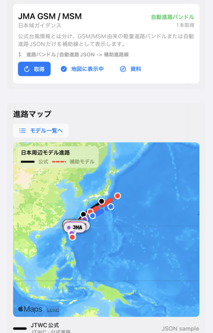
The application separates official agency bulletins, satellite observations, numerical weather model guidance, diagnostic layers, and AI-assisted explanations. It is designed to help users understand weather information without presenting AI interpretation as an official forecast.
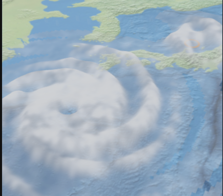
Its RealityKit view displays geographic terrain and weather layers in an interactive three-dimensional environment. Users can zoom, change their viewpoint, examine cloud distribution, and observe precipitation beneath the cloud layer.
The Build Week recording uses a clearly labeled historical severe-weather reconstruction. Conditions over Japan were broadly clear when the video was recorded, so live data alone would not clearly demonstrate the three-dimensional cloud and precipitation display. The sample is explicitly marked as synthetic and not live.
A Unity and ArcGIS prototype explores the next stage of the project: combining geospatial terrain with satellite-derived three-dimensional weather layers. The AI-generated concept clips in the demonstration are also clearly labeled and are not presented as current application output.
How I built it
The iOS application is built with Swift and SwiftUI. RealityKit provides interactive terrain and three-dimensional weather visualization, while Metal is used for experimental GPU-based atmospheric rendering.
MapKit and geographic data are used for storm monitoring and regional context. Terrain visualization uses elevation data derived from the Geospatial Information Authority of Japan. Weather information is organized around official and public sources such as JMA Himawari observations, numerical model guidance, and tropical cyclone bulletins.
The RealityKit renderer prioritizes stable mobile interaction and readable observation surfaces. The Unity and ArcGIS implementation is maintained as a separate prototype for the future transition from synoptic observation to immersive atmospheric flight.
How I used Codex and GPT-5.6
ExtremeWeather existed before Build Week, but it was meaningfully extended during the event.
Codex worked as a hands-on engineering partner across Swift, SwiftUI, RealityKit, Metal, Unity, and the iOS Simulator workflow. It helped inspect and repair rendering code, automate Xcode builds and simulator interactions, diagnose crashes and storage growth, correct camera and map behavior, investigate transparent-cloud depth artifacts, and repeatedly verify the application through screenshots and recorded video.
I remained responsible for the product and scientific decisions: separating official observations from model guidance, deciding which visualizations were safe to present, labeling historical and synthetic data, choosing renderer trade-offs, and distinguishing implemented functionality from future concepts.
GPT-5.6 helped structure weather explanations, review visual behavior from screenshots and video, refine the bilingual presentation, and clearly separate observations, synthetic reconstruction, and future concepts in the application and submission video.
Challenges
The largest technical challenge was rendering terrain, clouds, and precipitation together on a mobile GPU without making the interface unstable or difficult to understand.
Transparent cloud surfaces caused depth-ordering artifacts, camera movement could become disorienting, and terrain and weather caches created significant storage pressure during repeated device testing. These problems required several build, run, inspect, and revise cycles.
Another challenge was scientific communication. A visually impressive scene must not be mistaken for a live official forecast. Historical reconstructions, diagnostic estimates, and AI-generated concept footage therefore remain visibly labeled.
Accomplishments
- A working native iOS weather-observation prototype
- Official-source-first typhoon and disturbance monitoring
- Interactive RealityKit terrain for Japan and the western Pacific
- Satellite-shaped three-dimensional cloud-top relief
- Precipitation displayed below the cloud layer
- Japanese and English presentation support
- Clear separation of live information, synthetic samples, and future concepts
- A mobile-tested workflow on iPhone and iOS Simulator
What I learned
Three-dimensional rendering alone does not make weather easier to understand. Camera stability, readable labels, source attribution, data freshness, and honest uncertainty are just as important as visual quality.
Codex was especially valuable when the work required rapid movement between code, device behavior, rendering diagnostics, and repeated verification.
What's next
The next goal is to replace the historical demonstration with live Himawari-derived cloud structure, convert infrared cloud-top information into height and density, improve lighting and self-shadowing, and place precipitation physically beneath the diagnosed cloud canopy.
The Unity and ArcGIS prototype will continue toward a smooth transition from regional satellite observation to low-altitude atmospheric exploration.
ExtremeWeather is a weather observation application first. Immersive flight is an interface for understanding real atmospheric data—not a fictional game world. It does not replace official forecasts, warnings, or emergency information.

Log in or sign up for Devpost to join the conversation.