
Inspiration
We're working on a map based project right now. And we wanted to make something cool, which uses google maps api to dynamically show data.
How it works
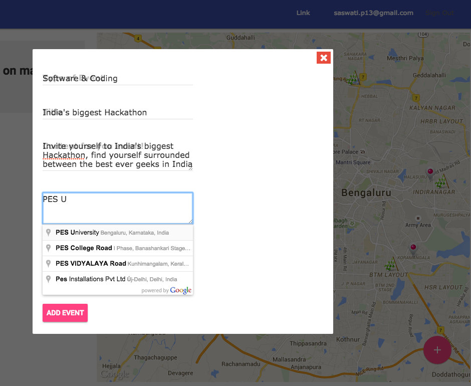
A user can use facebook to login to the website and create an new event!
It uses Google Maps API Places library to auto suggest the user the address so as to avoid typo errors and redundant places.
After filling up , type of event, When it starts, when it ends, a title, and a description, the user is ready to go.
Google Maps Geocode API fetches latitude and longitude information from the address, and puts a marker on the Map.
It shows when its going to start and end.
Upon clicking on the event marker, the user can see the a comment panel on the left sidebar, where he/she can see the current discussions about it. And facebook authentication makes it more genuine.
Challenges I ran into
While rendering objects as models, we were unable to show its related model data through ajax. We're still working on it, and hope to finish it in next few hours!
What I learned
Google Maps API
Next:
We want to implement web sockets to do a hassle free pushing of data to the end user, and perhaps a real time chatting for users. Inviting user's facebook friend


Log in or sign up for Devpost to join the conversation.