-
-
App Icon
-
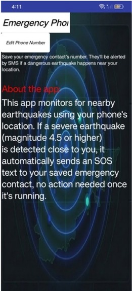
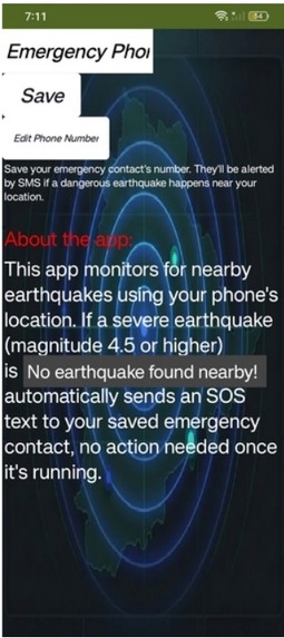
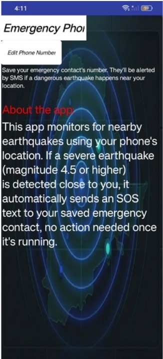
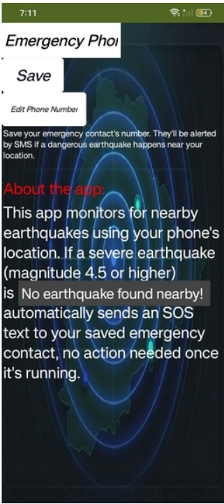
App UI screen
-
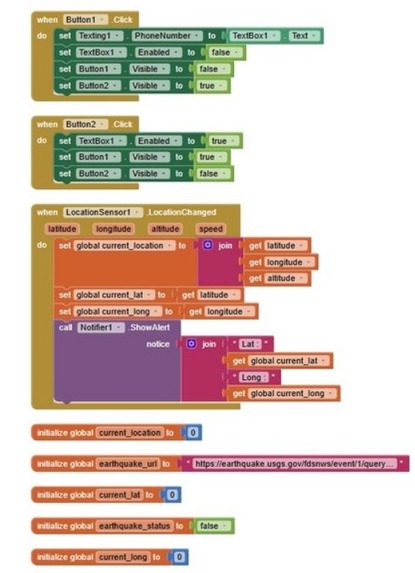
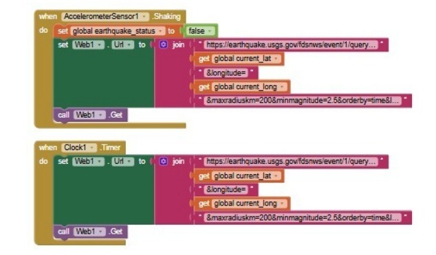
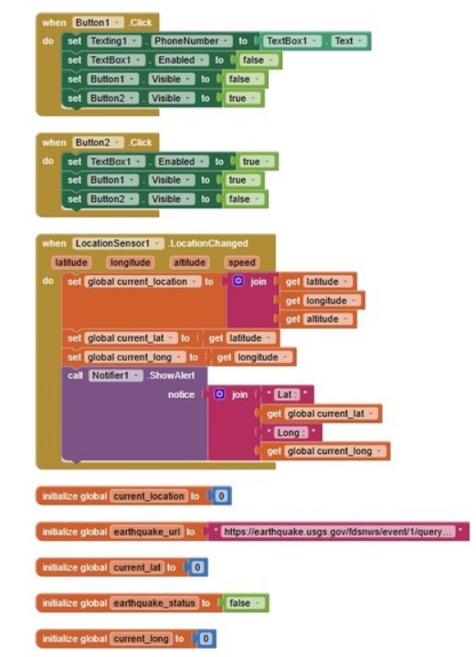
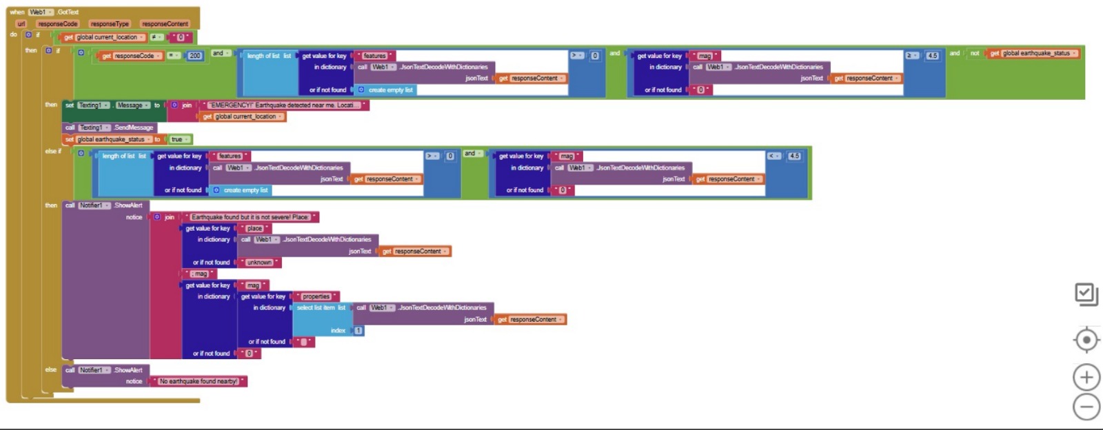
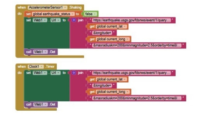
App Code
-
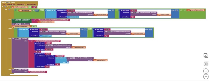
App Code
-
-
Inspiration
I was deeply moved by real-world disasters where people tragically lost their lives simply because rescue teams had no way of knowing they were trapped right there. In chaotic situations, victims are often unable to manually call for help, and rescue teams miss them completely.
I wanted to create an app that acts as an automated beacon, allowing a trapped user to simply shake their device to broadcast their precise location.
However, to ensure emergency workers can trust these critical alerts and deploy their limited resources immediately without second-guessing a prank, I built a system that automatically cross-checks the user's location with live disaster data. This ensures trapped victims are found and rescued instantly when every second counts.
What it does
I was deeply moved by real-world disasters where people tragically lost their lives simply because rescue teams had no way of knowing they were trapped right there. In chaotic situations, victims are often unable to manually call for help, and rescue teams miss them completely.
I wanted to create an app that acts as an automated beacon, allowing a trapped user to simply shake their device to broadcast their precise location.
However, to ensure emergency workers can trust these critical alerts and deploy their limited resources immediately without second-guessing a prank, I built a system that automatically cross-checks the user's location with live disaster data. This ensures trapped victims are found and rescued instantly when every second counts.
How I built it
I built the application entirely using the MIT App Inventor platform, leveraging its visual block-coding capabilities.
The core features utilize the AccelerometerSensor to track device shaking events and the LocationSensor to lock onto global positioning coordinates. To bridge the app with real-time real-world data, I configured a Web component to dynamically construct a GeoJSON API query using the victim’s live latitude and longitude values, sending a live GET request directly to the global USGS earthquake catalog.
Challenges I ran into
The biggest hurdle was learning how to parse text data coming back from a live internet server without writing lines of traditional code. The API response returns a long, complex text string. I had to figure out how to filter this data using text matching blocks to scan specifically for the "count":0 string, which indicates whether any active earthquakes were physically found near the user's location.
Accomplishments that we're proud of
I am incredibly proud of designing a "zero false-alarm architecture" as a Grade 9 student project. Successfully linking hardware phone sensors to live, global web data using block code proves that you don't need complex software engineering backgrounds to build tools that solve major humanitarian issues.
What we learned
I learned how to connect an app to external web services using APIs and the Web component in MIT App Inventor. I also deeply explored conditional logic, understanding how hardware sensor values can act as inputs to query live databases, allowing an application to make intelligent decisions based on real-world context.
What's next for Epicenter IQ
I plan to expand Epicenter IQ beyond earthquakes by integrating additional global weather APIs. This will allow the application to cross-reference coordinates for other active natural disasters, such as severe floods, cyclones, and wildfires, making it an all-in-one universal disaster safety tool.

Log in or sign up for Devpost to join the conversation.