-
-
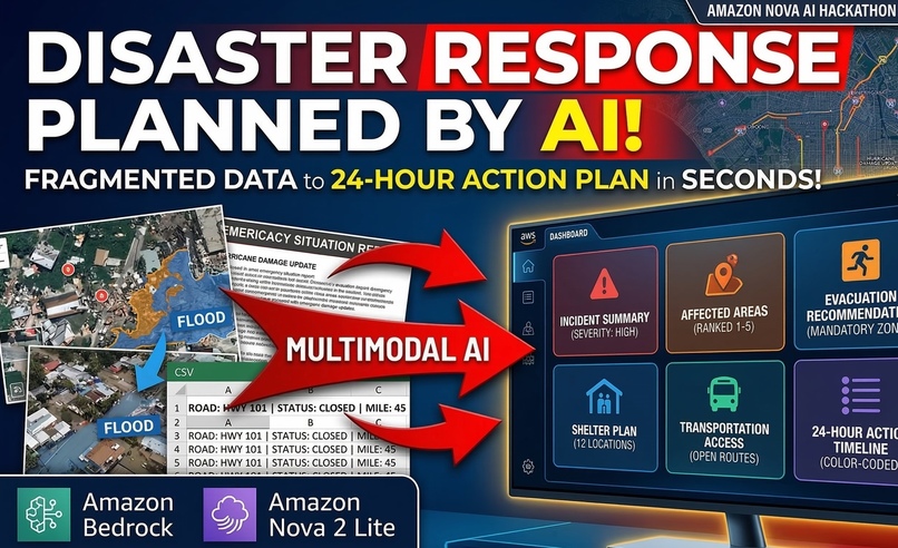
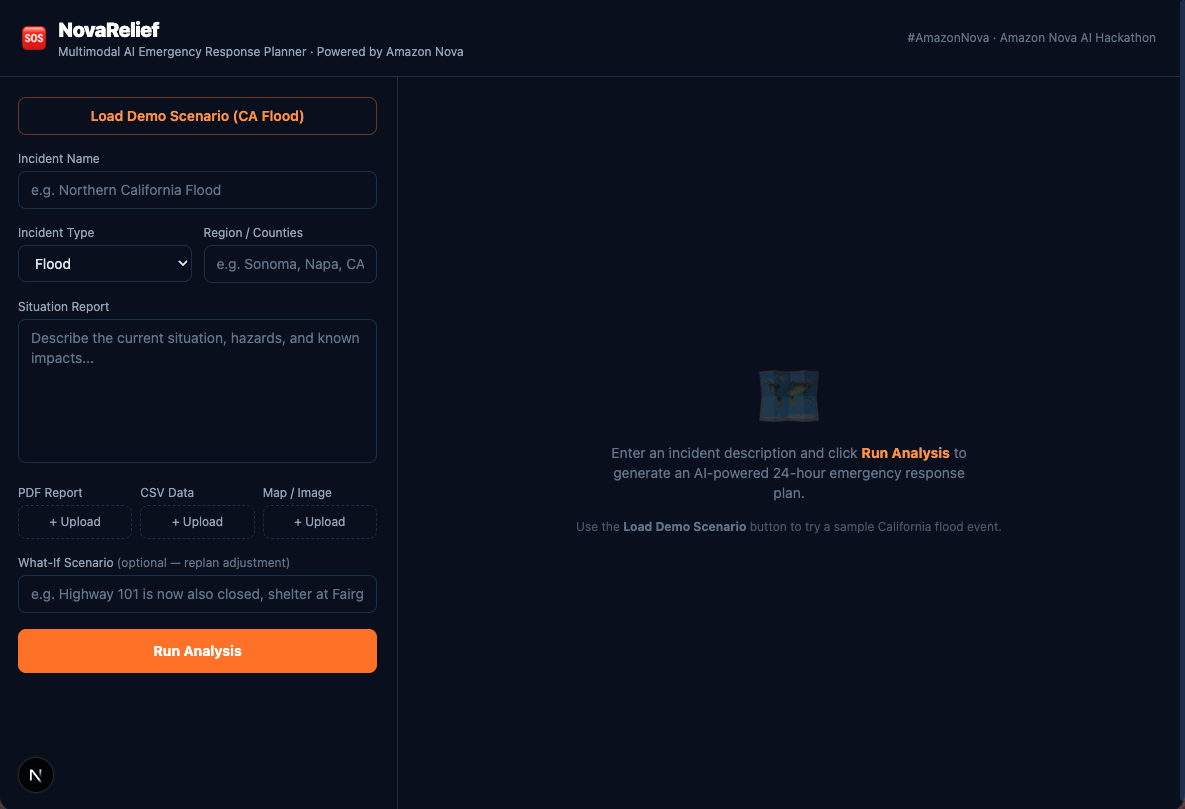
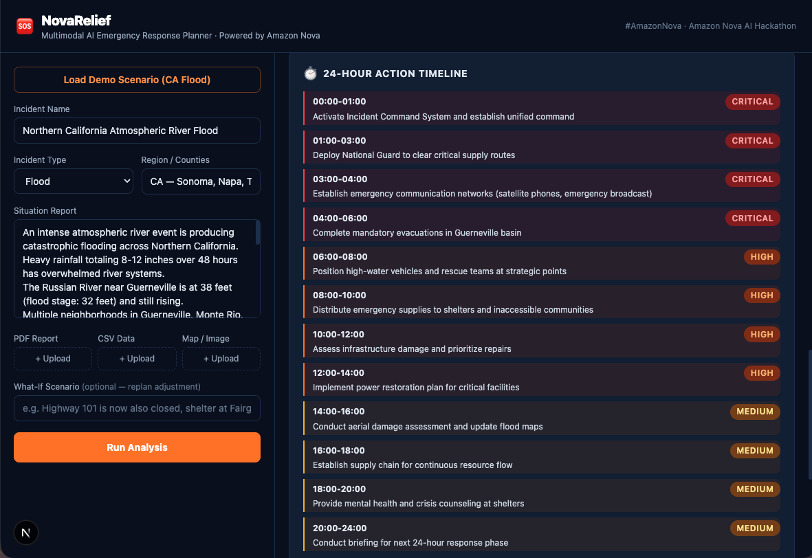
Multimodal input panel: incident name, type, region, situation report, plus PDF, CSV, and map image uploads.
-

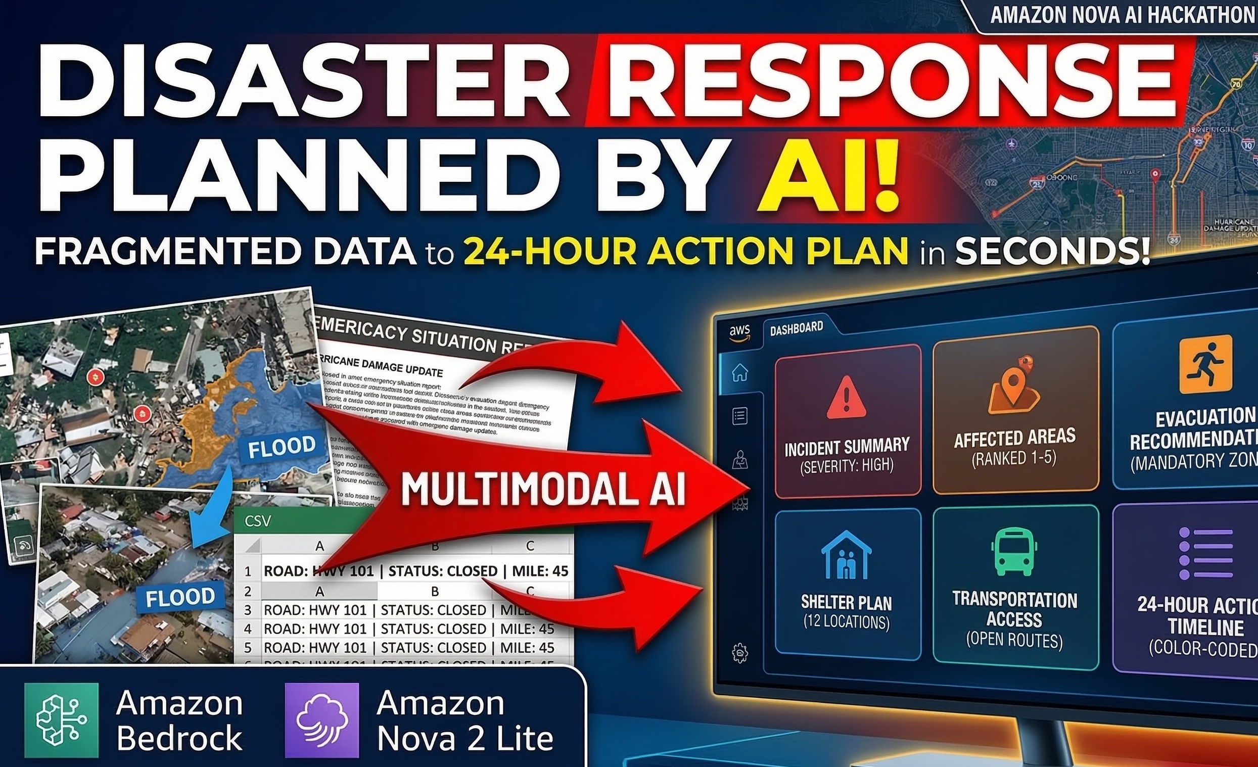
Amazon Nova 2 Lite processing incident data via Bedrock — analyzing text, CSV road closures, and satellite map simultaneously.
-
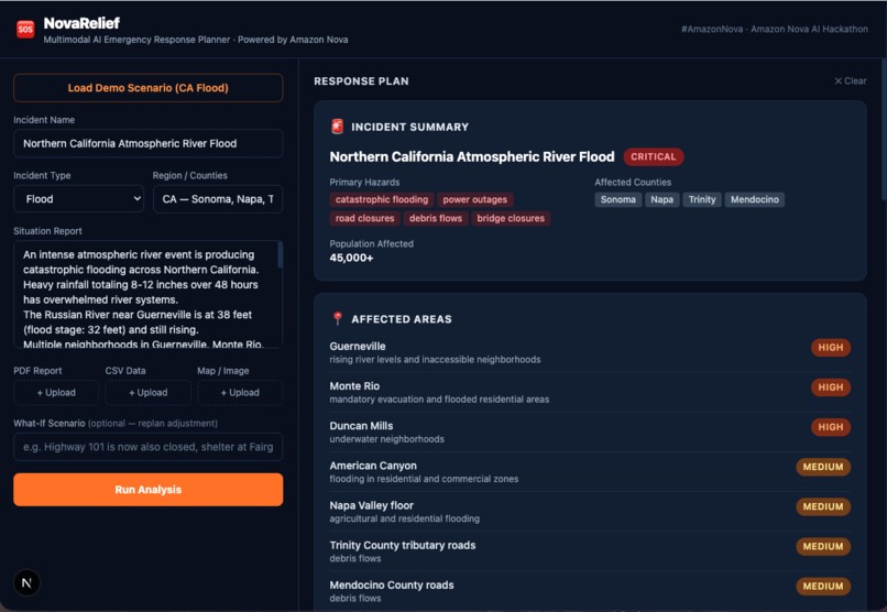
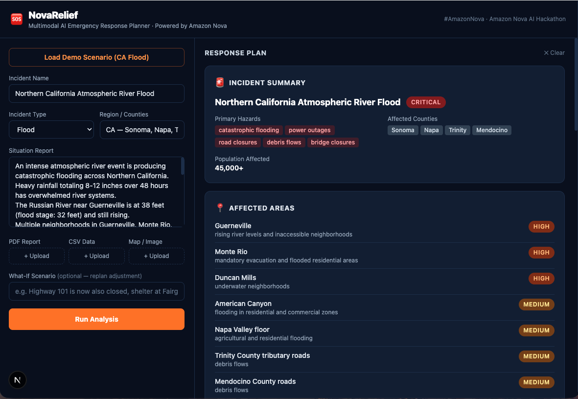
CRITICAL severity assessment with primary hazards, affected counties, population impacted, and zone-by-zone severity ranking.
-
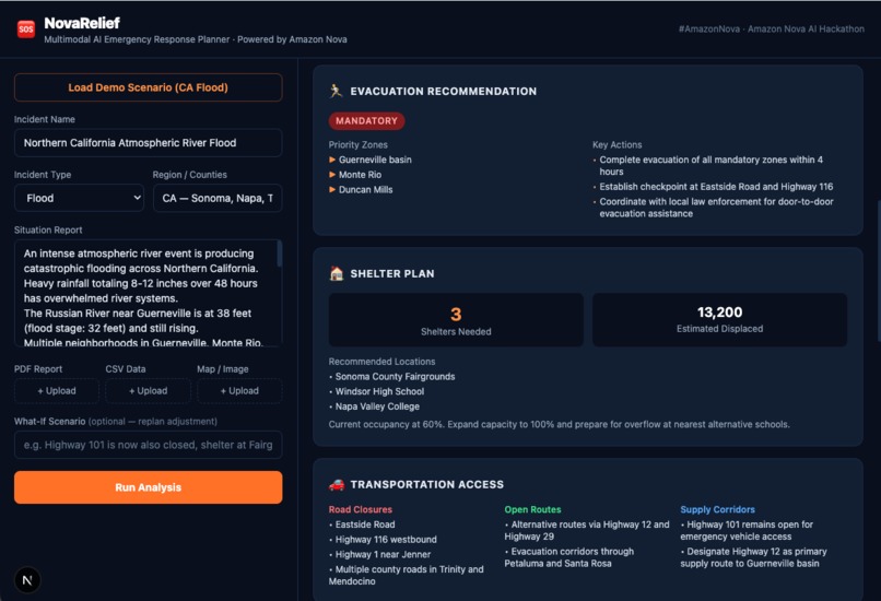
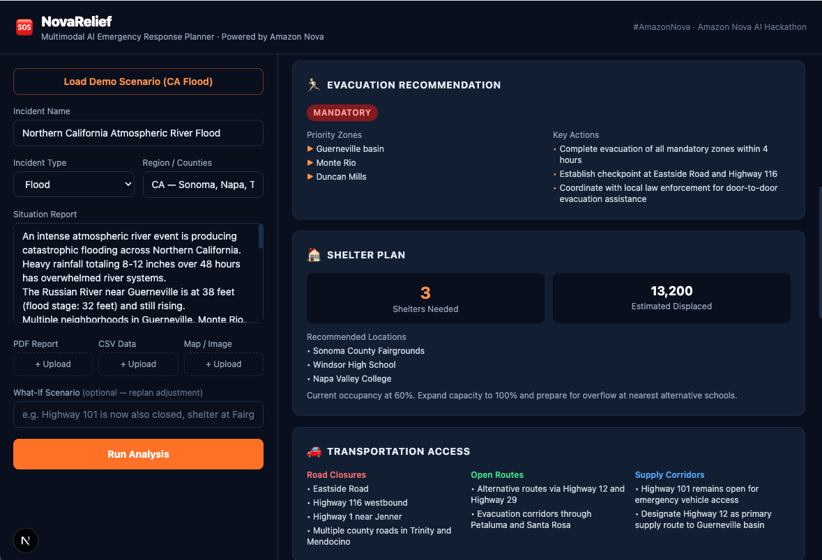
Shelter capacity metrics, road closure breakdown, open supply routes, and full resource deployment recommendations.
-
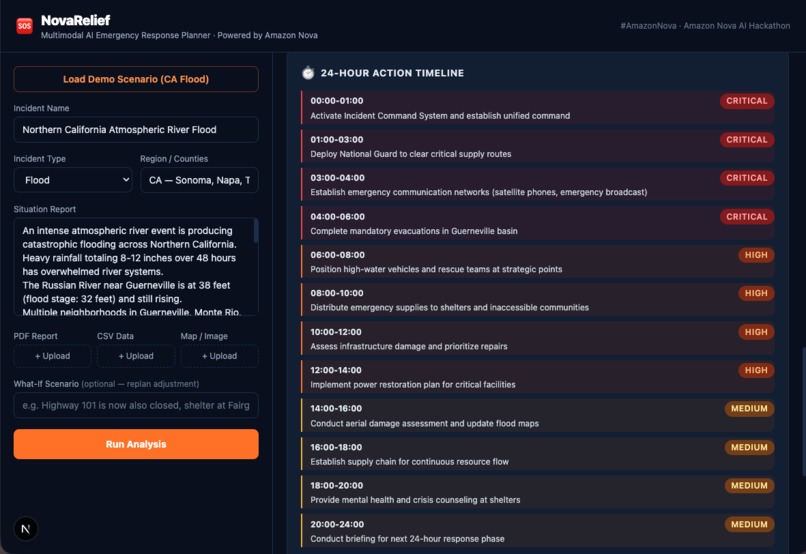
Hour-by-hour action timeline color-coded by priority: CRITICAL, HIGH, and MEDIUM — from aerial assessment to overnight patrols.
Inspiration
Disasters such as floods, wildfires, and severe storms generate large amounts of fragmented information. Emergency planners often receive updates from reports, maps, infrastructure damage assessments, road closures, and shelter availability. Turning this scattered information into a coordinated response plan is difficult and time-sensitive.
Recent atmospheric river storms in Northern California highlighted how quickly conditions can change. Emergency teams must rapidly determine which communities are most at risk, which roads are accessible, where shelters should be activated, and how resources should be deployed.
The inspiration behind this project was to explore how multimodal AI and reasoning models can help emergency planners synthesize multiple data sources into actionable insights. Instead of manually reviewing reports and maps, an AI system can analyze the information and generate a structured response plan in seconds.
NovaRelief was built to demonstrate how AI can assist first responders and planners in making faster, more informed decisions during disaster events.
What it does
NovaRelief is an AI-powered emergency response planning assistant designed to analyze disaster information and generate operational recommendations.
The system accepts multiple inputs related to a disaster scenario, including:
- Incident descriptions
- Situation reports
- Infrastructure damage summaries
- Map or satellite imagery
- Road closure data
- Shelter capacity information
Using Amazon Nova’s multimodal reasoning capabilities, the system analyzes the inputs and generates a structured response plan.
The platform produces operational insights including:
- Disaster severity assessment
- Identification of affected regions
- Evacuation recommendations
- Shelter allocation planning
- Transportation and access analysis
- Resource deployment suggestions
- Critical infrastructure risk evaluation
- A 24-hour emergency action timeline
The system can also perform scenario replanning. For example, planners can simulate changes such as blocked roads or overwhelmed shelters and generate an updated response strategy.
How we built it
The system was built as a modular architecture designed for rapid prototyping and clear reasoning workflows.
Backend
The backend is built using FastAPI, which handles:
- incident ingestion
- file uploads
- document parsing
- AI orchestration
- response generation
The backend normalizes all inputs into a structured incident package before sending the data to the AI reasoning layer.
Multimodal AI Layer
Amazon Nova foundation models are used to:
- interpret reports and textual updates
- analyze map or image inputs
- extract hazard indicators
- synthesize disaster impact assessments
- generate operational planning recommendations
Agent-based planning workflow
The reasoning pipeline is organized into logical modules that simulate specialized planning agents:
- Situation Assessment Agent – determines disaster type and severity
- Evacuation Planning Agent – evaluates evacuation requirements
- Shelter Planning Agent – estimates displaced populations and shelter capacity
- Transportation Agent – analyzes road closures and logistics constraints
- Resource Deployment Agent – recommends personnel and equipment
- Plan Composer – merges outputs into a unified response plan
Frontend
The frontend is built using React / Next.js and presents results through structured operational cards such as:
- Incident Summary
- Affected Areas
- Evacuation Recommendations
- Shelter Planning
- Transportation Constraints
- Resource Deployment
- 24-Hour Action Timeline
- Infrastructure Risk Assessment
This card-based interface allows responders to quickly interpret the system’s recommendations.
Challenges we ran into
One of the main challenges was designing a system that could process multiple data formats while still producing structured and reliable outputs.
Disaster information can come in many forms, including text reports, images, and structured datasets. Creating a pipeline that could normalize these inputs into a consistent context for AI reasoning required careful design.
Another challenge was ensuring that AI-generated outputs were structured enough to support operational decision-making rather than just producing long narrative summaries. This required designing prompts and response schemas that forced the model to generate well-defined planning recommendations.
Finally, building the system as a solo developer required focusing on simplicity and reliability. Instead of attempting a full GIS platform, the project focuses on a clean architecture that demonstrates the potential of AI-assisted emergency planning.
Accomplishments that we're proud of
We are proud of several aspects of the project.
First, the system demonstrates how multimodal AI can combine textual reports, structured data, and visual inputs to generate actionable disaster response insights.
Second, the project shows how AI reasoning can be structured into modular planning workflows that mirror how real emergency planning teams operate.
Third, the interface presents results in a clear operational format instead of a generic chatbot response. This makes the system feel closer to a practical planning tool.
Finally, building this system as a solo developer required designing a focused architecture that balances technical depth with demo reliability.
What we learned
This project highlighted several lessons about applying AI to real-world planning problems.
Multimodal reasoning can significantly improve situational awareness when information comes from multiple sources. However, the value of AI depends heavily on how structured the outputs are.
We also learned that designing a clear response schema is critical when using AI in operational contexts. Structured outputs make the system easier to interpret and reduce ambiguity.
Another key insight was that agent-style reasoning workflows can help organize complex planning tasks into smaller, specialized steps.
What's next for Emergency Response Planner
NovaRelief represents an early prototype of how AI could support emergency management workflows.
Future improvements could include:
- integration with real-time weather and disaster feeds
- GIS-based visualization of affected zones
- dynamic evacuation route optimization
- integration with emergency operations center dashboards
- collaborative planning tools for multiple agencies
- automated alert generation for affected communities
With further development, systems like NovaRelief could help responders process disaster information faster and coordinate more effective emergency response strategies.
Built With
- amazon-bedrock
- amazon-nova
- boto3
- fastapi
- next.js
- python
- tailwind-css

Log in or sign up for Devpost to join the conversation.