Inspiration
Growing up in California, the phrase “Safer from Wildfires” is everywhere, but most homeowners never get a clear, evidence‑based walkthrough of their actual risk.
We were inspired by how firefighters talk about ember‑driven ignition—roofs, vents, fences, vegetation in the first 5 feet—and wanted to turn that expert language into an accessible, AI‑powered home assessment.
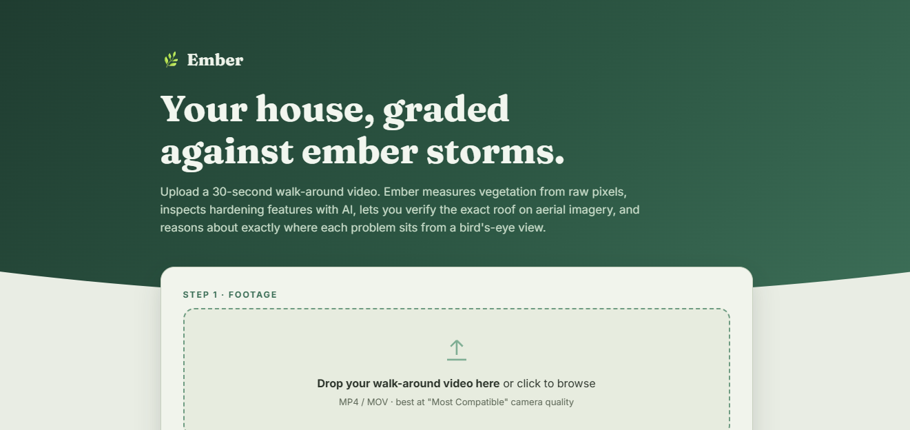
Ember is our attempt to compress a professional perimeter inspection into a 30‑second walk‑around video plus AI, so families and insurers can see the same risks on the same annotated photos.
What it does
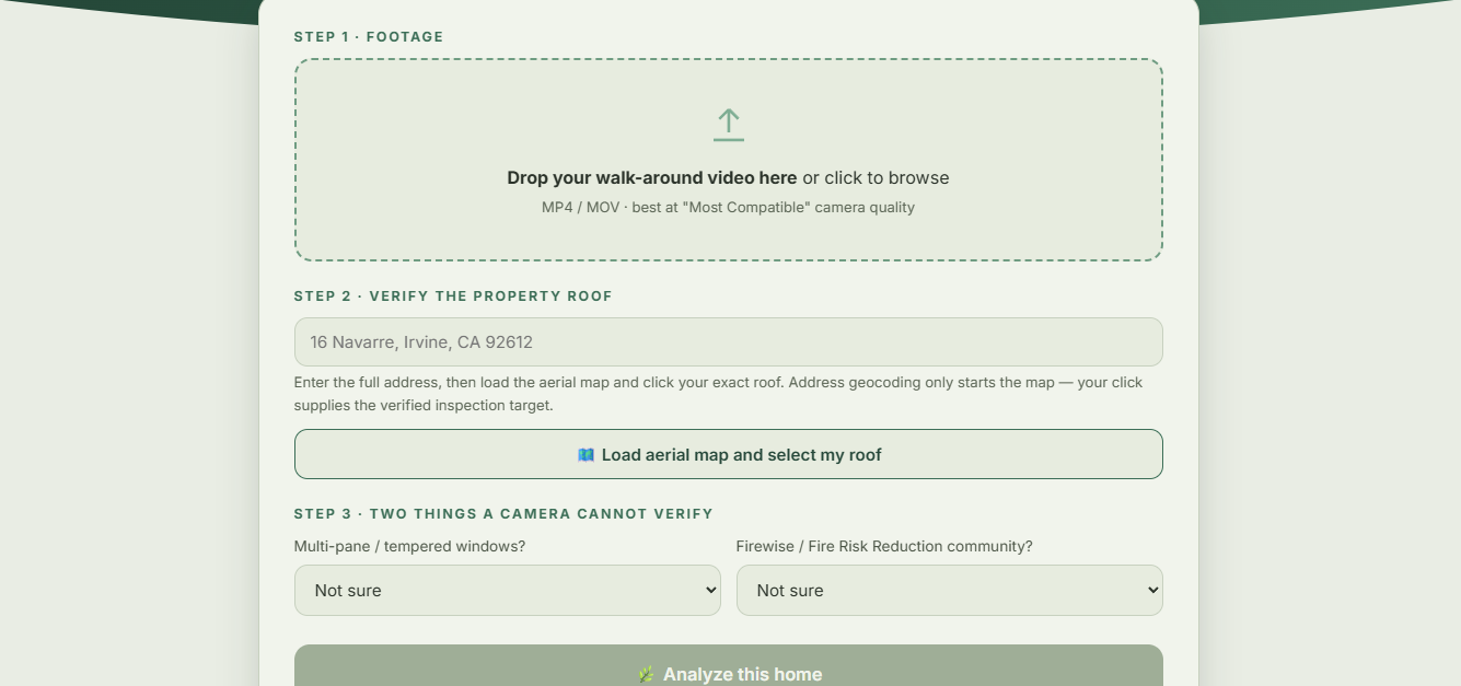
Ember lets a homeowner upload a ~30‑second walk‑around video of their house, then automatically selects sharp, motion‑rich frames and analyzes them against California’s official “Safer from Wildfires” hardening framework.
The app performs a 12‑measure inspection: roof material, vents, fencing into the structure, Zone 0 vegetation, gutters, canopy/ladder fuels, under‑deck storage, nearby sheds, and community Firewise participation, and turns all of that into a weighted ignition‑risk score and uncertainty band.
It independently measures vegetation coverage using an Excess‑Green (ExG) spectral index on raw pixels, and uses that measurement to corroborate whether vegetation actually exists near the wall instead of just guessing from model output.
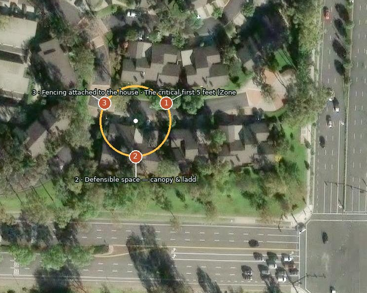
If the homeowner confirms a roof target on an aerial map, Ember fetches satellite imagery, reasons about compass bearings for each failed finding, and renders a final aerial “finding map” with numbered pins around the home.
Finally, it generates a branded, insurer‑ready PDF packet with an executive summary, finding table, AI‑annotated exhibits, methodology section, and a tamper‑evident SHA‑256 fingerprint over the results.
How we built it
On the backend, we built a FastAPI service that orchestrates video upload, background jobs, progress reporting, satellite geocoding, and PDF generation.
For computer vision, we use OpenCV to decode the video, compute Laplacian‑based sharpness, and optical flow to pick frames where the camera was actually moving—those motion peaks tend to contain the most informative views of the perimeter.
Wildfire‑specific reasoning is handled by Gemini vision models: we send selected frames plus a highly constrained JSON prompt that maps visual evidence to “yes/no/unclear” decisions for each hardening measure, and we treat “unknown” explicitly in our scoring band instead of pretending certainty.
We use Census and OpenStreetMap geocoding plus Esri World Imagery tiles to build an aerial canvas, then overlay a crosshair, north arrow, scale bar, and numbered pins where the AI believes each failed finding sits relative to the roof.
The Streamlit frontend wraps this into a calm, green‑themed UI with live status updates, technical findings tabs, AI witness notes, and a one‑click PDF download, so non‑technical users can still understand the inspection.
Challenges we ran into
Getting robust video decoding in a browser‑style workflow was surprisingly hard—HEVC videos and “Most Compatible” settings on phones caused failures we had to detect and explain clearly to the user.
Designing the Gemini prompt so it stayed strictly in JSON, didn’t hallucinate conditions, and respected “unclear” rather than over‑confident “yes/no” took multiple iterations and careful error handling around overloaded models.
Aerial mapping introduced both geospatial and UX challenges: we had to translate Mercator tile math to something homeowners could trust visually, and avoid placing findings on an unverified parcel if the user didn’t select a roof target.
Building a tamper‑evident fingerprint that felt meaningful required deciding which fields to hash, how to format an ID that looks like a report number, and making sure it could be recomputed from the PDF contents without exposing internals.
Accomplishments that we're proud of
We’re proud that Ember doesn’t just show “AI says yes/no”—it produces a rigorous score band that exposes uncertainty rather than hiding unknowns, which is rare in consumer‑facing risk tools.
The combination of motion‑aware frame sampling, ExG vegetation measurement, and Gemini‑based inspections gives homeowners a multi‑layered assessment that blends classic remote sensing with modern vision‑language models.
We managed to go from raw walk‑around video to a fully formatted technical packet—complete with evidence exhibits, aerial map, and integrity fingerprint—in a single flow that feels like a real pre‑inspection report.
We also like that the UI speaks in plain English (“What’s already protecting this home”, “What to fix in the order that matters”) while still exposing all the technical findings for insurers and engineers.
What we learned
We learned how sensitive AI systems are to video capture details: codec choices, sharpness, motion, and frame sampling strategies can make or break a vision pipeline long before a model sees the input.
We saw firsthand that embedding domain knowledge—like formal hardening frameworks, vegetation indices, and ladder‑fuel concepts—into prompts and scoring logic dramatically improves the usefulness of AI compared to generic “image captioning.”
We deepened our understanding of geospatial tooling, from tile math and Mercator projections to how to safely combine public imagery with user confirmation for property‑level reasoning.
Finally, we learned how important it is to represent uncertainty explicitly in risk scores; building bands and narrative around “unknown” items felt more honest than a single, over‑precise number.
What's next for Ember
Next, we want to integrate more data sources—parcel polygons, local fire history, and community‑level risk metrics—so Ember can contextualize a single home inside its neighborhood and wildland interface.
We plan to add a homeowner dashboard that tracks progress over time, showing which recommendations have been completed and how the hardening score band narrows as uncertainty is reduced.
We’re also exploring insurer and fire‑department partnerships, so Ember’s evidence packets can plug directly into underwriting workflows or community mitigation programs instead of just being a one‑off report.
Longer term, we’d like to expand beyond California, adapting Ember to other regions’ wildfire frameworks and eventually to related hazards like wind‑borne debris and storm surge.
Built With
- css
- javascript
- python
- render
- vscode

Log in or sign up for Devpost to join the conversation.