-
EcoVision
Inspiration
EcoVision is an application that aims to empower everyday people to see how their small actions can make a big environmental difference.
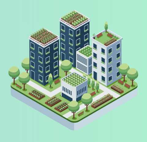
We wanted to answer questions like, "What if those buildings were a patch of forest?" or "What if we installed solar panels there?"
Using Machine Learning and AI, EcoVision helps build greener and more inclusive cities.
We believe that technology used for sustainability is one of the best uses of innovation — which is why EcoVision is a platform designed for urban planners who want to optimize sustainability in a given region.
What it does
EcoVision is an AI-powered tool that utilizes data from Google Earth Engine (GEE) to help urban planners — or even regular users — visualize the impact of environmental changes in their city.
The tool:
- Fetches satellite and environmental data from GEE (from the past year to the present).
- Allows users to segment an area of the city they select.
- Analyzes this data using the Gemini API, providing personalized reasoning and sustainability recommendations.
How we built it
Tech Stack:
- Frontend: React + TailwindCSS + Mapbox (for the interactive and accessible map interface)
- Backend: FastAPI (Python) for geospatial processing and AI integration
Data Sources:
- OpenStreetMap for buildings and green areas
- Global Solar Atlas for solar irradiance data
- Custom eco-facts JSON dataset compiled from WWF and UN SDG resources
AI Integration:
- GPT-powered chatbot trained with our eco-fact database for personalized responses
DevOps:
- Docker + GitHub Actions for CI/CD
Challenges we ran into
Some of the main challenges included:
- Integrating geospatial datasets for real-time satellite imagery
- Implementing the SAM (Segment Anything Model) deep learning framework
- Passing GEE analysis results into Gemini for coherent AI responses
- Designing accessibility features that go beyond checkboxes — including support for dyslexia and vision impairments
Accomplishments that we're proud of
- Successfully combined geospatial data, AI, and sustainability goals into one platform
- Built an inclusive design focused on accessibility
- Learned and implemented real-world integration between GEE, Gemini, and FastAPI
- Used an advanced deep learning model like Segment Anything Model (SAM) by Meta to process satellite data.
What we learned
We learned:
- How to use Google Cloud Console tools like GEE
- How to integrate Gemini for data-driven environmental insights
- That small, data-backed insights can communicate complex sustainability ideas
- The importance of teamwork — starting as strangers, we learned to combine our strengths to create something impactful
What's next for EcoVision
We plan to:
- Integrate more accurate datasets for improved area segmentation and precision
- Add dyslexia-friendly fonts and gesture-based accessibility for sign language users
- Explore Blockchain integration to gamify sustainability — rewarding users (and urban planners) with crypto incentives for optimal eco-friendly solutions
Built With
- autho
- css
- gemini
- gemini-api
- google-cloud
- google-generativeai
- htm
- machine-learning
- node.js
- pygments
- python
- react
- sam


Log in or sign up for Devpost to join the conversation.