EcoTwin FloodWatch
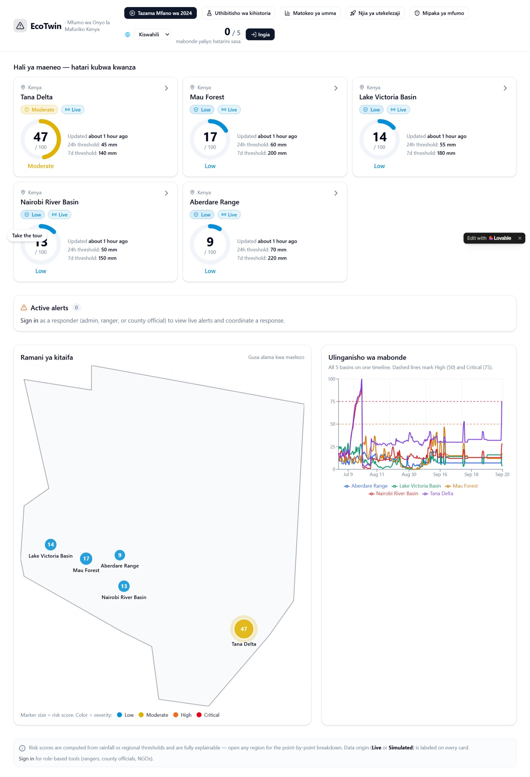
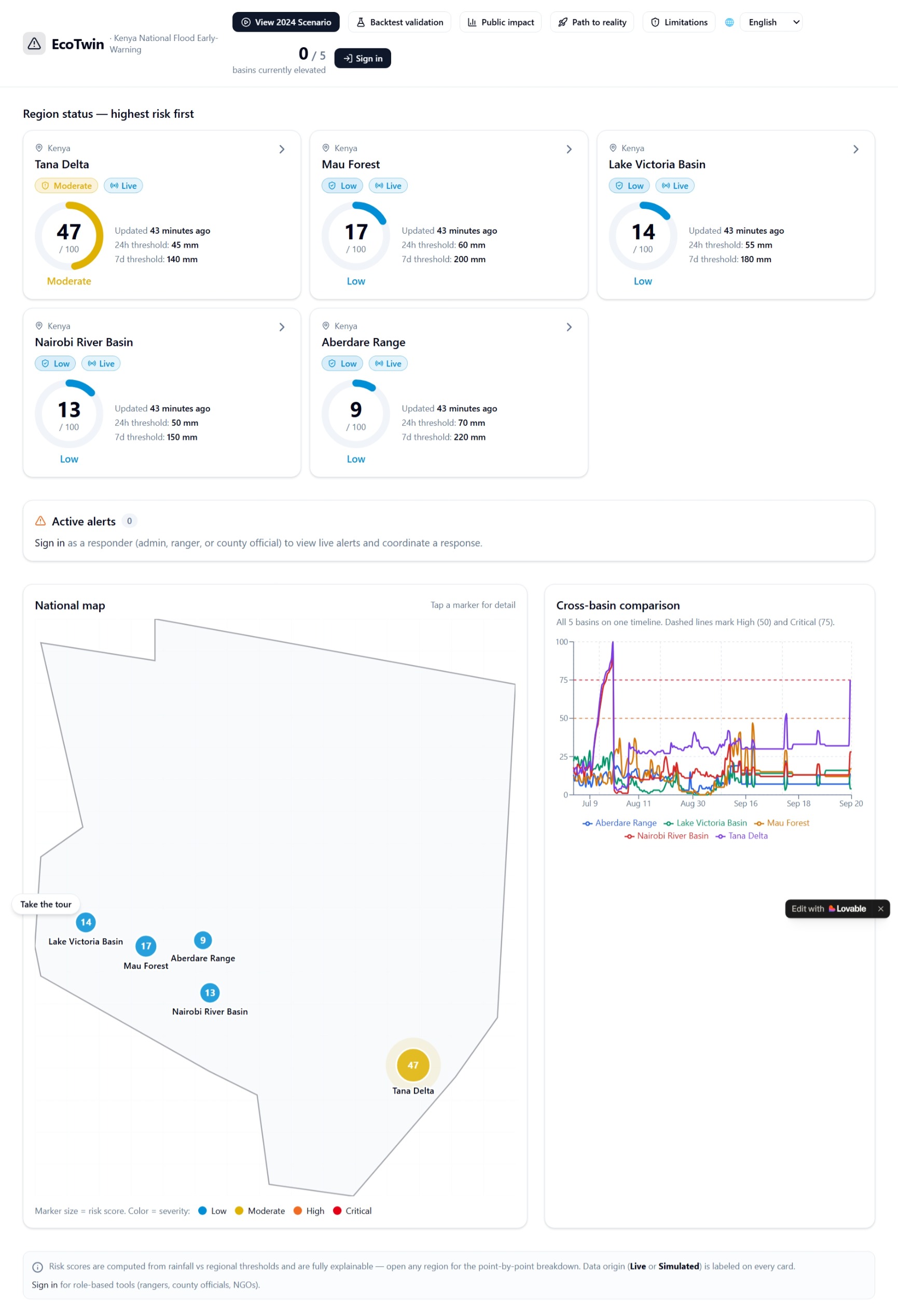
EcoTwin FloodWatch is an environmental intelligence platform designed to transform environmental data into clear, localized flood-risk information.
The Problem
Flooding can develop rapidly, while environmental information is often scattered across different sources. Raw environmental data can be difficult to interpret without a system that connects it to location and risk.
EcoTwin FloodWatch brings environmental information, spatial visualization, and flood-risk insights together in one platform.
How It Works
The system follows an end-to-end workflow:
Environmental Data → Processing → Risk Analysis → Spatial Visualization → Flood-Risk Information
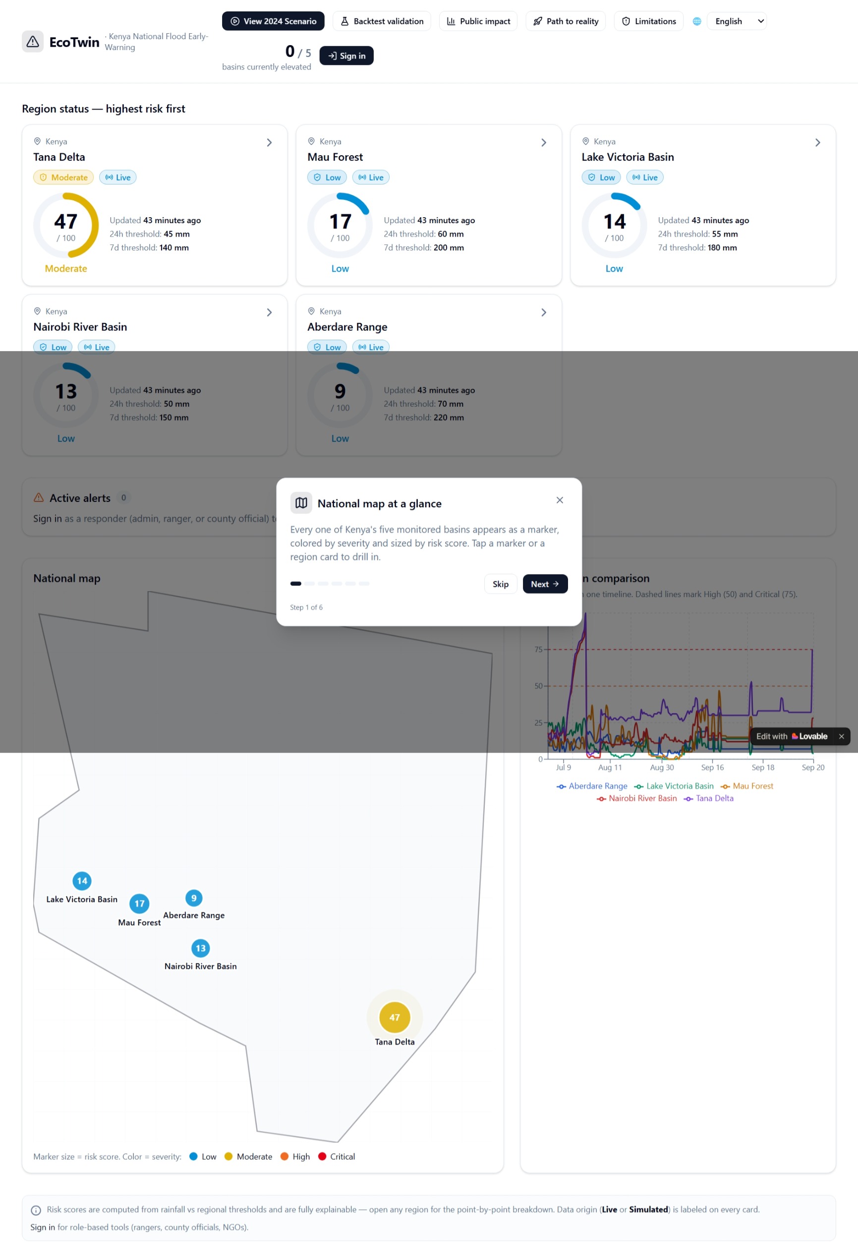
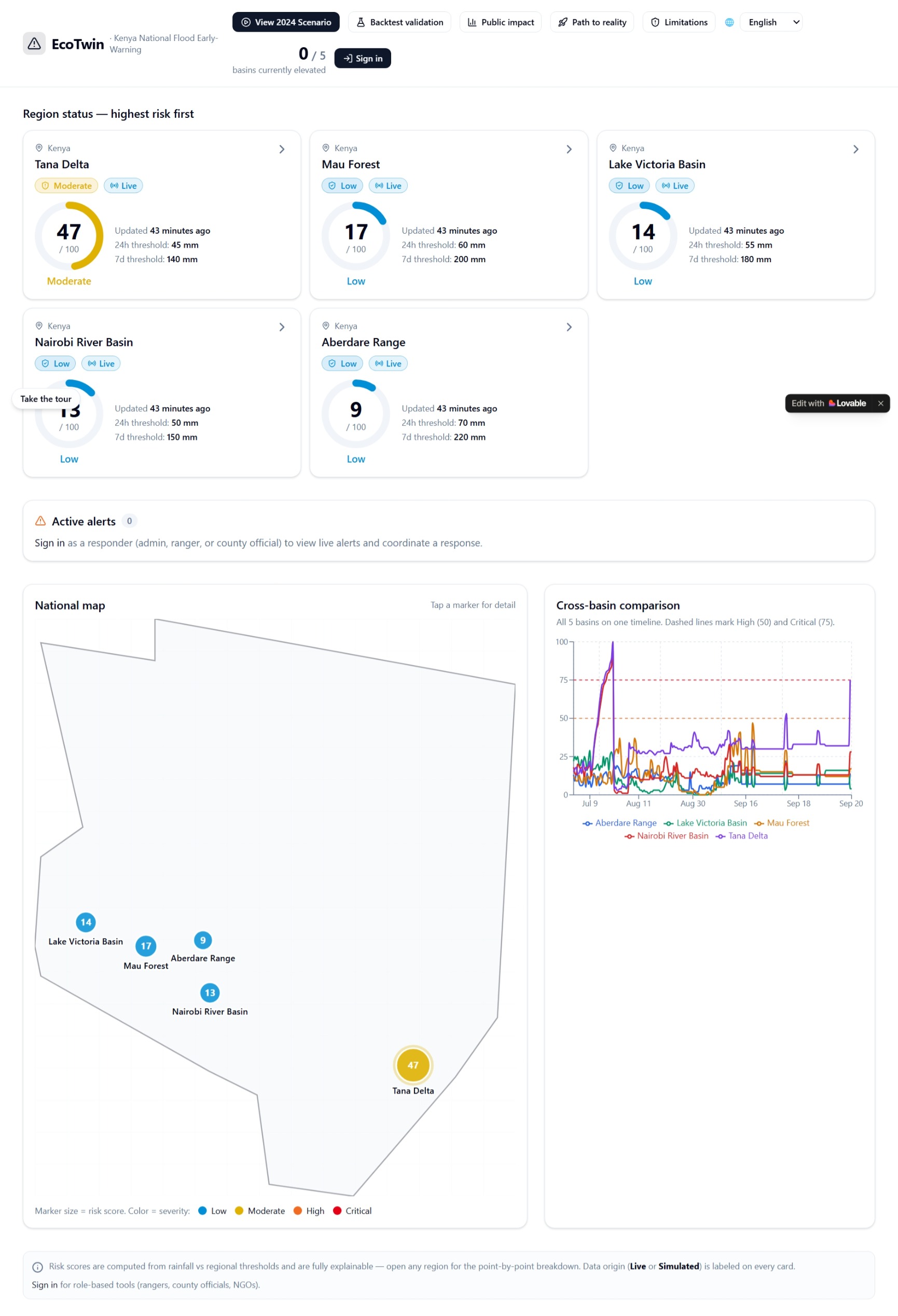
Users can explore environmental conditions through an interactive web interface and access location-based flood-risk information.
Key Features
- Interactive flood-risk monitoring
- Environmental data visualization
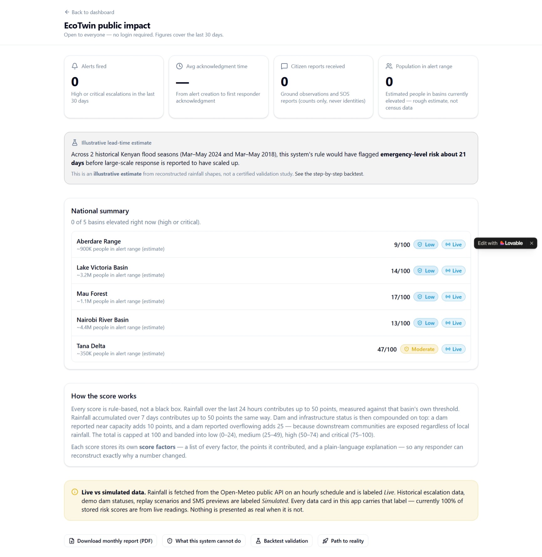
- Location-based flood information
- Interactive maps and spatial visualization
- Environmental condition monitoring
- Flood-risk awareness
- Web-based access
Technical Approach
EcoTwin FloodWatch is designed as a data-driven environmental monitoring system rather than a static information page.
The system connects data collection, processing, analysis, spatial representation, and the user interface into a single workflow.
This architecture provides a foundation for incorporating additional datasets and more advanced analytical and forecasting methods.
Why We Built It
The project was motivated by a simple question:
How can environmental data be transformed into information that people can understand and use before flood conditions become more severe?
EcoTwin FloodWatch focuses on connecting environmental information with location and risk awareness rather than presenting isolated measurements.
Challenges
One of the main challenges was combining environmental information with an intuitive spatial interface while keeping the system understandable to both technical and non-technical users.
Another challenge was developing a complete working application within a limited development period while maintaining a clear connection between the underlying information and what users see.
What We Learned
Building EcoTwin FloodWatch demonstrated that environmental technology requires more than an attractive interface. Data quality, processing, spatial representation, usability, and system architecture all influence how useful environmental information becomes.
Future Development
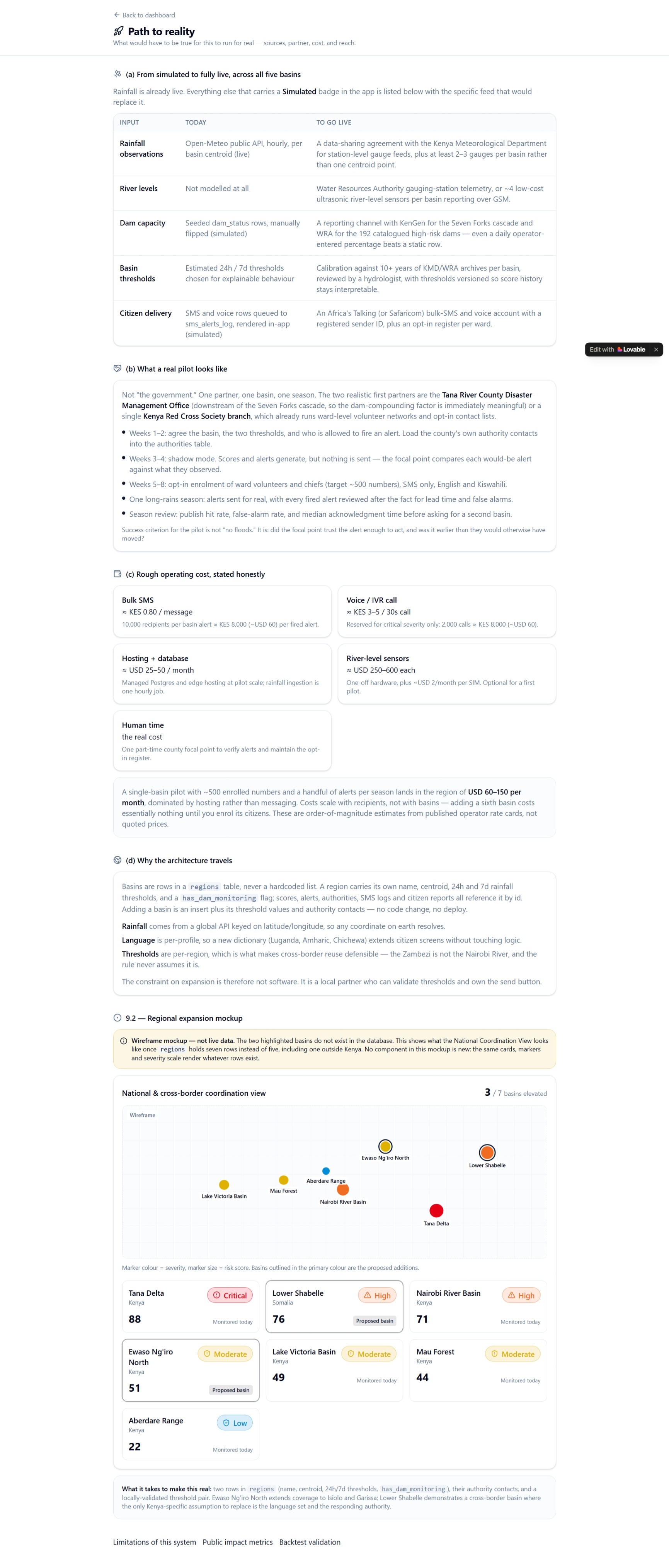
Future versions could incorporate additional environmental datasets, historical trend analysis, higher-resolution spatial information, improved flood forecasting, uncertainty estimates, and additional alert channels.
The long-term goal is to develop EcoTwin FloodWatch into a broader environmental intelligence platform for flood-risk awareness and decision support.
Built With
- apis
- css
- data
- environmental
- geospatial
- gis
- javascript
- next.js
- react
- supabase
- tailwind
- typescript
- visualization
- web

Log in or sign up for Devpost to join the conversation.