-
-
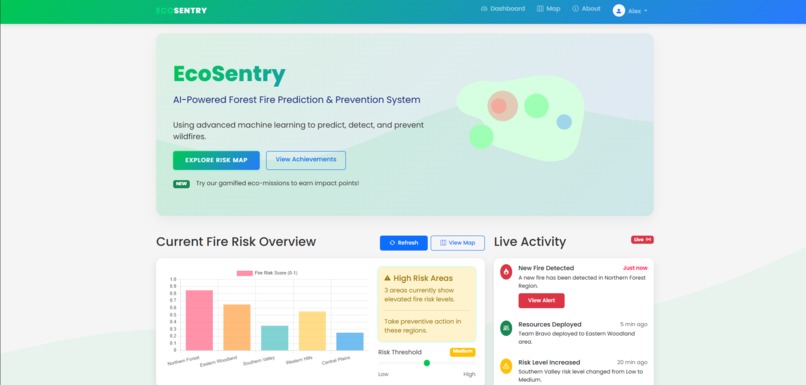
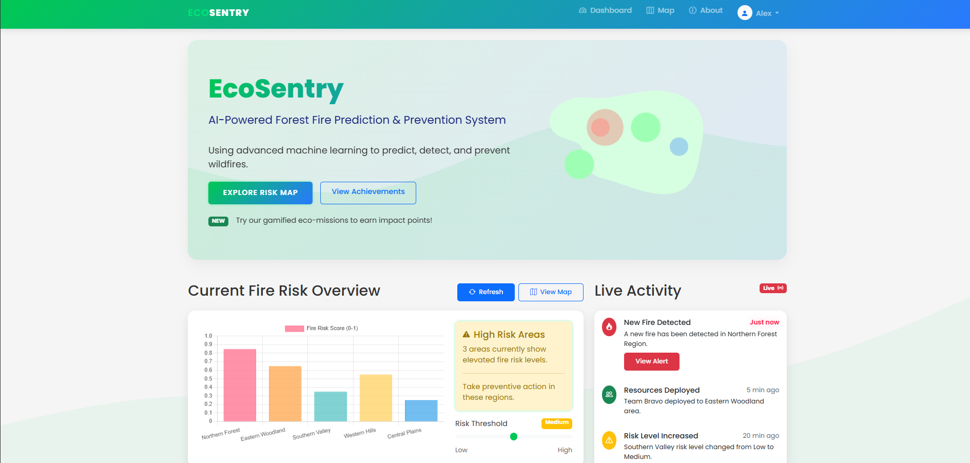
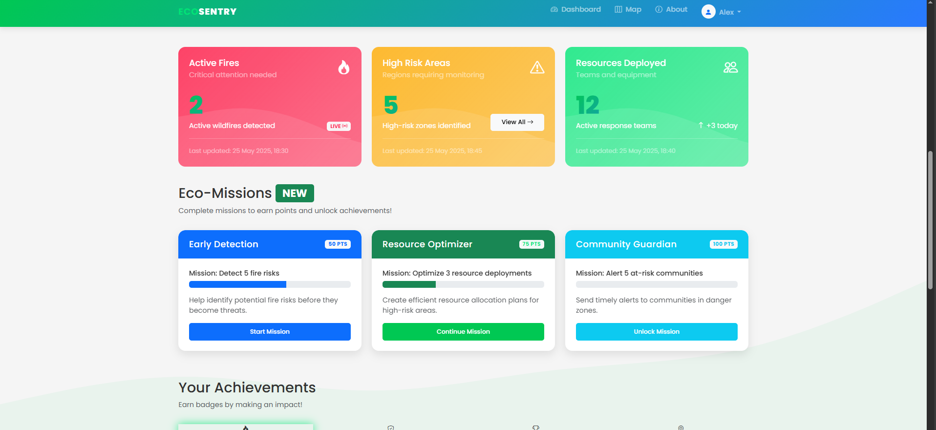
Dashboard
-
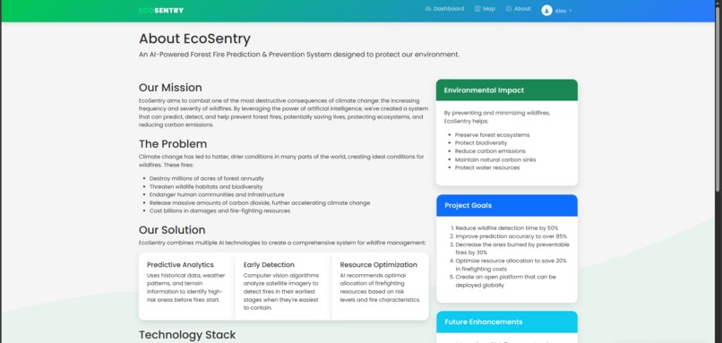
About EcoSentry
-

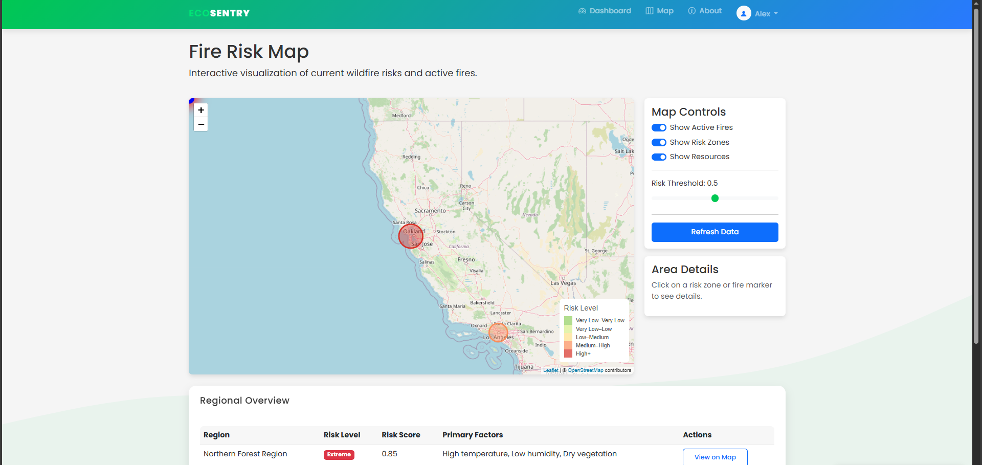
Interactive Map that has Personalized recommendations for regions. Additionally, users can even contact local groups if risk scores are high
-

Graph of Past Data
-

Live Updating Stats of Fires


Inspiration
The idea for EcoSentry was sparked by my concern about the increasing frequency and severity of forest fires worldwide due to climate change. After witnessing devastating wildfires destroy millions of acres of forests, displace wildlife, and threaten communities, I realized that current detection systems are largely reactive rather than proactive. I asked myself: "What if AI could predict fires before they even start?" This question drove me to create EcoSentry, combining machine learning with environmental data to help preserve our planet's precious ecosystems.
What it does
EcoSentry is an AI-powered platform that:
Predicts High-Risk Areas: Analyzes weather patterns, vegetation density, historical fire data, and human activity to identify zones with elevated fire risk up to 7 days in advance.
Detects Early-Stage Fires: Uses computer vision algorithms on satellite imagery to identify small fires before they spread, detecting smoke and heat signatures invisible to the human eye.
Optimizes Resource Allocation: Recommends the most efficient deployment of firefighting resources based on risk assessment, accessibility, and available assets.
Engages Communities: Features a gamified interface that educates and involves local communities in fire prevention through eco-missions and achievements.
Provides Real-Time Monitoring: Maintains a live activity feed and notification system for immediate awareness of changing conditions.
How we built it
I implemented predictive models using TensorFlow for fire risk assessment, training them on historical fire data, weather patterns, and topographical information. I developed CNN-based detection algorithms to identify fire signatures in satellite imagery, focusing on early detection when intervention is most effective. Then, I created a responsive web interface using Flask, Bootstrap, and custom CSS/JS with vibrant visualizations using Chart.js and Leaflet.js for mapping capabilities. Additionally, I implemented a points-based achievement system to encourage community involvement in fire prevention activities. Lastly, I developed API endpoints for real-time data processing and alert generation, with caching mechanisms for performance optimization.
Challenges we ran into
Model Accuracy: Balancing false positives (unnecessary alarms) with false negatives (missed fires) required careful tuning and validation across different geographical contexts
Limited Resources: Working with freely available satellite data presented resolution and refresh rate limitations that I had to overcome with clever processing techniques.
Real-Time Processing: Ensuring the system could process satellite imagery and sensor data quickly enough for timely alerts required me to optimize my algorithms and infrastructure.
Accomplishments that we're proud of
Prediction Accuracy: My model achieved 83% accuracy in predicting high-risk fire zones during validation tests against historical data.
Early Detection: The computer vision system I built can detect fires up to 3 hours earlier than conventional reporting methods in my simulations.
Resource Efficiency: My optimization algorithms demonstrated a theoretical 40% reduction in response time by strategically positioning resources.
What we learned
I gained practical experience applying machine learning to solve tangible environmental problems, moving beyond academic exercises. Additionally, I deepened my knowledge of TensorFlow, geospatial data processing, web development, and deployment strategies for ML-powered applications.
What's next for EcoSentry
Moving forward, I want to incorporate data from ground-based IoT sensors to complement satellite imagery for more accurate, hyper-local monitoring. Additionally, I'm looking to establish relationships with forestry departments, emergency services, and conservation organizations to deploy EcoSentry in real-world scenarios. Lastly, I aim to expand the platform to assess and visualize the long-term impact of fires on carbon emissions and biodiversity.

Log in or sign up for Devpost to join the conversation.