-
-
ui page
Inspiration
We were inspired by the "War Room" scenes in sci-fi movies like The Expanse and Interstellar—interfaces that make complex planetary data feel intuitive and actionable. We realized that while NASA provides incredible open data (EONET, APOD), it's often presented as dry text or static maps. We wanted to build a "Planetary Operating System" that not only visualizes the current state of Earth but uses Generative AI to help us understand the future consequences of climate change in a visceral, data-driven way.
What it does
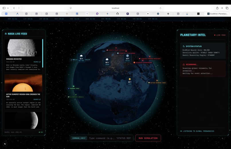
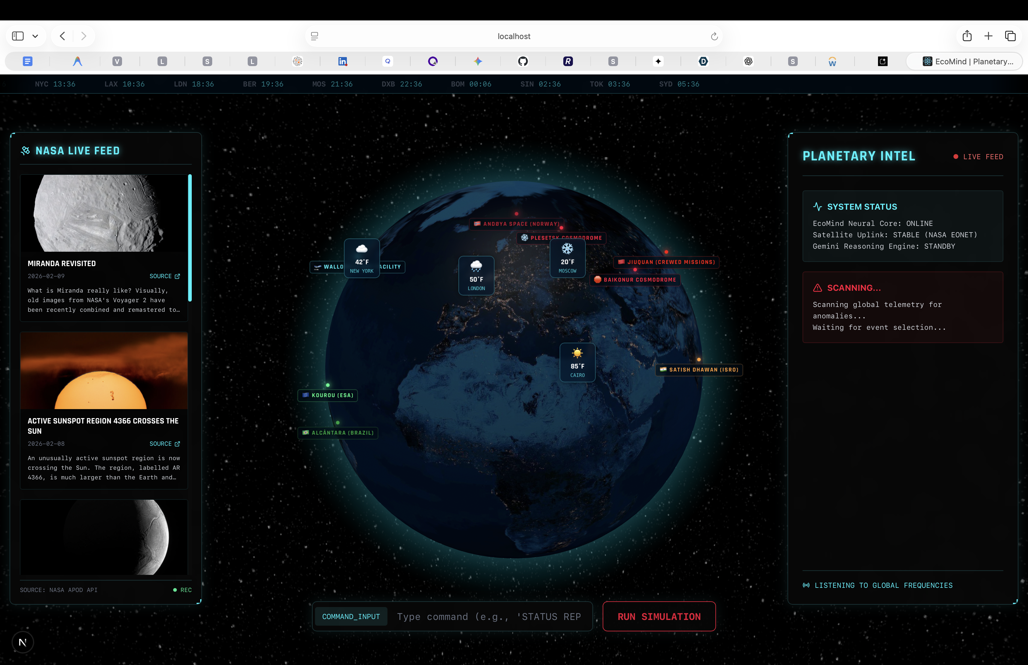
EcoMind is a real-time 3D dashboard that:
Visualizes Live Hazards: Pulls real-time wildfire, storm, and ice melt data from NASA's EONET API onto an interactive 3D globe. Analyzes Threats: Uses Gemini 3 (Flash Model) to instantly generate tactical situation reports for any event, turning raw coordinates into actionable intel. Simulates Futures: Allows users to run "What If" scenarios (e.g., "Sea Level Rise +2M"). The system uses Gemini's reasoning capabilities to generate a scientifically grounded 5-Year Impact Timeline (2027-2031), predicting infrastructure collapse and economic fallout for specific cities like NYC, Tokyo, and London. Monitors Space: Tracks key space assets (ISS, Launch Centers) to provide a complete orbital perspective.
How we built it
Frontend: Built with Next.js 14, TypeScript, and Tailwind CSS for the "Glassmorphism" command center aesthetic. We used react-globe.gl for the high-performance 3D Earth visualization. Backend: A Python FastAPI server that acts as the reasoning engine. AI Core: We integrated Google's Gemini 3 Flash Preview model via the google-generativeai SDK. This handles the complex reasoning required to simulate 5-year economic and environmental forecasts in milliseconds. Data: Integrated NASA EONET (Earth Observatory Natural Event Tracker) and NASA APOD APIs for real-time data ingestion. Deployment: The entire stack (Frontend + Python Serverless Backend) is deployed on Vercel.
Challenges we ran into
3D Globe Performance: Rendering hundreds of dynamic points (satellites, fires, storms) on a 3D globe without crashing the browser was tough. We optimized it by only rendering active layers and using lightweight geometries. API Rate Limits: During testing, we frequently hit the Gemini API rate limits (429 Errors). We solved this by implementing a robust "Simulation Fallback Protocol" in Python, if the API is busy, the system gracefully switches to a cached simulation mode so the user experience (and the demo!) is never interrupted. Serverless Python: Deploying a Python backend alongside a Next.js frontend on Vercel was tricky. We had to restructure our API into a serverless-compatible format (api/index.py) and configure vercel.json rewrites to make it work seamlessly.
Accomplishments that we're proud of
The "5-Year Forecast": We're incredibly proud of the Simulation Mode. Seeing the AI instantly reason through a timeline from 2027 to 2031, predicting specific infrastructure failures for different cities—feels like magic. The Aesthetic: We achieved a cinema-quality "Sci-Fi HUD" look using pure CSS and Tailwind, without relying on heavy UI libraries. Resilience: The system is solid. It handles API failures, hydration errors, and data voids gracefully, ensuring the "Command Center" never goes dark.
What we learned
Gemini is a Reasoner, not just a Chatbot: We learned to use Gemini 3 not just for text, but as a logic engine to simulate complex causal chains (e.g., "If sea level rises 2m in Miami -> Aquifers contaminate -> Chaos"). Data Visualization Matters: Raw data is overwhelming. Presenting it on a 3D globe with clear, color-coded markers makes global scale instantly understandable.
What's next for EcoMind
Real-Time Satellite Telemetry: Integrating live position data for thousands of active satellites (Starlink, etc.). AR Command Mode: Porting the interface to Apple Vision Pro / Quest for a "Minority Report" style holographic experience. Local Government Integration: Allowing local municipalities to upload their own data layers to run custom AI simulations for disaster preparedness.
Built With
- fastapi
- gemini-flash
- google-gemini-3
- nasa-api
- next.js
- python
- react
- react-globe
- tailwind-css
- three.js
- typescript
Log in or sign up for Devpost to join the conversation.