-
-
1
-
2
-
3
-
4


Earthquake Risk and Preparedness Simulation
Inspiration
Earthquakes are inevitable, but their impact is not.
We were inspired by how difficult it is for governments, NGOs, and even individuals to understand earthquake risk in a clear, location-specific, and actionable way. While large amounts of seismic data are publicly available, they are often fragmented, technical, and inaccessible to non-experts.
Our goal was to transform raw earthquake data into an interactive risk simulation and visualization platform that helps users quickly assess seismic risk at the country level and explore historical earthquake and tsunami patterns interactively.
What it does
Earthquake Risk and Preparedness Simulation is an interactive data-driven application that:
- Analyzes historical earthquake events (1995–2023).
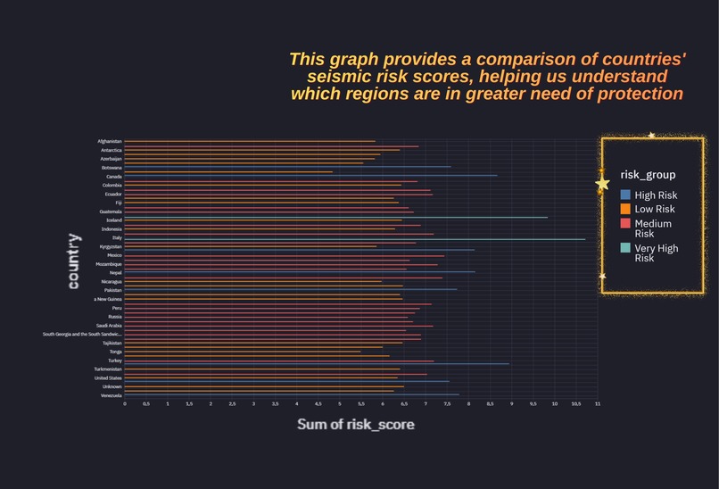
- Calculates country-level earthquake risk scores.
- Classifies countries into discrete risk groups (Low $\rightarrow$ Very High).
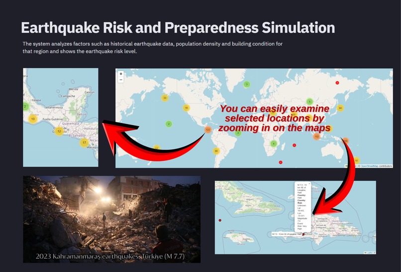
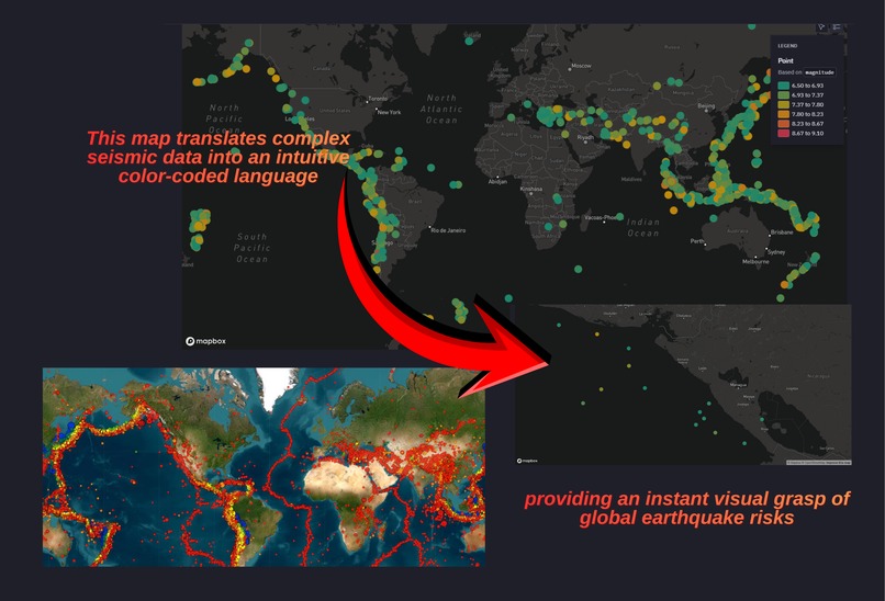
- Visualizes earthquakes on an interactive global map.
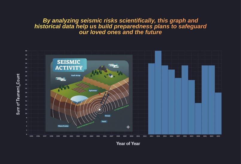
- Shows tsunami occurrence summaries and yearly trends.
- Allows users to select a country and instantly see localized insights.
The system combines seismic intensity, magnitude, tsunami occurrence, and signal strength into a composite risk metric to provide a clear, explainable assessment of seismic danger.
How we built it
We built the project as a data pipeline + visualization app using:
- Python & Pandas for data cleaning, preprocessing, and aggregation.
- Custom risk scoring logic combining multiple seismic indicators.
- Folium & Leaflet for interactive geospatial visualization.
- Hex Platform for building an interactive, no-backend dashboard app.
Data Processing Pipeline
- Cleaned and normalized raw earthquake data.
- Handled missing values and inconsistent metadata.
- Aggregated earthquake statistics at the country level.
- Computed a composite risk score using weighted factors:
$$\text{Risk Score} = 0.4 \times \text{Magnitude} + 0.3 \times \text{MMI} + 0.2 \times \frac{\text{SIG}}{100} + 1.0 \times \text{Tsunami}$$
- Classified countries into risk categories.
- Connected all outputs to interactive maps and charts.
Challenges we ran into
- Data Quality: Missing and incomplete metadata (continent, alert levels, locations).
- Integration: Aligning event-level data with country-level risk analysis.
- Logic Design: Designing a risk score that is both meaningful and explainable.
- Scalability: Ensuring visual clarity when plotting hundreds of earthquake events.
- Time Dynamics: Handling time-series aggregation issues with datetime formats.
Each challenge pushed us to improve our data engineering and validation approach.
Accomplishments that we're proud of
- Built an end-to-end earthquake risk simulation in a limited hackathon timeframe.
- Designed an interpretable risk scoring system instead of a black-box model.
- Created a fully interactive country-based exploration experience.
- Successfully combined maps, charts, and statistical summaries into one cohesive app.
- Delivered a project that balances technical depth and usability.
What we learned
- How to design composite risk metrics from heterogeneous data.
- Best practices for data cleaning and preprocessing at scale.
- The importance of explainability in risk and disaster-related systems.
- How interactive visualization dramatically improves understanding.
- How to scope and finish a data product under hackathon constraints.
What's next for Earthquake Risk and Preparedness Simulation
While this hackathon version is complete, future extensions could include:
- Vulnerability Mapping: Integrating population density and building vulnerability data.
- Live Alerts: Adding real-time earthquake feeds.
- Simulations: Scenario-based preparedness simulations.
- Reporting: Exportable reports for governments and NGOs.
- Granularity: Regional (city-level) risk analysis.
This project lays a strong foundation for data-driven disaster preparedness tools.
Built With
- csvdatasource
- folium
- hex
- jupyter-stylenotebooks
- leaflet.js
- numpy
- pandas
- python


Log in or sign up for Devpost to join the conversation.