-

Title
-
Component Selection
-

Scout
-
Eco-Vision
-
Eco-Vision Cont.

Inspiration
Some of us had recently been to a tall tower, and while enjoying the view, we wondered why so many Vancouver buildings had barren roofs when they could've had solar infrastructure or green space on top. This led us to develop the idea of E-valuate when we were brainstorming. A software that allows both consumers and enterprises to plan sustainable infrastructure.
What it does
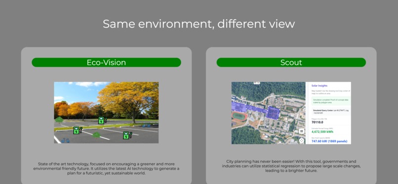
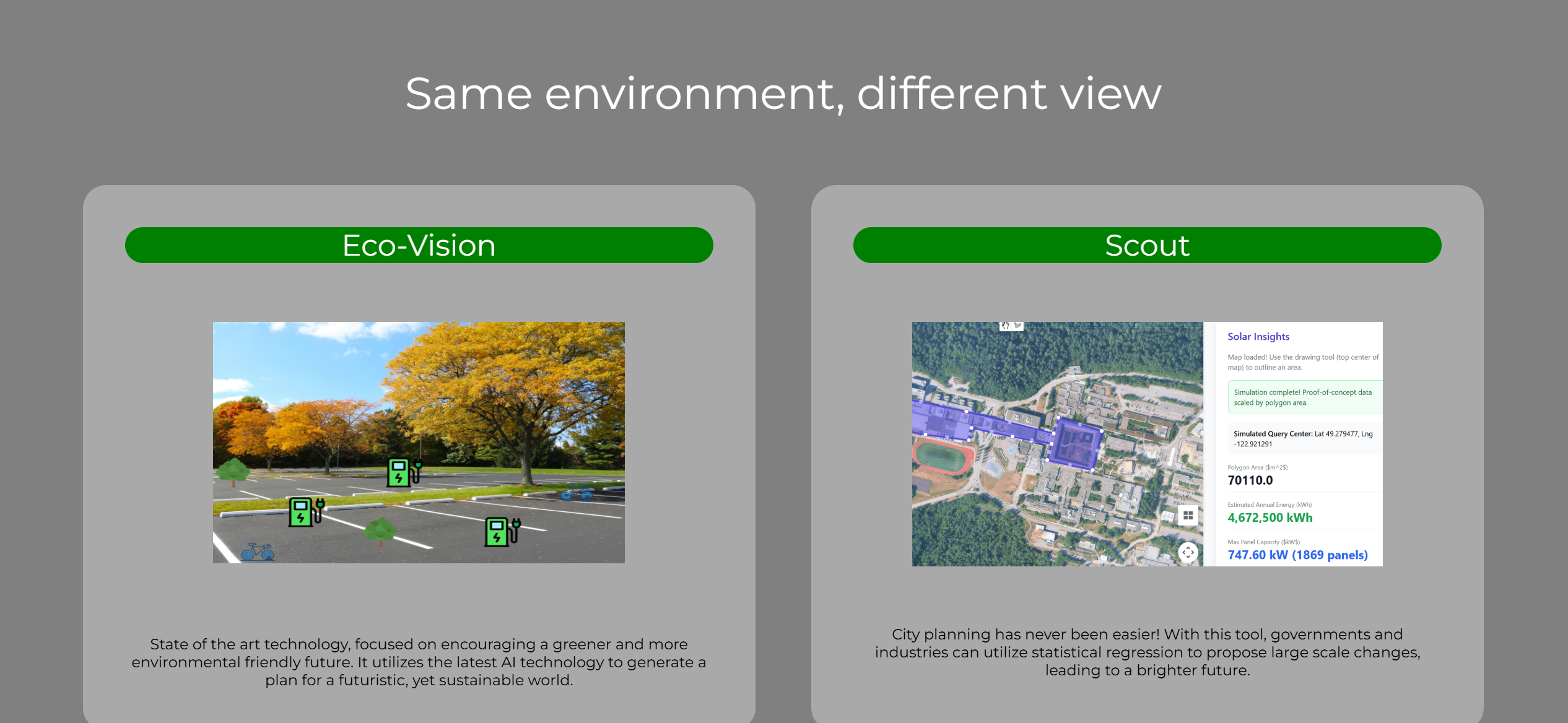
E-Valuate splits into 2 main components: eco-vision and Scout.
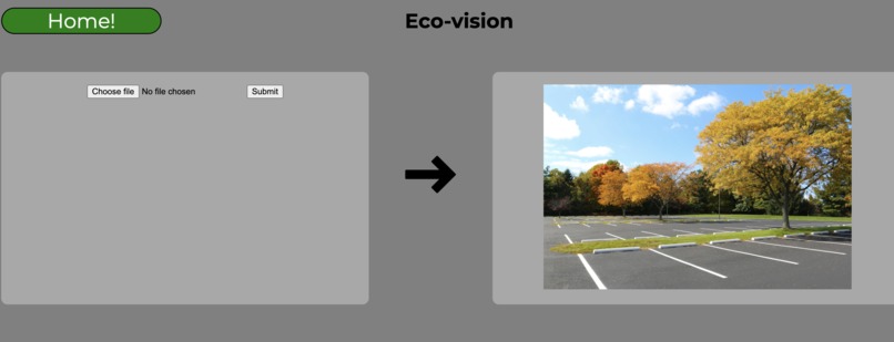
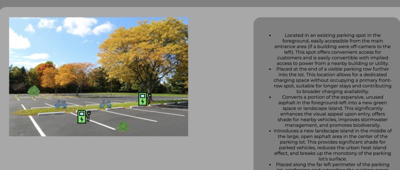
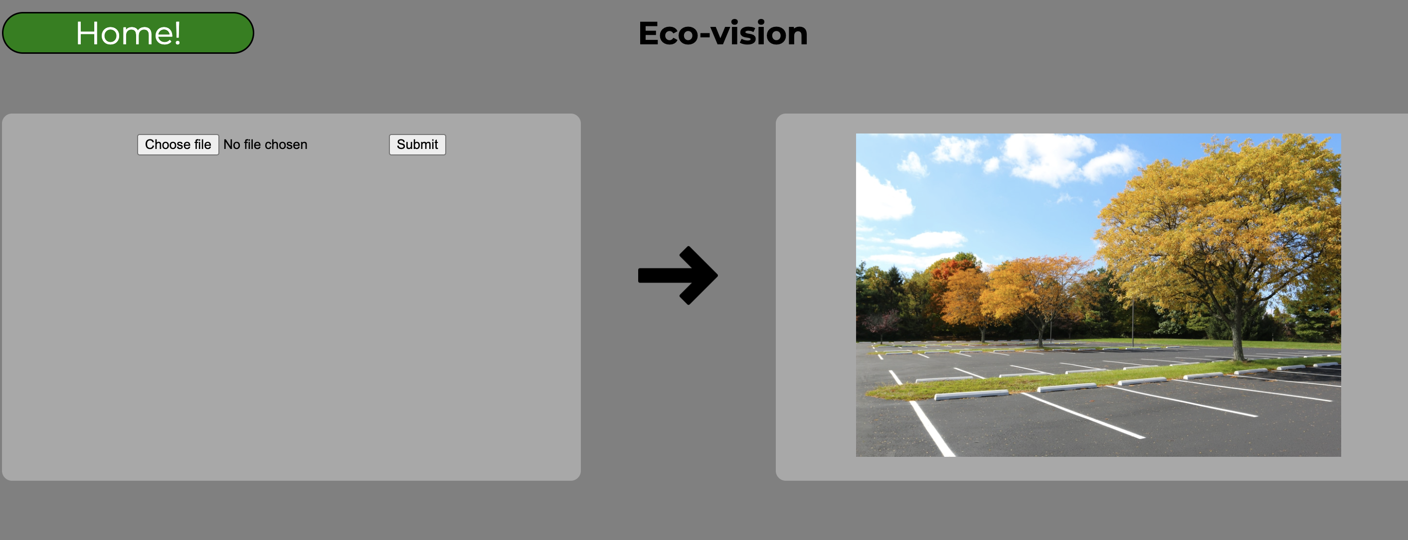
Eco-vision is a home-grade software that allows anyone to upload images of an outdoor space and receive an AI analysis, giving them suggestions on how to make their environment more sustainable. This is done through the Google Gemini api. These suggestions can be additions like green space, EV chargers, and bike racks. These suggestions are conveniently marked using an icon placed on the uploaded image, and are paired with a rationale explaining why these suggestions were made. It is made for anyone, from people improving their front yard to people planning an office parking lot.
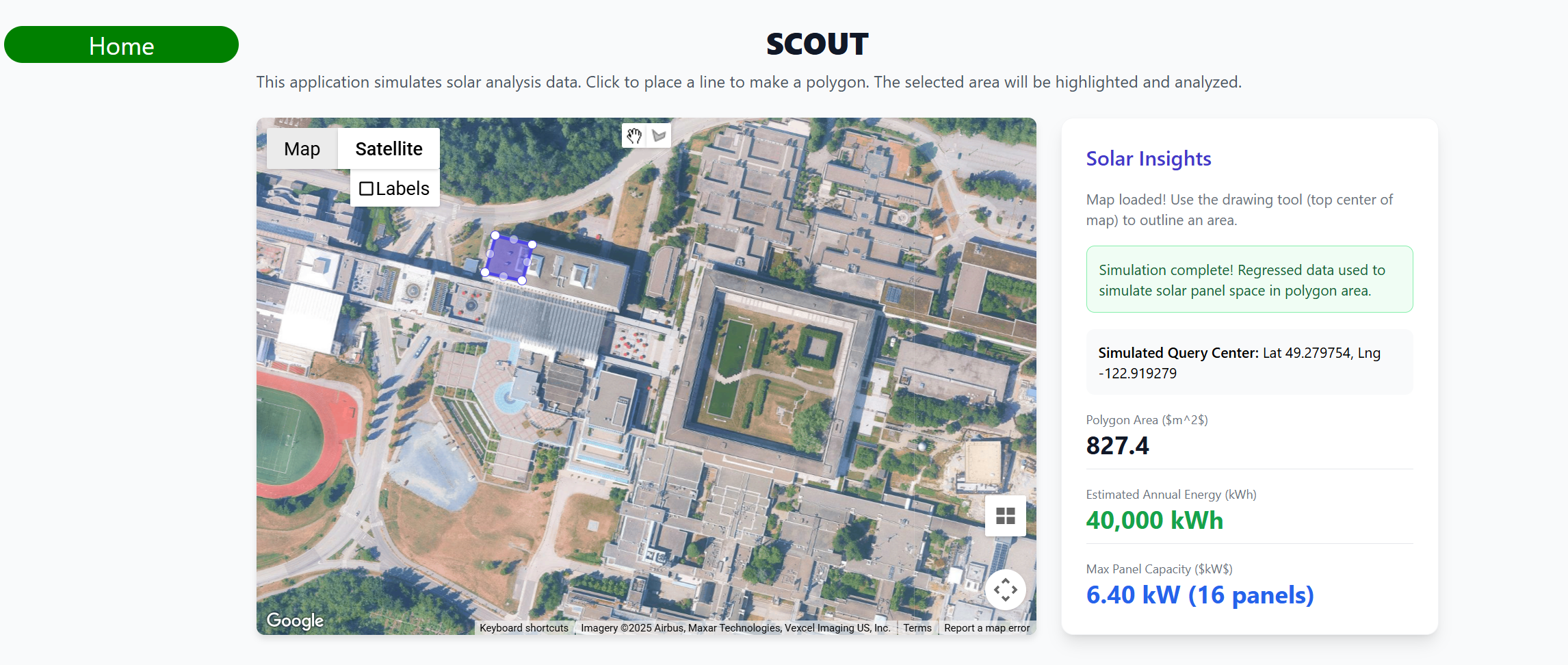
Scout is an enterprise-grade solar energy infrastructure tool that allows companies and governments to plan out solar infrastructure. It uses data that's been statistically regressed to give an accurate idea of how many solar panels could be added to an area, as well as how much energy the new solar infrastructure would bring in. It uses the Google Maps javascript api, and was made using data from Google Maps Solar.
How we built it
Andrew and Brett split the coding of the components, while Augus and Brandon worked on the front end. Andrew coded Scout using HTML, JavaScript, the Google Maps api, and information from Google Maps Solar. Brett made Eco-vision using Python, FastAPI, React.js, and the Google Gemini api. Augus and Brandon did the front end using React.js, HTML, and CSS.
Challenges we ran into
Finding usable data on solar panel infrastructure using Google Maps Solar was a new experience, and it was extremely difficult before we figured out our current design of using statistical regression. It took about 4 hours of coding before we had to pivot our initial plan of doing api pulls from Google Maps Solar directly.
Getting Google Gemini to give us coordinates for the icon placement was a tricky process of attempting a method and checking if the results were accurate, which was time-consuming and difficult.
Accomplishments that we're proud of
Being able to select a polygon of space on Google Maps and get the approximate roof space inside the polygon was a difficult process, and we were very proud of being able to accomplish this.
Giving a prompt in-depth enough that the AI will always return the same JSON format every single time it is requested was another large accomplishment, as if it were not consistent, it would have broken the eco-vision component.
What we learned
We all became far more adept in various APIs, and we had the opportunity to use time management and planning to utilize our time effectively.
What's next for E-Valuate
If able to expand, E-Valuate hopes to gain more data about solar infrastructure so we can be more accurate and give better recommendations to users, so that the amount of solar infrastructure in the world grows. We would also invest in paying for API keys so that we could expand our capabilities, especially in our AI systems.


Log in or sign up for Devpost to join the conversation.