-
-
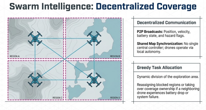
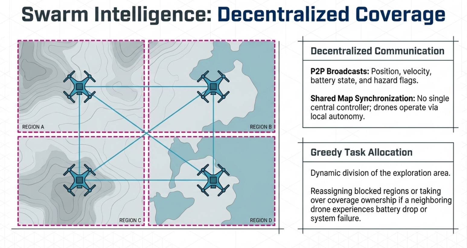
different drone cover diff area lead to faster search
-
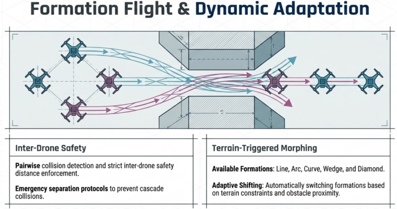
small path when only one drone can go
-
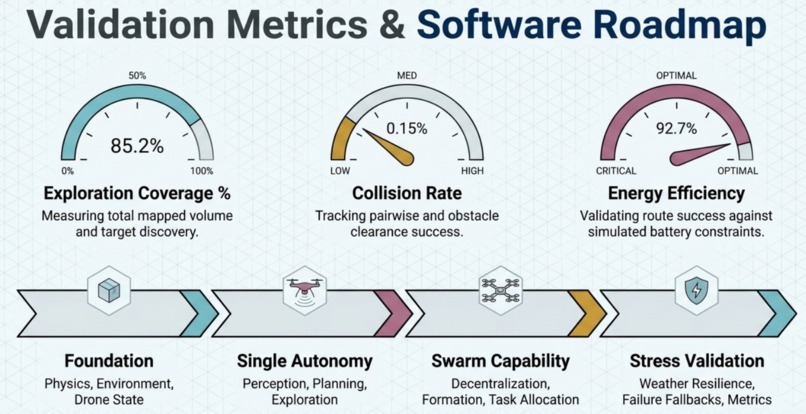
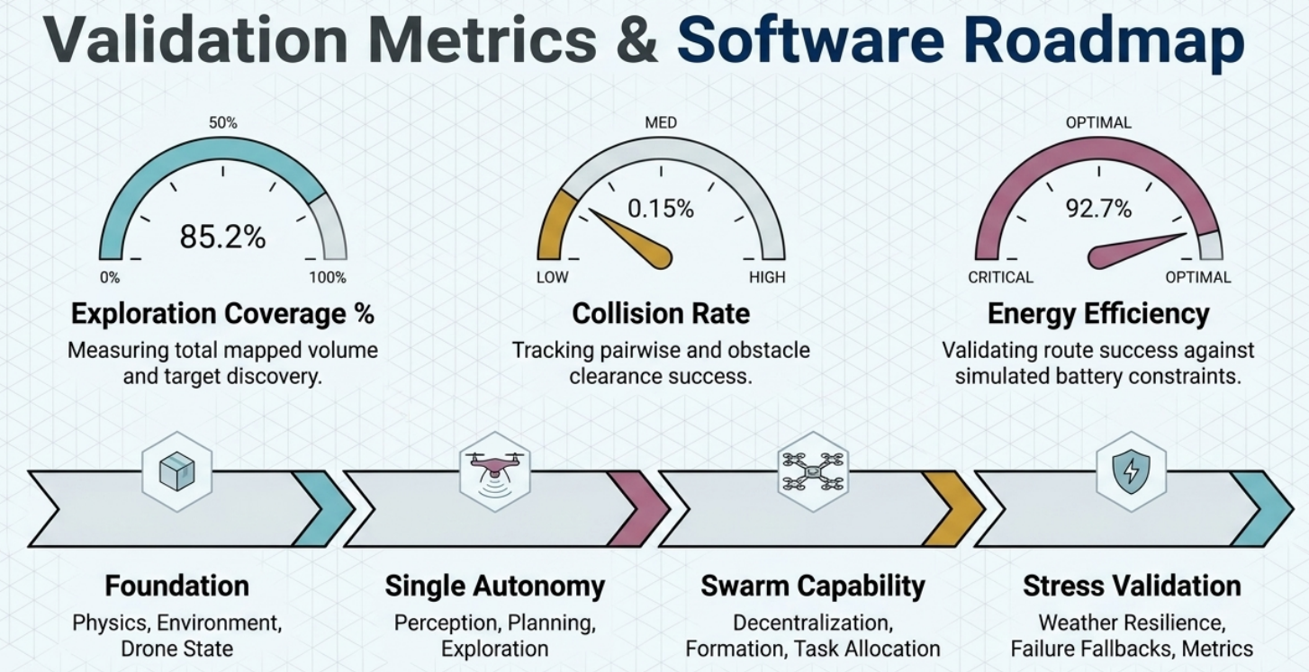
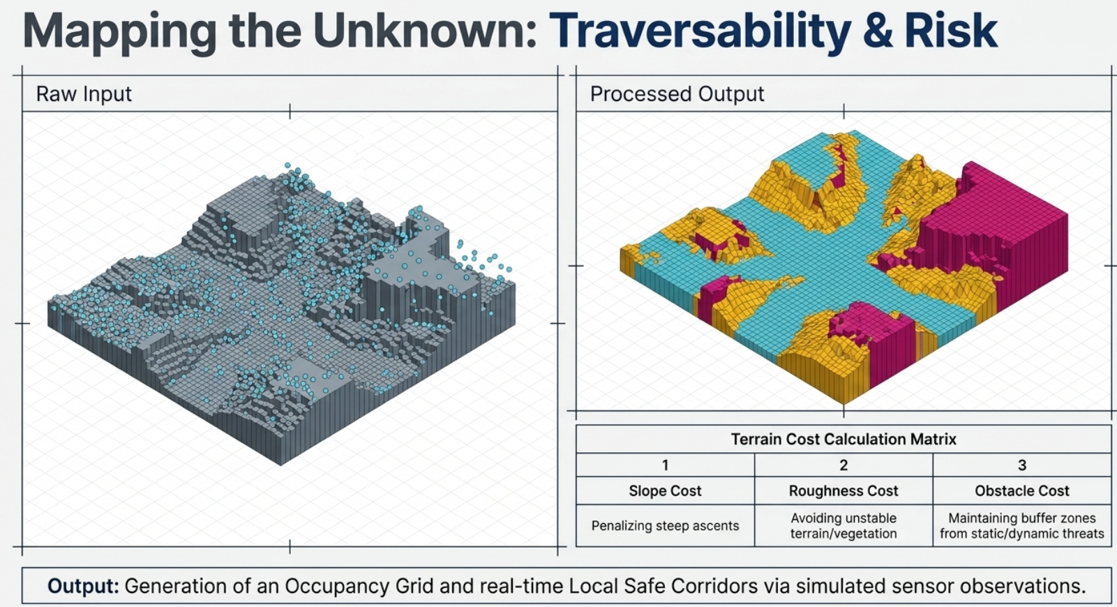
metrics
-
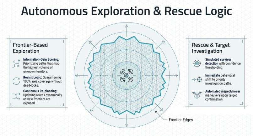
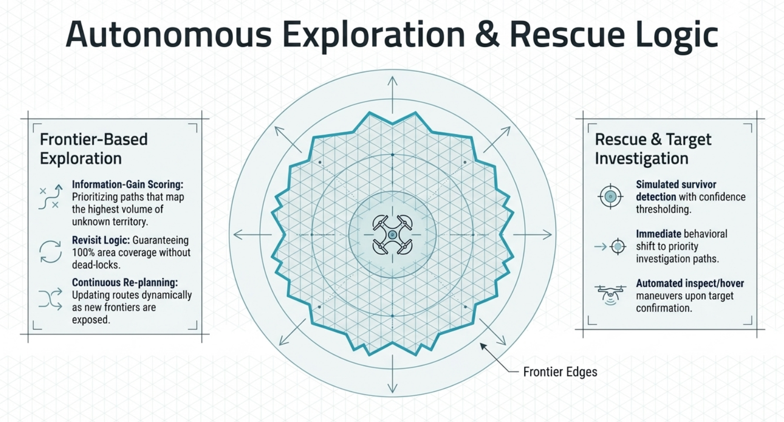
covering 360 degree area
-
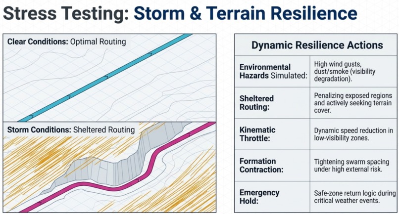
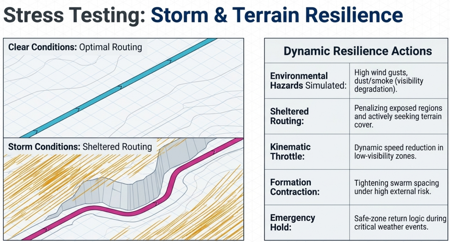
path under mountain when winds are high
-
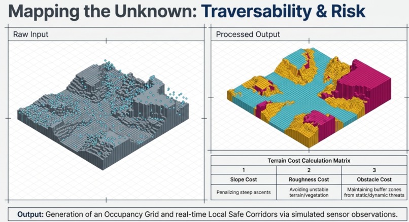
diff path for diff geometry
-
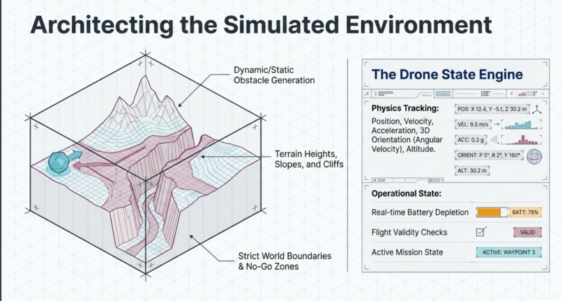
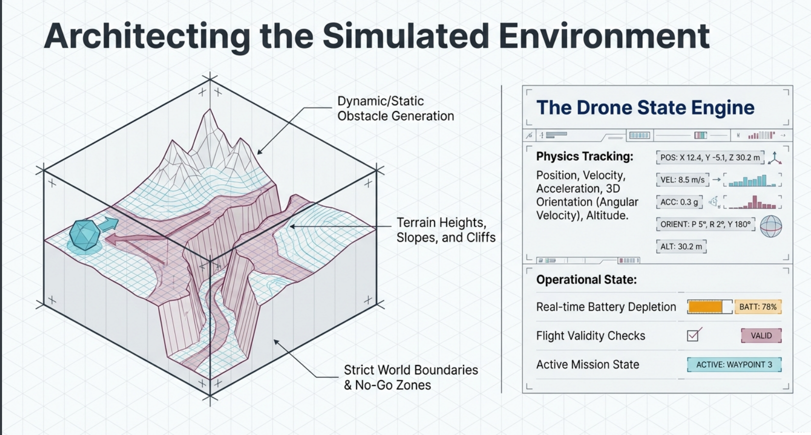
simulated environment and detail
-
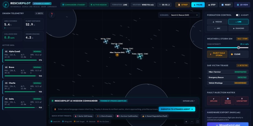
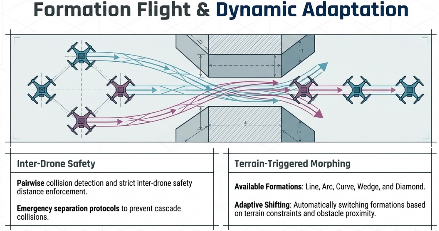
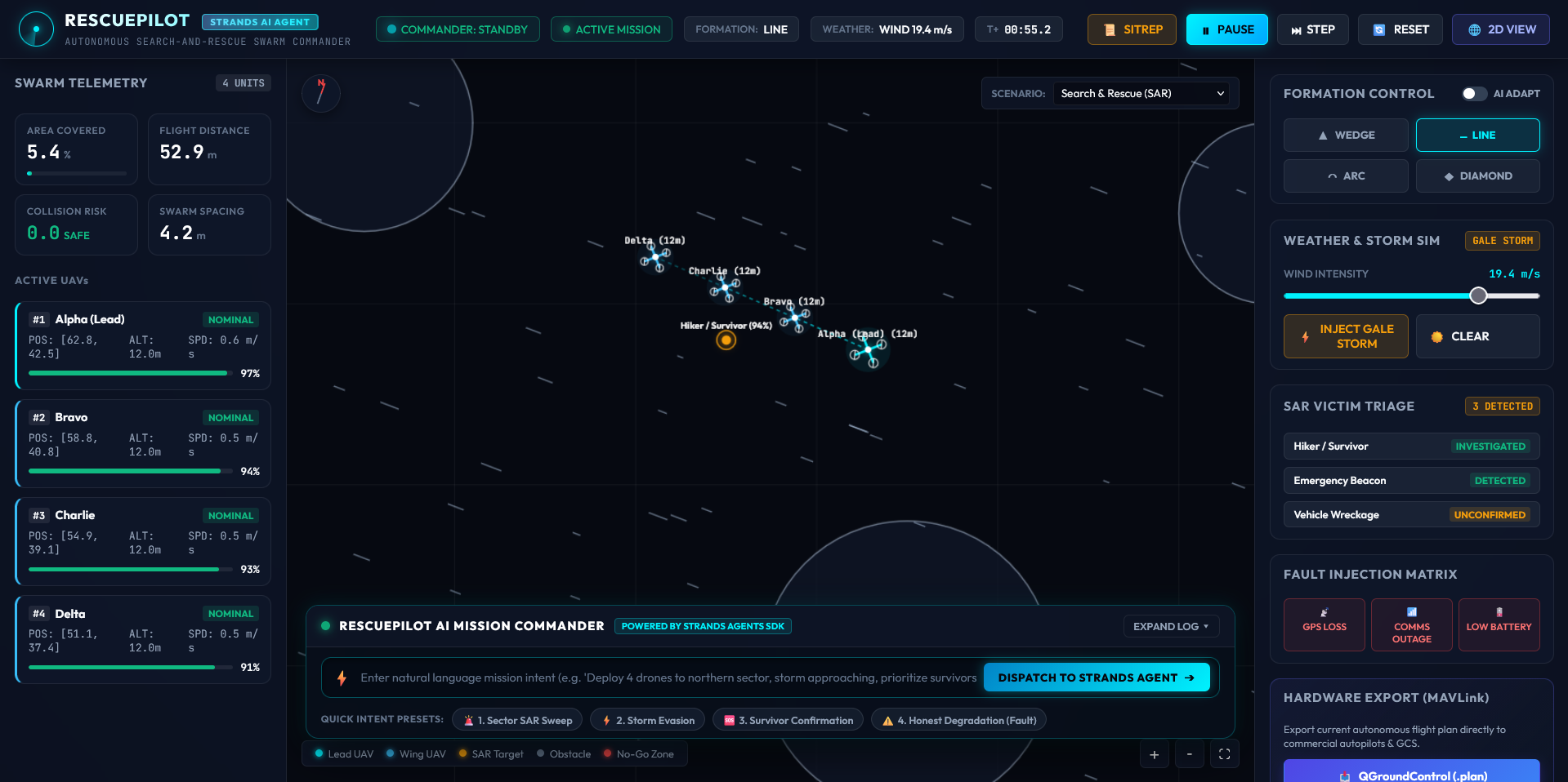
in a line formation
-
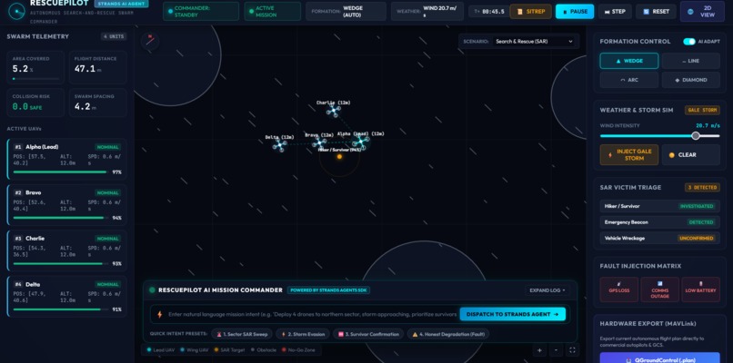
v shape path for better flight efficiency
-
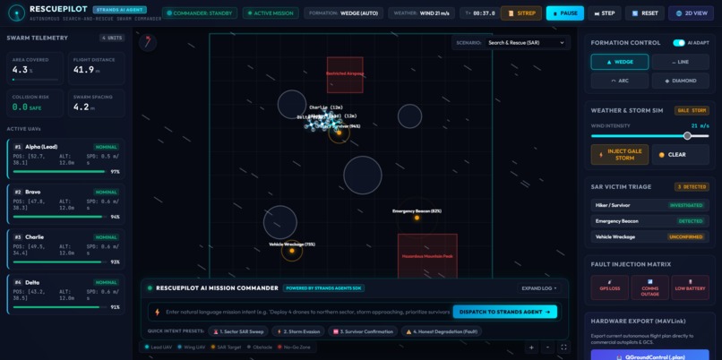
going for target
-
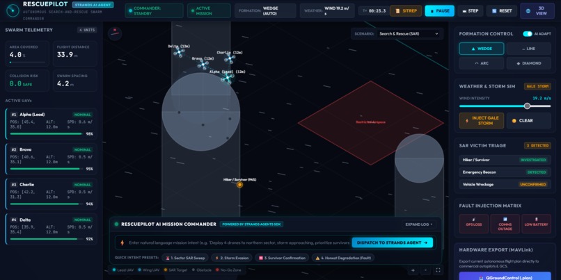
passing
-
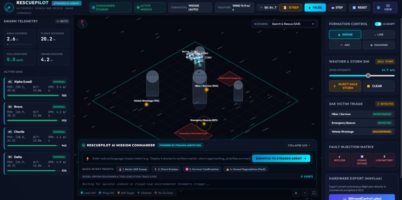
3d view of environment
Inspiration
there are many natural disaster damage electricity and internet connection causes delay in rescue and where fast search and rescue needed and many die because of delay like in nepal flood, jungle fire , fast search and rescue mission can save many life.
What it does
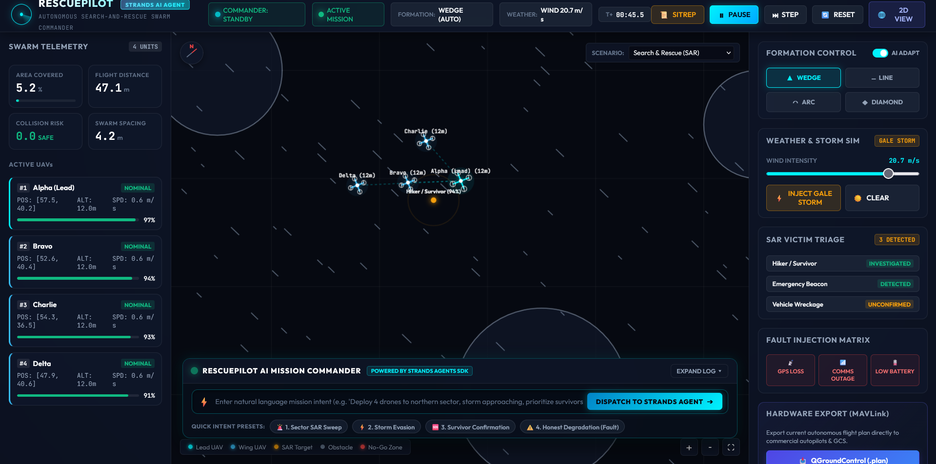
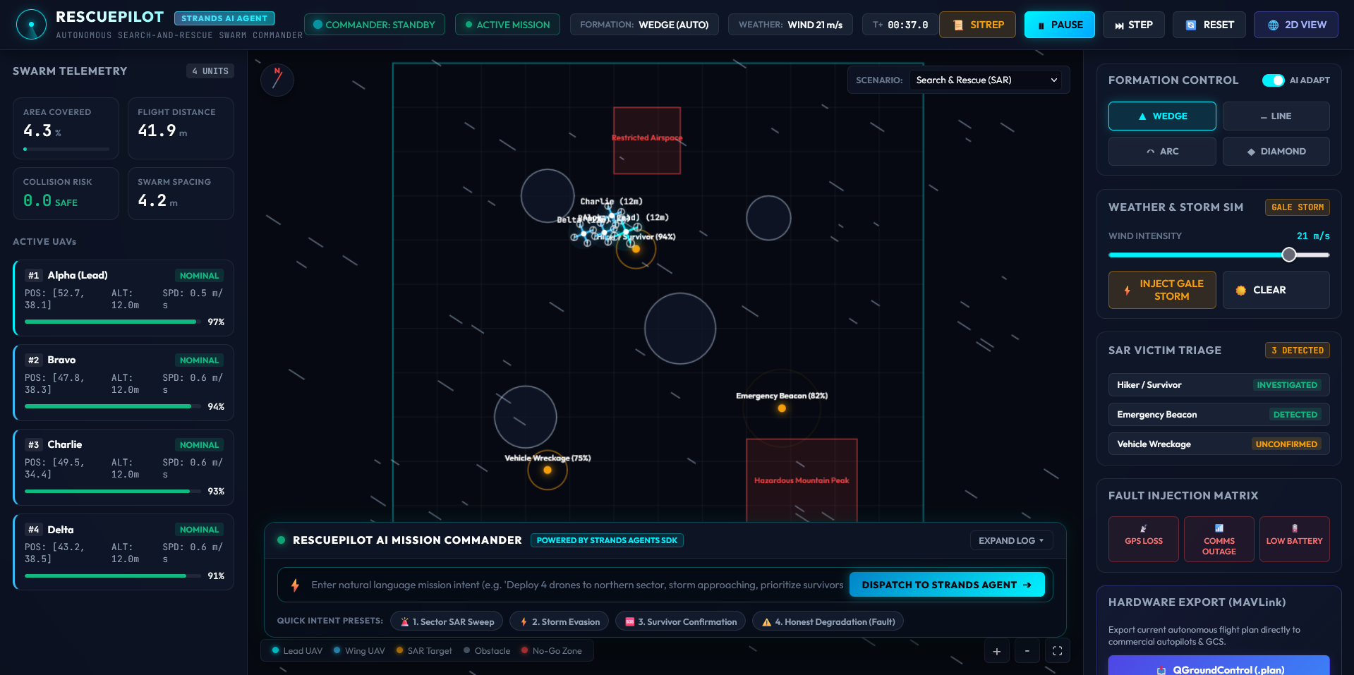
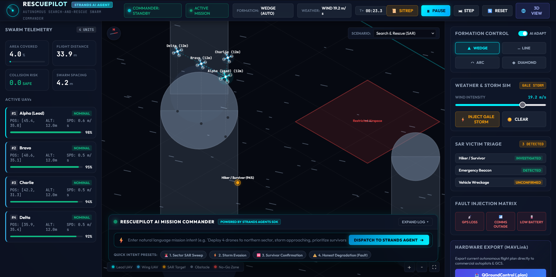
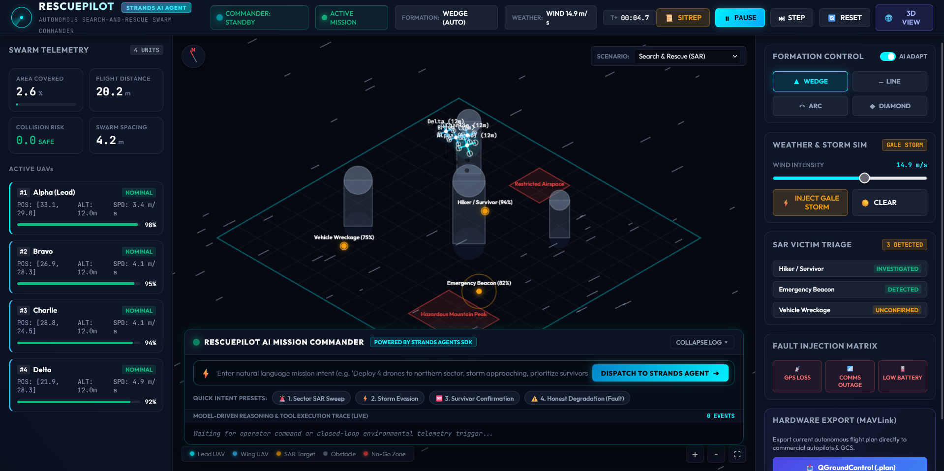
it is an autonomous multi-drone search and rescue algorithms with a browser-based 2D/3D dashboard visualizes missions in real time. , It enables drones to explore unknown environments, coordinate search areas, avoid collisions, detect targets, and adapt to weather and system failures.
How we built it
Built in Python with a simulation-first architecture covering 3D environments, path planning, mapping, exploration, SAR, swarm coordination, formations, and failure resilience. Multi-tool agentic architecture powered by local model, Synthetic Long-Wave Infrared (LWIR) thermal CV feed paired with Web Speech / Web Audio tactical radio alerts
Challenges we ran into
There are serious challenges like synchronizing high-level LLM reasoning with fast low-level flight physics during sudden wind spikes. In wildfire cases distinguishing human body temperature from hot rocks, debris, and wildfire hotspots. In bad weather adjusting search grid geometry in real time when a drone unexpectedly drops out
Accomplishments that we're proud of
Build a resilient self-healing swarm that degrades gracefully without crashing and allowing the system to run in disaster zones with zero internet. Successfully exported real, standard mission files (.plan)
What we learned
i learned life-or-death crisis management, resilience and honest degradation in very bad situation. First responders need high-level intent orchestration without complex manual joysticks. Ground-level autonomous agents must couple spatial geometry and terrain physics directly with language models to be practically useful.
What's next for Drone_smart_path
Need to Running the agent pipeline directly on companion computers (NVIDIA Jetson / Raspberry Pi) mounted on lead drones. Validating performance with physical - PX4/ArduPilot quadcopters in rugged floodplains and forest reserves. Integrating mixed fleets and can be used and local network to share information
Built With
- css3
- google-gemini
- html5
- javascript
- pytest
- python
- qgroundcontrol
- web-speech-api

Log in or sign up for Devpost to join the conversation.